Shivering in the shithouse — and other tests at Sol Duc

Everyone has a plan until they get punched in the mouth.”

— Mike Tyson.

Cold was in the air already, an omnipotent all penetrating wet. It was in the slick on the road, the low gray sky, the close ranks of firs and hemlocks — a billion silver droplets on the needles, droplets in the bracken, on the grass. Spotted yellow maple leaves fell heavy with little ceremony, plopping to the pavement, plastered on.

A whisper of diesel lingered from the bus that had just dropped me on the empty stretch of Highway 101 beneath the Sol Duc Valley. I hustled across the yellow lines, pushing my road bike. The full pack was a nightmare on my spine. I regretted this trip before it stared. Yet, there was no choice.

OK, there was a choice. There was a choice between the 15-mile bike, 9-mile hike — and staying home for another “get things done weekend.”

The last “get things done weekend” had began with good intentions of housecleaning, writing canning fruit for the winter (new hobby) but my attention span got sucked out through my internet connection and run over by the news cycle. My hours of productive labor became joyless hours of content consumption and self-loathing. The idea of repeating the experience for another weekend was a nauseating one.

No. I needed a kick in the ass. I needed some adventure. If that adventure required cold hands, shivering and soggy spirits, hopefully I’d at least learn something along the way.

Most of those lessons would come painfully, of course, but the kayak pogies were an exception.  Putting pogies on the bike handlebars actually works pretty well, I learned. Fingers were firmly connected with the gear shifts and brakes, yet they remained encased within their warming shells of neoprene. I didn’t need to worry about wetting my gloves or mitts before I hit the trail.

My decision to wear a trash bag as a kind of skirt while cycling kept a great deal of the moisture off my pants. I was, however, developing a wet zone above the knees. I pedaled slowly.
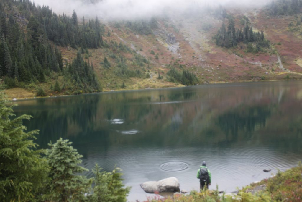
Salmon cascades

My trash skirt and bike helmet certainly made me among the more fashionable visitors at the Sol Duc River salmon cascades. Several vehicles were pulled  along the roadside near the prominent overlook. A small crowd  had gathered by the river to watch the huge fish leaping up at the series of surging falls.

These were coho salmon returning to their spawning sites from the sea. Though I had seen salmon in the rivers before, I had never seen such perseverance. Fish after fish flew above the surging water to try and clear the four foot ledge into a side pool partway up the falls. Almost all of them fell backward into the foam that they had leaped from.

An instant before they hit the water, the fish would whip their bodies, thrumming with the tight, directed power of a vibrating string. For a couple fish that landed just below the top of the falls, this Hail Mary, was enough to overpower the current for an instant and push them into the pool on top. Others flailed, pathetically to their sides, flopping back down into the maelstrom.

The largest salmon seemed to have the best luck. They took the greatest leaps. Even in shallow water, they could grapple their bodies to the stone and dyno like rock climbers against gravity.

The tumult of the cascades annihilated all noise from these struggles. It was as though the standing wave at the base of the falls was the flywheel on an enormous pitching machine. Instead of baseballs flying up, there were silver 20-pound fish, arching noiselessly from the river.

Satisfying as it was to watch the salmon make it to the first pool, I didn’t see a single one make it past the even higher leap that came next.

They had eaten their last meals long ago, were running down their gauges toward empty. The top of the falls was their Hillary Step, a final test that their years of struggle in sea and river had built up to. Each failure brought them closer to the possibility that they would die without spawning, that this season would be the last chapter in their ancient genetic story.

It was painful to watch the fish jump off from the redoubt they had fought so hard for. I held my breath every time, only to watch the fish tumble out into the main current and — fighting, still fighting — fall all the way back to the bottom of the cascade

It has never been easy to be a salmon, though this moment in history may be their greatest challenge yet. Years of dams, development, over harvest and global warming have devastated the old runs, shrank the size of the fish themselves. Perhaps the fish at the cascades would have been bigger and stronger if the Pacific Ocean, wasn’t still reeling from the enormous “blob” pattern of unnaturally warm water that began in 2015. The phenomenon killed off much of the krill that salmon feed on.*  If not for the failures of our species to respect life on this planet, there might have been a different scene at Sol Duc.

Maybe then, I would have seen some of them complete that last leap.

The river thundered on.

The cold and the beautiful

I got back on my bike and continued up the wet road to its end.

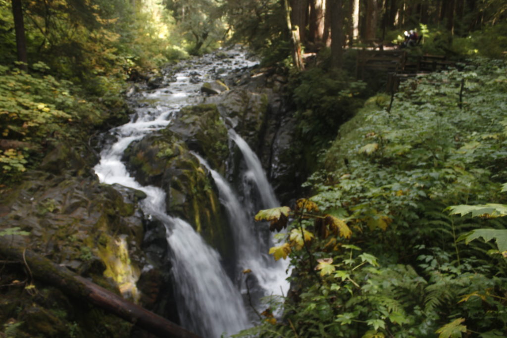
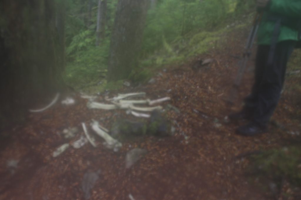
15 miles from where I’d started on Highway 101, I locked my bike and shouldered my pack. I began walking toward Sol Duc Falls. Plenty of people were walking with massive cameras, talking in several languages. There was a family with brown paper bags out looking for chanterelle mushrooms growing under logs.

I went off my route briefly to admire the place where the river falls sideways into a deep chasm (no salmon would ever make it this far.) It occurred to me that if I were really smart, I would just turn around here and then catch an afternoon bus back to Port Angeles. The falls and the salmon cascades were enough fodder to make up a small, successful, low carbon trip with moderate suffering.

Haha. Moderate suffering. Suffering would be abundant. It occurred to me that if suffering were some valuable commodity like goat cheese or maple syrup, I could start a nice artisanal business for myself.

Try Wandering Tom’s latest, Homemade Suffering! This 2017, limited release small-batch edition has strong notes of cold and wet  — a bold contrast to its themes of back pain and numb extremities. It goes great on pancakes.

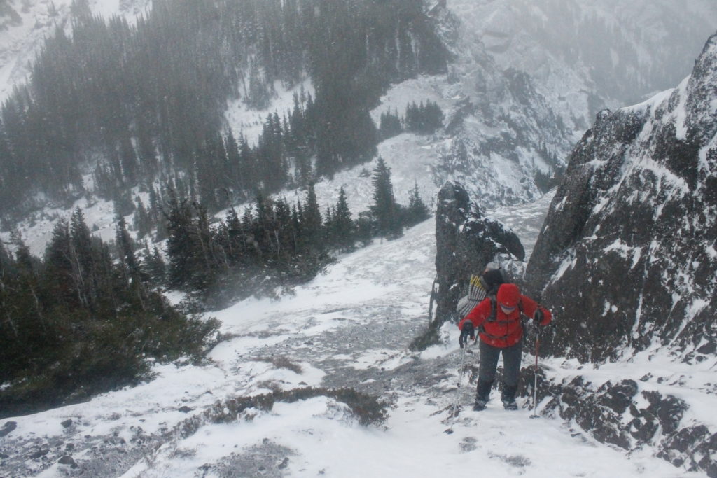
In order to gather the proper amount of suffering on this trip, it wasn’t good enough for me to just muck around below tree line; I needed to get to the alpine zone where the good stuff was. My Parks Service overnight permit was for the Heart Lake camp area, which happens to be at 4,700 feet, nine miles up the trail. It was raining at the trailhead. I was told to expect snow by the time I got to camp.

So the hike began.

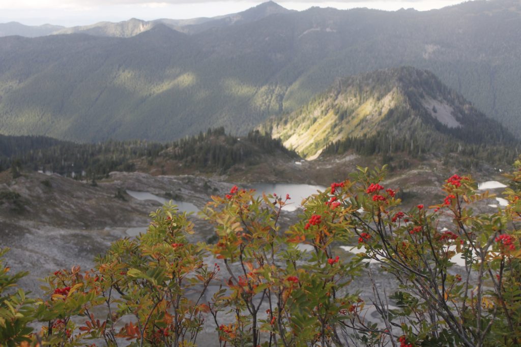
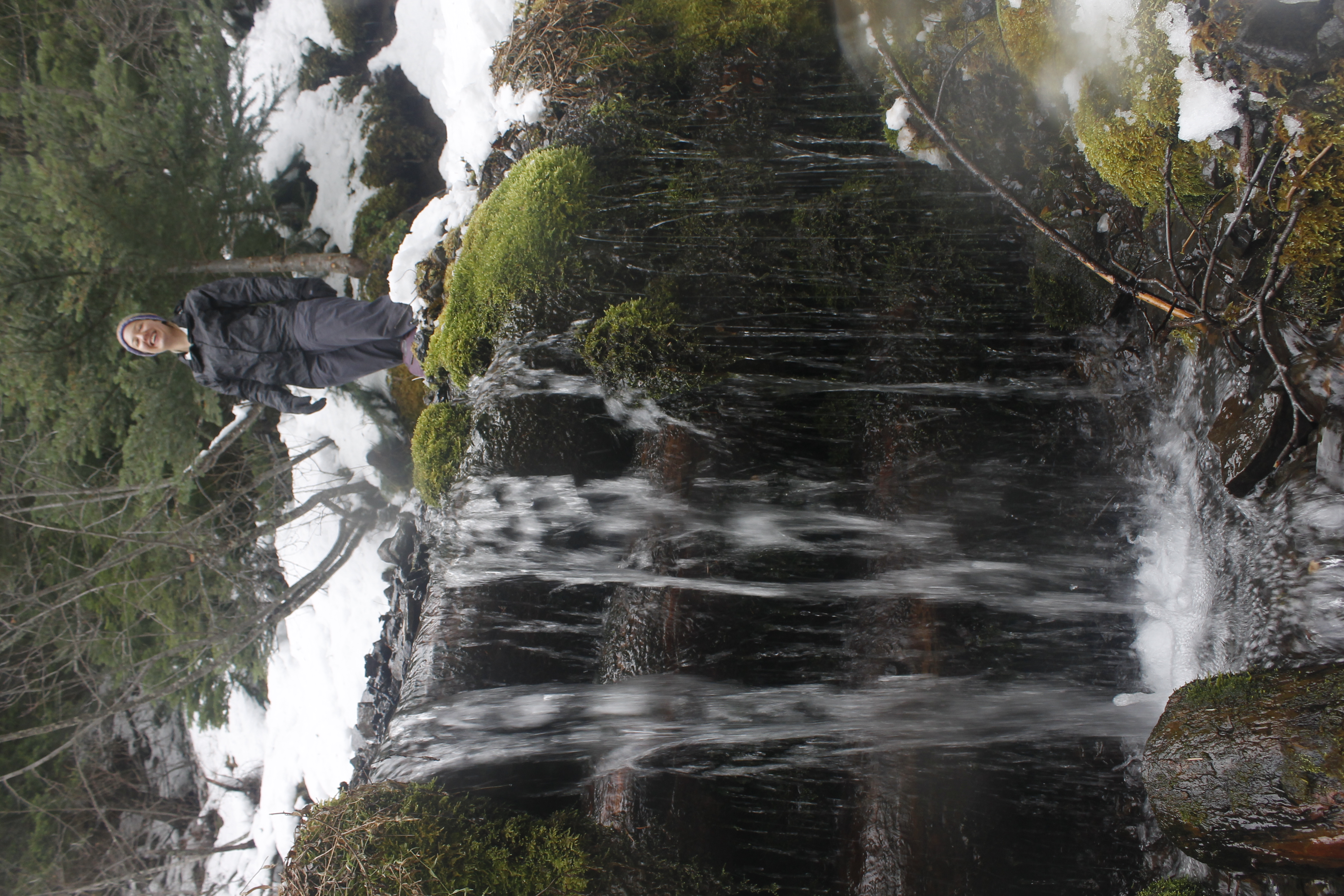
It is worth noting, amidst my morbid contemplations, that there were actually a couple of beautiful things that I noticed going up the trail. One of these was the deep gully that crossed my path, plunging down the slope toward the river. Plaited bands of aerated water splashed over the mossy rocks. Overhead, a canopy of warm yellow leaves on the vine maples. These small trees followed the gully in a perfect line. They flashed out against the dark boughs of the spruces and firs.

The generous amounts of rain at Sol Duc creates a habitat for verdant swaths of moss, goatsbeard lichen hanging off the branches, beads of water clinging to the hairs. Monumental firs stand dark against the light in their shining filigree of epiphytes.

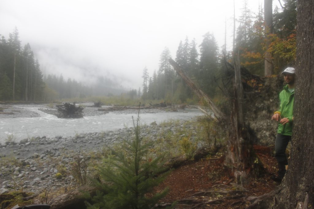
I could look down from the edge of Sol Duc Canyon and see a river that thundered like a fire-hose, bulling against the walls, throwing itself off ledges, swirling through logjams and leaping up into the air in sheets of mist.

Where was all the water coming from? Everywhere. Every inch of the valley was saturated.

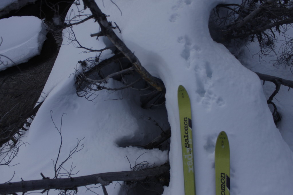
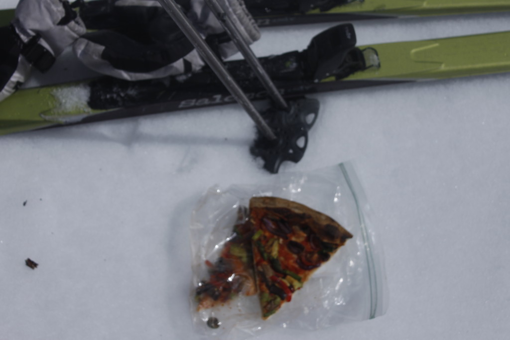
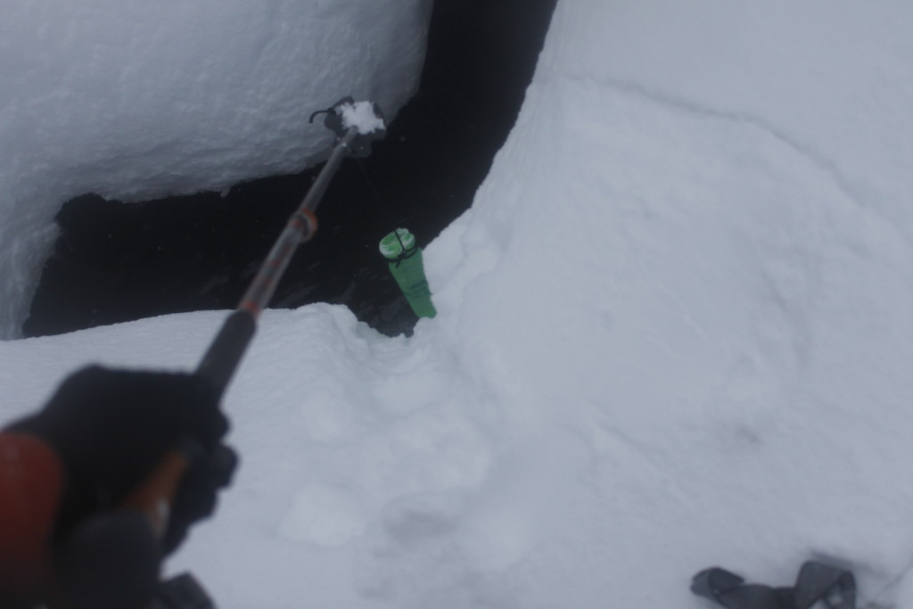
Half of the trail was a stream course. My tall boots deflected most of the moisture, but I sensed that it was beginning to make inroads. Some vapor-barrier socks would have been a smart move. The kayak pogies were a surprise success however. I attached them to my poles much as I would a paddle, creating comfy neoprene nests for my bare hands. This was literally handy, because I could take my hands out in an instant and work ungloved on some minor adjustment. It was far less time consuming than me having to take a glove or mitt off to work on something.

I took few breaks while climbing the trail. To stop was to lose temperature. If I put another layer on to warm up, I knew I would get it soaked and have one less piece of dry clothing for the cold night ahead.

When the weight of my fully-loaded pack became too much, I stopped with my pack on my shoulders, crouched into a ball to distribute the weight onto my hips and retain heat.

The rain rolled off my jacket onto the small of my back.

Making myself small for this 30 second interval, I shut out the hostile outside environment and breathed the dirt smell of the rotten log I was leaning against. This short break from struggle was an important way to ground myself, tending to my spirits in the same way I was trying to keep an even body-temperature. The micro-world below gave me a measure of reassurance that I didn’t feel when I contemplated the long miles ahead of me, or the sure to be hellish night ahead.

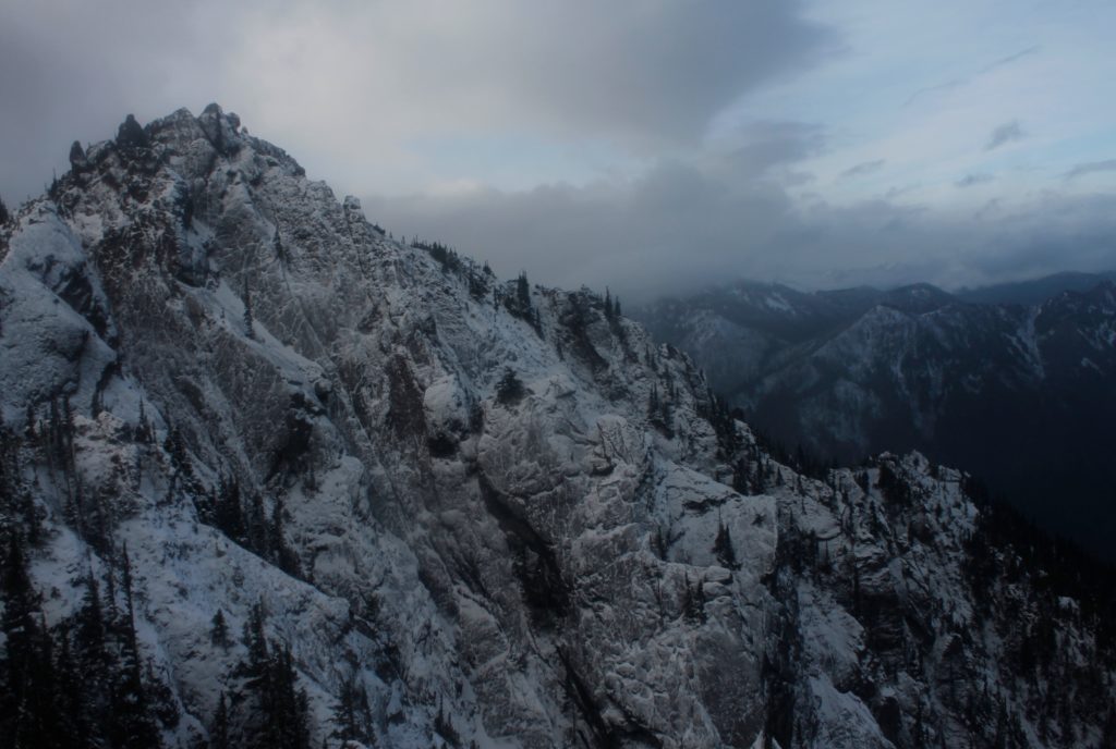
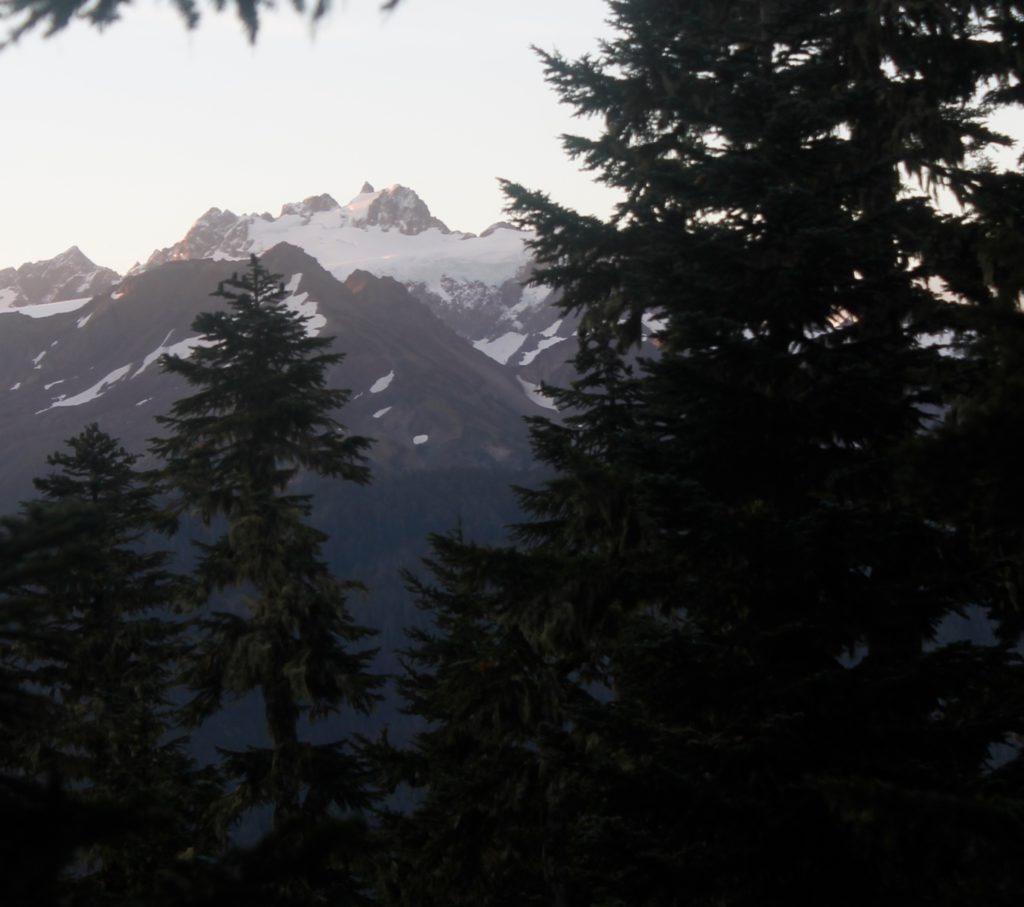
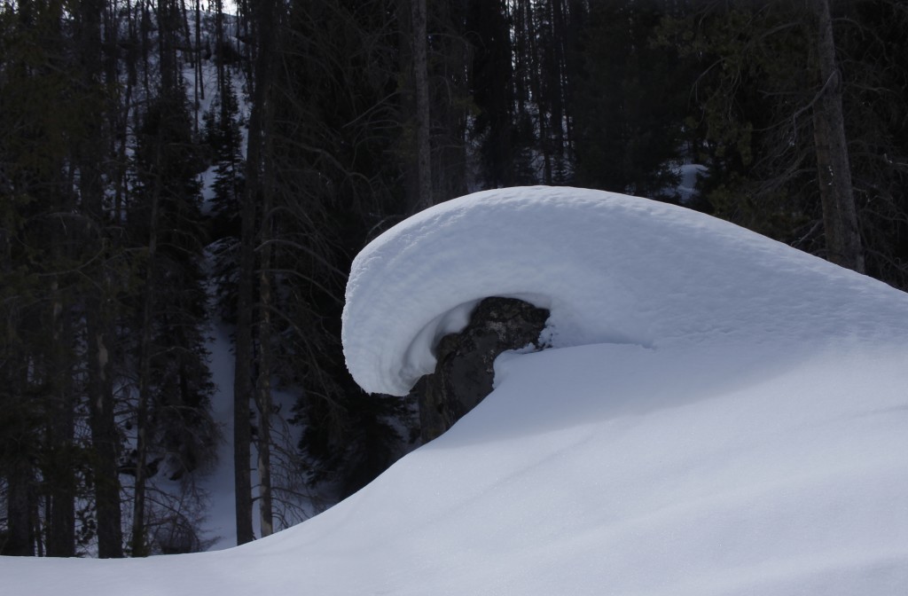
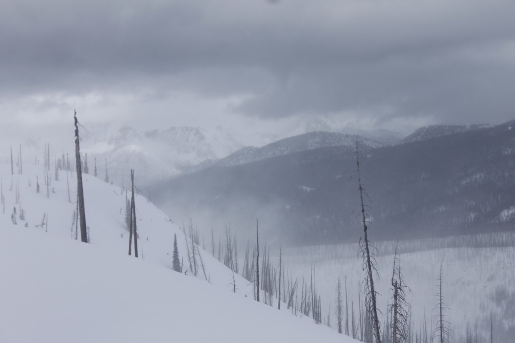
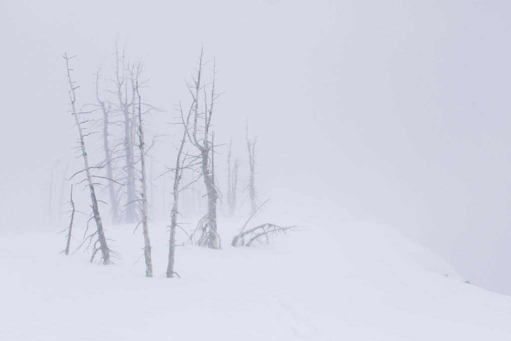
Hints at what that night would be like included the patches of white I began to see along the trail. There was just a faint frosting on the mosses, or in the shadows of the trees. It was still raining. The clouds hid the highest slopes of the mountains above me, but I’d get a glimpse of ghost white slopes above veiled in rain clouds.

The snow grew thicker as I climbed. It was still raining. I hiked through a goulash of wet snow. I thought of the several empty camps I had passed below tree line. Surely, these would have been more pleasant places to spend the night than what was in store for me in the high country.

Ah, but I still had lessons to learn up there; I still had a suffering quota to meet.

The trail crossed the Sol Duc again, but this time there was no log bridge. I tried to toss a couple branches into the river, but the current laughed and whisked them downstream. I ended up slogging through shin deep water to reach the other side.

After another half mile of goulash hiking I had another river crossing. I had to will myself to go slow, even as the cold water soaked into my boots. A fall would be a survival crisis, likely hypothermia. I reached the side and climbed on. Finally, the trail popped up at the bottom of a snow filled basin where the wind was howling. Chunks of slush and broken ice lolled in the gray, heart-shaped lake. I’d arrived at camp.

Outhouse Camp

The rain was one thing, but when the droplets were thrown by a thundering wind, it became something much worse. The outhouse, naturally, was the place to find relief.

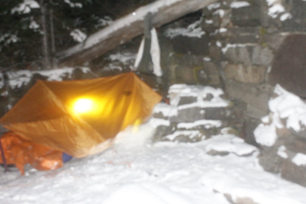
I shut the door and threw on a fleece layer beneath my raincoat. It would be soaked within short order. I felt my jaw clenching up from the cold. If there was going to be a shelter tonight, I needed to get it set up fast.

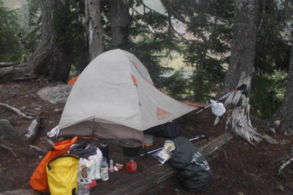
The shelter was my tarp, which had served me well throughout the summer. Initially, I’d planned to use the rainfly from my tent as the upper level, but realized that this was a no-go because it wouldn’t stand up without the under-tent. A dumb mistake, but still salvageable, because I could use it as my shelter’s footprint with the tarp overhead.

Another problem: Even as I cleared away the snow from the shelter site, the rainwater would start to gather up below. I used my fire pan to dig a drainage trench, which helped somewhat, but only to the extent that I’d be sleeping in shallower water.

I set up the tarp as a flat rectangle that was a couple inches above where I would sleep. This was workable, unless the rain turned to snow, in which case the weight of the snow would collapse it on top of me while I slept. OK, I could try to rejigger the ropes so that the central guy-line was higher up.

BUT, my hands were freezing cold now. Untying and retying knots would be slow work.  Light and temperature were falling. The longer I stood exposed in the face of the wind, the colder I became, the more difficult it would be for me to, warm up or to do simple tasks necessary for survival. The zipper on my rainjacket had blown open and rain was getting into my puffy layer.

The shelter was shit. I was going to be sleeping in a pond with the wind blowing through the whole night.

Should I take it down then? Well, at that point, even disassembling the thing would cost precious energy.  The two river crossings would leave me in an even worse way before I got below tree line to set up shelter again. After I’d been through all of that, who knows how stupid and useless I’d be. It was going to be an outhouse night.

I lurched back to the narrow building and shut the door. I shed my wet layers and arranged my sleeping bag. The last time that I’d spent a night in an outhouse was in Colorado, where I’d used a roomy handicap-accessible building that gave me room to set up a sleeping pad and stove.

This building gave me five feet to stretch out  if I slept on top of the toilet with the lid down. Gusts of wind send droplets of icy water in through the cracks in the walls.

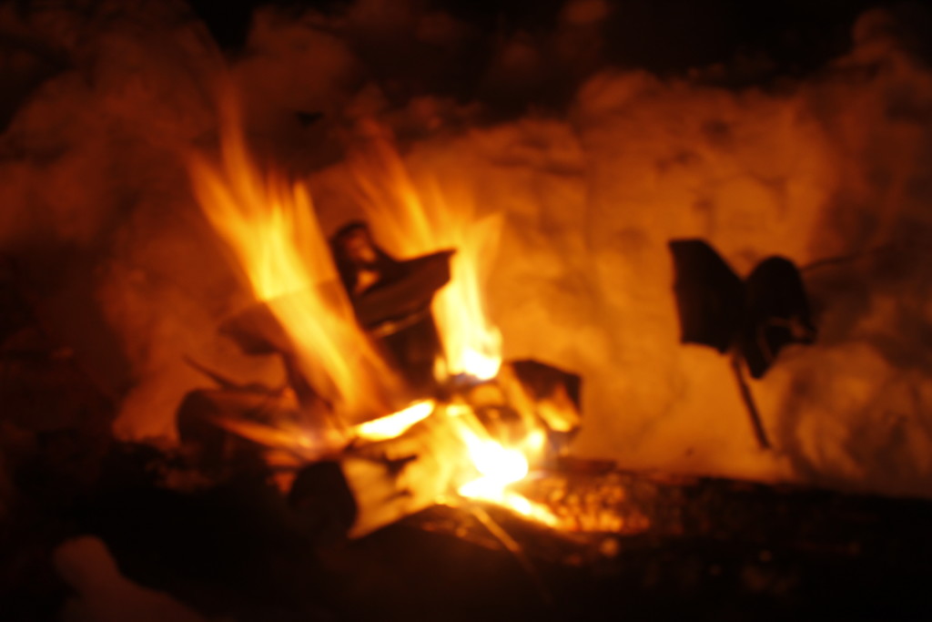
Miserable as this sounds, I had piled on enough layers to maintain a damp warmth. I set my fire pan down on the edge of the toilet and used a flint striker to light a cotton ball, transferring the flames to a hexamine tablet, which gave me a small but very hot smokeless fire. The fire gave me boiling water for hot pea soup and contributed some toxic fumes to help deaden my awareness. I fed additional tabs to the flames as I ate, warming my little shelter as the wind outside thundered into the boards.

When the fire died, I got out my sleeping bag. I bolstered my sleep system with two reflective mylar bivvy sacks. One  protected my insulation from the wet on the outside; the other bivvy went inside the sleeping bag to protect it from my own sweat and damp,  marinating my body inside plastic.

I contorted myself so that I could lie down with my head resting on my pack, knees bent. This was more or less how I would spend the next 10 hours. Though supremely uncomfortable, I was warm. I listened to the wind,  heard the droplets spattering onto the bivvy sack. I thought of the wretched tarp that I’d pitched outside, and how hellish it would have been to spend the night under it.

I was in the outhouse because I’d screwed up. My preparations were inadequate. Plans that seemed solid to me when I was beneath a roof in Port Angeles, were torn up by the mountain wind.

“Everyone has a plan until they get punched in the mouth,” Mike Tyson said.

He may have been talking about boxing, but the windswept campground was a place where punches came fast and survival required action to move at the speed of muscle memory and instinct.

I’d been able to afford the time it took to noodle and tweaking with my tarp during the months of summer hiking. The October weather was less forgiving. Now noodling with gear was the equivalent of lacing up boxing gloves while the opponent was already taking swings at me.

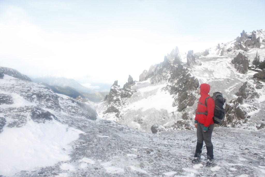
Cold and disorientation had landed like blows on my unprepared frame. Next time, I vowed to have a stronger system ready for the elements. Another option: I could have kept my lightweight system and camped below tree line. If I’d really wanted to explore Heart Lake and beyond, I could have marched up from a lower camp with a lighter pack.

Now I spent many hours in the half waking, half dreaming state, pausing to sit up now and then to stretch my cramping legs. I thought of the refugees of the world, what it was like to be insecure against the elements, utterly vulnerable. How outraged I would be, I thought, if someone turned me away from shelter on a night like this. Yet, our government routinely turns people out who face not only rain but bullets, not only cold but famine, whose struggles are not over when they get home — because there is no home. It is easy it is to be heartless to those in need when you have no understanding of what their suffering is like.

“I am grateful for this outhouse,” I murmured.

Rough trails, dark roads

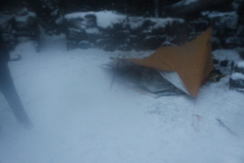
The tarp shelter stayed up. It had rained all night, with just a little bit of new snow that alighted during the coldest hours. Perhaps I could have slept under there after all, but if I could have gone back in time, I still would have chose the outhouse.

The wind continued throughout my morning routine, blasting little hail pellets over the mountainside. I gathered some slush water in my pot and boiled it for oatmeal.

I wrung out my hiking pants, put them back on. It was a slog back to the bike, but I was in control of my body heat.

Throughout the hike down, I had fantasized about an imaginary clothes dryer that would be waiting for me at the campground/resort next to the Sol Duc Hot Springs. I would dry all my clothes and then buy a pass to the hot springs and rewarm my core, telling the story of my adventures to any bather who would listen.

Unfortunately, there were no clothes dryers at the resort. There was no Sunday bus service out to Port Angeles either. My plan had been to spend the night camped near Highway 101 and then catch a Monday morning bus back to town. As I contemplated another night of damp sleep, this option became less and less appealing.

Another option was to bike the 32 remaining miles to Port Angeles — a trip I was certain to finish in the dark. I stood for awhile thinking, even put my thumb out for a couple pickup trucks going down 101. Finally, I decided to stop waffling and start pedaling.

The section of 101 that goes along Lake Crescent is incredibly risky for bikes, as there are tight turns and almost no margin. I decided not to try it with a fully loaded pack in fading light.

Instead, I opted to take the Spruce Railroad Trail, which goes on the other side of the lake. The compromise here was that I would face long sections of loose rock and roots that were for mountain bikes, not the skinny tires I was riding that day. I would have to walk long sections of trail.

Even pedaling the pavement proved challenging, as recent winds had knocked several trees down over the path. Branches and leaves were scattered everywhere.

One saving grace: The rain had stopped.

As the paved trail gave way to dirt, I risked biking on some of the smoother sections. I had to stop frequently to clear out pine needles which got stuck between the wheel and bike frame. Finally, I crossed through the railroad tunnel at the east end of the lake, and got back onto paved road. The light was getting low.

I stopped in the village of Joyce to flick on my headlamp and taillight. This was the highway section that I’d been  dreading most. There would be plenty of traffic, a narrow margin and dark pavement.

To clinch it all, my headlamp beam was dying I hadn’t packed extra batteries (stupid.) This forced me to take it slow along the bumpy pavement, fearing potholes and outstretched branches hiding at the limits of vision.

Another worry: Every once in a while I would look back and see that the taillight had flicked off for some reason. Unnerving, considering that this signaled my existence to oncoming trucks with the potential to blot said existence out on their front grilles. I’d stop and hit the on button again and start pedaling until I noticed it was out again. I haven’t had the problem since the trip, so I don’t think it was battery-related. Whatever it was, it wasn’t helping my relaxation.

I’d hoped that some of the fears and hardships would diminish once I reconnected with the bike path, away from traffic. Not so. The trail was covered in leaves, which made it difficult to distinguish the pavement from the edge of the forest. The dim headlamp forced me to bike slowly. Twice, I got disoriented and biked right into the woods.

My most epic fall came when I biked past a roadside construction site. I saw no warning sign,  just a sudden drop off right in front of me. I hit the brakes but it was too late. The bike went over an 18-inch drop and landed hard on the rocky substrate. I fell over and the bike went on top of me. I issued a stream of oaths, got up and dusted off.

I had to readjust the bike wheel before I started pedaling. I was ready to be done.

Finally, a couple miles later, the trail ended at the suburbs west of Port Angeles. There was street lighting, the happy glow of televisions in the windows of warm houses. I could hear waves pounding on the beach below the bluffs nearby. A hilltop vantage point gave me a view of miles of lights, stretching out along the dark waters of the Strait.

Blobs of brightness by the water eroded to disparate sparks of illumination as civilization climbed the hills. And then there were the mountains where darkness  reigned again. My time up there was over for now, until my next journey when I hoped to return wiser and better equipped.  I was happy to follow the orange road, street lamp by street lamp, the rest of the way to a warm bed.


Sources

* Information on salmon stock decline can be found here: http://www.oceanfutures.org/news/blog/salmon-stocks-trouble-pacific-northwest

http://www.idahostatesman.com/news/local/news-columns-blogs/letters-from-the-west/article73268602.html
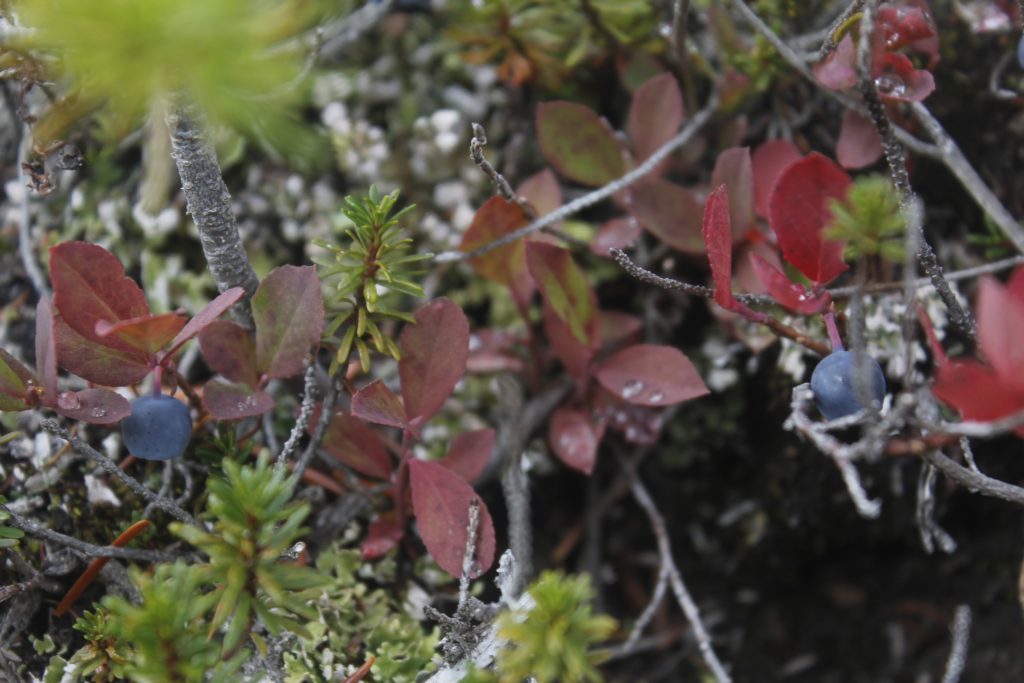
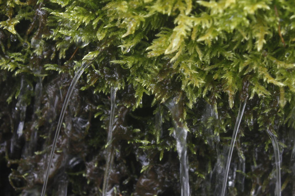
Bike Climbing and Snow Sliding: A Doorstep Mount Angeles Expedition

There was the world of the pavement and there was everything else.

Pavement was the Hurricane Ridge Road, an asphalt tendril climbing out from Port Angeles, and penetrating into the Olympic Mountains. was is the accommodation that allowed the river of internal combustion to flow uphill — the shuddering swarms of Harley’s, Subarus, Tahoes and other vehicles to convey their day-trip passengers toward the snow realm up above.

They looked out of windows, and saw the other world: the treacherous stands of stinging nettles and shoots of devil’s club armed with vicious barbs, diaphanous leaves of the big leaf maple shifting iridescent in the sun mist. They were just starting the climb, these visitors. So was I.

I too, grunted and shuddered my up the pavement, and I did it in the lowest gear on my bike. The plan was to notch another entry in the doorstep chronicles with a doorstep ascent of Klahhane Ridge.

The ridge is 6,000 feet above Port Angeles Harbor. It forms what I think of as the most impressive feature you can see from town. Torturous layers of jagged stone jut up out of the ridge’s west side to create the 6,400 foot summit of Mount Angeles. Snow clings to the shadowed north slope, even in July and August.

I knew I was going to pedal long and hard to get there. I knew my back was going to ache and that I would loathe the traffic going past my bike. The bike ride was the part I wanted to get over with before I traipsed merrily up the trail toward Mount Angeles. I thought of all the cars going by as I kept the bike tires on the narrow margin.

But sometimes you sweat the climb a thousand times before the wheels start turning. As I started up the hill, I found myself in a pleasant frame of mind, enjoying the sun on my face. I let my eyes wander off the road and up the narrow gullies where pearly-white freshets cascaded over moss. Fat orange salmonberries grew in the roadside thickets, though they were not quite ripe enough to eat.

An occasional vehicle did perturb my reverie, but the traffic was far lighter than what I had feared. It had been dumb to spend so much energy climbing the mountain in my mind earlier.

After over an hour of climbing, I had knocked out about five miles, which brought me to the entrance station to Olympic National Park. I found a place in a rumbling line of vehicles, then kicked my bike along with the rest of the traffic inching its way toward the kiosk.

Eighty dollars later, I had a crisp new National Parks Pass in my wallet and was pedaling past thick-trunked Douglas Firs. The investment felt good, especially knowing the threat national parks throughout America face from the current president and others who follow his brand of thug-ignorance.

A vehicle stopped ahead of me so that passengers could click at a doe and her two fawns — the size of puppies with delicate white spots along their flanks. These park deer registered minimal concern about my bicycle or the other traffic along the road. I hoped no one had been feeding them, but the world is rich in well-meaning fools.

The lush understory from the lower elevations dropped away to thinner pine forest, with long views across the valley to Blue Mountain and the snow covered face of the Obstruction Point ridge. Day-trippers wandered from their cars to get in front of the views.

“You must be a glutton for punishment,” one woman called after me as I chugged by with my heavy pack.

“I’m loving it out here,” I called back.

Fifteen miles and 4,000 feet after I left my doorstep, I pulled my bicycle up to the trailhead for the Switchback Trail. I immediately peeled out of my soaked shirt and replaced it. A couple of peanut butter banana wraps were the calories I needed before the hike. Water gushed down the mountain valley, melting off the thick patches of snow higher up the way. A guy plodded down the trail with a pair of skis on his back. A minute later, his daughters caught up with him, also with skis.

“How was it out there?” I asked.

It was skiing for the sake of novelty at this point, the man admitted. They had found mushy snow that tended to cave in near rock outcrops. The biggest worry was the fog, which was still wrapped around the mountains higher up. There were no regrets about getting up there though.

The beginning of the Switchback Trail was a muddy line zigging up between stands of Alaska yellow cedar and mountain meadow. Tiny alpine flowers were coming into bloom. Groups of black-tailed deer meandered lazily through their forage, with velvet on their antlers.

I encountered snow gradually, then all at once. A few patches over the trail, became large swaths where other hikers had kicked steps in for traction. No need for me to get the crampons out yet. I did use an ice axe to cut up a couple of switchbacks on the snow.

Typically, cutting switchbacks is a hiking sin, because it tramps out vegetation and can cause erosion. In this case, the snow absorbed the impact of my waffle stomping feet and I could proceed guiltless.

Still, the axe and crampons proved to be overkill for the expedition, where the majority of the climb was snow free.

By the time I reached the crest of Klahhane Ridge, the clouds had closed in thoroughly. This was my turnaround goal, Climbing to 6,000 feet from my home at 300 feet above sea level wasn’t such a bad day. Yet, I knew I could go further. Last year, I had taken a little used side trail up to one of the peaks of Mount Angeles. The tallest peak (which I’d also climbed last year) would be out of reach from this approach, but I would still be at almost the same height of 6,400.

The ridge divided the mostly snow-free area where I hiked, from an entirely different world on the north face. Here, in the shadows, I could peer over a 45 degree slope, where a chest-deep slab of winter snow held onto the rock. Peering down, the white snow blended seamless into the nothingness of the cloud layers. It was impossible to tell where one ended and the other began. The depthless white concealed danger as well as or better than darkness would. I understood why the skiers had been freaked out.

Still…what a ride it would be. All I had to do is hop over the edge, and start sliding on my butt. I’d gather speed — tremendous speed — as I flew into that great white unknown with the ice axe as my only brake. It was a thought that was as terrifying as it was appealing. I thought of Herman Melville who wrote a whole chapter in Moby Dick regarding the terror of white:

“…there yet lurks an elusive something in the innermost idea of this hue, which strikes more of panic to the soul than that redness which affrights in blood.”

The rock scree on the south side of the mountain was enough excitement for the blood right then. The slope looked like a cake turned on its side, with various shales, sandstones and basalts that were bastard children of volcanism and ocean floor upheaval. The rock was pulverized into bits and pieces. I kicked my boots in for purchase in pencil shards of shale.

The basalt was more solid, but still dicey. I test wiggled every hand hold before I put weight on it. Often I would find a toaster-sized rock, just waiting to tumble down slope. When I had the chance, I used my axe to “dry tool” out holds in the rock above me. There were even a couple of snow slopes, that I used the axe for, though I didn’t bother putting the crampons on. Carrying them up 6,000 feet of mountain was just my way of making sure I got the proper dose of exercise that day.

Eventually, the rock got more technical — as in technically, it was class IV climbing if that sounds impressive. I ditched the backpack, and scrambled my way up the last section to a lookout slab.

The clouds hid plenty, but I also saw a good amount of the June snow slopes to my north. The concealing nature of the fog made the jagged landscape more mysterious and menacing. I grinned in the wind for a couple minutes, then started down.

Descending the scree was predictably unpleasant. I placed little trust in any one footfall. Still, I got a little fun out of glissading down a couple snow slopes. I got a little too ebullient on one of these jaunts, and missed my chance to sink my axe in before the snow went out. The result was a bit like coming to the end of a waterslide to find that someone had replaced the pool with a gravel pit.

I emerged slightly battered and slightly humbled, to hike the rest of the way down the Switchback Trail (and glissade a few more snow slopes.) Though I had hauled heavy snow pants up this far, I didn’t bother putting them on. Instead, I worked on a new glissade technique, sliding backwards on my hands and feet with the axe twisted sideways. When it was time to hit the brakes, I turned the axe into the snow. The method worked OK, for the short sections that I had to deal with, though my hands were thoroughly chilled in their thin gloves.

Near the bottom of the trail, I took a moment to sit on a boulder, while clouds parted and mountains strobed in and out of the early evening light. I let myself breathe in satisfaction. These are moments that reaffirm that adventures, even day trips, have unfathomable worth to me. More and more, I have begun to believe in the Doorstep Adventure and I want to take more of them. If I cannot be in the places I love most, without putting money in the pockets of the people that destroy them, perhaps I don’t deserve to be there.

And it is important to find an equal measure of joy to the hardship that comes with getting into wild places without an automobile. Otherwise, why the hell did you bother coming out?

If you drive up to Hurricane Ridge and have a crappy time, you wasted a couple hours and a few dollars’ worth of gas. No biggie. Hey, let’s catch a movie sequel at the theater.

If you bike, hike or run from sea level, you better enjoy yourself out there, or else you just squandered a day’s worth of time and effort. So you have a good time.

The bike ride up had been fun for sure. The ride down was a complete blast:  14 miles of (almost) unadulterated descent. I leaned my way past curves and through mountain tunnels, white knuckling it with fingers on the brakes. I used the brakes as little as possible.

A Doorstep Adventure for Bike and Snowshoes

Bicycle

As I wheeled my road bike out onto the street to start my doorstep adventure, I could still see margins of frost on the north face of the neighbor’s roof. Soon the frost would retreat as the sun continued its climb. Higher up, fields of bright white snow filled the bowls and couloirs of Klahanne Ridge. It would stay white up there a while longer.

Yet, the expanse of frozen waste and toothy crags could be mistaken for mere background decoration to the fresh green day that was unfolding in Port Angeles — a glory of spring warmth complete with chirping birds, blossoming cherry trees fresh cut lawns, and the earthy smell of living organisms crawling out of winter sleep.

The disparate scenes were separated by several miles and a couple thousand feet of elevation. Today’s adventure was about closing that gap.

By biking, then hiking and finally snowshoeing up the ridge, I would feel the challenge of the mountains while taking the chance to connect with their snowy realm.

There was a mighty pack on my shoulders, flanked by powder snowshoes and a trekking pole/ice axe. It didn’t take long for that weight to feel uncomfortable on my spine. In the best case scenario, I imagined that I would be able to traipse across 6,000-foot Klahhane Ridge itself. I had ran up there from Port Angeles while training for my ultra marathon last summer. With deep snow in the equation however, the task wouldn’t be so simple. Avalanche forecasts called for elevated risk of slides, especially above tree line. I remembered encountering harsh slopes on my summer runs, which could be hazard zones. If nothing else, I knew I could travel to 5,000 feet or so and get amazing views.

I biked out of the neighborhood past the National Park Headquarters and onto Hurricane Ridge Road. There would be five miles of uphill biking to the Heather Park Trailhead at 1,800 feet.

I ground through the miles, weeping for my aching back. Cars swept up and down easily past me. Why do I have to make everything so hard?

Sometimes I brought my head up to appreciate the endless pavement view in front of me. Mostly I watched the little twigs and bits of gravel creep by my tires. There was progress, at least in the small scale.

Shoes

I made it to the trailhead parking lot by 10:20 a.m., and locked my bike against a sapling.

Other hikers were loading and unloading themselves into vehicles. Most of them, I guessed, were going up the more popular Lake Angeles Trail.

Still, I was in no mood to get caught up in another group of walkers. I was loaded too heavily to run, but managed an aggressive walk up the smooth grade of dead pine needles. At this elevation, the evergreen salal and Oregon grape shrubs grew in abundance. Big leaf maples with mossy limbs still found niches between western red cedar and the Douglass fir. After a few switchbacks, the maples would fall behind and the scrub would disappear.

An hour of climbing switchbacks brought me to the first dabs of icy snow up in the trees. They fell in a barrage of hard little pellets as the sun loosened their grasp upon the branches. Within a hundred yards, a hard-crusted, slippery snow firmed over the trail, dusted with a fine layer of powder. Hikers who had gone before had already worn some indents into the crust which were useful to prevent sliding. I thought of my snowshoes, but decided to wait until I encountered snow that I might sink into.

The more I climbed, the trickier travel on the crust became. The trail traversed the mountainside, but not enough people had been through to notch it out. The result: My feet constantly slid out to the left. Snowy branches above the trail waited for me to brush against them so they could dump their payload down my neck.

I could have protected myself by putting my rain jacket on. Some gaiters for my legs would have been nice too. I also wanted to eat lunch. Still, I knew the transition would take time and I didn’t want to stop for all of that, only to have to stop again and take my snowshoes out — or peel a layer off because I was sweating. I wanted to be in the place where I could do all those things, and I wanted it to be in the warm sun.

There had been one lookout that I had been saving up for. Yet, when I passed it, I saw that it was shaded, and that clouds had moved in below to rob me of the view I’d wanted. I kept going until I found a random patch of sun in the trail where I threw my pack off.

Sun or no sun, the cold found me immediately. The rain jacket and parka I threw on were little help to my cooling metabolic furnace. My hands immediately became dumb blocks of frozen meat. Still, I took my mini show shovel out to dig a small indentation in the slope where I could put a sitting pad.

Lunch included some bread heels and hummus, along with a not-too-bad vegan banana brownie I’d made for myself the other day.

Having tossed fuel back into the furnace, it was time to winterize myself. I had decided to go light on my feet, and was only wearing running shoes — not designed to withstand cold, wet snow. But I would make them honorary winter boots. I put plastic bags around my socks to keep water out, then strapped my gaiters on for reinforcement at the ankles. I brought out my ice axe/pole for additional support on the tricky terrain. Finally, I got my snowshoes on and hefted up my pack.

These relatively straightforward tasks were made far more onerous by numb hands that I had to rewarm with body heat several times in the course of my work. I cursed and struggled several minutes trying to get them into warm mittens, pulling with my teeth.

Forty-five minutes had passed between when I stopped for my break and when I started back up the trail.

Snowshoes

Putting snowshoes on was no magic bullet for making the slippery crust terrain more navigable.

I still would slide violently to the left sometimes on the thin powder layer. The spikes on the snowshoes worked best if I were going straight up or down, but the rounded edges afforded little help on the tilt-a-trail. A pair of smaller mountaineering shoes may have been a better ticket.

Having the pole/axe in my hand, did help here and there for certain maneuvers.

I saw the last section of footprints end in a series of postholes. Then I was the one making tracks. Several times I walked sideways because the snowshoes engaged pretty well that way. The constant sliding was jarring though, and I was getting frustrated.

Now and then I would walk straight up the hill off the trail and then cut back over along the edge of a tree well, where the snow was slightly easier to navigate.

During one of these maneuvers, I realized that I’d lost sight of the trail. I half-heartedly searched for it and realized that I didn’t particularly care. I had my tracks to follow and it wasn’t going to snow anytime soon. My slow progress meant that there was no way I was going to make Klahhane Ridge. There was an adjacent, shorter ridge below First Top, a 5,500 foot peak that I could reach by hiking straight up. Seeing that the snowshoes actually did well climbing straight uphill, I decided that this was a course worth pursuing.

There were several helpful cuts in the trees that I could take. As the going got steeper, I found myself swing kicking my snowshoes into the slope for traction, and sometimes climbing over crust ledges. These would take a while because my feet would routinely slide out under the substrate and I might have to kick in several times to get a real foothold. A lot of the sunny areas included crumbly corn snow that gave out easily. The axe would slide right through it without grabbing anything, so I would slam my hands in and pull myself up. I grabbed tree branches when available.

Just when I was beginning to feel like a grubbing animal, a break in the clouds revealed the Dungeness Spit, which jabs five miles out into the Strait. Meanwhile, Klahanne Ridge loomed big as ever behind me. Enormous snow bowls rose up between blades of rock. White wisps of cloud curled off the ridge, while much darker clouds lurked behind — malevolent and full of power.

So much snow everywhere, I thought. If I flew for 50 miles south above the Olympics, no doubt I would see more snow than bare ground. It made me think of my home where I had started and how springtime with its flowers and cut lawns only really existed on a thin strip above the water. These mountains felt more like the true character of the peninsula.

A recent slide had left a run of broken cheddar snow to my left. The slide was shallow, but ran for about a 75 feet down the snowfield, a reminder to stay alert. I chose to avoid a obvious climb up a steep, clear slope by staying in the protection of a downed tree, and then doing a weird, rock climbing/snowshoeing move to get to the top of another ledge.

The slope became more gradual, then I got to where I could see down the other side.

Mount Fitzhenry rose up beyond the Elwha River Valley. The tallest peaks I could see on Vancouver Island were below me, but were still high enough to hold snow. The top of First Top was maybe a quarter mile away, but only by going through a gnarly looking traverse. I decided that I was happy with the view.

Looking  back down, I could see Freshwater Bay and Bachelor Rock where I had some fun times kayak surfing earlier this year. Bachelor Rock appeared disconnected to the mainland, so I ascertained it was high tide. And perhaps it was high time that I started heading back to Port Angeles. It was 3 p.m. and there was plenty of sun left, but I didn’t want to get cocky.

Ducking into the shelter of some rocks, I put my parka back on, and worked my snowpants on over my shoes (couldn’t have pulled this move if I’d been in boots.)  I was glad for the extra layers, because I was sure to be colder on the way down. After one more look at my surroundings, I began the descent.

Glissade, Run, Ride

Having struggled to find footing on the way up, I had dreaded what the descent had in store for me. Sure enough, my snowshoes soon went out from under me.

As I sat with my butt on the snow, I realized that I was going to be just fine. I could slide down the mountain on my butt quickly and easily in a glissade. The snow pants, which I had thrown into my pack as an afterthought, were now going to be a saving grace. No way would I sit on the snow in thin wind pants up here.

My pole/axe, like the snow pants, was finally proving its worth. The pitches I was sliding down were quite steep. Yet, by holding the pole across my chest and digging the axe head into the crust I could moderate my speed.

Well, mostly.

I lost control a couple times and got swallowed in tree wells beneath Alaska yellow cedars. I kicked off the branches with my snowshoes, crawled away and got in place for another run.

Slide after slide, I ripped down the mountain. A big grin stretched across my face. I realized I was finally having some fun.

When I got back to the trail, I alternated between awkward snowshoe steps and crawling over the crust. If I fell, I just went with the momentum. I felt like a lurching bear, allowing myself to be not-quite in control. Further down, the snow became flatter and I started running.

In a couple places, I glissaded over some switchbacks, but the snow was getting dirtier and sharper as I went down. Melting snow felt like rain off the needles overhead. I snowshoed over crud snow and ice until I got to bare ground and took the shoes off.

I started running again. The pack was lighter now, and the downhill momentum made for a good push. I kept my knees slightly bent to protect them from trauma and put it all on my quadriceps.

The salal and Oregon grape reappeared. By the time I reached my bike, it had only been two hours since I had left the ridge.

There was a short flat section before the downhill descent. I swung into a highway pull out above Port Angeles, and looked northeast. The air was extraordinarily clear, affording me a view of the San Juan Islands and 10,000-foot Mount Baker. Even further north, I could see the white peaks of the mountains near Whistler, Canada.

It is worth mentioning that I tested my brakes before the final descent on Hurricane Ridge Road. It turned out the back back brake was loose. Resetting it was a simple matter. I just flicked a lever back into place. The lessons of last month’s wipeout are still with me, even if the cuts have faded.

I spun the pedals around so that my feet were on the rough sides, kicked off, and started down the road.

Twenty -five minutes later, I was back to my doorstep. The late day light played across the valleys of Klahanne Ridge where the snow still held rein. Those were mountains —  not some pretty background decoration from the kitchen window.

As winter retreats up the slopes, I know I will have to spend more time up there.

The Doorstep Deer Park Adventure: Mountain Biking and Skiing into The Olympic Mountains

Midnight.

A chirping chorus of Pacific tree frogs  rose up out of the soggy canyon creek near my apartment. A fine rain misted down out of the dark sky as I went to wrangle my new mountain bike out from behind the building and start spinning down the dismal streets on the first part of a journey that would take me to the snow line and then continue on skies to over a mile above sea level.

Yes it was a fun business, this doorstep adventuring.

Throw out that easy luxury of driving the first 15 miles and 2,000 feet of elevation. Swap out the gasoline you would have burned for some blood sweat and tears. Work starts at 1:30 p.m. that afternoon. Make sure to be back with enough time to gulp down lunch and rinse off your grimy self into an approximation of presentability.

These are some of the challenges and compromises you’ll face when you get sick of oil companies profiting off of your desire to experience mountains and have adventure. Such challenges only increase when you are responsible enough to have a job.

If you are willing to accept the terms of an adventure under the above constraints, you too might find yourself doing very strange things that other people might have a hard time understanding. I’ve gotten better at ignoring weird looks while pedaling through town with skis on my back.

I had already taken one day off to do the journey, but when the day rolled around, I found myself sick as a dog and stayed home instead. I was unwilling to spend another vacation day, and decided it made sense to pull a night shift to reach my ultimate goal: a doorstep adventure from sea level to the top of 6,000-foot Blue Mountain in Olympic National Park, about 24 miles away.

My apartment is a couple hundred feet above the water. I flew down the empty streets at top speed, tire treads whirring on the slick pavement. The road lit up in pools of green from traffic lights and the deep halogen orange of the street lamps. The lights from Victoria, British Columbia lit up an angry blotch of clouds across the Strait to the north.

I left the roads for the Olympic Discovery Trail, a former railroad, now paved over on a route that follows the coast. Wind on my face peeled away some of the cobwebs of sleep deprivation. I turned the pedals over faster. There was the smell of seaweed and the gentle lap of waves from Port Angeles Harbor.

A couple miles went by and my mind went into the rhythm of the pedaling. I barely paid attention to the pale form lying across the path. Wait, something wasn’t right.

I squinted ahead and saw that the whole path was blocked. I hit the brakes. A giant birch tree had toppled down the mud cliff above the trail in a minor landslide. Several trunks lay in a shattered tangle, towering well over my head, and creating several yards’ worth of obstacles. Between the cliff on one side and the sea on the other, there was no way past except through. Finding a new route would have meant backtracking a couple of miles, which had no appeal. I got out and worked my bike over and under the trunks and through the branches.

The obstacles meant lost time, but I felt strong when I hit the pedals again. I wheeled over an old railroad trestle above Morse Creek, which ran strong from the rains and from the melting snows in the high peaks.

This was where the climb would begin. Though my temperature was comfortable, I peeled off all my layers and put my wind shell on over my bare skin. I gasped at the freezing, clammy sensation. The sudden cold was an incentive to bike hard.

I pumped my legs as the bike path climbed up a steep incline beside Highway 101 where an occasional car would whirr by. Then I turned beneath an overpass and pedaled past a movie theater parking lot onto Deer Park Road.

A Park Service sign flashed in my headlamp beam. It was 17 miles to the summit of Blue Mountain. The first section of that journey involved nine miles of road and 2,000 feet of climbing to get to the Olympic National Park entrance. I’d biked out a week earlier and stashed my skis and boots in the woods there. Hopefully, they’d still be in their place.

I climbed past suburban houses and farmland in the dark. One or two cars went past, briefly blinding me with their headlights, before proceeding on their lonely journeys. A shaggy pair of dogs howled at me and chased me along their fence.

Within a couple of miles, my headlamp picked up the ghost reflection of snow on the ground. My calves were starting to feel the burn from the climb, and I was saddle sore from the bike seat.

At four miles, the road narrowed and steepened. Houses gave way to massive-trunked Douglas fir and cedar trees. Large sections of pavement were snow-covered, making me grateful for the mountain bike’s tough tire treads and low gears.

Pedaling past a clear cut, I could look down to the distant lights of Port Angeles and across the Strait to Victoria. I was climbing out of the coastlands, into the mountain kingdom where there were no lights, where the road before me was one of the only indications that humans had travelled here at all.

Wooded slopes rose up on either side, with snowy mountain peaks laying to the south, their forbidding edifices barely discernible from the cloud cover.

It was just after 3 a.m. when I came to the metal gate delineating the National Park boundary. No cars could go beyond this point until the snow melt.

Back in the 1930s, there had been a ski area at the top of the road. Intrepid drivers could brave the switchbacks to get to the small ski area at the top, which used rope tows.

The resort closed a long time ago. Now the only ski area in the Olympic Mountains with groomed slopes is the Hurricane Ridge area, which is just across the valley.

The road was no longer a way to get to skiing. The road itself was for skiing.

The snow here was a couple inches deep. I tried pathetically to keep pedaling through it, but eventually, even the thick mountain bike tires faltered. I set the bike down in a gully and jogged another quarter mile to the bend in the road where I’d stashed my skis and boots.

I kicked around in the crusty snow behind a tree stump before I found the gear. I threw it out onto the road.

Next, I put on a fleece and parka. I had just climbed 2,000 feet, and knew that my core temperature would likely take a nose dive as soon as I stopped. I unscrewed my thermos for a few swigs of lukewarm coffee and gobbled horse-choking quantities of granola for energy. Thanks to Mom for sending your son the best homemade trail food anyone could ask for.

I stuck some climbing skins on the bottom of my skis, put on several pairs of socks so I would fit into my oversized telemark boots. Then, I had to mess with my bindings, which had a nasty habit of popping off the skis before I got the boots in. All the dressing, eating, and gear fussing cost me about 40 minutes. It was frustrating losing all this time, but I still felt like I had at least a 50-50 chance of getting to the top of Blue Mountain before I needed to turn around.

The lower elevation snow was icy, and the skis moved quickly over it. Some previous skiers had left tracks, which made progress even faster.

When I switched off my headlamp, I could still make out the vague imprints in the snow. The gathering green light in the sky hinted at the coming dawn.

Switchback after switchback, the birches and the salal shrubbery faded away and scraggly spruces began to take their place.

After an hour or so of climbing, I could see the whole of Blue Mountain in front of me. Evergreens darkened most of its slopes, but there was a crown of white along the top. A thin diagonal line below the summit marked the road before me and the miles yet to ski.

I focused on moving quickly by lifting my skis high and getting as much glide as possible along the skins.

Still, lifting the heavy-duty telemark boards with their plastic boots made me wistful for my lighter pair of backcountry nordic skis, which would have given me better slide and glide, and still had tough enough bindings to take on the moderate grade on the descent. Too bad I had toasted those bindings on a not-so-moderate descent once upon a time.

Eventually, the slope began to steepen. Dull morning light revealed the mountain kingdom all around, with the tall white fin of Klahhane Ridge rising up to the west, falling down to path of the Hurricane Ridge Road. Obstruction Peak and Gray Wolf Ridge rose out of the South. What a slog it had been to get to this point! Yet, that feeling of awe amidst the grand mountains felt all the more meaningful because of it.

Just as the snow began to deepen and become more powdery, the ski tracks I’d been using disappeared. The uphill climb had just gotten harder.

Despite the setback, I was proud to be the trailblazer and to have come the furthest. Who knew when the last person to come through here might have been?

It was getting close to my eight o’clock turn around time, but I decided I could afford another half hour. I came upon the Obstruction Point trailhead, along with a sign pointing to the Deer Park campground. When I skied into the campground, I saw the summit of Blue Mountain about a mile away and just over 500 feet overhead. I knew I had the energy to get there, but I didn’t have the time. Reaching the campground had put me at 5,400 feet starting from sea level, and that didn’t feel too bad.

I took a quick stop to peel the skins off and eat a couple vegan magic bars (also from Mom.) I layered up, and started down the slope.

The skis moved slowly at first, but there were a couple steeper sections that made me hoot and holler. I dropped into telemark stance once or twice so I could whip around a corner.

Though the slope got more gradual as I lost elevation, the snow became icier too, and I was able to start skate skiing with my boards, maintaining high speed and getting a good workout also.

I swung by my staging area from earlier to pick up the boots that I’d pedaled up in, then skied the rest of the way down to the mountain bike.

Here is where I got kind of stupid, and decided to ski the rest of the way down to the road with the boots and mountain bike in my arms. Mistake.

I didn’t realize that the pavement was less then an inch beneath the snow until I came to a very sudden stop. Of course I fell on my bike. Of course it landed gear-side down, just like toast always falls down on the jelly side.

My hands were now skinned nicely from my stupidity attack, but worse was the fact that the bike derailleur was rubbing into the spokes of the rear wheel. I gently attempted to bend it away, but it just flopped right back into place.

Now how the hell would I get to work on time?

A man in a truck went by to ask if I needed help. Quite possibly, I thought.

In fact, the truck might have been my last chance to get a lift out of there. Back home safe; doorstep adventure over.

I waved off the driver. I spent some time with the bike flipped over, figuring out what to do. I realized that I could get the derailleur off the spokes by staying in low gear. That was no problem, considering that the next nine miles would be downhill. The brakes were still working fine, and that was most important.

I loaded the skis on my pack along with my hiking boots. I kept the heavy telemark boots on my feet.

The ride down the hill went without incident, though I had to go slower than I’d wanted.

When I got back on the bike path, I messed with the gears some more and found a setting that allowed me to bike in a higher gear without ruining the spokes. All of the morning walkers on the bike path avoided my gaze, figuring that it was probably better not to make eye-contact with the bicycle lunatic with a massive backpack, plastic boots and skis. My watch told me there would be enough time to get home, shower off and get to work — barely.

The fallen tree was still waiting for me on the path.

This time, I looked for a path up the hillside on the other side, and kicked and crawled over the slippery mud, contorting myself to avoid catching the skis on obstacles. I slid through a patch of briars down to the pavement, and went back to take my bike through the same torturous obstacle course.

The whole process was impractical, dirty, and not what most people would define as fun. In short, it was the perfect way to end a doorstep adventure.

Tubal Cain

tubal-cain
The author steps inside the Tubal Cain mine

The snowfall was one thing Lauren and I hadn’t counted on when we set out in search of the Tubal Cain mine in the Dungeness Valley.

First there was the drive up from Sequim, where we climbed a couple thousand feet into the Olympic Mountains via a winding dirt road that was full of potholes. We got to the trailhead a bit before noon. The snow was beginning to pack onto the dirt. Soon enough, it would become impassable.

There was only a light dusting on the trail as we began our hike, but as we gained elevation, the snow deepened. High white peaks glared down on us.

A couple hours into our hike, the trail we’d been following through the trees became a slog through deeper powder. Following the twists and turns of the trail became more difficult. There appeared to be a fork next to some orange flagging. Lauren thought we should go left, but I insisted that we go straight ahead. My way petered out into a meadow a couple minutes later. The snow made it difficult to see where anything went.

We doubled back and tried Lauren’s route, which led into a boulder garden. We passed a few pieces of metal, which seemed out of place. A B-17 had crashed  here on a rescue mission back in the ’50s, and apparently the debris had scattered over a large area (though we were probably looking at old mining equipment.) The main crash site was close by, and was a popular spot for visitors to check out, but it seemed unlikely that we would have time to check it out now that it was getting late.

_mg_1266
On the pothole road

_mg_1305Lauren at a stream crossing along the trail

_mg_1300Moss closeup 

We had both put off lunch for a while, and were hungry. A large, overhanging boulder made for a semi-sheltered rest stop, where we could sit down.

The rocks had a weird smell to them like a mix between stale beer and marijuana. For a second, I wondered if someone else was out there with us, but we had seen no other tracks in the snow.

We sat down on my sleeping pad, eating fistfuls of Lauren’s homemade trail mix. I looked dubiously at a bruised up banana I had brought along. Fortunately, Lauren had the idea to incorporate it into a sandwich with flatbread and pieces of a chocolate bar. As if this weren’t fancy enough, she added a bit of the flambé. Using my lighter in lieu of a torch, she put the chocolate to the flame, melted it over the banana in a fine drizzle. This method took no small amount of time, but the melted chocolate pattern elevated the utilitarian wrap into backcountry gourmet.

_mg_1334

_mg_1342
Wrap construction and Lauren with the finished product.

Unfortunately, the clock was running down on us.

If we didn’t head back soon, we would likely finish our hike in the dark. I decided that we owed ourselves another 10 minutes of searching for the mine before we called it a day.

I pulled the map out and squinted at the features to see where the trail was supposed to go.

It looked like the mine could be on the other side of a creek, so we crossed over. I took us up a snowy hillside, approaching a cliff wall. Something about this felt right, but I couldn’t tell if I was drawing conclusions based on false optimism. I beat my way ahead of Lauren through the drifted snow on the way uphill. There was a patch of gravel that looked trail-like. Once again, there was that strange skunky odor in the air. A few steps beyond and I was at the bottom of the cliff.

And there was the mine! It was a dark opening, a mouth in the gray body of the rock.

Row on row of icicles hung above the darkness like an array of fangs.

The beast had announced itself with stale breath — the dead odor that I had perceived earlier.

A drool of a stream gurgled out from the unseen depths.

Come on in.

I let myself savor my trepidation and turned back down the slope.

“Whoo Lauren! Come on up! You gotta see this!”

Several icicles fell off the rocks and smashed into the stream below. Plenty more of them were waiting up there — a definite hazard.

I also wanted to go in. But how far did the rabbit hole go?

I took a headlamp and a small lantern out from my pack. Well, we’d come this far.

Lauren was game to accompany me on some minor-league spelunking. I walked in first, with ginger steps upon the various stones and pieces of smashed up wood poking up above the water. There were segments of dilapidated tracks that would have transported cars full of ore back in the day.

Here in there were half-rusted pipes put in there God-knows-when; I only trusted half of them not to shatter beneath my feet. I shone the light in front of me, saw only a uniform corridor, retreating to oblivion. There was no undulation or other variation as in what one would expect from an ordinary cave. Neither were there stalactites or stalagmites.  It was just tall enough to walk under, just wide  enough to stretch hands out to reach either side.

A century ago, efficient men had chipped the tunnel straight and direct into the rock so it would bring them to the copper ore. The mine was named after Tubal Cain, a metalsmith and the biblical descendant of Cain — Abel’s jealous brother. For all the work that the men had put in, the mine had brought more hardship than profit. The clearest legacy of the men’s labors was the straight and narrow shaft bored into the rock.

There was one variation against the uniformity of the stone however. It was on the ceiling, where I perceived small hanging objects, here and there. Small, furry, hanging objects.

I turned carefully around to Lauren, noticed one of them near her head.

“Sooooo…” I said in a voice that was meant to sound calm, and which likely inspired the opposite, “How do you feel about bats?”

“I actually really don’t like them,” Lauren said.

“OK, so maybe we should walk back out the way we came.”

“You’re seeing bats in here?”

“Just don’t look up at the ceiling.”.

I waited until we made our retreat back to the light to announce that indeed there had been several chiropterans in the mine, one of which had been only a couple feet away from Lauren’s head.

Lauren noted that bats or birds, or anything flying at her head were really not her cup of tea.

They weren’t my cup of tea either. I recalled Stephen King’s book Cujo, where a bat bite turned a once lovable dog into a homicidal killer.

But that was just a story. What business did stories have to do with being afraid of the dark and its mutants and zombies and Gollum and old Tubal Cain himself, waiting for victims dumb enough to enter his lair?

What business?

I turned back to the mouth.

_mg_1268
Mountain view within the valley

“I’ll be back in a little bit. I just want to see some more,” I said. You can tell them my story if I don’t come back.

Going back into the cave, I hunched over like Quasimodo, in hopes that any bats I dislodged would miss my face.* The stale air in the shaft made me uneasy. No photosynthesis putting out fresh oxygen here. Our nostrils can tell us much about our proximity to life.

I began to feel hot under my jacket as I walked into the earth. I picked my way above the stream, moving from stone to wood, to any section of pipe I trusted enough to put my weight on. I took one misstep and managed to put half my boot in the water.

“Damn!”

“Are you alright?” Lauren called from the open world far away.

“Yeah, I’m OK.”

I kept trudging forward. I wondered if there would be any side alcoves or tunnels and if I would have the nerve to explore them. A big open chamber would be pretty cool. All I found was the same endless tunnel. Finally, after I spent many minutes of walking straight, the ceiling dropped lower and the walls closed in. The corridor went further toward some unseeable destination.

While the passage was still wide enough to move through on my feet, do to so, I’d have to walk through the stream, which ran deeper in the narrows. With a couple of hours of snowy hiking ahead of me, I was in no mood to turn my feet into ice blocks.

I hated to admit it, but I was relieved not to have an excuse to turn around. If not for the obstruction, how much farther would I have gone?** I guessed that I had gone about 100 yards through the narrow corridor, or about the length of a football field. I was ready to go back.

Hardier explorers than I will have to plumb the mysteries of Tubal Cain.

I picked my way back over the stream to the entrance of the mine. Every step made the walls a little brighter. I exhaled in relief and then took a breath of the fresh mountain air outside.

No bats had attacked, I had made it out alive and it was time for Lauren and I to hike back out through the snow to the car. I was glad get back to the land of the living.

_mg_1311
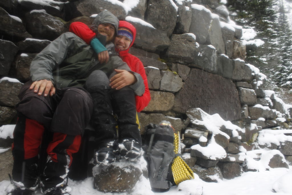
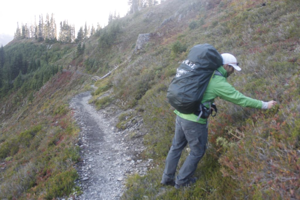
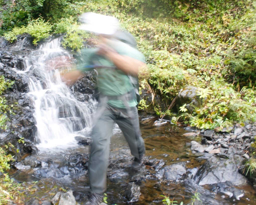
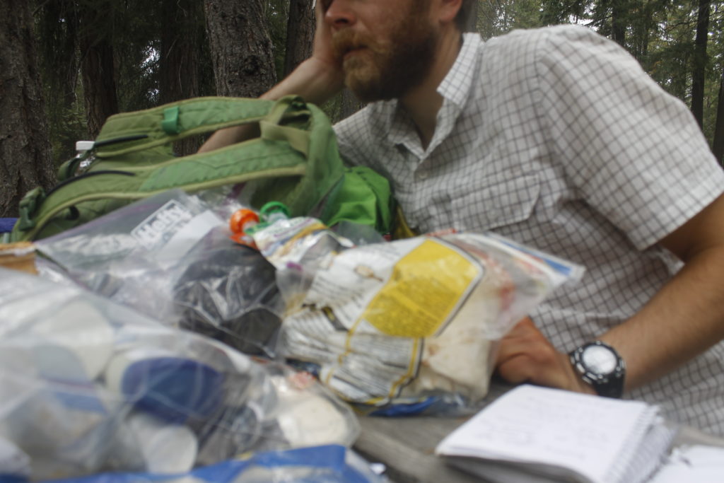
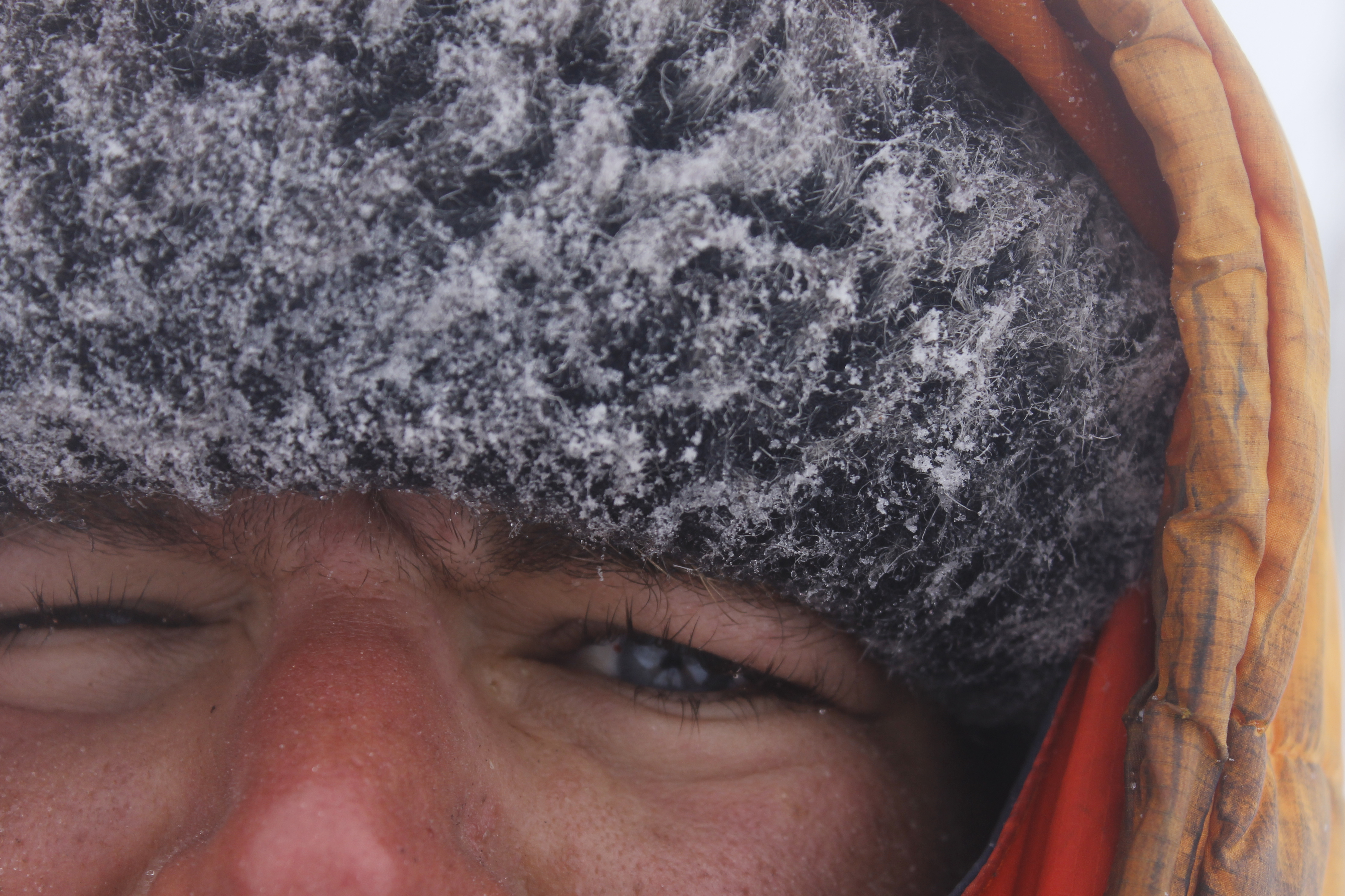
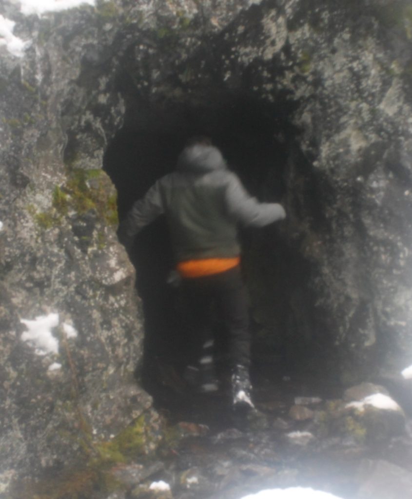
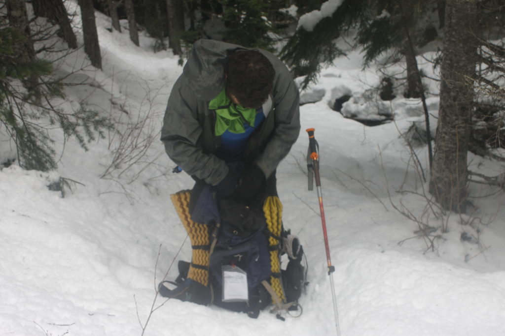
The author takes a moment to mess with his pack

Notes

* After I returned from the hike, I talked to a friend who had been on a few cave tours. Even when bats fly out, they will avoid collisions with sonar, she said. The best thing to do if a bunch of bats come at you is to stay still and let them steer away. If you freak out and flap your arms, they are more likely to be confused and hit you.

** Apparently, the Tubal Cain mine goes almost 3,000 feet back into the rock. So I was probably only a tenth of the way in. I also learned later that the mine is still private property and I was not supposed to go in because of risk (unspecified.) I’ll plead innocent here, having not read this anywhere before the trip. I dug information about mine history here: http://www.kawal.net/tubalcain.htm.

I learned about the scale of the mine, its current ownership and the B-17 here:  http://www.seattletimes.com/life/travel/an-eerie-october-hike-to-downed-b-17-and-old-mine-site/

Tarp Tenting in Goat Country

_mg_1172
Tarp Camp at a foundation in Heather Park

I have this fantasy that one day I will become a Master of Gear.

The Master Of Gear knows exactly what to bring on any given trip, can effortlessly summon shelter, fire, warmth and dryness against the hostile elements. He or she can produce a cup of hot tea to warm your numb fingers, deflect windblown snow with a handy tarp, will always have an extra dry pair of socks, puts on a waterproof layer before the rain starts, wears exactly the right amount of clothes, is never cold, never sweats and has a pack that is much lighter than yours. Nothing is unnecessary.

You will look at your too heavy tent, ripped sleeping bag, the rag-tag assortment of bent stakes and garbage bags, remember that the gloves you need are in the bottom of your pack and feel like the amateur you are. Why do you even try? You’ll never get it right.

And yet I keep striving to get better and to become more fluent in the little tricks and beats that make up the rhythm of hiking, especially if I happen to be traveling with a significant other, especially if I’d talked big game earlier.

When Lauren had said she was looking to buy a tent for herself, I told her that she might save money and weight by choosing a lightweight tarp instead.

“They are better than tents in some ways,” I remember saying with conviction. “You can cook inside them without poisoning yourself with carbon monoxide, the ventilation will reduce the amount of moisture inside.”

I went on about how a cheap lightweight bivy sack could provide wind protection to the sleeping bag, how I had a friend who’d hiked the Appalachian Trail under a tarp, how explorers had even used them for winter camping.

Lauren was skeptical. Then she saw a tarp that weighed just over a pound going for $24 online. She went for it.

Not one to step down from a challenge, I suggested that we try it out on a November camping trip in the Olympic Mountains.

That is how we ended up hiking up along the Heather Park Trail on our way to a 5,300-foot campsite.

If I am not yet Master of Gear, I try to at least become Moderately Capable Guy.

As such, I have a couple of OK tricks in the bag. such as keeping a small piece of insulated mat at the outside of my pack. This enabled us to take a quick sit-down break on the side of the trail without getting our butts wet or cold. I’ve also taken to hiking with food and water in my jacket pockets to make it easier to access the basics when needed. Some “extras” that I brought along included crampons, if I wanted to mess around on hard-packed slopes up higher, an ice axe and a ski pole with ice axe attachment.

A quick sip of water was in order after a couple of hours (and 2,000 feet) of climbing up the trail. The lush environment that we had started in had given way to thinner trees, with many fallen trunks strewn about the mountain side. A fine dusting of snow was on the ground, a cold bite was in the air.

An opening in the trees led to a ledge, where Lauren and I could step out and look at Port Angeles Harbor, where gigantic cargo ships at anchor looked like rectangular islands. To the west, I traced the land to Protection Island and near the harbor of Port Townsend.

A mere 15 miles (give or take) out I saw Vancouver Island, Canada. Though I can see the island on any clear day from Port Angeles, it usually looks like a two-dimensional strip of hills and mountains. From on high, I could see beyond Victoria into the heartland of the enormous chunk of land (the largest island in the eastern Pacific) to the intricate passages off its eastern coast and over to vast inland lakes.

Our break went before another mile of steep hiking where the powdered snow got a couple inches deep. Later, we came to a stream and an abandoned foundation for a hiker hotel. The builders  had abandoned their project long ago, but left a footprint for two weary travelers to set up tarp.

I let Lauren get water for our dinner while I bravely took on the challenge of putting up our shelter.

The tarp to tent substitution is something that I have tried at different times over the years, with varying degrees of success.  I went for a walk down memory lane through some of my older blogs and concluded that something usually sucks about every tarp I’ve built. Here’s how I describe one night in the Black Hills four years ago:

Now that I had some tiny cocoon of body heat, I was damn reluctant to get up and fool around in the rain trying to adjust my demented shelter while getting everything soaked in the process. Instead, I forced myself into the fetal position, trying to think happy thoughts and reflect on all that valuable wilderness experience that I was getting.

And now I was subjecting my girlfriend to this?

But, hey, the tarp shelter that I’d built back in July had worked out decently enough. The shelter of the foundation gave me confidence too.

First, I kicked away the snow from the place where we would be sleeping, and swept it clear with a pine bough.

I tied one end of a rope to a tree branch where the foundation walls formed a corner and tied the other end to the head of my ice axe, which I sank into the dirt further away. This place, I was sure, would provide plenty of protection. I placed the tarp over the rope and secured the corners down with stake. I secured other corners down with two other tree branches and a piece of metal within a fireplace. I hauled off on knots so that I could make everything tight as possible.

Lauren came back to see a hodgepodge of ropes and knots, me still fiddling to get stakes in the semi-frozen ground.

“This is taking forever. Maybe we should have just brought a tent.”

“Nonsense. This is under control. I’m just a little rusty at tarp set up. It takes awhile.”

Eventually, I had everything into a crude, but workable shelter for us to  put our pads and sleeping bags. Next, we folded our sleeping bags into lightweight, reflective bivy sacks that would hold in heat and shield us from the elements. Lauren’s feet were cold, so I took a moment to warm them on my belly, and then she got herself settled into her bag. I knew that if we were low on calories, it would be harder for both of us to maintain core temperature. A hot dinner was an obvious priority.

I took a bathroom break shortly before dinner, making sure to move a good distance away from the shelter. The last thing I wanted was the scent of urine drawing unwelcome visitors: mountain goats.

Hunters in the early 20th century saw the bold crags of the Olympic Mountains, the green blue waters of glacial lakes and gushing rivers and thought, “What this place really needs are some new large animals for us to shoot.”

Never mind that the fragile ecosystems in the Olympic Mountains developed without the large disruptive herbivores foraging the vegetation, and beating paths through the brush. The Cascade Mountains, not far away, did have mountain goats and it was easy enough to truck them over. The relocated goats did find the new environment to their liking. Unfortunately, for the hunters, their dreams of open goat season went off the table once the Olympics became national park in 1938. The shaggy beasts were left to stalk over the rocks and ridges to forage on the alpine plants and thrive in their new environment.

Even if these goats were bad for the mountains, I can’t deny that I would have loved to have seen some of these majestic creatures in their element. I’ve always admired their ability to leap gracefully along the sides of sheer cliffs. The sure-hoofedness of the animals would have been a spectacle to  behold — though hopefully from a distance.

Goats are known to have a territorial streak. They can get stand-offish. Since they also can weigh hundreds of pounds and have large pointy horns on their heads, this can be dangerous. The one recorded animal fatality in Olympic National Park was the result of a goat charge near Hurricane Ridge.

It would seem logical for humans exploring the Olympics to try to avoid goat encounters, but unfortunately, human activities will attract goats. They seek out human sweat and urine because of its salt content. The Park Service encourages people to pee away from trails so that the goats don’t hang out there.

I had a ranger tell me the troubles of one unfortunate hiker who had set his sweaty shirt down in goat country. He must have walked away or else have been pretty unobservant, because a goat gobbled it up. Bummer.

Later, the goat decided the shirt wasn’t its style and regurgitated it back up. That was “lucky” for the hiker, who only had only brought one shirt into the cold, mountainous area. He put it back on and wore his newly-moistened garb the rest of the hike out.

For those of us unlucky enough to have a close goat encounter, the rangers have advised yelling and throwing rocks.

The advice changes during mating season, to “Stay out of the goats’ way,” — according to the same ranger who told me about the shirt-eating incident.

This time of year is mating season, which means that any yelling or posturing at goats would probably threaten the manhood of the males — kind of like calling the biggest guy in the biker bar a pansy in front of his friends —  with predictable, violent consequences. Better to move aside and act non-threatening.

As early as the summer, the Park Service still hadn’t have a definitive plan as to what to do with the goats inside the park. They are a popular sight for tourists and a majestic creature to boot. It just happens that they are in the wrong place, through no fault of their own.

One proposal is a relocation program that involves tranquilizing goats and trucking them back to the Cascades. Goats that evade capture will then face bullets from human hunters who will finally get to do what the people who brought the goats to the mountains had wanted to do in the first place.*

The fact that there may not be goats in the Olympics someday soon only made me want to see a goat even more. Again, I should reemphasize that I only want to see this goat on my own terms. A pee-seeking goat stomping around the campsite was not what I had in mind.

I put aside goat thoughts and went back to food.

The chef’s special of the evening included split pea soup made from dehydrated flakes I’d brought from a natural food store earlier.

Lauren got my stove running from her sleeping bag and we got water up to boil. The flakes cooked in no time and soon we had a meal that could put some warmth back in our guts . The fact that we could cook this meal from inside our shelter was a definite plus. If we had been tent-camping, I would have set the stove outside in the raw elements so as not to burn the tent down or kill us with carbon monoxide. Score for the tarp tent!

The stove added warmth and a little moisture to our small shelter. Little beads formed on the inside of the tarp that would surely freeze later.

Spanish rice followed the pea soup. I added a tube of tomato paste for additional flavor. The heat was great for us, but Lauren’s feet were getting cold again.

I saw the obvious solution in an empty peanut jar I’d brought along. It could make a great hot water bottle. I boiled another pot of water and poured it in. While I had done this before with Nalgene bottles and aluminum, the heat of boiling water was too much for the thin plastic canister and it melted the top of the jar, rendering the screw top completely useless.

I cursed mightily at the spilled water and at myself. Why did I have to fill the jar to the very top? Why did I have to put completely boiling water in there?

The spill had moved toward Lauren’s sleeping area, but we were able to swipe it away before it did real harm. It had left a salty residue that goats might be interested in. I was bummed that I wasn’t able to help with Lauren’s feet. The whole thing felt like a bad omen for the oncoming night.

I gathered the remains of dinner back in the bear can and walked it up the trail to where it would be away from our tent. I took one last pee before I went back to the tent area. I had no interest in leaving my sleeping bag until morning.

Night time in a sleeping bag is the perfect time to wander into that half-sleep of speculation. Is that noise the wind jostling the branches, or is it a massive horned animal stalking the woods for urine deposits? Maybe the strange slits of its pupils were glowing red with malicious inner light.

And, hey, maybe it wants to kill you.

It is not difficult to imagine bad intentions from the beast with cloven hooves.

“Did you hear something?” Lauren asked.

“Hmmm. It probably wasn’t anything.” I said. I moved my ski pole with the ice axe closer to my sleeping bag.

I drifted back toward almost sleep until I heard a scuff, or maybe it was a sneeze.

Lauren: “What was that?”

I peeked over the flapping tarp, saw nothing in the darkness.

“Not sure,” I said.

The demons were toying with us, no doubt.

Sometimes music is the best remedy in times of stress, and I channeled the Rolling Stones.

“Wiiyiilld mountain goats …. couldn’t butt me to death.”

But maybe it was the wind that was going to do us in. Katabatic winds are common in the mountains, especially around coastal ranges like the Olympics. What happens is the warm air that rose to the higher elevations in the day time, begins to condense on the cold mountainside come nightfall. Then that colder, denser air begins falling down the mountains, producing intense wind gusts.

Not long after I got into my bag, a sigh went through the trees, and then the tarp began flapping around like the dickens. The moisture from our cooking and our breath now formed a frosty layer that the wind beat away like dust out of a carpet. Each gust of wind brought a little sprinkle of this icy stuff down onto our faces. Then the wind would stop or I’d here it blowing on some other part of the mountain, I would start to feel myself drifting back toward sleep and the wind would come back. It always came back.

I pictured the wind twisting effortlessly over the rock wall and swiping its cold fury over us. I cursed myself for not putting the tent right up into the corner. Right now, the wall was accomplishing next to nothing.

Plus, the knots that I had used to lash the tarp tightly together were coming loose, and the structure flapped nastily. Reviewing the flaws in my structure, made me feel like no Master of Gear, but perhaps the Master’s dull student who hadn’t done his homework.

“You should lower the front, so the wind doesn’t get in so much,” Lauren said.

The idea made sense, although, I had to get half out of my sleeping bag to make it work. I reluctantly untied the guy-lines from the fixed objects in the front and staked them into the ground. This did lower the wind profile of the tarp and it felt better inside. I clipped my pack into the center line also to make the shelter less apt to billow upward when the wind filled it. It also provided a partial wind barrier. Snowflakes were drifting into the shelter now.

I figured I’d done the best I could and rolled back over into my sleeping bag.

Sleep might have come then, but a few minutes later, the wind seemed to get much worse and the flapping louder.

“A tent stake came up!” Lauren announced. I could look up and see stars in the night sky. I cursed some more and got up to drive the stake back into the ground and reinforced it with a second stake in the same place. A while later, a different stake came up, and I had to reinforce that one too.

“Should we go back down the mountain?” Lauren asked.

I thought about getting out of the sleeping bag to reorganize everything for a trip out into that icy wind. I felt no great excitement at the prospect.

_mg_1177
This was the best shot of the tarp I could manage through my fogged lens that morning The night winds had been unkind to our shelter.

At least our bivy sacks gave us a greater level of protection than what we would have encountered in our sleeping bags alone. If a little snow got on us, it wouldn’t melt into our insulation.

Still, we were both getting plenty cold. It was about 4 a.m. now and my hope was that the sunrise would give us some renewed vigor. The path of least resistance, staying in place, felt like the way to go.

By some miracle, the rest of the stakes held through the night.

We stumbled out of our bags to fetch the bear can and to fill up water for breakfast.

Sure enough the warm food and hot coffee put life back into us. Better yet, there was light coming in through the clouds and a little warmth to go with it.

We dismantled shelter, packed our gear and headed up the trail.

Initially, Lauren had voted we go right back down to the car, but the promising weather had changed her mind. The scenery around Heather Park includes views of the jagged peaks around First Top and Second Top.

_mg_1213
Lauren climbing on ridge near Heather Park

We wore gaiters to keep snow out of our boots, and Lauren had a pair of micro-spikes to improve her grip on the snow. My crampons stayed in the pack. For the moment, they were too heavy-duty for what we were dealing with.

The trail wound up a series of switch backs until we got to a ridge where we could look out toward the Mount Angeles ridge and Hurricane Hill. I could make out the pale, blue line of Lake Crescent. It looked like another beautiful day down there.

The scenery, Lauren said, was worth the brutal night. I breathed a sigh of relief. Not all of the gear had worked perfectly, but we had stayed in the game.

On high, the wind whipped like a banshee through the hills and the clouds raced above the jagged peaks at unnatural speed. We topped out at Heather Pass. There was an inhuman drama to the scene that appealed to me. I always remember how much I love mountains when I go up into them.

_mg_1207
Another view above Heather Park
_mg_1239
After the freezing night, I’m glad Lauren was in high spirits, didn’t try to throw me off the mountain.

Before we went down to the lower elevations, we went up onto a higher ridge. I went ahead for the top, grabbing holds in the rock with the tips of my axes and pulling myself up. The effort rewarded me with a view of Port Angeles and the little toy boats moored in the harbor.

The ridge had something else: goat prints in the snow. Sometimes I followed in their tracks because they beat their way through the thickest brush. I had to hand it to them, thriving up in this freezing country without the sleeping bags, stoves, ice axes or tarps we humans were compelled to bring. If I had seen any of the rugged creatures roaming around, I might have asked how they pulled it off.

Alas, the hoof prints were the only sign. They kept themselves, and their secrets, hidden.

_mg_1232

  • Regarding mountain goat removal plans: I heard about the proposal from the ranger station, and wanted to do more research.The information I found online was sketchy, but there is a document here, that suggests a plan to get the goats out of the Olympic Mountains.https://parkplanning.nps.gov/projectHome.cfm?projectId=49246

Amidst Bears and Glaciers: A Trip To The Olympic Mountains’ Seven-Lakes Basin and Hoh Rain Forest

_mg_0855
Huckleberries in the high alpine zone of the Olympic Mountains. Good bear food.

Sol Duc 

Deciding where to hike in the Olympic Mountains was no easy task for my friend Sean and I, partly because the area has so many faces.

When we researched the ideal two-night trip, we had our pick of wild beaches along the Pacific Coast, the lush rainforests of the western valleys or amidst the drier, but still massive forests in the rain shadow. Higher trails access alpine tundra, even glacier.

We knew that black bears are a very real presence, to the point that the Park Service require overnight hikers to carry their food in canisters or else use specialized cable hangs available at certain sites. That limits freedom a bit. The park is host to a heavy mountain lion population, which also grabs attention, even if there is only a slightly higher risk of an attack then, say, a Bigfoot sighting.

The more credible threat that I anticipated, was cold September rains, which would throw down the challenge of staying dry — at least warm — while we were hiking and camping.

I wanted us to avoid cold and misery, and enjoy the natural beauty of the Olympics. It would be time for both of us to unplug and recharge.

The trip was also a great chance to catch up with Sean. We go back to college, where we ran cross-country together. He lives in Brooklyn now, but has a passion for getting out, whether to the Catskills or the Adirondacks further north. We’ve done a couple of hikes together through the years, including a couple mountains in the Adirondacks and an icy visit to New Hampshire’s White Mountains this spring.

We chose a path that would show us many of the different zones within the park, including  the semi-rain forest of the Sol Duc valley, up to the 5,400-foot Bogachiel Peak, around Seven Lakes Basin, thence down to camp at Hoh Lake and into the Hoh Rain Forest and back the way we came. The plan would get us out of having to carry in a bulky bear canister, because the Hoh Lake campsite had cables where we could hang our food stuff. Even though Seven Lakes is a popular park spot, we had a good shot at enjoying solitude because we would be leaving midweek in September.

I put the tent in my backpack, and gave Sean the pleasure of carrying my cook stove, bulky pots and most of the food.

The sky above the trees was gray as we started along a smooth-packed trail beneath cedar, spruce and fir, their branches draped with the hair-like tendrils of goat’s beard lichen. The Sol Duc River ran through a black walled canyon to our south. Soon, we reached a bridge crossing above Sol Duc Falls, where the river course suddenly turned and dropped into a dark crevice.

Abundant moss grew in the falls mist, further up, spiky stands of devil’s club.

The trail began to climb from here along a series of switchbacks toward Deer Lake.

The cloudy skies had begun to drizzle, then to loose fat drops onto the trees above. Sean and I were protected for the moment, but if the rain continued, the drops would begin rolling off the branches, soaking us.

Neither of us were wearing our rain gear, and we were loath to put it on and start marinating in sweat. Given the mercurial nature of the weather in the northwest, it seemed likely that the rain would pass soon anyway. One day hiker that we passed simply held a trash bag over his head. Not a bad stopgap.

Alas, the rain continued falling, and we started getting wet as we went through clearings. Eventually, we caved and threw on our rain gear and pack covers. That, of course, brought the rain to a prompt halt.

_mg_0630
Sol Duc Falls

The Bears of Bogachiel

As we climbed above the Sol Duc river, Sean and I hashed out a plan for any encounter with Sasquatch Americanus,.

Say we were going around the bend and Bigfoot walked across the trail, should we tell anyone?

Sean was inclined not to on the basis that anyone we told our story to would think we were lying or nuts. Later we agreed that we would only come forward with a Sasquatch sighting if there we could get solid photographic evidence.

Photographing  Bigfoot might have been a tall order, but there were plenty of other opportunities to click the shutter as we climbed past Deer Lake onto an exposed ridge.

The trees became shorter and gnarled. A grand vista opened up to the north where we could see above the foothills across the hard blue water of the Strait of Juan de Fuca out to the mountains on Vancouver Island, British Columbia.

The rocks along the trail were angular, blasted by winter ice. Glacier-carved bowls opened up on either side. Wisps of cloud gathered below.

Further on, we could gaze down into the Seven Lakes Basin, a bare landscape of arctic scrub, sprinkled with water-filled depressions.

“That looks like more than seven lakes,” I remarked.

Sean observed that all of the lakes had fallen from their high-water marks. As the water levels fell, there were places where one lake had diminished into two smaller ones. It had been a dry summer on the Olympic Peninsula. At least we didn’t have to deal with the wildfires and smoke that plagued the park earlier this year.

_mg_0682
Seven Lakes Basin view with sumac in foreground, Sol Duc Valley in Background.

The ridge climbed a saddle where we could look south to the big mountains, including the jagged slopes of Mount Tom and Mount Olympus. Both were hidden in cloud, but occasionally a gap opened where we could peek at a snowfield or glacier.

We had less than a mile to hike down into our camp at Hoh Lake, but the nearby summit of Bogachiel Peak beckoned.

We took a side trail in that direction. The valley below us was filled with low-growing huckleberries with bright red leaves. One dark shape in that field caught my eye. I squinted at it for a moment, sure that it was some shadow cast by a dead tree or boulder. But the shape was moving.

“Hey! That’s a bear down there!”

Most of the bears I’ve seen in the wild have been pretty small, but I’m sure that this one was at least 250 pounds. It grazed slowly among the huckleberries like some bovine in the pasture. If it had noticed us, it didn’t care much.

We watched it for several minutes. Hardly a lumbering brute, the bear moved nimbly among the broken rock, keeping its head down in order to graze microscopic huckleberries out of the twigs and leaves. The black coat had a healthy shine. Elegance isn’t usually the word that pops into mind when I think of bears, but even this large specimen carried itself with refinement and dignity.

Seeing that the bear likely hadn’t noticed us, neither Sean or I bothered to make loud noises or tried to scare it off.  We went on along the trail to the top of the mountain.

The lakes and mountains surrounding us delineated a domain of harsh weather and limited resources— a place that played by the old, hard rules that undergird the upholstery of our day-to-day existence.

Soil on these mountain tops stretches thin as erosion constantly feeds it to the valleys below and nothing washes down to replenish it— yet this film of organic matter was enough to support acres of huckleberries and to provide a bounty to the bears.

When Sean and I walked back down the trail, there were two bears grazing. We stared again, and this time, one of them did look up, seeming to acknowledge us. The look wasn’t menacing, but it seemed wise to move on. If nothing else, I didn’t want to disrupt them.

A small blue nugget of bear scat lay in the trail further on. They must have been getting all or most of their calories from the huckleberries, which is impressive considering that the berries growing here were half the size of a pea at largest.


_mg_0699
Two bears going berry picking
_mg_0708
Sean going berry picking

Sean and I picked a few of them as we went. They were tasty, but the picking was incredibly slow. I guessed that the bears would have to pretty much graze continuously at the berries to feed themselves. That was what they appeared to be doing.

The blue splats of bird droppings decorating the rocks along the trail indicated that bears were not the only ones who profited from the berries.

Further down the trail, Sean spotted another bear, also grazing below us. The camp area at Hoh Lake was not too much further. We felt very motivated to be careful with our food, considering that there were bears nearby who were hungry enough to forage for hours in the huckleberries, They could get the calories they needed in minutes from one ambush into our supplies.

Sure enough, Sean saw one bear grazing on the hillside above Hoh lake, only about a quarter mile from where we’d pitched tent.

We turned in early while we still had the warmth of dinner in our bellies. I hoped we would wake up warm and ready to take on whatever the next day had in store.

_mg_0718
Camp

Descent to the Hoh

Cold and mist were in store.

Soon after we awoke, Sean went out to pick some huckleberries to make morning oatmeal more interesting,

We finished our meal by slugging down morning coffee for Sean and some black tea for myself, then we were on the trail to the Hoh rainforest. We left the tent, gear and extra food at at camp (the latter hung up on the bear cable) so that we could move along with lighter loads.

The path dropped past mossy waterfalls, into groves of cedar. Unlike the wide trails we had hiked the day before, this route seemed infrequently traveled, with soaking vegetation closing in on either side of us. Sodden branches bounced harmlessly off of our rain jackets, but my lower half was drenched in short order. One hiker coming up from the other direction wore a makeshift plastic skirt. Excellent idea.

Further down the trail, we found a pile of bones beneath a cedar tree. The massive femurs could have only belonged to an elk. But what had killed it?

Sean speculated that it was a mountain lion. If one of those big cats was about, I definitely wanted my camera at the ready — only now, I discovered that despite my best efforts to protect it, moisture had gotten in and fogged the lens housing.

By the time we met the Hoh River Trail at the bottom of the switchbacks, some six miles below camp, it was already getting later in the day, and it was clear that we would only have a couple of hours to explore.

_mg_0798
Stream crossing
_mg_0737
The bone pile

But the wonder of the Hoh Rainforest was worth even a brief visit. In contrast to the tundra we had seen earlier, life ran rampant here. Massive conifers towered over with their  lower branches draped in goat’s beard. Thick moss ran up and down the trunks of maple trees.  Gigantic fallen logs supported ecosystems of sword fern moss and smaller plants growing out of them.

The environment had that fairy tale feeling to it, so much so that  I almost expected to run across some Keebler elves out gathering mushrooms.

Elves we did not find, but sometimes we would stop and gawk at one of the enormous banana slugs or the black slugs that crawled onto the path.

The moist air was warm, almost sultry, compared to the exposed heights where we had hiked earlier. A whopping 141 to 165 inches of rain fall in this rainforest.*

We took breaks to explore an incongruous meadow, then did lunch at an overlook above the Hoh River, which was low and milky-white with sediment.

Much of the river originates from glacial melt off Mount Olympus. If we were going to see any of this mountainous splendor, it wouldn’t be from here. A low cloud base above the forest prevented us from seeing much above the tree tops.

The climb back up was a long one, but fortunately, passing hikers had knocked most of the moisture off the branches along the trail and we didn’t get so wet as when we started.

We stopped back at Hoh Lake to skip some rocks. There were no bears that we could see, but there was an occasional fish jump.

When I went up to the bear cable to bring the food down, the clouds broke and afforded me a view of the glaciers of Mount Tom and Mount Olympus. Miles of ice sat in the depressions between jagged crags.

I called Sean up and we watched the mountains. Even though Olympus is not quite 8,000 feet tall, the sharp profile of the mountains could have passed them off as giants of the American Rockies. The fact that there were huge glaciers helped too. In fact, we were looking at the third largest glacial system in the continental U.S. ** Altitude isn’t everything, especially when considering the 50 to 70 feet  of snow that Olympus receives every year. Constant cloud cover protects the snowfields from the heat of the sun. Unfortunately, like most other glaciers in the world, the glaciers around Olympus have been in retreat. ***

As the sun sank toward the western horizon, the glaciers glowed in the pinkish light. Many hikers never get to see Olympus because it is so often in the clouds. I was glad that we had this chance.

_mg_0783
Slug specimen
_mg_0761
Sean at the Hoh River
_mg_0817
Skipping rocks at Hoh Lake
_mg_0841
View of Olympus from our campsite

More Bears and Mountain Views.

Early the next morning we hiked out of camp with after a light oatmeal breakfast. We had cut things a little fine with our food planning, so most of our lunch calories were going to come from bars and gel.

The morning chill left us as we climbed back up toward Bogachiel and the sun began to emerge.

Going past the plains of blueberries, we saw two black bears. One was on the trail, the other below. They were about the same size as the bears we had seemed earlier, and it seemed likely that they were the same ones.

We decided to wait a few minutes to see if the bear on the trail would move. When it didn’t, we started shouting, and the bear moved, slowly, up the hill.

We decided to add some miles to our total going back by following the High Divide trail the rest of the way around the Seven Lakes Basin, before descending back to the Sol Duc river. This route turned out to be an excellent choice because we were lucky enough to have more clear weather. We had superb views of Mount Olympus and some of the other nearby Olympic peaks.

As we walked further east, we got a better look at the Blue Glacier. Deep cracks within the ice revealed where it got the name, displaying that sublime turquoise tint you might recognize  from photographs of arctic icebergs. Further down, the glacier formed a long tongue through the mountain valley.

Tragically, my lens was fogged for much of the morning, and I didn’t get any good shots of the mountains from this angle.

The warm sun and clear skies lent itself to more huckleberry picking, so Sean and I stopped frequently to load up.

We saw  two more bears on distant hillsides, enjoying the same snack. That brought the number of unique bear sightings up to at least six for our trip — doubling the number of bear sightings that either of us had seen in our lifetimes. But who’s counting?

The trail took us down along the Sol Duc, offering plenty of opportunities to enjoy the sight of waterfalls in the mossy canyon.

We were no longer contemplating the natural beauty in solitude however. Several groups of hikers coming up the trail the other way to get to the campsites they had reserved for the weekend. It would be a lot busier on the ridges on the days to come. I was glad that we had seen everything when we did.

As for an encounter with Sasquatch? He stumbled out of the woods to give me a high-five — right after my camera battery died.

_mg_0854
Parting bear shot

*http://www.summitpost.org/mount-olympus/150427

**http://www.summitpost.org/olympic-range-wa/171068

***https://www.nps.gov/olym/learn/nature/glaciers.htm

How I Ran, Hiked and Lollygagged a 100K: My Trail Race at the Plain 100 in the Cascade Mountains

_mg_0594
Getting food, medical supplies and other gear ready for my first 100K trail race (unsupported)

Preparation

The Plain 100 is an Ultra Marathon in the Cascade Mountains near Stevens Pass Washington. Runners can choose to compete in a 100-mile event or a 100-kilometer (62.1-mile) race. I signed up for the latter.

True to the name, Plain is plain. There are check in stations, but no volunteer or race staff will feed, water or otherwise aid you along the course (to accept aid is to drop out.) They won’t even tell you which way to go. You will have a map and directions and you should figure it out. The food you eat is what you carry in on your back, the water you drink is what you find along the trails.

The trails are almost entirely rugged single track, made for dirt bikes., The 100K has about 12,000 feet of elevation gain (about 24,000 feet of gain for the 100-miler.)

I knew that to do this race, I stood a high chance of becoming lost, miserable, exhausted, shattered — and there was a good chance I would drop out.

So why?

Good question. I wanted to push something and I wanted to see if I had the mettle to do a long distance mountain run. Having run a 50-mile race the last summer, I felt the need to go up a rung.

I have spent weekends this summer running trails in Olympic National Park, and have enjoyed figuring out how to run and power-hike the long switchbacks and how to turn my legs over quickly on the downhills. Some of my best runs were between 30 and 40 miles and included up to 8,000 feet of elevation change.

I planned on doing a 100K that had aid stations. A major mountain climb would be OK by me, though I’d hoped not to do over 10,000 feet of it. Unfortunately, several of the 100Ks in the Pacific Northwest were already booked up by the time that I decided to move. The Plain 100 was the only race left.

I sent an email to race director Tim Denhoff, asking if he thought a newbie ultra-runner like me had the chops to take on Plain — even the truncated 100K version of it. After he sent me an extensive description of the challenges of carrying food and water on a tugged course he wrote, “Tom, I want you to consider what I’m telling you, not discourage you from coming and giving it your best shot. Hope to see you at Plain!”

When I got to race headquarters at the Lake Wenatchee Rec Club for the mandatory meeting the day before, there were just over 30 participants who showed. Only eight of these were running the 100K. I felt Junior Varsity next to the 100-milers.

I spotted one or two longhaired distance gurus in the crowd, but they were the exception. Most of  the runners had a sleek, efficient haircuts and the bearing of attendees at, say, a business management convention. The runners I talked to did seem to have well-paying professional jobs, such as mineralogist and lawyer. It is tempting to wonder whether the same competitive instinct that helped them succeed in business also motivates them to thrash their bodies in the primal competition of ultra running.  But I’m just a kayak guide. What would I know?

The runners were at ease swapping war stories from previous races, commenting on notorious runners they’ve encountered through the years. Many pulled out their phones during their conversations to check out each others stats on the Ultra Sign Up website.

At my table, there was a man from British Columbia, from the UK, and Japan — who was based in Seattle now.

They pulled my name up and apparently the computers had already projected that I would win the 100K. The computers get it wrong a lot, I heard

Race directors Tim Stroh and Tim Dehnhoff gave us a war room-style briefing, complete with oversized maps on the table for us to pore over elevation differences and watering holes. There would be a few check in stations along the course to make sure the runners were coming along and not getting eaten by Bigfoot, but these would offer no assistance. We would give the stations our race numbers and tell them “I’m a warrior!” when they asked “What are you?”

I hadn’t studied the maps much beforehand and now I was playing catch up, marking my own map with a pen as the presentation went along.

There were two long waterless sections for eight miles and a 14 mile section that would include a 5,000 foot climb. I run further than this without water all the time on the roads. On the trails, I knew it would be another matter. Tim Stroh, said he personally carried a gallon up the mountain and drank all of it.

The water was just one piece of the gear, clothes food puzzle that I was putting together. The main question was how I would have everything I needed without an elephant on my back.

Here’s what I threw in my pack:

Food

It was bette to have too much than too little.  I had bonked on a couple of previous runs when I tried to cut the pack weight down and came up short of fuel in the last miles. I was determined not to repeat the same mistake for the big race, but in retrospect, I went way overboard.

  • Six peanut butter flatbread burritos (two with raisins)
  • Twenty Oreos
  • Two Gerber baby food packets (bananna oatmeal)
  • One Clif Bar
  • Three chocolate bars
  • Six packs of sports gel
  • Eight sports drink tabs to add to water
  • Three Kind bars, hickory smoked with almonds (Thanks Mom and Dad!)
  • Two other energy bars from the pre-race goody bag.
  • Multiple empty Gatorade bottles and one half-full bottle of juice. 

I ended up eating two of the burritos, one full chocolate bar, the cliff bar, 16 oreos, three or four gel packs, the granola bars, 1 gerber pack and two of the Kind bars.

Clothing

This was to be another crucial part of the game, especially because the forecast called for rain, and there were bound to be extreme changes in how warm or cold based on elevation or effort

I carried:

  • A synthetic T-shirt
  • Ball cap
  • A North Face shell
  • A fleece
  • My Fargo-style synthetic fur hat with ear flaps.
  • Compression shorts
  • Synthetic socks
  • Zero-drop Altra running shoes.

Other Stuff

  • A backpack to put everything in (borrowed from a friend as my normal pack tore a strap at the last minute)
  • A headlamp.
  • A Luci solar light (backup)
  • Extra batteries.
  • An SOL micro bivvy sack with heat reflective sides (for an unplanned night in the woods.)
  • A nylon pack cover.
  • A med kit that included gauze, band-aides, athletic tape and a small tub of petroleum jelly.

I ended up carrying map and directions in a see-through plastic portfolio that I carried in one hand for quick consultation along the trail. The system I had rigged seemed comprehensive, but I soon realized that it was amateur-hour compared to what other runners had.

When it came to mental preparation, I had some, from the 50-mile race I’d run last year, to numerous trail runs throughout the summer. But the fact remained that this was the longest, hilliest run I’d ever attempted. Also, I should have invested more time going over the maps, not just for the race course, but getting there.

Disaster

It was 5:00 a.m.: the race start time, but I was not at the starting line. I was driving way too fast over dark country roads, wondering where the hell the starting line was.

I loosed a steady stream of invective as I tried frantically to look at the map and drive at the same time, and then call a friend to get me better directions off the internet. The feeling of failure felt like a weight crushing down on my chest.

This is what you get for being sloppy and stupid and cocky and now you’ve wasted your whole summer running and you’ll have to tell all your friends that you didn’t run the race because you’re such an idiot. Stupid, stupid, stupid!

Just as I had begun to resign myself to the idea that I had really screwed the pooch, I saw a truck coming up from the other direction.

I flashed my lights and stuck my hand out the window.

The truck stopped and I saw a guy with a headlamp stick his head out the window.

“You know where the starting line is?” I asked.

“I was wondering the same thing.”

I decided to follow him. Somehow, within 15 minutes, we found the turn, which was on the other side of the road then the directions (because I’d gotten turned around somehow.) The runners were already on the course with headlamps shining in the dark. We were the assholes spraying them with dust as we drove by.

When we got to the start line, were 37 minutes late. The director allowed us to proceed ahead. It wasn’t the first time someone had started the race early. It was not a promising start, but it was a start.

Recovery 

The two of us started running together in the dark. His name was Phil. As luck would have it, he was one of the six runners who were only doing 100 miles.

As our headlamps swung together through the dark, we talked about ourselves. He was 48 and administered psychological screenings. I talked about my travels and work as a guide. Talking about anything was far preferable then fixating on our late start. We also were able to coordinate navigation together with him looking at the written race directions and me looking at the race map. Eventually, we let ourselves talk about how freaked out we’d been that we were going to miss the race.

If I’d been running alone, I might have told myself that the race was hopeless and that it was stupid to go out and get lost in the woods for a race I wasn’t ready for. I might have been tempted to run hard up hills, trying to catch the competition. Though this would have felt satisfying at first it would have been bad for my energy long-term.

Instead, I ended up walking the steep hills along a switch-backed road into the mountains. I was going a little slower than I planned, but I didn’t know what was ahead and it seemed wise to go conservative at the start of the race. Phil guessed that we would be out there until around midnight. This seemed insanely late to me, even though it was close to the time that it had taken other ultra-runners to go that distance.

Yeah, but I was going to run down the hills faster than the other guys, I thought. I held onto this illusion that I was going to finish early for long into the race.

Dull illumination crept up behind the clouds as the morning spread over the land.

Soon we were at the top of Maverick Saddle, which was the first check-in station, and the beginning of the trail running.

“What’s your race number?”

“Three!”

“And what are you?”

“I’m a warrior!”

We left the roads for the Mad River Trail and the rocks and roots that would fill up the hours to come.

Striking out 

We took our first water break out of the Mad River. I drank right from the source, raising my torso so that the water could run down my throat without choking me.

We turned onto the Hi Yu trail and climbed onto a ridge line. I was starting to feel energy from the  trails, which was the thrill of moving myself over the rough terrain, maintaining momentum. I pointed out a few thimbleberries growing along the side of the trail and we grabbed them.

I sensed that Phil wanted to be more conservative and take more walks on the uphills than I did. He had more race experience than I did and maybe he was right to go slower. But it wasn’t right for me to push him to start his race faster than the race he wanted to run. I told him it had been awesome running together this far and then started running down the trail.

In a little while, I started catching runners.

The boost of confidence I got from passing people balanced out my nervousness that I would be on my own after I left Phil.

The other runners ran beneath ponchos to keep out of the rain. I waited to put on any rain protection because I worried about getting soaked from sweat. Still, I knew that it if it kept raining, I would eventually have to stop and put new layers on. The process would sacrifice time and sacrifice heat.

I drank from streams and lakes directly, not bothering to treat the water — most of the runners weren’t willing to sacrifice the time. These hydration stops were vital, especially leading up to the long mountain ridge section, which would go for miles without water sources. Nonetheless, I was keenly aware of the minutes going by as I stopped to fill bottles in my pack. I played leapfrog with other runners as I made these stops, and they made stops of there own. Every stop also put my body temperature into a tailspin; I would try to pull out by gunning my engines harder on the trail.

The veteran ultra runners were far more efficient with their re-watering and refueling than I was. They seemed able to drop their bottles or Camelbaks into streams and pluck them out  without breaking stride. The fact that I had a rain cover on my pack added another layer of slowness that cut efficiency.

Cold

Cold finally caught up to me on the way to 6,820-foot Klone Peak. With the light rain falling, I knew it was only a matter of time before my core temperature took a dive. I shed my soaking shirt and put a windbreaker over my naked chest. The jacket kept the whipping winds at bay while the armpit zippers offered some ventilation to prevent things from getting overly clammy.

Some of the runners in front of me were already doubling back down from Klone. “The climb sucks, but the view is worth it,” one of them told me. Of course, when I got to the summit, all I saw was a cloud blanket.

Going back down the mountain, the trail went through burned out  forest where there had been a wildfire the previous year. There had been no Plain 100 in 2015 due to the flames. Now acres of charred branches whistled ominously in the wind, a post-apocalyptic landscape worthy of The Road. The trail lead to a series of switchbacks on a long descent toward the Entiat River.  Every turn was banked with concrete blocks for the dirt bikes who used the trails.

I’d read accounts of runners struggling not to slip on these blocks, and indeed I did feel as though I needed to pay more attention to my steps as I went through these sections. I was relieved to find they were far more manageable then I’d anticipated.

The narrow trail rut did cause some trouble, because my left foot always came down at a funky angle.

I focused on my running form, twisting my body so that my legs followed into the curves. The repetition of switchbacks distracted me from fatigue. I could see the Entiat River valley emerge through the fog, but it was still a long way down.

I passed two runners on the descent, then popped out at a paved road where there was another check in station. There were a couple of turns coming up that seemed ambiguous to me, and the other runners who had done the race before gave me guidance.

“How’s your race going?” I asked one man with a handlebar mustache. “I’m cold and wet and not having much fun,” he replied. He was doing the 100 miles. We were maybe 33 miles from the start.

Eventually, I got back on the single track and started going downhill.

I knew I could refill water at Tommy Creek, just a bit further ahead, and planned on stopping there, but wasn’t sure how far ahead it would be. I’d planned to delay eating until this refill point. But a sudden feeling of fatigue helped me decide to stop. This meant taking off my pack and messing with a bunch of stuff while other runners caught up to me. Of course, when I ran for a quarter mile further, I came right up to the Creek and had to stop again to fill my water stores before the long climb up Signal Peak.

“Noob move,” I muttered.

The Lonely Climb

Several other runners had picked there way down over mossy rocks to the river bank, and I got race news from them.

At least two of the top runners had gotten lost and wasted a bunch of time going down the wrong trail. The race directors had let several of the hundred-mile people know that they had a shot at finishing before the 36-hour cutoff, but there could be no lollygagging.

“I haven’t been lollygagging,” one women answered tersely. Indeed she hadn’t. I recognized her from much earlier on the race course moving at a much slower pace than me. She must not have broken her stride much at all in order to catch up.

“We’re probably going to finish the 100K around midnight,” another runner predicted.

Most of the runners seemed encouraged by this, though I felt the opposite way. The 100-mile runners were happy to take a break to refuel or nap in their cars, then slog out the remaining forty-odd miles. I was intimidated at the prospect of all those hours running in the dark.

The next 14 miles included a 5,000 foot climb to the top of Signal Peak and no water on the trail until Billy Creek. I remembered Tim Stroh saying he carried at least a gallon of water up the mountain. In the cold conditions, I decided to carry a little bit less.

I started up a long steep grade at a brisk hike. It was too steep to run it worth anything.

Switchback after switchback, I climbed alone. Despair began to show its ugly face.

What if I’m on the wrong trail?

The thought was unlikely, but carried deadly menace. A 5,000 foot climb in the wrong direction would almost certainly mean I would drop out of the race. I would have to carry my demoralized body to the last checkpoint and hope someone would still be there. My thoughts went to the tiny reflective mylar bag I’d stashed in the bottom of my backpack. That might be my home for the night, curled under a log somewhere, clenching myself for warmth.

I could see the jagged sides of the mountain ridge in front of me — there was plenty of hill left to climb. The sinking sun shimmered off of wet leaves in the valley below and cast a rainbow above the hills.

“That’s beautiful,” I said, waiting for the inspiration to carry me uphill. But the worries were stronger.

I’m through with this crap. What’s the point? This is physically damaging, mentally isolating and it doesn’t do a damn for anybody. There are a million other worthy things I could be doing right now.

Each time I thought I had reached the crest of the ridge, I found out that there was another switchback to climb. The wind became colder, making me put my jacket on.

The trail didn’t climb forever. It started going down where it merged with the Tyee Ridge Trail, the trail on the map. I was on course.

“Thank God!”


I immediately saw another racer in a blue jacket emerge from the trees. I recognized him from earlier in the course when he’d helped me with directions. He had gone to a spring a quarter-mile off the trail to refill his water stores. My relief grew. If there were someone else I could navigate the darkness with, I felt far more comfortable.

“I’m glad to see someone else out here,” I said.

“Yeah. Me too.” he replied.

“One thing I know is that I want to be off this damn ridge before nightfall,” I said.

We stuck together for about two miles until I felt a fresh surge of confidence and started running downhill faster. I used the written directions to take me onto Billy Creek Trail just as the orange light left the mountaintops and troubled grays began their creep across the landscape.

Slow Misery

I made my way past the next check in station station with a new burst of confidence. There were a number of switchbacks going down soft needles, that I was able to run aggressively. Soon I passed two other runners with their headlamps on, right as I went past two turns that I’d worried about missing earlier.

“Hey you might want that,” a runner warned me. The headlamp I’d been carrying in my map case had fallen out somehow.

“Thanks,” I said, feeling like a complete idiot.

When I announced that I was doing the 100K, the runners told me it must feel like I was the horse smelling the barn. Only about 14 miles left, one told me. That didn’t sound bad at all. I pictured the last segment of one of my training runs from the top of Hurricane Ridge to my apartment in Port Angeles, Washington. It had been about that far.

“There’s about a thousand-foot climb in four miles.” one of the runners remarked.

Details. I thought. Surely that was nothing compared to the 5,000 feet I had ascended earlier. I was about to find out.

The temperatures began to get warmer as we got deeper into the valley, boosting my confidence more.

The feeling of confidence first began to falter as I began pushing through thicker vegetation, that forced me to slow down and watch my step. I stopped for a quick drink and eat, allowing the two runners from earlier to pass me again.

The drop off into Jimmy Creek brought some of the steepest trail I had run yet that day. Under the narrow illumination of my headlamp, I ran down loose, jagged rocks, mindful of the drop-off on the other side. Switchbacks slowed me to an almost walk. I re-passed the two other runners shortly before we got to the creek below

It was no use though. I had to fumble in my pack to refill water for the first time in 14 miles; my two followers simply popped their bottles off their chest holsters and started running again.

At this point chafing in my shorts had worsened to the point that I had resorted to carrying my petroleum jelly in my jacket pocket. I reapplied, fumbled some more with clothes, and also with a headlamp strap that wouldn’t tighten properly. Eventually, I tied a knot in the thing, which seemed to work.

The trail left Jimmy Creek and started following the slow ascent through the Mad River Valley. The section where I had expected moderate difficulty was proving massively hard. The narrow confines of the headlamp beam only gave me so much time to anticipate and react to trail obstacles. Moreover, my muscles that had felt strong only half an hour ago, now seemed jelly-like and reluctant. I tried to run, but could only manage a fast walk.

Just four miles! I thought And then it’s literally all downhill. It was maddening to find my body, which had seemed to do so well on the downhill section earlier, suddenly rendered slow and stupid.

I heard the Mad River rushing below and desperately wanted to refill my bottles, but I found nowhere to get down its steep banks easily.

Eventually, the path crossed a small stream. I took off my headlamp and leaned over on my belly so that I could drink directly from the water. This required me to lift my head up periodically to get the water down. As I raised myself to swallow another mouthful, I found myself looking at a large toad sitting on a stone nearby.

I thought, I had drank enough, but at the next stream, I found myself drinking all over again. I was peeing plenty, but I couldn’t shake thirst.

I wouldn’t say I was hallucinating at this point, only that my mind was extremely motivated to see mundane things as things that were helpful to me. A circular cut through a log looked a lot like a trail sign announcing the end of the climb — until I got closer and saw it for what it was.  Leafy branches looked like trail signs also. This happened several times.

I crossed the Mad River, drank again, peed again. I looked around a campsite for the road leading up to the last check in station at the top of Maverick Saddle.

The chafing was bad, causing me to tighten up my stride in fear of a bad rub causing fresh pain. I soon saw a jeep parked nearby and recognized the trailhead where I had started earlier in the morning. The check in was a couple hundred feet down the road, a Search and Rescue guy standing outside a truck. There were maybe four miles left in the race.

“Are you OK, Man?” he asked. That wasn’t exactly reassuring to mine ears. I must have looked worse than I thought. The last thing I wanted was to get pulled at the course this close to the finish line.

“I’m fine,” I said. “I just hit a wall in the woods back there. I’ve come back from worse.”

Of course, I nearly wandered off in the wrong direction, before I stopped myself and forced myself to look at the map more carefully. I checked my compass to make sure I was going south (and I was!) and then started jogging awkwardly along the cobbled road, downhill toward the finish.

Soon I heard footsteps coming up from behind. The cool light of another headlamp beam splashed across the road in front of me, and I knew I had company.

Finisher

At first I started to run harder, but this felt pointless.

A glance over my shoulder into the bright light revealed about my pursuer.

“Say, you wouldn’t happen to be the guy in the blue jacket from earlier?” I called.

“That’s me,” the man said. “The name’s Ray by the way.”

He ran up alongside me and I matched his pace. Since he was doing the 100-miler, not the 100K, he felt less like my competition. Soon I felt the funk that had slowed me down earlier start to lift. There was no way I wasn’t going to finish this race.

I told him about the crash I’d felt earlier when I was going up toward the Saddle.

“You probably went too long without eating,” Ray told me.


Indeed, I had lowered my food consumption for the long waterless stretch so that I wouldn’t have to drink so much. Another difference, was that running with someone else made me feel stronger, much in the same way that it had helped when I ran with Phil at the beginning of the race. Coincidentally or not, my lowest portions of the race had come when I’d been running alone.

Now, the two of our headlamps swept together across the gravel road, and the added light made me feel more confident about what was in the path. Ray also had a small flash light in one hand to reduce the distracting contrast between light and shadow.

We made the final turn that indicated we had about three miles left.

I felt more than able to run the rest of the way in, but I did make a few stops to walk with Ray, who had helped me with directions several times along the course. His headlamp had started flickering, and I would have felt crappy about leaving him to run the course behind me if I went ahead. The spare flashlight probably would have covered him, but still. Whatever minutes I could have shaved in the last few miles didn’t seem to matter after 18 hours on the trail.

At the top of a small rise, we started running again.

“I’m going to finish this race as a runner,” I said.

A lighted tent appeared. around the curve. We continued up toward the light where a couple of people were preparing soup and burgers.

“Is this the finish for the 100K?” I asked.

“This is it.”

I eased myself into a chair.

It was 12:12 am, a full 18 hours and 35 minutes from when I had started — 19 hours 12 minutes from official race start time. I was fourth place out of eight racers, two of whom had dropped out. Winner Kyle McCoy finished the 100K in  only 14:45. Steve Slaby won the 100-mile race in 29:22.

I let the volunteers serve me some minestrone soup, while Ray had a burger.

Many of the 100-mile runners were sitting inside their cars parked nearby with the engines running, trying to warm themselves. Here and there a door would open, a headlight would flick on, another runner would start off down the gravel. They had miles to go before they slept.

Afterthoughts

From the comfort of the chair at the end of the race, it was easy enough to speculate as to whether I could have gone on to run those remaining miles with the rest of the 100-mile crowd. It is even easier to speculate from the comfort of my room as I type these words. Ultimately, however, that is a test that only the miles can prove — just as only the miles could prove whether I was capable of running 100 kilometers to begin with. The Plain does offer the option to 100K runners who want to upgrade to the 100-mile mid-race, but I was in no mood to find out that night. For one, my chafing was pretty bad. Not having studied the map for the last section of the race also left me vulnerable to getting really lost.

Going as far as I had did give me the luxury of learning from mistakes and trying to be better prepared and more efficient for the next competition.

Some lessons for me included the idea of managing water and food more efficiently with a rig that has front pouches available (or even stashing more stuff in jacket pockets)

I would be tempted to get a Camelbak or similar hydration system for my next race, though chest-mounted bottles would work nicely too. A laminated map with a chest lanyard would be another efficient thing to have in order to help navigation. Also, next time, I will remember that directions to the start can be just as important as directions on the race course.

Another lesson I took away is that it can be immensely helpful and enjoyable to share the miles with someone else instead of trying to push through alone.

I ended the race with an abundance of food, almost half the amount that I had started out with, including four smashed up Oreos, most of the gel packs, two chocolate bars, a baby food pack and four of the six burritos. I never used any of the drink mix tabs except for the ones that I had put at the bottom of my empty water bottles before the start. The amount I had would most likely have made it for a 100-mile race, and if I did another unsupported competition, I might use the about the same amount of everything.

I didn’t end up using either my spare fleece, the mico-bivvy sack, or any of the first aid stuff aside from the petroleum jelly, but I don’t regret bringing any one of those. In a race when anything could have happened, including a twisted ankle on a cold dark trail, it was nice to have a measure of security.

_mg_0600
Trail foot

The Broken Road and Healing River: Camp Running in the Elwha Valley

The break in the road was far less dramatic than what I had envisioned. The only thing that kept motorized traffic off the eight miles of asphalt leading to Olympic Hot Springs was a minor washout, hardly more than a dozen feet across, carved by an errant channel of the Elwha River. A small wooden bridge over the gap, made it easy enough to cross and, apparently, Park Service vehicles were already using it to conduct their business. Nonetheless, that gap in the road, cut off civilian traffic to the springs — unless, of course, they were motivated to get there without a car.

I left my car back at the Madison Falls parking lot, where the Park Service had barred the road, and started down the pavement, backcountry camping permit attached to my pack. After going a few paces at a walk, I fell into a light jog, then thrust my chin forward and started running.

This was the first time I’d tried camping with a backpack light enough for me to run with. Items like a sleeping bag, tarp, food and first aid supplies added weight on my shoulders, but the burden was a manageable one. I was pleased to see myself moving much faster than conventional hiking speed.

Crowds of people of people strolling out from the parking lot diminished rapidly as I put miles down. Here and there, and odd biker cruised along the pavement.

The murmurings of the Elwha drifted through the trees, sounds that would no doubt have been drowned out by the din of auto traffic a year earlier. There was no exhaust in the air, but a stimulating tang of sun-warmed pine needles refreshed my spirit. For all my scattershot planning, second guesses and doubts, it was good to actually be out there doing the thing.


I would run 10 miles and climb 2,000 feet, then camp near the springs with the small provisions in my pack. The next day, I would log about 22 miles over a five-thousand foot mountain ridge.

I stopped on my fourth mile to walk out on the remains of the Glines Canyon Dam. The abandoned road had already lent a post-apocalyptic theme for my trip, but this was something else.

A walkway led out onto the 210-foot span, then ended abruptly for a view into a chasm where the rest of the dam used to be. The milky-blue Elwha river ran unencumbered beneath the gaze of its former captor. Rapids thrashed out against the stone walls and churned in a confusion of rapids downstream.

What disaster had destroyed this mighty dam? No disaster (depending on who you ask) but a public project to restore the river and bring back salmon. The Park Service signs around the site explained the work, the largest of its kind in US History.

Since the Elwha Dam construction began in 2010, the Elwha has been a dammed river. The Glines Canyon Dam followed in the 20s, providing the electricity that helped run the mills in nearby Port Angeles, Washington. The dams also blocked salmon access to 70 miles worth of prime salmon spawning ground. Thomas Aldwell, the Canadian-born dam financier, did not bother putting fish ladders in either of his dams. Even if there had been ladders, the fact that the dams held back sediment and drastically changed the river temperature was still enough to spell disaster for salmon and steelhead populations that would have used the river before. How much sediment? The volume is equal to the area of a football field multiplied by 2.25 miles according to the Park Service. A beach has reformed at the river mouth as the sediment comes down the current, and it is even replenishing Ediz Hook, the narrow of land spit that forms Port Angeles’s natural harbor. The Hook has become a popular fishing spot in the wake of dam removal.

When the dams went up, they dealt a hard blow to the salmon fishing livelihood of the Lower Elwha Klallam Tribe, which lives near the mouth of the river. Not surprisingly, the Klallam were a major proponent of dam removal. Congress approved the process with the 1992 Elwha River Ecosystem and Fisheries Restoration Act, signed by George H.W. Bush.

It took until 2011 for the last of the Elwha Dam to come out and longer for a floating barge to chip out the Glines Canyon Dam. In 2014, the last 30 feet of the structure went down in a blast of dynamite.


Life is finding its way back to the river. The salmon are beginning to re-find their old spawning grounds now, thanks in part to help from humans, who have released the tiny spawn upstream of the dam sites so that they would imprint and later return to these habitats.  On a recent kayak trip down the Elwha rapids, I got to see the artificial log-jams along the river that slow and cool the currents, making life better for returning salmon.

More human effort to realign the human-scarred landscape included the willow, salal, black cottonwood and numerous other native species workers had planted along the edges of the gray siltscape that marked the former Mills Reservoir to my south.

After a century of imprisonment, however, it should be unsurprising that the river should lash out a bit upon release. Hence the washed-out section of road, which made the traffic on the Hot Springs road a no-go.

The landscape around me seemed more wild just knowing that there wouldn’t be seeing any families leaving the engine idling as they got out for a quick picture of it. I looked up to the snow on the peaks in the Olympic Mountains and knew it was time to start running again.


My calves got a nice workout as I knocked out 2,000 feet of elevation in a couple miles. I stopped to enjoy a lookout over the Straight of Juan De Fuca and distant Vancouver Island.

The road ended at a National Park trailhead. No mountain bikes allowed beyond this point. Everyone was now foot traffic like me. Other notices remarked that a suspension bridge along the trail was considered unsafe, also that fecal coliform had been found in the hot springs (I thought all coliform was fecal, but yeah, nice way to emphasize that point.) The National Park Service still says no to weed, no matter what the laws were in Washington State. Uncle Sam set the house rules here.

The trail was easy running, with wide margins and the occasional ditch to hop. I spied a woman walking over the questionable suspension bridge, and decided to take my chances with it, even though I was a bit heavier.

The trail continued along an Elwha tributary and led to another bridge where I smelled the faint aroma of rotten eggs. Lines of rocks marked the springs, helping to shore up the water. The manmade walls were a far cry from the concrete, entrance fee and bath towel affairs that I’ve seen at commercial hot springs elsewhere. They were a small human improvement, and the damming seemed far less egregious than the toppled behemoths that had sequestered the Elwha.

I explored tiny trails leading to secret springs, finally found a murky pool that was a way above the main trail. A bright blue line of mineral substrate issued from the crack in the rocks where the water fed this natural spa. Steam wisped upward from the dark mirror surface. I took my clothes off.

I put a foot in the spring. The water was scalding. Then, I dangled a leg in and waited until it seemed OK. I let the rest of myself settle beneath the murky surface.

Aahhhhhh. Not bad! Not bad at all!

 Beads of sweat formed on my forehead as I gazed at moss-covered branches overhead and the blue sky beyond.

If I had no one else to share the spring with me I could thank/blame the Elwha again for taking out the section of road and limiting access. I’d heard from others that the springs were usually crowded during the summer months. Such crowds had likely brought the coliform contamination as bathers answered nature’s call near springs.

I made a mental note to use plenty of hand sanitizer before dinner that night.


Fires were not allowed at the springs campsite, but I hadn’t found out until I got there and I’d saved weight by not bringing a fuel stove in my backpack. There had yet to be a general burn ban in the forest. Nor did the prospect of cold pea soup crunch for dinner did not appeal.

I was determined to make the tiniest of fires, reasoning that done right, this would be more ecological than fossil fuel. I used mineral soil at the base of a felled tree as the fire sight, and built a fire pit of about six inches across using three large stones. Using a vaseline-soaked cotton ball as starter, I started a minute twig fire, that was nonetheless enough to boil water in a pot for soup.

Plenty of us use camping as a way to reward the fire bug in ourselves, delighting in how large we can build the flames from the available wood. It is a perverse application of American “more is better” mentality, where people think that the ability to squander resources makes it their right. Knowing that most people are going to strip large amounts of wood from the surrounding forest, it is no wonder that the Park Service would want to ban campfires at the site.

Some may call me an elitist scofflaw for excepting myself from the rules. I nonetheless took pleasure from trying to make the smallest, most efficient blaze and utilizing it to full capacity. I got plenty of warmth by getting close up to the flames. By the time the fire had burned itself out, I had scarcely gone through a few handfuls of twigs. I heated some more water on the embers and drank the scrapings from the pot.

Like the fire before it, my shelter was a small affair` . I strung rope between two trees and lay a short tarp over it. I carved out some stakes from twigs with my pocket knife. Sleeping bag and tent pad went beneath the tarp. Though the end of the bag stuck out from the end of the tarp, I’d planned for this by bringing an ultralight bivy sack to put the bag in. If it rained that night, I should be dry. I found a scrap of plywood nearby and used it as a wind block.

What the bivy sack did was it made me way too warm in the bag and that is why I woke up early that morning with plenty of sweat soaked through my sleeping bag.


Mountain peaks that had shone in the alpenglow the night before were now obscured in cloud. I considered that the trail ahead of me could be cold and damp. All the more reason for a morning fire.

I set up a pot of water for oatmeal. As the flames leaped, I held the wet sleeping bag as close as I dared to the fire, and was pleased to see much of the moisture evaporate.

I started running down the trail at around 7:45 am. The trail beyond the campsite narrowed and began taking me up a series of switchbacks on my way to Happy Lake Ridge. My water bottles were empty, I planned to fill up when I got to Boulder Lake which was still about 2,000 feet above my head.

I split my time between running and power hiking as I continued to gain elevation. After a while, I saw the “No Fires” sign, that meant that I had reached 3,500 feet. The trees were less dense then when I had started the other day, with large Douglas firs and Sitka spruce predominating.

I paused at Boulder Lake to filter water and eat second breakfast. The cold mist soon had me chilled and made me put on other layers. I realized that I didn’t have any gloves, but I had accidentally packed one extra sock, which I put over one hand. I wondered if I were really equipped to take on a mountain ridge, bound to be more exposed and colder than what I was dealing with. The trail beyond the lake looked not so well maintained, which worried me because I wanted to cover ground quickly to get back to the car by the end of the day. It would have felt defeating to turn around at this point, though, and I vowed to press on.

I started a brisk hike up a series of switchbacks before starting a brisk hike up to the top of the ridge. The trail was narrower here and the wet shrubbery slapped at my legs. I had to pause repeatedly to climb over and under fallen tree trunks. Spears of broken wood waited for my soles to slip on the slick bark.

More meadow-like areas waited at the crest of the ridge. The trees became scrubby dwarfs. Beyond the shifting clouds were hints of grand valleys and towering peaks just outside my vision. I ran along a rollercoaster of ups and downs, leaning forward to tackle the steep descents on gravel. I breathed easily, pushing, not straining, letting my feet turn over under the pull of gravity and for the rhythm of tiny footfalls to carry me down. The energy flowed over into the next rise, and then, I sank tiny steps into the hill, letting them bring me up to the top. Then down again. The trail cut along steep pitches, where a missed step could translate into a messy tumble through rock and briar.


I may not have been smiling, but my heart beat with the quiet joy of the moment. Trail running affirms the present tense, or at least it diminishes my awareness of past and future. I work on a micro-future of what will happen in the fraction of a second before the next footfall, how the torso should turn before the feet do, how to anticipate a landing with one’s entire body. Focus on these minute calculations helps me hold off worry, whether it is troubles in the past or anxieties for the future. I take simple happiness in flowing through the motions with my mind and body. Like the river below, I had (however briefly) unshackled myself.

A patch of snow on the trail, emphasized that I was in mountain country now. A couple miles later, I took a half-mile detour to run down the trail to Happy Lake, where contours of snow clung to the north face of the valley, bleeding into a small stream. The water was so cold that the first mouthful gave me brain freeze.

The clouds broke to the blue sky. A glaciated mountain ridge revealed itself in the distance.

The trail started going down. It would be about 3,000 feet of descent to get back to the paved road and then another 2,000 feet to the Glines Canyon Dam. I let myself begin turning the feet over.

I knew my quadriceps were going to hate me for going down the switchbacks at full tilt. Still, it was good training for them if I wanted to do more mountain running in the months to come. I ran with tiny steps to minimize the individual impacts on my knees.

The sheer pitch of the hill made it impossible for me to run with total abandon, and soon I felt the burning in the quads, which would render me a hobbling oldster for days later every time I walked down stairs.

The trees got bigger again. The scrub grew low and even in a verdant layer that looked like it had to have been manicured. It made me think of some twee victorian park. But I was the only one on the trail.

The twisted, orange trunks of madrona trees flashed by as I skidded down through the curves. Soon, I saw the asphalt line of the road. I got back on and pounded the remaining 2,000 feet to the Glines Canyon Dam.


Walkers and bikers strolled at their leisure along the closed road. I smiled and waved. Everyone seemed in high spirits. If they had been in vehicles they would have blown by me with waves of noise and exhaust.

They should keep the road closed, I thought.

Edward Abbey, famous road hater, would have approved, just as the dam removal would have been much to his liking.

In his book Desert Solitaire, Abbey proposes closing all national parks to personal automobiles, and that people go in on “…horses, bicycles, mules, wild pigs..” instead. He reasons that parks will seem far vaster and grander to people if it takes them more effort to get in than, say, pulling up to a drive-thru.

Abbey writes: “We have agreed not to drive our automobiles into cathedrals, concert halls, art museums, legislative assemblies, private bedrooms and the other sanctums of our culture; we should treat our national parks with the same deference, for they too, are holy places.”

I’m inclined to agree. Just to the east of the Elwha River, the popular Hurricane Ridge Road allows tourists to go mountain climbing in their cars. The shimmering snarl of traffic with the grumble of engines reverberating through the valley is a desecration.

Perhaps simply getting people into these places is worth the road building, the smog and the chaos of crowds. When I see the vast majority of these smartphone-equipped people hardly straying a mile from the machines that brought them in, I wonder how much they are appreciating there surroundings, and how much they are just sucking down the experience like so many Big Gulps from the drive-thru window. Is it a meaningful experience for them, or just a momentary sugar rush, an audiovisual novelty? I see little difference between looking at something from the RV window and seeing it on a screen.

Alas, construction on the broken road is going through as I write. Now completely closed off to civilian access, it will remain off limits for an eight-week period. Then, the asphalt river will reopen, and visitors will be able to migrate back up into their territory.

With the dam broken and the road back under construction, the end result seems half right.

As I ran along, a mountain biker called out to me.

“Hey, didn’t I see you here yesterday?”

He had biked to the trailhead yesterday and hiked the remaining two miles to the springs. He’d liked it so much, he was doing it again today. Bombing back down the 2,000 feet of twisting turns on the empty road was one of his favorite parts of the trip — he clocked himself around 40 miles-per-hour.

When he got to the top of the hill, he would hike the remaining two miles into the springs.

“It’s nice having them without the crowds isn’t it?” I ventured.

“Are you kidding?” He said. “That road washout was the best thing that’s ever happened out here!”

The Right Exposure: A tentless ski adventure in Bear Canyon

_MG_8769
The author takes a break from the wind before skiing to the top of an 11,000-foot ridge.

South Fork

Somewhere at the entrance of the canyon, an unseen coyote was howling, barking, howling, barking.

I skied toward it slowly, picking my way between stands of willow and alder shrub that grew in the gray flatland of the South Fork drainage. It was just after noontime. Fast moving clouds flew across the sky, allowing the sun to warm the land one instant — before they snatched the light away again. The sharp peaks in the Zirkel range to my east alternately gleamed glorious bright in full illumination or brooded in shadow like a vision out of Transylvania.

I tried not to let the weather psych me out, but it struck a harmony with my own brooding malaise.

Bear Canyon, where the coyote continued howling outrage, lay to the south in a somewhat rounder stand of mountains. It was a U-shaped gap between two ridge lines, maybe a quarter-mile across at the mouth. I couldn’t see too far up the way, but I knew that I would camp somewhere inside those walls — without a tent.

I’d sleep in a snow-shelter and rise the next morning to climb onto the ridge below The Dome. This 11,900-foot mountain, with its sheer walls, was probably out of my league, but there was an un-named sister peak, just above 11,000 feet, that had mellower topo lines on the map. I could climb it on skis, maybe.

_MG_8732
Skis and coyote tracks above the South Fork

If the absent tent left an uneasy weight in my mind, I hoped the lessened weight on my back would make up for it. The pack was heavy enough with its winter sleeping bag, extra clothes, food, fuel, tarp and other miscellaneous and sundry camping items.

The abandoned tent gave me room to move a bit quicker and with less back strain (though plenty of that would come later.) There was also more responsibility when it came to setting up camp. I’m always relieved when I know I can snap a shelter together out of poles and nylon fabric in minutes. Building from nature required me to channel whatever MacGyver skills I might have. I knew that the shelter would take time, and I might make mistakes along the way. I’d have to pay attention to the elements, to work with and not in spite of them.

Not that the elements had any trouble finding challenges for me.

There was the river, for one.

I had been able to cross a couple of streams earlier in the trip by skiing over snow bridges. The South Fork offered no such convenience, just a channel of open water between me and Bear Canyon that I would have to get across somehow.

The only solution, I could see (other than taking off skis and boots and wading through barefoot) was a tree that had fallen across the current and had a layer of snow on top.

Fresh canine tracks had crossed here. The coyote was still howling outrage from somewhere in the trees, but I never saw it.

If I went too far off center, my skis would likely break the snow and drop me in the water. I set the skis at a slight angle against the log and slowly began to cross where the coyote had gone, obliterating its tracks with my own.

I reached the other side unscathed and continued toward the base of the canyon. This was north-facing territory, and thus, dominated by pines, spruce and fir. The canyon walls were scarcely visible through the thick boughs.

I stopped to eat some vegan pizza, then put the skins back on and started climbing through the forest.

_MG_8696
Snow tsunami

The winding climb

The clouds hid the sun again, and I found myself looking at the sameness of the trees, feeling less than inspired.

I knew that this trip had me checking off a box before the end of the season. My head wasn’t entirely in the game; it was worrying about things like career path, the descent into adulthood, my need to put down roots and build more long-term relationships with places and people. There would be laundry to do when I got back, and I would be that much further behind in filling out paperwork, making plans.

Now, I incriminated myself. How unworthy it was to be in a wild place and stand there, uninspired. Hell, real suffering hadn’t even started yet.

I’d managed to ditch five pounds of tent, but still carried several tons worth of worldly bullshit into the mountains with me. But what was I supposed to do, just cut it all loose? Pretend that the real responsibilities and questions of the world had no right to exist because, “Oooh, the mountains are so beautiful!”?

I admit that escapism is one reason why I choose to go on adventures — it’s nice to stop worrying about things because the mountains are beautiful. But nature isn’t there just to be eye candy or to plaster us with child-like wonder. It is not separate from the world we live in every day, but permeates every inch of it, from the air we breathe to the bacteria in our guts and the primal hardware that governs our wants and needs. Human nature.

The real challenge is to see sameness between that moose browsing the willows and you, online shopping; between the chittering birds and the guys shouting at each other outside a bar on Friday night.

Natural instinct is one of the reasons why many of us find hiking and camping unappealing. We are designed not to enjoy cold, exposure, vulnerability. This is in conflict with the fact that we are also designed to crave the feeling of accomplishment that comes with summiting a mountain or traveling miles of backcountry.

Walls limit the scope of our experience, whether we put them between ourselves and nature or between ourselves and other people. Taking them down also means greater risks.

Lacking a tent gave me the opportunity to have a beautiful walls-free communion with the natural world outside that night, though this came with the slight downside that the wind was picking up and it was probably going to snow. Too much exposure would get me a nice case of hypothermia.

I’d limit the exposure with a sleeping bag, tarp, and whatever I could build out of the resources I’d have in the canyon.

The more I climbed, the more dead trees I saw, a legacy of the Rocky Mountains’ pine beetle scourge. Worse, many of the trees had toppled in a recent windstorm. I found myself weaving around, doubling or tripping any straight-line distance between two points. The trees made hill climbing a special pain in the ass, because they got in the way of diagonal traverses.

_MG_8710
Fuel for fire
_MG_8736
And for the skier

My priorities were to get shelter, water and a cook fire set up before darkness fell. Experience has taught me that it usually takes longer to do these things than I think. At around 3:15, I started the real-estate hunt.

I stopped at a couple of pines to strip away some dead red boughs (which seem to be more difficult to find at higher elevations) as fire starter. I strapped the lot of them to my pack as a home-warming present to myself.

But were there any places I wanted to settle down in this neighborhood?

Certainly, much of the west side was a no-go. I saw two places where small avalanches had left  swaths of snow rubble on the bare slope. Falling snow was easy enough to avoid, but falling trees were another matter.

Almost all the trees in this part of the canyon were dead. I saw the burn marks around the trunks. I recalled that the mountains to the west of me were part of “Burn Ridge.” Yeah, there had been a burn here all right. Black skeletons of immolated pines creaked in the breeze.

The forecast called for high winds that night, leaving me none too comfortable with the idea of what thousands of pounds of falling tree trunk could do to a potential campsite. The thing was, I couldn’t find a single place outside the radius of one nasty widowmaker or another.

The sun was only a couple of degrees above the western wall. When it dropped, so would the temperature in the canyon, making camp construction that much more uncomfortable.

A time to build

The place where I threw my pack down was far from perfect as far as campsites go. There were still a couple of worrisome trees closer than what I liked. I positioned myself behind a massive burned trunk for protection.

The creek where I planned to get water was well buried in snow, requiring me to dig a five-foot hole before I could fill my cook pan with murky liquid.

_MG_8749
Completed snow trench shelter with snow piled on the roof

O.K., there was one life-need taken care of. Now I needed a structure to protect me from the elements.

The several feet of snow beneath my feet made for a cheap and readily available construction material. Using a snow shovel, I was able to work my way though snow crust into the compact snow, piling the rubble up onto walls on either side of the pit. I ended up with a trench that was long enough to lie down in, and about four-feet deep. Looking up was like peering out of a fresh-dug grave.

Ideally, I’d be able to use the snow to build a roof above the trench, but this was not to be. Though the snow was compact and chunky, I found that it wasn’t quite consolidated enough to dig out decent-sized snow blocks (or the more frequent, irregular snow boogers.) I did have a reflective tarp that I could use instead.

I wanted support beams for this, so it was time to do some woodwork. Fortunately, I’d packed a miniature “chainsaw” — non-motorized, unless you count the operator. There’s a toothed chain with two nylon handles that I can work around a trunk or branch like a garrote, running it back and forth to make a cut. Almost as fast as a bow saw, it made quick work of a blackened tree post, that I cut into sections. The effort helped get me warm too.

I set two long logs in an X above my snow trench, then added reinforcing girders from lighter branches. I plunged two heavy log posts into the snow at either end of the trench so that I’d have a sturdy place to hitch the tarp.*

At first, I set the tarp lengthwise, but it didn’t look long enough. I realized that I wanted to set the tarp on a diagonal with the trench so that I could have the most coverage from head to toe. I also used pine boughs and snow boogers to expand my roof slightly.

A few remaining holes kept me busy trying to secure things. Then, I remembered a trick from a book on backcountry ski camping, and dug a mini snow-cave at the end of the trench. It was just enough room for my feet and knees, but it meant that I now had plenty of room for my head to fit beneath the tarp. If I’d thought of that earlier, it would have saved time and hassle.

I set my pad and sleeping bag inside, laying them over some fresh fir boughs. The wind didn’t blow inside my trench. It was plenty comfortable, even cozy, down there.

I’d just used the elements to MacGyver myself a shelter. It gave me more pride than any tent I’d pitched.

But now it was getting dim and I had to gather more firewood, because I’d used most of the sticks I’d gathered to build the roof above the snow trench.

I dug out a kitchen area near the entrance, set three stout logs down in the snow so I had a platform to build a fire. Though the wind was blowing above me, the pit protected me from most of it.

I arranged strips of dead pine bough above a cotton ball coated in Vaseline, used a flint and steel striker to start the fire.

The warmth was welcome; the choking smoke was not.

Soon, I had a hearty blaze that I used to cook a meal of pasta and red lentils. I dried my socks on sticks near the flames. I had to shift the pot several times so it wouldn’t collapse into the fire (note that it is much easier to do these things with a pot you can hang) and got rewarded with choking draughts of smoke into my lungs. By the time I slurped down the last of the lentils, my eyes were watering, my throat was raw and I had a dull headache.

According to my watch, it had taken about four hours from when I settled on my campsite to the time that I spooned the last dinner morsel into my mouth. Time to go to bed. I felt cold dots land on my forehead. The first snowflakes were whirling down from the dark sky.

_MG_8744
Setting the burner on high

Reluctant awakenings

The sleep was good, warm and dry. I woke up late to the sound of a mean wind roaring through the canyon. It was a world I was uninterested in joining. Too bad my bladder had other plans. I struggled out of my sleeping bag and trudged a couple feet outside my shelter in whirling snowflakes to take my morning pee.

Back within the shelter, I weighed my options. Though I had thought about climbing the mountain, the wind and flakes would make for unpleasant going, not to mention the fact that a whiteout could throw off navigation. Having spent one night in the canyon, I felt that I could call the trip a semi-success before heading home.

I made my breakfast on my camp stove inside. This was a wonderful luxury, considering I wouldn’t have risked using a stove inside a flammable nylon tent and that would have meant I’d have had to cook in the blowing snow.

_MG_8746
View from inside the shelter

The shelter had kept most of the heavy snowfall out, but I was glad that I had put my sleeping bag into a lightweight bivy sack to keep it dry. The outside of the bag was damp, but I’d had that on tenting trips too. and it was probably moisture from my own body.

Packing up was slow trying to corral various loose items within the cramped space. Pulling away the roof was the hardest part, because after that, I had no shelter to crawl back inside.

Must go up

Backpack fully loaded, I was ready to start the return journey. Of course, the snow chose that exact moment to relent so that I could feel like a total wimp. Because of this, I started skiing up-canyon instead of back. What the hell? Maybe I could go for an hour or so before turning back, just to look around.

Within five minutes, I came to the place where I should have camped. Live pine trees made a good wind break; a gap in the snow above the creek revealed clear running water.

There was no easy way down to the current without the risk of falling in, so I tied a bottle on a string and lowered it into the current off the end of a ski pole as if fishing for water.

_MG_8760
Easier than fishing catfish I suppose

I put skins on the skis and started again. Soon the storm was back at full bore. The howling wind made me nervous about falling trees. I kept glancing over my shoulder, half-expecting to see a tree trunk flying down at me like a death angel.

Moving was slow and harder work then it had been skimming above the crust a day earlier. But the fresh snow was good news too, because it meant that there would be ample powder to carve on the decent.

The climb steepened, forcing me to make several switchbacks. Looking into the wind was coldest, but I preferred it to having the wind at my back, where I wouldn’t be able to see which way a falling tree was coming.

The western sky was a dark mass of snow and menace. I watched the darkness grow, felt the wind rise. Soon sharp flakes whipped all around and the world went over to fading grades of white. Maybe the top of that ridge was the place to turn around, I thought. By the time I got there, the snow had let up somewhat, though I could see another blast bearing down from the west.

Well exposed

There was another ridge higher up, and I decided that since I had come this far, I might as well go to the next one.

I skied toward an overlook above a 1,000-foot bowl. A lonely pillar of burnt pine gave me a place to put my back to the wind and chew a chocolate bar in relative shelter. Wind and flakes flew past me and over the gulf. The sharp columns and rock flutings of Big Agnes and the Zirkels stood jagged, half-visible on the other side. Snow streamers blew off the ridges like chimney smoke, leaving white imprints against the dark sky.

The storm showed a side of the mountains’ nature that’s harder to grasp on those perfect sunny days. The high peaks defied the winds ravaging their slopes, but also fed them, glorying in the chaos. It was a violent ritual, but nonetheless, necessary to affirm what the mountains were.

My stubborn ascent, the night in the snow trench, were another kind of affirmation ritual. I needed to prove that I was tough for evidence against the times when I was not tough. I needed to show that there was a place for me in these mountains, even when my instincts sought the routine and comforts of home life. Now, I saw that the blasted mountain range across the gulf, with its tough, unfeeling rock columns, was far more confident in its position than I could be.

_MG_8771
Zirkels in the wind

I had sought exposure in nature as a means to enlighten myself. Now, the mountain ridge looked very exposed indeed. The light was treacherous.

More than once, I wandered into a snowbank, because I couldn’t distinguish it from the rest of the white snow. The mountains, practically lost in the white of whirling flakes, looked just like what happens when I set my camera’s shutter speed too slow. It was getting harder to tell things apart and set a course.

This overexposed world required a smaller aperture. I needed to close up, narrow my focus to the foreground elements and put one ski in front of the other.

I skied out from behind the tree trunk, intending to turn around. Instead, I found myself skiing along the ridge, then continuing up toward the unseen summit. Switchback after switchback, I climbed furiously.

2 p.m. was my hard turn around time. Get to the top of this damn thing, I thought. It would remain to be seen if there would be time to ski back home before evening. It was possible I might just hole up in a forest service outhouse for the night.

Finally, I topped out on a broad ridge, where I would have to go down before I went back up again. The dark bulk of The Dome rose out of the veils of snow. Forbidding rock faces frowned down at the land below. Even if there were time, it didn’t look like anything I wanted to try without technical equipment and more experience.

I had, however, climbed the topo lines to the unnamed black dot on the map that I had set out for. The whole trip had built up toward a couple of brief blasted visions of distant peaks. I could weigh whether I’d learned anything later. It was time to go back.

I peeled the skins off the ski bottoms and pointed the boards downhill.

The fresh snow was great for skiing. I weaved through the burned trees with a series of juicy telemark turns, covering distances that had taken me 20 minutes worth of climbing in two minutes. The wind had mostly obliterated my old tracks, so I navigated by going downhill and to the northwest, checking my compass periodically. The snow kicked up and washed out my view of mountains or any other landmarks I could have used to navigate.

At one ridge, I found myself looking down a gulf to my right and to my left, unsure which was the one I’d come up from because I didn’t know where I was standing.

By dumb luck, I saw a ghost imprint of my old tracks going toward the western valley and went that way.

I switched from bold telemark turns to slower, zigging kick turns as the terrain steepened. Wind had shaped the powder into unpredictable formations. One moment I’d be crawling through shin-deep snow, the next, I could be rocketing over bare crust. It was impossible to know what the snow ahead was like until I was already skiing over it.

As I went deeper into the canyon, the wind started to relent.

I noticed a familiar clearing, then saw the place where I had refilled my water bottles in the stream when I’d set out that morning.

I filled them once more. There were hours of skiing left before I got back home over tricky terrain and uneven snowmobile trails. It was a relief to know where I stood.

_MG_8774
A near whiteout on the high ridge


*(Footnote regarding shelter construction)
I probably reinforced the tarp more than I needed to. Because I left it flat, that meant that I needed to bring more lumber than if I had built a pitched roof, which could have shed snow weight via gravity. One downside to the alternative method was that it would require me to settle for a smaller roof. The fact that I weighted the tarp made it less susceptible to the vagaries of wind.