Kayak camping with pumpkin pie: a November adventure on the Strait

The turn of the season had brought change to the waters in the Strait of Juan de Fuca.

On the day after Thanksgiving, the bull kelp had grown thick as my arm. The transparent brown leaves undulated like a mermaid’s hair dozens of feet out. Fully developed, at the end of life, they were not so succulent a snack as they had been in early summer. Age had hardened their flesh. The hollow stipe and bulblike tubes were cloaked in sea lettuce, a tissue-like green algae which provided lighter, saltier fare.

Cold currents had already clearcut the kelp forests so that only the heartiest stalks remained. Soon the others would break off from their holdfasts on the cobble bar dozens of feet below. The snake-like tubes would wash up on the beach the following spring, rigid as PVC pipe, crusted with barnacles.

A pair of Pacific loons floated in Port Angeles Harbor near where I launched my kayak. Their pale color was unfamiliar, but their mournful trill stoked old memories. So did the V-shaped gaggle of geese honking past on the wing and woodsmoke climbing out of chimneys on the hill.

The message should have been clear: Summer was long gone. Gone with it were the days of pleasant paddling and carefree camping. The sun would set around 4:15, but I wouldn’t see it through the heavy clouds (It’s always cloudy or raining now) that hung around the mountain tops. The sunset would chill the air and make the dark water more menacing.
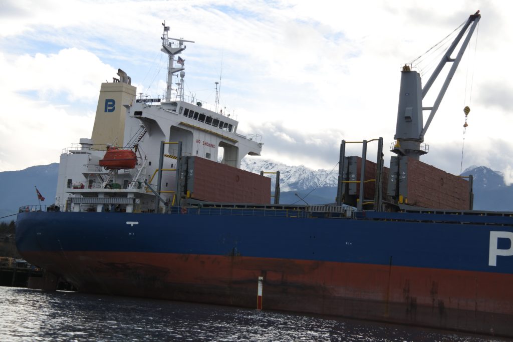
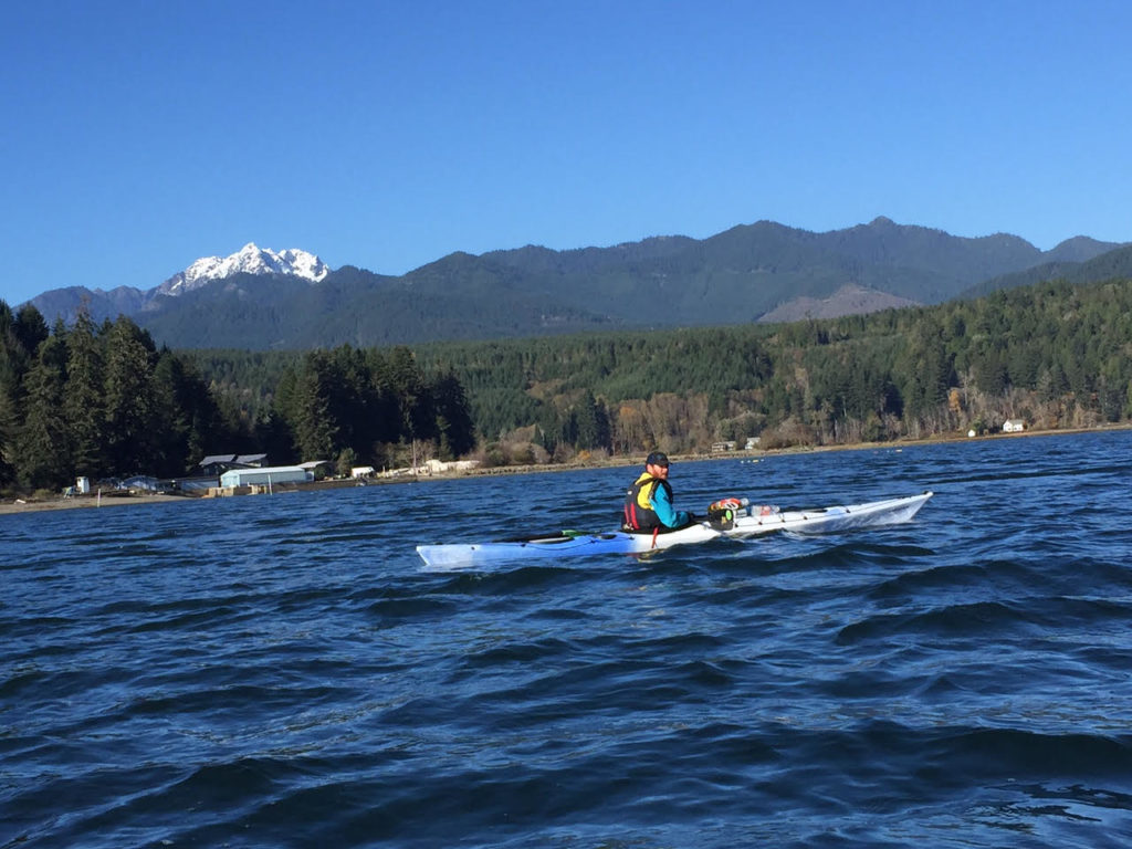
Astoria Bay with Klahhane Ridge

If these were the circumstances of my departure, you might think that it would have affected the kind of plans I’d make for a kayak trip. But I had set the bar high again, my mind set on a months old ambition.

I wanted to paddle east to Port Townsend and back to Port Angeles in three days — about 70 miles of kayaking with a portage over the Dungeness Spit. I would also camp on the bluffs above the spit for two nights.

My other aim was to avoid sleeping in the outhouse like I had on my last trip hiking in the Sol Duc Valley. I wanted to prove to myself that I could launch a trip with creature comforts and a decent quality of life.

Noble goals, Port Townsend and creature comforts, but the 4:15 sunset wasn’t the only thing working against me.

Boat launch to tarp camp

Before I started paddling I spent the morning filling dry bags with warm clothes, wrangling camping equipment and packing food. The goodies going into my bear-proof bin included vegan pumpkin pie that I’d made the day before. The aluminum pie pan didn’t quite fit into the opening, so I folded it into pumpkin taco.

It’d been a good Thanksgiving with friends in town. Now, hitting the water on a three day solo-trip, I felt loneliness. The lifeless gray skies did little to boost spirits. The pie gave me something to look forward to, a dinnertime treat that would brighten my time at camp.

There was a dozen miles of paddling between me and the camp when I hit the water at noon. That closing window between light and dark was on my mind, though I didn’t hurry at first.

I dawdled in the harbor, where the massive industrial infrastructure dwarfed my kayak.

Mega-cranes above the Astoria Bay perched over the docks, waiting to snatch up piles of tree trunks off the docks and load them aboard. Only the mountains were big enough to outrank these massive machines of commerce. The gray-white flanks of Klahhane Ridge rose taller than the radar arrays, snowfields merging into the dull cloud ceiling.

I cut through the pier at the old Rayonier Mill site, where a mature bald eagle sat perched upon a light fixture. Further on, there was Morse Creek, flushed with weeks of rain and snow melt. The easterly swells climbed against the current, peaked and crashed over the surging water.

I surfed a couple waves upstream, and thrashed my way up the current for a couple hundred yards to an eddy by a pedestrian bridge.

I spun myself back into the swift water, leaning downstream with a low brace turn. Paddling a narrow sea kayak with a river current behind me was fast and fun. The scenic detour ended with my bow slapping over the sharp waves at the river mouth.

My paddling became brisker and more business-like after Morse. The shoreline climbed up into inaccessible bluffs. The high tide was right up to the bottom of the cliffs, providing scant opportunity to land. High above, I saw the only patch of blue sky for the day. A swath of golden snow lit up along the Gray Wolf range with purple cloud behind. I paused for a minute, regarding the distant sunlight like holy vision. I also noted how low the light was above the mountains.

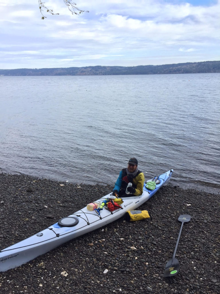
It was close to dark by the time I landed on the beach at Dungeness Spit. I still had to hike three quarters of a mile to get to my campsite up on the bluffs. I poured myself a couple of cups of hot chocolate out of my Thermos. If the sunlight wasn’t going to warm my bones anymore, I would have to get heat elsewhere.

I used a bike lock to secure my kayak to a sign post nearby, clipped my gear to my paddle and lifted it up like it was a hobo stick. Thus arrayed, I slouched up the hill toward camp. Darkness was complete by the time I reached the picnic table where I would sleep. I lashed a tarp down over the top of it, rigged another tarp at the front with my kayak paddle — my cooking area and mud room. I peeled my drysuit and damp underclothes, cloaked myself in fleece and polyester batting.

“Let there be fire!” I proclaimed. And my butane stove issued fire. The fire was good — so was the hot pea soup, made rich with coconut oil. I topped my feast with two smushed pumpkin pie slabs.

Warm and flushed with calories, I opted not to crawl immediately into my sleeping bag, but walk around camp instead, coming out to a footpath along the bluffs. Port Angeles lights twinkled in the west, Victoria to the north. The Strait of Juan de Fuca was the dark passage between the islands of light. Restless waters rolled onto the beach below me in their endless surges and retreats.
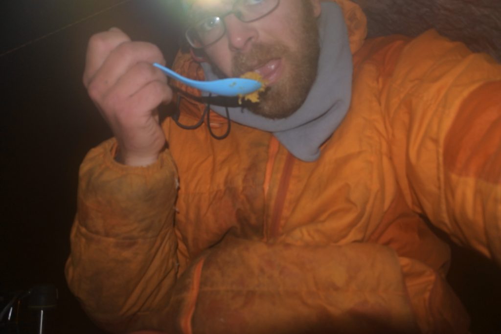
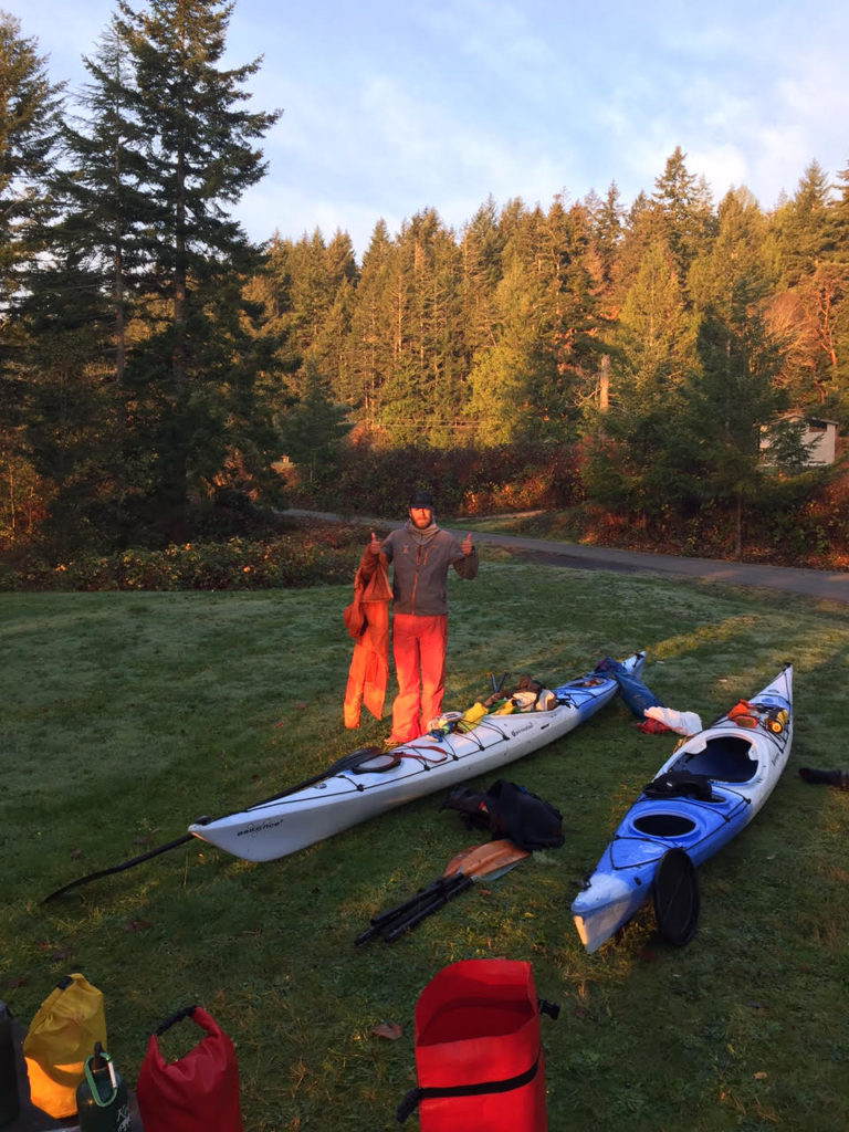
Orange man with orange pie

The east wind

Light flowed back slow into the gray morning.

I took my breakfast, ensconced myself into the drysuit and lifted the gear that I needed back onto my paddle for the trip into Port Townsend. It was a slow start with all the gear wrangling, and the  hike back down to the water. After I had re-geared my kayak and pushed it out, it was 11 a.m.. The late start already not so good; added to that, it looked like I needed to change the course I’d planned.

I had intended to carry my kayak over the Dungeness Spit to the calm waters of the harbor on the other side. Alas, the National Wildlife Refuge had put up signs recently forbidding people from crossing over the strip of sand. It was to protect the migrating birds coming through. There was a place on the margins where signage was ambiguous enough that I might have at least maintained plausible deniability carrying my kayak through. Still, the site of birds floating in a lagoon nearby gave me pause. Maybe they would abandon the site if I barged through.
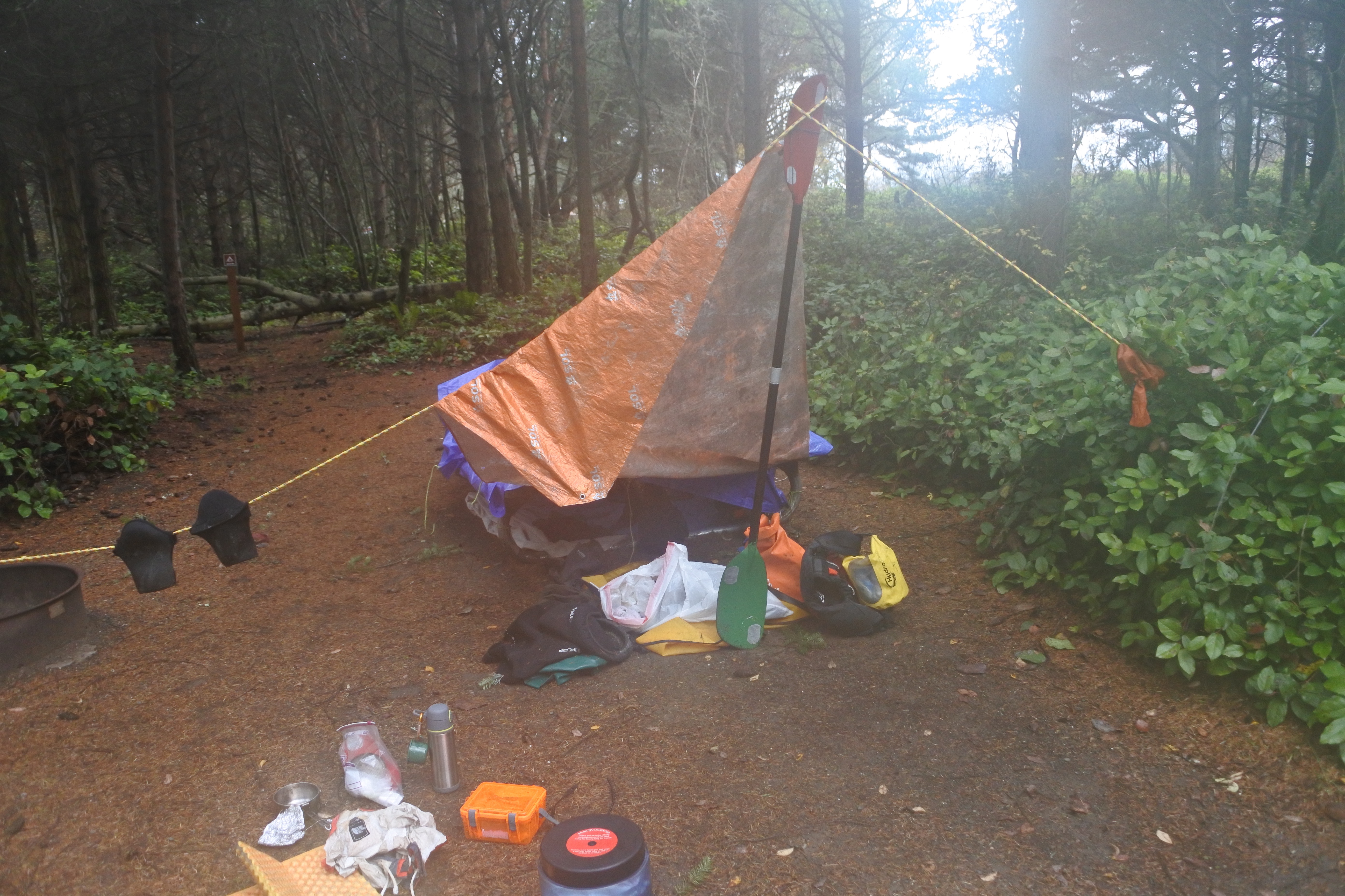
Dungeness Camp.

Finally, I decided I would just paddle a couple extra miles and go on the outside of the spit, past New Dungeness Lighthouse.

The spit juts out for over five miles and is in fact the longest sand spit in the United States — the geographical uniqueness is one reason it’s so important to migrating birds. The westerly waves provided an extra push from behind my boat. When the waves come in from that angle, the spit creates a longshore current (little brother to the more infamous riptide phenomenon.) I stayed as close to shore as I could to get the most out of the longshore, though this also meant weaving in and out of the break zone. I looked constantly over my left shoulder as the waves stacked up, and then got the hell out of there before they crashed. When I messed up, the cold frothing water exploded over the top of my kayak, and I had to stick my paddle in a high brace to stay balanced.

The skies had cleared enough that I could see the mountains on the San Juan Islands to the northeast, and the white wall of the Cascade Range right in front of me. It was far more prominent than the way it looked from Port Angeles. The eastern Olympic Mountains towered over me with snowy gables.

The fun and sightseeing wouldn’t last long, though.

First there was an easterly breeze. Tiny little wavelets scurried against the westerly swell. The wind increased, blowing the tops off of the breakers as they came into the beach. I found myself slowing down. By the time that I got to the end of the spit, the biggest waves were coming right at me. I stuck on stubbornly, though when I saw the distant headland at Point Wilson, my hopes of rounding the corner into Puget Sound dimmed. Port Townsend would have to wait another day.

The detour around the spit had left me miles offshore, no way to hide from waves behind shoreline features. I set my trajectory toward the bluffs on Protection Island, near Discovery Bay. It was a few miles distant, but if I could get there, it would mean that I had reached the furthest point that I had paddled west out of Port Townsend. It would have closed a loop and meant that I had paddled all the shoreline between the two town. I guessed that if I could get within a mile of the island, it would live up to its name and give me some protection from the incoming waves.

But the seas were building. I kept fighting for another hour. At 1 p.m., I knew that I had lost, and the only way I could get back to Dungeness by dark was to turn around.

Turning around I had the waves pushing behind me, against an ebb tide leaving Dungeness Bay. The opposition made the waves steep and squirrelly. I found myself leaning on the paddle more than once, taking a few surf rides that skirted the edge between exhilarating and scary.

Surprisingly, once I got back on the outside of the spit, things calmed markedly. The flagpole on the lighthouse indicated that the wind was coming from the southeast now, thus the spit was blocking the biggest waves. It was ironic to find rougher conditions inside the bay than on open sea, but I could hardly complain.

I finally worked up the nerve to take my hands off the paddle and grab lunch. Without the paddle, the muscles in my butt were the most important thing keeping my boat upright. I stayed balanced by clenching left cheek and then right as the waves lapped against my stern and I had lunch. Best of all was the hot water out of my thermos that brought me back to life.
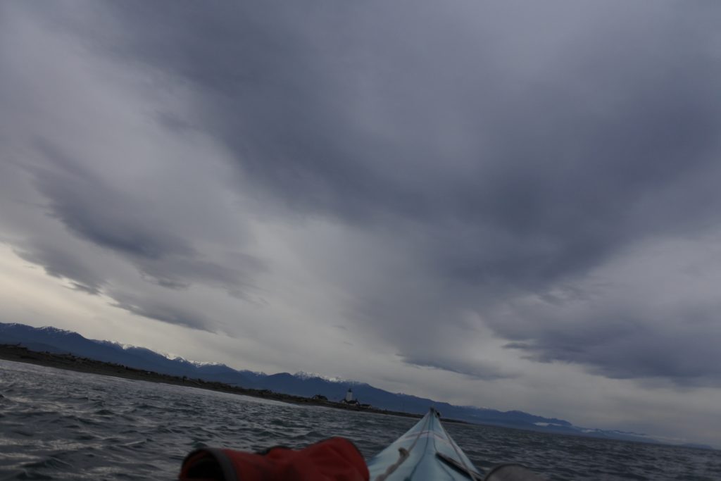
Clouds and mountains at New Dungeness Lighthouse

The tough ride home

Back at the campground, I felt a little bummed that Port Townsend hadn’t happened, but made my peace with the fact that conditions had been against me. Even I had started earlier, it seemed unlikely that I could have made it to Port Townsend and back in the face of the east wind.

If the wind kept up, I would have a very fast time getting back to Port Angeles, and might even be able to get in some time noodling around the cliffs or surfing at Morse Creek.

Alas, luck was not on my side.

When I walked down to my kayak and found a strong west wind blowing four-foot breaking waves over the beach.

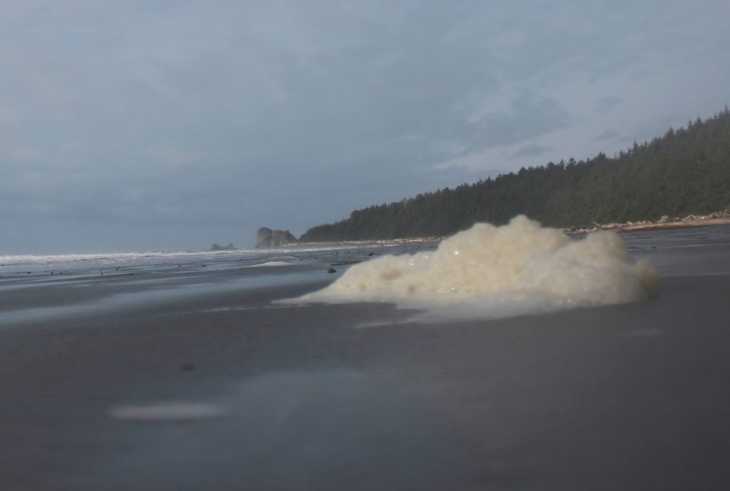
It was beautiful, foam rolling over foam, gobs of it blowing over driftwood as if this was some nautical-themed rave. Along shore, it stacked into little clusters that quivered like marshmallow peeps.

If I launched out into the mayhem, it was going to be a helluva time, a dangerous time. And I had to be at work tomorrow.

I ended up waiting. When wind raked the beach, I huddled in the trees up in the bluffs nearby. Plenty of daytrippers were going down to the spit to check out the dramatic views. Their entertainment, my predicament. I found a bench inside an educational exhibit — a roof over my head — sipped from my Thermos, and wondered if I’d ever leave the beach. Occasionally, I wondered over to the cliffs and looked at the miles of whitecaps. I squinted at them long and hard. Were the waves softening? Or was it just wishful thinking?

Eventually, I ended up calling my friend Jarrett to ask him if he could check what the weather was going to look like this afternoon.

He said he would find out and call back.

A couple minutes later, my phone rang.

“It’s going to be a shit show,” he said.

By night, the Weather Service called for 40-knot winds around Dungeness with five foot wind waves. 50 miles west, at the entrance of the Strait of Juan de Fuca, the models predicted 25-foot waves.

Jarrett, on his way back from a family visit, was going to be driving near Dungeness in a few hours and offered to pick me up with my boat. I said, I’d probably take him up on it, but would let him know for sure.

I walked over to the cliff; the waves were still tall but had rounded out. I barely felt any wind. If I was going to go for it, I knew I needed to act fast. I texted Jarrett my intentions and hustled back to my boat. There would be about five miles of real exposure where the cliffs would hem me off from the headlands. The other half of my journey, I’d have protection from Ediz Hook, which would take the brunt of the biggest waves. If not for that reassurance, I probably wouldn’t have launched out.

Still, I felt the pressure of a narrow window. Who knew when that wind might pick up again? I scrambled to get all the gear secured into my boat. In my haste, I ended up putting more gear on top than I had before. When it came time to push out into the water, I attempted to scoot myself off the beach into the breakers. I accepted one gentleman’s offer to help push my boat. When the opening came, I paddled hard as I could, taking a breaking wave on my chest. The next wave sent my bow up before I crashed back down the other side. I took a few more strokes and I was free. Yet, I realized that my hasty work rigging my boat up came at a price. The extra weight on my back deck made me extra wobbly. Still, I didn’t dare go ashore and put myself through another launch.

The main wave set was coming at me sideways from the right, while the reflector waves jostled me from the left. I constantly needed to set micro-corrections with my paddle to stabilize the boat.

I was sweating hard beneath the drysuit, but I had done such a rushed job attaching my hydration bladder, that I hadn’t thought that I might want to grab the tube and drink. Well, no water then.

I kept on paddling hard, paranoid at the the thought that the wind was going to come back and jam me over. Neptune’s wrath was not forthcoming, however.

The waves got smaller and smaller the further west I travelled. I set my eyes on the dull line of Ediz Hook with the blinking Coast Guard station tower. It marked the boundary of my salvation. By the time I crossed Morse Creek, it was close to 5 p.m., halfway dark. Still, I was relieved to have entered the protected zone around Port Angeles Harbor.

I switched on a tiny waterproof light atop my deck so that the shipping traffic could see me. Mostly, I just tried to avoid traffic by staying close to shore.

The blast from the MV Coho startled me. The passenger ferry was chugging in from its last run out of Victoria. I lingered near the Port Angeles pier while the boat swept in front of me, waited before crossing the swirling black water churned up by the propellers. I crossed behind the boat, started to relax, only to realize that the bow was coming back at me. The ship was spinning around. I sprinted quickly out of the way.

I was within sight of the ramp at the boat launch I ran my boat up on a floating log that I hadn’t seen in the dark. The bow in the air meant that I had immediately lost much of my stability. I had to paddle backwards very carefully to avoid flipping over.

I got my boat back off and paddled the rest of the way to ramp. I stumbled out onto the concrete. All I needed to do now was unload my boat, throw it on top of my car, strap it down, drive home, peel out my drysuit, shower and cook dinner for myself. I could resort all my gear and clean and launder everything the next day. It all comes out to more hours than the time that I’d actually spent on the water, not getting to Port Townsend.

I couldn’t pretend that kayaking in winter was just the same as summertime when I had happily paddled in warm conditions until 11 p.m. If I got cold now, there was less of a chance that I would shake it off and warm up eventually. The consequences of a capsize were starker and more frightening. East winds are rare in the summer, yet in wintertime, they are common enough in winter. Because of them, my plan to get from Dungeness to Port Townsend and back in a day went from being ambitious to nigh impossible. For all the times that I had been on the water this season, I had to remember that I was only there at the good graces of Mother Nature; there was only so much that I could do to defy her will.

At least I had more pumpkin pie waiting for me in the fridge. Bed would be a welcome place to camp for the night.
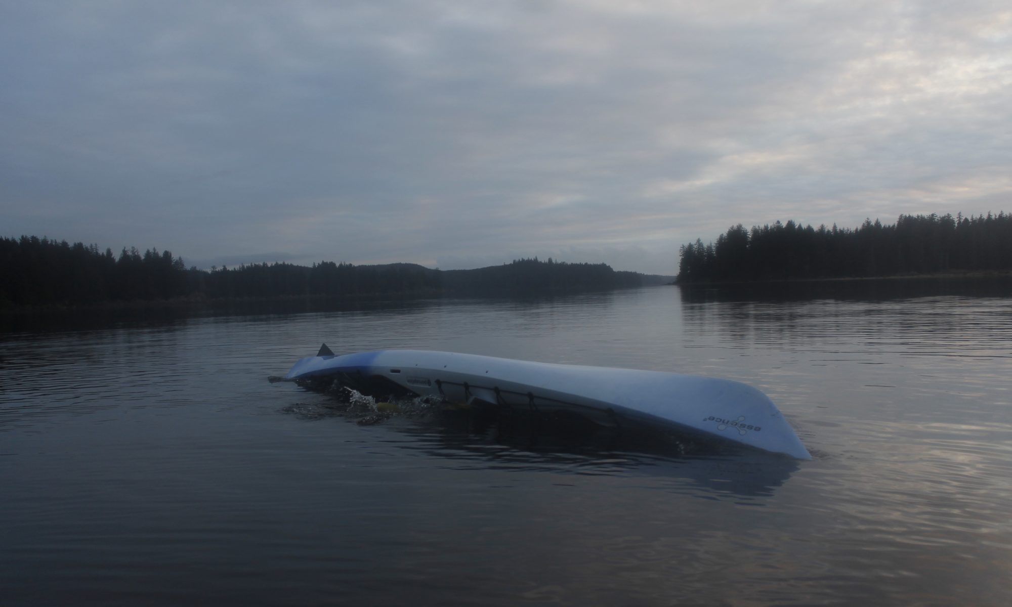
The Big Spit

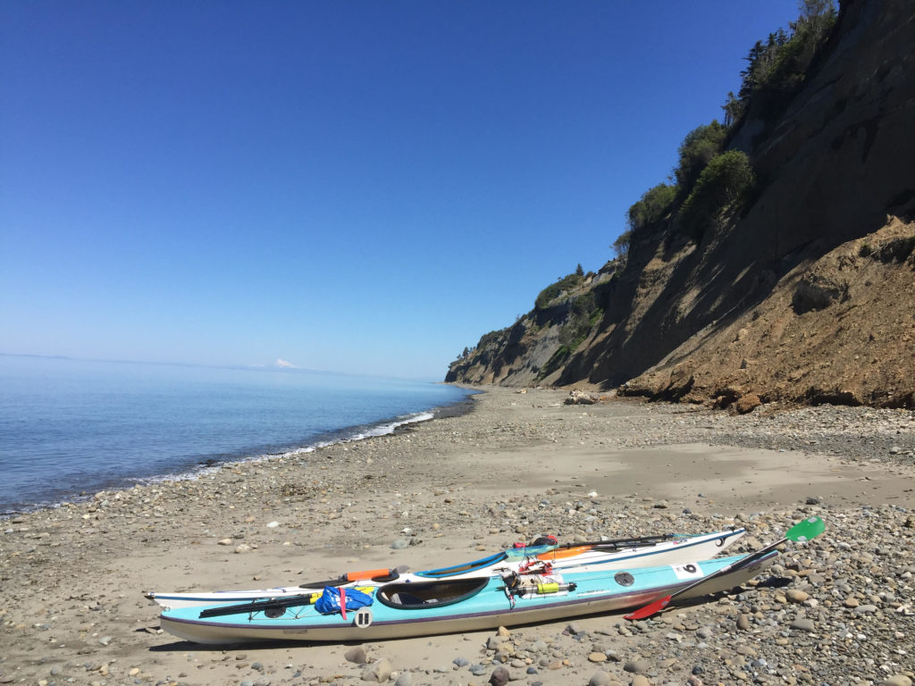
Kayaks beneath cliffs west of Dungeness Spit. You can see the erosion coming down on the right side. Photos by Jarrett Swan.


The houses along the cliffs in Dungeness, Washington are beautiful and doomed.

Erosion marches slow and steady toward these stately manors. For now, they stand at the brink of the approaching edge looking out over world class views of the Strait of Juan de Fuca, Vancouver Island, Mount Baker — and that vast strip of sand jutting out into the water: The Dungeness Spit. At 5.5 miles long, it is the longest of its kind in the United States. The eventual destruction of those houses and the creation of the spit are linked in a fascinating Yin-Yang relationship.

More on that later.

On a recent sunny day, I was also taking in the view of the Spit from my bicycle saddle. I was pedaling 17 miles back to Port Angeles to meet my friend Jarrett where our kayaks would be loaded on his truck. We would put the boats in the water out of Hollywood Beach downtown and paddle east with until we got to where my car was parked at Cline Spit in Dungeness Bay. It would be an 11 mile paddle with a short boat portage. If we went all the way around the spit instead of portaging, it would be a 21 mile paddle. You can probably guess which option I preferred.

The day was serenely beautiful, in a way that made me feel that, somehow, all was right with the world. I pedaled against a light breeze that cooled me nicely against the warm sun. Looking out from the sea-cliffs, I saw that half the water in Dungeness Bay was gone, vanished with the low tide of a new moon. In a couple hours, the powerful flood tide would start refilling the basin as our boats took advantage of the eastbound current in the strait.

Mature and juvenile bald eagles wheeled above the shallow waters. I saw them take turns harassing ducks. A small crowd had gathered on on the cliff to ogle a large juvenile perched in the branches of a fir. Signs nearby warned them not to get too close to the edge. It was eroding rapidly.

Even the road I was biking seemed uncomfortably near to the edge of destruction. I wondered how many years it had left.

A couple miles later, I was biking through the amber fields outside of Sequim. Earlier, I’d  planned to bike to nearby Carlsborg and catch a bus to Port Angeles. This plan would have involved sitting in a bus stop for forty-five minutes breathing exhaust from Highway 101. If I pedaled a little faster, however, I could still get to Port Angeles in time for Jarrett and I to catch the flood tide.

I took backroads to the Old Olympic Highway and connected with the Olympic Discovery Trail. The trail was blissfully un-busy, weaving in and out of forest where the leaves cast dapples on the pavement.

Instead of highway exhaust, I breathed the cool scent of ferns and moss as I maneuvered switchbacks into creek gullies. A couple miles later, the trail popped out at the coastline, where acres of kelp and sea lettuce steamed on the hot cobbles.

By the time I reached Jarrett’s place, he was still packing/eating breakfast.


“So what do you think about wearing drysuits today,” he said.

“It’s going to be rough with this heat,” I said. “I’m probably going to end up splashing myself a lot. But it’s worth it having the extra safety.”

“Yeah,” he said. “Though, I was thinking about just wearing my Farmer John today.” As it happened, he had two of the sleeveless wetsuits at his place. One would fit me.

The only thing was, I had this awesome drysuit that really worked at keeping the water out. A prolonged immersion in the water was extremely unlikely, but I liked to think that I could be immersed in the water for a long time and turn out fine, thanks to my drysuit. Was that really the best course of action? Heat exhaustion from paddling in the full sun was another risk. I had to weigh.

As I looked at that beautiful orange suit of waterproof fabric, leaving it behind felt like a betrayal.

“I mean … I love my drysuit,” I said.

“Yeah, I love mine too,” Jarrett said. Both of us were wavering. “But I don’t think it’s going to be any fun paddling in it today.”

“Screw it. I’ll take the wetsuit.”

Emotional attachment is not the best rationale for choosing gear anyway. Take it from a guy who’s had (too) much loved hiking boots fall apart on him on the second day hiking the Hundred Mile Wilderness.

Our drysuits stayed on their hangars.

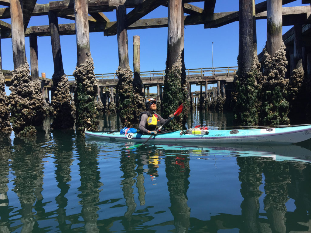
Padding beneath the pilings at the abandoned Rayonier Mill site


The hot sun and warm air at Hollywood Beach reinforced our certainty: We had made the right decision. Before I got in my boat, I deliberately dropped in the mucky shallow water to get myself soaked. The cool water evaporating off my trunk was most welcome as I started paddling.

The beginning of our trip stayed close to shore, following the riprap barrier below the Olympic Discovery Trail where bicyclists zipped past our boats on the way to Morse Creek.

“Bikes move faster than kayaks,” I observed.

Though we may have been lagging behind the bike trail traffic, we had more opportunities to explore, including the haunted remains of the Rayonier Mill. An abandoned wood pier with tall pilings jutted out in front of us, offering dark narrow places where we could squeeze our boats through.

Closed since 1997, the mill recently marked its 20 year anniversary as a Superfund cleanup site. The mill had been a major paper goods manufacturer that processed wood chips into consumer products like film, cigarette filters and diapers. The business also left behind some less desirable products, such as PCBs and dioxins. The EPA labeled Rayonier as the biggest polluter in Washington State in 1993.

In the film, “The Memory of Fish,” former employee Dick Goin recalls seeing fish coming down Ennis Creek turning belly up as soon as they came in contact with the mill discharge.

Tons of toxic soil have been hauled away but the cleanup is ongoing. A chainlink fence separates it from the bike path.

It is scheduled to be completely cleaned up (at least by the government’s standards) by the year 2026. Meanwhile, Rayonier, headquartered in Jacksonville, Fla, still owns the site and has paid out millions to clean the site. I have been running and biking past the site for over a year now, and have yet to see any work that looks like cleanup.

The large wooden pilings jutting out from the pier represent another hazard.  Within a hundred feet of them, I could smell the tarry scent of creosote. As it happens, the county’s latest shoreline strategic plan proposal bans this type of piling, presumably due to the fact that creosote is toxic and will eventually leach out into the environment.

The spaces beneath the piers had the subterranean feel of a subway station, with pilings instead of pillars, the flutter of cormorants’ wings instead of pigeons. More alien were ochre sea stars the size of medium pizzas feeding on the mussels along the posts. They hadn’t gotten the memo about the toxic creosote, I guess, though I’d hesitate to say that the presence of life precludes the possibility of environmental harm.

Clearly the pilings provided a large amount of surface area for clinging life.

Northern feather duster tube worms jutted out like mummified cinnamon sticks. Below the water, the worms released their delicate red fans of feeder cilia at their ends — about the size of silver dollars. I couldn’t resist letting my fingers brush up against one. The reaction was immediate: the cilia shot in, sending a blob of bubbles upward.

White plumose anemone’s wafted in green water further down, trolling for bits of plankton.

The next couple miles of paddling took us past a coast that was armored by riprap. The busted stone kept the shoreline from eroding, though there were still a couple landslide zones behind the bike path After Morse Creek, the riprap went away. Massive earthen sea cliffs jutted up, cutting off access to the headlands except for in the occasional creek gully.


The blissful day called for a lack of hurry, and small explorations. Jarrett and I took a stop at one of these gullies and found a small campground on what appeared to be private property. We ate lunch, paddled for half an hour, got out again so I could explore another gully. There is supposed to be a large cavern hidden somewhere in these cliffs, but I couldn’t find it.

At one point,we heard a crack and a few pounds worth of stones and dirt clattered off the cliff onto the beach below. Further on, we saw where someone had built an elaborate sequence of wooden steps down to the water from above. The only problem was, the cliffs had given out and the steps were mangled, half fallen off.

A week before this paddle, a woman hiking along the beach below of one of these cliffs stumbled upon a giant wooly mammoth molar that eroded out of the substrate above. Over the years, locals have found pieces of mammoth skulls as well as tusks from these bluffs. Jarrett has collected (legally) a few pieces of petrified wood in these places also.

The cliffs were so interesting to look at that we stayed close, even though we could have caught a faster current out in the strait. They were just damn interesting to look at, these weird conglomerations that were neither stone, nor sand exactly. There was symmetry between the delta shaped drainages and the pyramidal deposits at their base. They formed hourglass shapes, and like hour glasses, they marked time by the passage of sand.

The warm colors and the bleakness of the walls was desert-like, reminiscent of African coastline.

All I had to do was ignore the pine trees along the top. It certainly felt hot enough for us to be pulling out of Algiers .

“Thank God, we didn’t wear the drysuits,” I remarked.


When we started getting hot, we had the 54 degree Strait water to cool down.

We got out of our boats and waded in the water along the beach. I practiced getting back into the boat from my kayak, and got a couple pointers from Jarrett, who made it look easy despite his high center of gravity.

“See the lighthouse?”

He pointed, and I could see the New Dungeness Lighthouse, built near the end of the Dungeness Spit.

We were getting close.

The cliffs became even more unstable as we paddled along, so much so that they now tilted forty-five degrees, with enormous piles of sand and gravel accumulated at their bases. We stopped our kayaks for a moment to watch erosion in action. There would be a sudden tinkling noise and a flow would start moving down the cliffs. It looked kind of like a waterfall, it was falling sediment. The flow would continue for a minute or so before it ran out. Then another flow would begin somewhere else.

“It’s like the cliffs are taking a leak,” I said.

These must have been the “feeder” cliffs that I had been hearing about. The super-fast eroding ones were moving backward at a a rate of three feet a year. Watch out!

Why are they called feeder cliffs though?

Because they feed important ecosystems and landforms in the local environment. That sediment leaking out from the cliffs would eventually reach the water, creating the ideal substrate for eelgrass beds, which are habitat for juvenile salmon and other small marine critters. Longshore currents and tides carry much of the sediment further, and it deposits on the Dungeness Spit. The spit is born out of the destruction of these cliffs.

A similar deposition process helped form the three mile long Ediz Hook, which gives Port Angeles its harbor and is home to the local Coast Guard base. The Hook has faced erosion over the decades however, partly because of the dams on the Elwha River, partly because of all the riprap around Port Angeles. The dams (now demolished) plugged up useful sediment coming down the Elwha from the mountains. The riprap, still plugs up the useful erosion coming down from the sea cliffs around Port Angeles, and diminishes a supply that could still be used to rebuild the Hook. Last year, the U.S. Army Corps of Engineers contracted with a construction company to expedite that building process by dumping several tons of cobbles off the Hook. In 1995, the Corps was paying up to $100,000 a year moving rocks out onto the Hook. It is ironic considering that the Hook is threatened precisely because of the tons of rock laid out along the Port Angeles shoreline.

The falling sand beside my kayak reminded me of dead trees in a forest or compost in a garden. Something needed to die for rebirth to happen. Humans with their usual impulses to leash the unruly universe had mucked the system well.

A mantra entered my head as I paddled: “Don’t resist the rot of this world.”

The cliff, is falling away, so don’t build there. Let the sand slip out of your grasp, let dead leaves crumble into dirt. There’s a place for it all. Don’t interfere until you really know what you’re doing. If you don’t figure out this much, maybe it’s better to sit back, slow down and see how nature can do it better than you do.

The undeveloped beaches around Dungeness Spit are far nicer to paddle than those around the Hook. There are easy places to land a kayak, fewer power boats to dodge.

The Hook is crowded with its access road, boat launch and the navy docks under construction. The Dungeness Spit has no roads, only the lonely lighthouse at the end.


If we paddled all the way around the lighthouse, we would essentially double our trip, making it about 21 miles. The other option would be to portage over the spit and paddle directly to my car, shaving 11 miles of travel.

Jarrett was in favor of the later plan. I wanted to change his mind, but didn’t want to be pushy about it.

“So…” I said. “What would you think about going around?”

“No man. I’ve been doing kayak tours all week. I think I’m done today.”

I was bummed, but didn’t want to end the trip on a sour note by arguing into getting my way.

“No sweat, Man. It’s been a great trip. Where should we portage?”

Jarrett scanned the beach where tourists and day hikers were thick on the the sand.

“We’ll go down a little ways to get to somewhere where there aren’t as many people,” Jarrett said.

The lighthouse was drifting closer into view.

Jarrett kicked his kayak into high gear. My muscles ached to keep up. I was glad he was in front though, because I had a feeling that he actually wanted to go around the lighthouse. It was my job to shut up and let him decide it for himself.

For half an hour we raced down the spit with the wind behind us, saying nothing. Finally, Jarrett put his paddle down on the deck.

“That lighthouse is getting pretty close.”

“It is,” I said.

“Alright. I could go around. You game?”

I pumped my fist.

“Hell yes!”

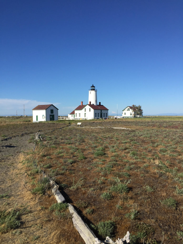
The New Dungeness Lighthouse. Glacier Peak is visible between the lighthouse and the building to the right.


We celebrated our decision by pulling off and grabbing some food on the beach. The Cascade mountains had grown taller and better defined. My view included Glacier Peak and Mount Baker and the smaller mountains on the San Juan Islands. Behind us we had a view up into the Obstruction Point Ridge area and Elk Mountain where there 1,000-foot snowfields clung to the north faces (Stay tuned for news of my next Doorstep Adventure.)

Time was no longer on our side. After we launched the boats back out, I saw the strands of bull kelp were straining against an ebb current. We were fighting the tide now.

The current only got stiffer as we rounded the spit into Dungeness Bay, slowing progress to a crawl. The tidal grip weakened as we got further into the bay, however. We pulled our boats up on the bay side of the lighthouse to do some more exploring.

A small footpath led us up toward the white building, with its red roof and central lighthouse and tower. It dates back to 1857.

Faded laundry flapped on a line above the lawn. I saw one man reading a book outside. The scene looked peaceful and old-fashioned. I felt that I could drop in, find a seat, put my feet up on the railing and argue about whether one of those newfangled steam engines would ever really outrun a clipper ship on a broad reach.

I’d accept the invitation to stay at the lighthouse, where I would write at hardwood desks, gather salt in my beard, look out at waves, wear sweaters.

In fact several people reserve places for the of staying at the lighthouse. 2018 reservations are going for $375 per person per week or $2,250 for the whole house. To earn your lighthouse keep, you also tend to chores like tending the lawn and polishing (daily) the brass inside the tower.

A small driftwood sign pointed an arrow back down the Spit to where it connected to the mainland. “Real World: Five miles.” I saw the appeal.

The spit stretched west as a sandy ribbon down the middle of our sightline, diminishing with distance. There were breaking waves from the Strait to the north and calm water inside the bay. The proud houses on the mainland were distant, superfluous seeming. You could see the worried world from this dreamy perch on the sand, but the worries were at arm’s length.

Empty beach replaced the large crowds we’d seen at the west end.

Few people hiked all the way out, not only because of the 10 mile round trip, but also because it meant trudging that 10 miles over soft sand at a tilted angle.

This long stretch of land doesn’t just isolate lighthouse keepers from the bustle of the mainland. It is also a popular spot for birds, who benefit from being able to nest in an isolated spot where predators are less likely to come and get them. The south side of the Spit is a national wildlife refuge, which is off limits to human visitors. Signs warn boats not to get too close to the land.

We got back in our kayaks and started paddling back to the “Real World” with its email, riprap and superfund sites. Part of me wanted to stay out on the spit away from the noise waiting on the mainland. On the other hand, I was hungry and had eaten my last Clif bar. The lighthouse keepers come back to mainland for similar reasons, I imagine.

As the sun got lower, we started seeing eagles wheeling across the sky. I saw the cliffs where I had biked earlier, my car parked in the lot.

Jarrett and I high-fived at the boat ramp. 21 miles on the water. No regrets.

Thankfully, the road hadn’t crumbled off the cliffs by the time it was time to drive back home.

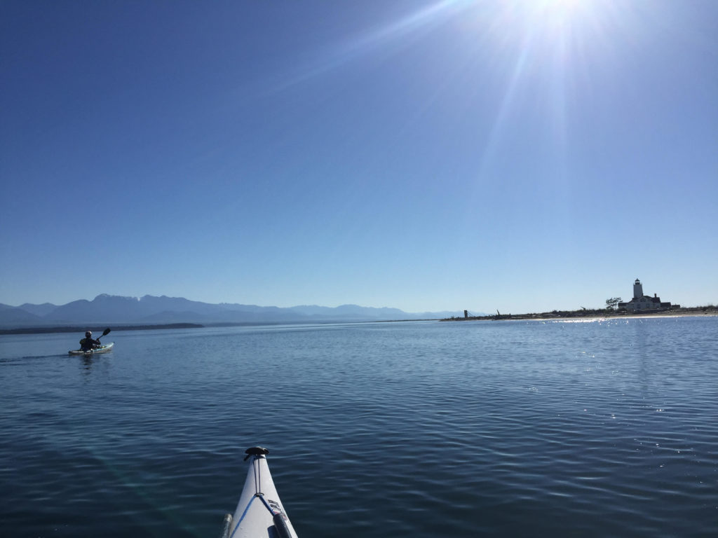
Paddling into Dungeness Bay. The Olympic Mountains rise up to the left.


FURTHER READING

Mammoth finds around Port Angeles sources:

Who’da thunk it? Those crumbly cliffs around Sequim are full of mammoth parts!

A big find: Locals stumble upon mammoth molar on Sequim beach

http://www.burkemuseum.org/blog/mammoth-find-sequim

Feeder cliffs sources:

Clallam County, Washington is in the middle of updating its Shoreline Master Plan document. Much of the document is policy proposal (i.e. a prohibition against creosote treated pilings as seen at the Rayonier site.) The document also talks about how feeder cliffs work by depositing their erosion into the sea, which eventually helps build up sandy deposits like Dungeness Spit

http://www.clallam.net/LandUse/documents/CCSMP_dftSRP0213.pdf

Ediz Hook rebuilding sources:

This Peninsula Daily News article discusses the recent Army Corps of Engineers project of dumping cobbles onto the northwest side of Ediz Hook in order to shore up the hook against erosion. Come to think of it, this is exactly where I had struggled to land my kayak against the crashing seas on my recent Lyre River trip. A sandy beach would have been nice.

http://www.peninsuladailynews.com/news/rocky-additions-to-cut-ediz-hook-erosion/

The cobbles were only of many attempts to save Ediz Hook from erosion. This source reveals the $100,000 a year that the Army Corps of Engineers spent (as of 1995) to rebuild Ediz Hook. While the report points to the  Elwha River dams as one of the main reasons that the Hook is no longer rebuilding itself, it also points to the problem of shoreline armoring, which has prevented valuable cliff erosion from going into the sea and rebuilding.

https://play.google.com/books/reader?id=dC03AQAAMAAJ&printsec=frontcover&output=reader&hl=en&pg=GBS.PA92

Information on the Rayonier superfund cleanup site:

This Peninsula Daily News article talked about the 20-year history of the Rayonier Mill as a Superfund site.

http://www.peninsuladailynews.com/news/rayonier-20-year-anniversary-sees-site-still-dormant-with-2026-as-cleanup-target/

I watched a screening for the film Memory of Fish a couple months ago. The film explores the decades fly fisherman Dick Goin spent on the Elwha River, the decline of the salmon that he watched over the years, and his push for dam removal on the Elwha River. Shortly before his death, he got to see the Glines Canyon dam come down. Goin was also a former Rayonier employee. The film explores his ambivalence about his role working for a company that polluted fish habitat.

http://www.thememoryoffish.com/#intro

Information on the New Dungeness Lighthouse:

If you want to live on a lighthouse for a while, the folks at New Dungeness would like to talk to you.

http://newdungenesslighthouse.com

Oh yeah, why is it called the New Dungeness lighthouse? Was the old one destroyed by a storm?

Nope? The old one is actually back in Dungeness, England. George Vancouver named the Dungeness Spit after Dungeness, England because it reminded him of back home. Thanks Wikipedia!

https://en.wikipedia.org/wiki/Dungeness_Spit

A lot of stuff around the Northwest got named by or after Vancouver’s expedition. See Mount Baker, Mount Ranier, Puget Sound, Port Townsend, Discovery Bay, Protection Island, Vancouver Island, Whidbey Island…etc.

I Kayaked to Canada

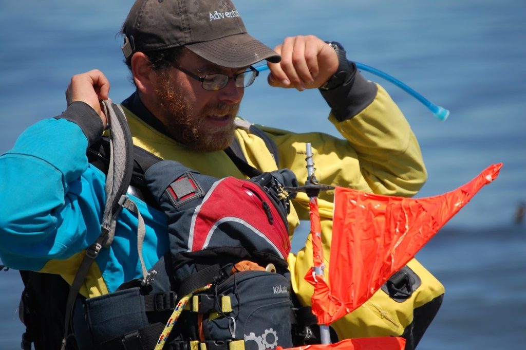
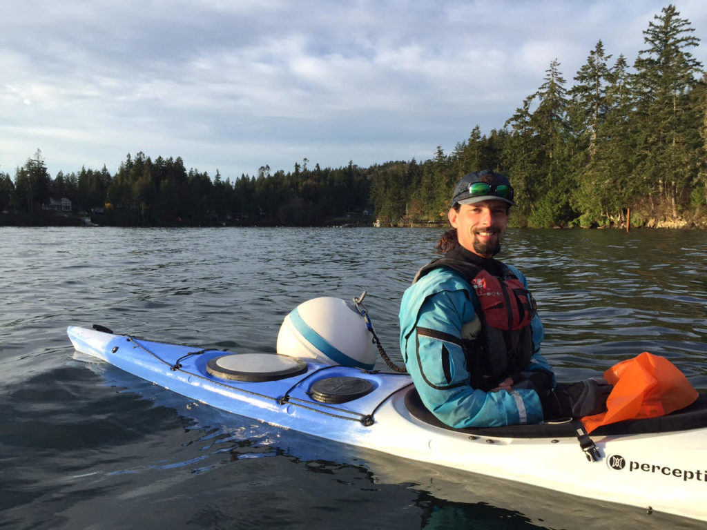
Me in my kayak with radar reflector mounted on back as I prepare to cross the Strait of Juan de Fuca. It’s a new kayak, by the way. Like it? — Photo Credits to Emma Lanham.


Ah, Victoria. How many nights have I seen your lights shimmer like so many jewels above the dark water?

How many windless days have I squinted over the pale miles in the Strait of Juan de Fuca that lie between — days when I thought I should launch a boat and pay a visit?

How many times have I watched whitecaps rage out of the west, or watched you disappear behind cold fogs — fogs where unseen ships, tall as buildings, moan out warnings?

It has always seemed so easy to get there, yet also impossible.

But I got tired of waiting.

Eventually, I pushed my boat off shore, and put my paddle in the water.


As a straight line journey, it is possible to kayak north from Port Angeles, Washington to Victoria, British Columbia in about 18-miles.

The journey crosses a couple of busy shipping lanes, patrolled by seven story cargo ships, supertankers and cruise ships. The tides go west to east on the flood, and east to west on the ebb, so it is easy to get pushed well off course — not to mention the difficulties of what would happen when a wind picks up. There are plenty of shallow banks out there that create choppy, confused seas.

It wasn’t the distance of the paddle that intimidated me; it was the exposure to hazard, the fact that I would be a long way from shore if something went wrong. But this would only be a training run.

I recently signed up for the first leg of Race To Alaska, a motorless boat race starting in Port Townsend, Washington and ending 40 miles later in Victoria. Competitors who do the full race go all the way to Ketchikan, Alaska.) Even though I was only going only a short fraction of the 750 miles to Ketchikan, it was still a longer open-water crossing than anything I had attempted before. I was nervous about it.

I recently had a dream that I was out there in the middle of the crossing in 15-foot waves breaking around my boat. I remember asking my kayak buddy what the hell we were doing out there.

Dreams are typically inaccurate though. What kayak buddy? I was making the crossing alone.


I stood on Ediz Hook, north of Port Angeles, looking across to Vancouver island, trying to see Victoria out of the smudgy haze. The plan was to let the ebb current carry me to the west. Then at around 1:30 pm the tide would turn around and start carrying me northeast toward Victoria. This course had the advantage of spending less time in a north-south shipping lane, but it brought the total trip distance to 22 miles.

I almost put the kibosh on the whole voyage when I realized that the slack tide (the window where there is no significant current) in the middle of the Strait would be a couple hours later than I’d planned — pushing my departure time toward midday.

The winds were supposed to pick up slightly later in the afternoon. It was nothing near high enough to be a big deal. I would only worry if I happened to be alone in a kayak in the middle of the Strait, miles from land.

In the event of an emergency, I had a new hand-operated bilge pump, a spare paddle, a paddle float (which would help me get back into the cockpit if I got flipped out of the kayak) and some extra warm clothes, stuffed into a dry bag. I was also borrowing a flare gun and a VHF radio that I could use to signal for help if necessary.

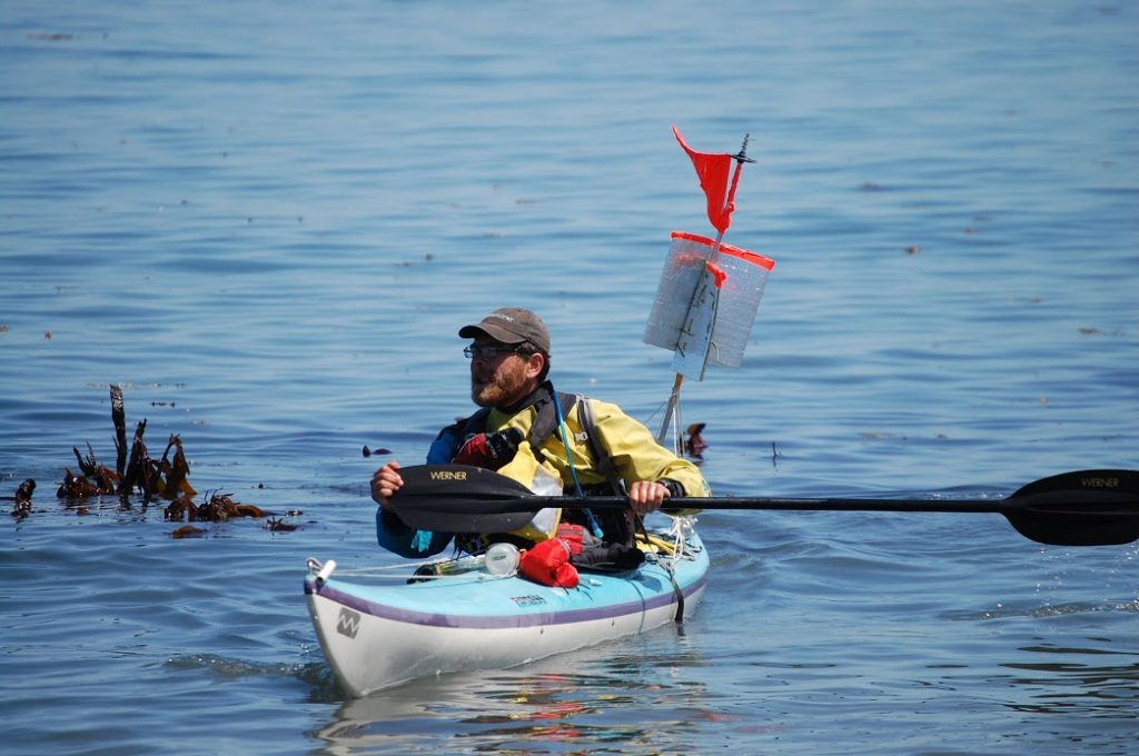
My latest creation was a signal flag/radar reflector mounted on the kayak’s back deck. I fashioned it from an old ski pole, orange duct tape and some reflective foam I cut off of a windshield cover. The thing added visibility so ships could see my boat. Kayaks tend to hide out in the crests of waves, concealed to vessel operators and their radar systems. My jury-rigged contraption gave me a better chance of being seen, but also made my boat more vulnerable to wind, and made the prospect of rolling a capsized kayak back upright more dubious. I secured the pole upright with guy-lines attached to the deck cords. There was an awkward lean to the array, but I didn’t spend much time trying to fix it. The tides were going to turn around soon and I needed to hustle.

As I got ready to push the boat into the water, a voice called out, and I was surprised and happy to see my friends Jarrett and Emma coming down the beach to see me off.

“That’s Victoria, over there right?” I asked Jarrett, pointing towards the hazy smudge of land on the other side.

“It hope so” Jarrett said. “You have that new compass on your deck you should use.”

He helped me carry the boat down the last stretch of slimy rocks into the water. Emma took photographs.

I was glad to hear later that my duct tape flag stayed visible long after my kayak faded from sight.

With everything else loaded into the boat, putting myself in it was the last challenge, made more difficult by the seat sliding forward. It took a minute to stuff my leg into the cockpit and to find the pedals.


Final preparations onshore.

I paddled a slow loop around the bull kelp and then I pointed my bow northwest.

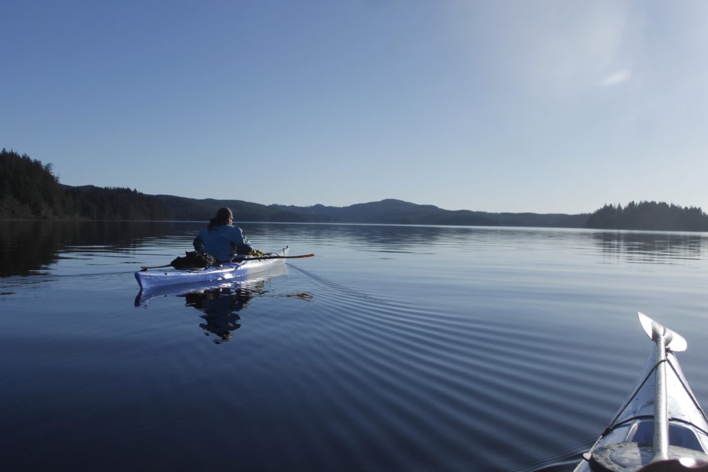
There water was glassy smooth. I paddled with my sprayskirt off so that I could vent heat from the cockpit. I paddled with fast, light strokes out into the open water.

About a half-mile out, I found an enormous stipe of bull kelp from last year, lolling on the surface like a rotting anaconda. I grabbed hold and broke two feet off the end of the tube, grimaced, and bit a hole in the top end. I lifted my new bugle to my lips and blew out a loud note: “Heeyaaaaawhnk!” It was about as loud as a ship’s horn and would be another way I could make my presence known on the Strait.

For the first miles of paddling I kept my eyes trained on Canada, occasionally looking left and right to watch for ships. I saw one cargo ship moving in from the east, but was comfortable that it would pass well in front of me.

Later, I passed within two miles of a large container ship, and cut about four miles in front of another one. There were a couple smaller boats out there also, but none got uncomfortably close.

I set my course toward a small white point on shore that turned out to be the lighthouse at Race Rocks. When I got there, I would have gone past the southernmost point of Vancouver Island and halfway to Victoria. I would keep well away from the rocks though; the area was known for dangerous currents.

Meanwhile, my kayak began to undulate up and down in four-foot swells. I swung my boat around rough patches where the water danced in swirls and sharp little ridges. The swells were still too round to crash over the front deck, but I worried that I would get nauseous if I stayed out in them too long. After about half an hour, the water smoothed again.

I was starting to see the Canadian coast in better definition: gently rolling hills, populated by pines.

I heard a short puff of breath, and looked to my left to watch a harbor porpoise roll out of the water. A second later, its companion popped up behind it.

“You are so awesome!” I declared. The porpoises went back under, but reemerged a moment later.

15 minutes went by, and then I saw another pair of porpoises come up to breathe on the other side, blowing out their puffs of air.

My nervousness about the trip began to subside, and I paddled with confidence.

I passed by Race Rocks without incident and started turning the boat more to the east so that I could take advantage of the flood tide.

Seeing no other large ships coming out of Victoria harbor, I decided not to worry as much about the shipping lanes. A buoy nearby revealed that the current was already flowing in my favor. I took a break to eat some food I’d squirreled away into my fanny pack as I cruised toward the final destination.

A large cruise ship marked the harbor entrance. A sharp current was moving into the harbor now and I swung quickly past a group of people hanging out on the jetty nearby.

The place was busy. There was a whole neighborhood of houseboats moored on some nearby piers. Tiny yellow taxi boats took people back and forth across the harbor while sea planes landed in and out. People on pleasure cruisers played tunes and lounged in board shorts and bikinis. I felt like a spaceman in my drysuit, out of place as usual.

Well, I was an alien here after all. I was legally obliged to report my presence as a foreign visitor to the local authorities. I tied up at the dock in Raymur Marina where there was a courtesy phone and a number to call Customs. I read out my passport number to one of the officials, announced my plans and received my own special number that indicated I had permission to be in Canada. That was it.

I sat down on the dock with an orange, watching a woman lead a kayak paddling class. The snowy reaches of the Olympic Mountains rose up above the buildings. I was starting to like this place. It would have to be a brief visit though.

I had about 20 minutes to enjoy paddling before I needed to haul my boat up and get to U.S. Customs at the ferry terminal so I could make the return journey.

The harbor went through a sharp narrows before it opened up again into the downtown. I flew through on the current.

The really tricky part was figuring out how to get my boat up to the ferry terminal. The only public docks in the harbor were a good distance away and metal retaining walls around the harbor cut off access.

The best way I could find to get on shore was a small park where I could get out of the water and lift my boat over a jumble of rocks. Two Canadians helped me out.

“Holy shit man!” one of them exclaimed when I told him where I’d come from.

They asked me how long it took me to get across the Strait, and I figured it was just about four and a half hours.

“That’s faster than the sailers make it sometimes,” one of them remarked.

Unfortunately, my awesome kayak is a lot less of a swift machine when it is out of water.

I was still nowhere near the ferry terminal and had to walk with my kayak and its radar reflector for about a quarter mile of busy sidewalk to get to the ticket booth and when I got there my spine was killing me.


Going through customs with my kayak was nowhere near as scary as I had worried   — no one checked the hatches for contraband maple syrup or hockey pucks. But I still had to wait 90 minutes to get on board the ferry back to the States.

One of the customs guys was a kayak fisherman and we talked for a while about our boating experiences.

I watched a tractor trailer get off the ferry and cut the corner a little too close around the customs pavilion. Crunch! Several pieces of board fell to the asphalt and a bunch of government employees went to chat with the driver while others took photos of the scene.

Poor bastard.

And poor me. I had to pick the kayak up and bring it back onto the ferry.

I went above decks and watched as the boat pulled out of Victoria Harbour. I paced around the deck in my spaceman suit, making note of different landmarks I would want to remember for the Race To Alaska finish.

Eventually I went downstairs for a victory beer. The greater challenge still lies ahead.

Victoria, it was a good visit, if a short one. Hope to see you again soon!


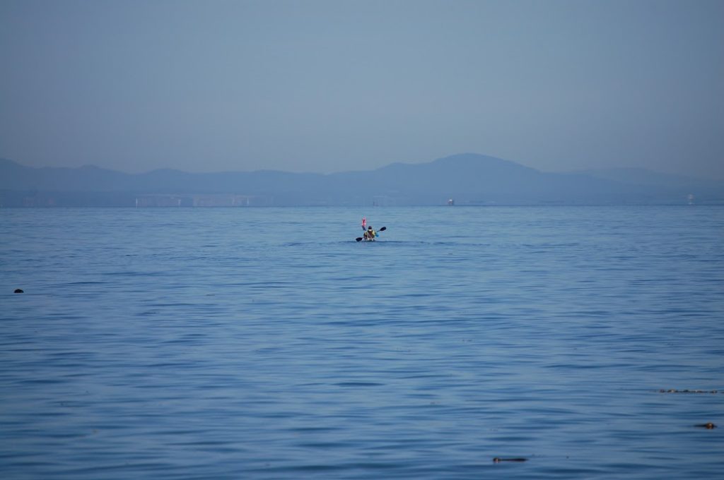
Me beginning my crossing. Vancouver Island is in the background. You can’t see Victoria, but if you squint, you might notice the large cargo ship  on the horizon in front of my kayak.

On Blasted Seas: A February Kayak Surfing Safari in Washington

“Ahh, I’m hoping to avoid that happening to me,” John said.

He was looking at the back of a heavy-set man in a plaid jacket, lurching awkwardly, painfully, from his vehicle across the gas station parking lot toward the doors of the convenience store.

The vision was quickly gone, as we were speeding down the highway out of Port Angeles, two beautiful fiberglass kayaks strapped to the roof of John’s truck. There was no way to assess whether we had seen a man who’d eaten a few too many convenience store Twinkies over the years, or whether other factors like injury or illness had robbed him of the ability to walk easily.

Either way, even the brief sight of those tortured steps made an impression on John who, at 65, has seen plenty of his peers go down the road of decreasing ability and decreasing will to be active. He’s nowhere near slowing down though, keeping active through mountain biking, road biking and going dancing with his wife.

And he still hits the water in his sweet fleet of kayaks multiple times a week, winter weather be damned. He logs eight-mile downwind runs in a dagger-fast surf skis on Lake Crescent, regularly plies Port Angeles Harbor, amidst the log booms and harbor seals. Last fall, he and a friend paddled across the Strait of Juan de Fuca to Vancouver Island and Victoria, British Columbia. (some 30+ miles.) When he needs a little more adrenaline, he’ll take his squat 14-foot plastic kayak, “rock gardening” — a pastime that involves veering the boat into, out of and over rocks when the waves are crashing in.

The waves would be crashing in today, alright. The forecast called for a strong wind flowing out of the Fraser Valley in Canada, howling down the Haro Strait to our launch at Freshwater Bay — a few miles west of Port Angeles. The National Weather Service had posted a Small Craft Advisory. Even so, the weather in Port Angeles was mild and windless. Feeling complacent, I only put a thin layer on beneath my drysuit before I headed out the door.

The tree branches did not clash, nor was there any other sign of wind as we drove along the road down to the put-in. It was only the last turn in the road, before I saw the trees begin to sway. Then I looked at the sea.

“Whoa!”

There were six-foot slabs of water rolling in, toppling over themselves in blasts of angry foam. The shallow, tidal beach only extended the violent interplay between land and water — row, upon row of breakers snarling into shore. When strong westerlies trouble the Strait of Juan de Fuca in the summertime, Freshwater Bay is usually a patch of calm. On this first day of February, it was the rodeo.

Further out, the sea hardly seemed kinder, with the waves rebounding off of Bachelor Rock creating more tumult. Even mightier waves loomed up and broke over themselves just beyond the bay.

To the north lay the snowy flanks of Mount Baker. It seemed to me that some hoary war god was pointing his finger at us from the summit, whipping up the armies of the sea against our launch.

John and I consulted. The waves were bigger than we’d expected, but we were confident we could punch our way off the beach in his 16-foot fiberglass kayaks. Maybe we wouldn’t be doing any rock gardening today. Maybe we wouldn’t even go out of the bay, but just getting on the water would be a worthy adventure, one with an exciting opportunity for surfing off the beach.

Before we headed out, both of us put some extra layers on beneath our drysuits for warmth. I slapped on a rain jacket too so that I could use it’s hood. John didn’t bring any head gear, but I gave him a wraparound hood, that I’d salvaged from one of my old jackets.

“Only trouble with these hoods is that they cut out peripheral vision,” I said.

Nonetheless, we agreed that it was going to be helpful to have as many warm layers as possible on this blowy February day.

I was also glad to have someone like John on board, who has spent years kayak surfing off the Olympic Peninsula and has experience in kayak rescue and other gnarly situations. An ex-prison guard (you would never guess from his easy smile or ready laughter), his job required that he be able and willing to restrain, incapacitate or kill violent inmates. This reality didn’t make him into anyone’s hardhearted authoritarian. In fact, he sympathized for the prisoners he watched, and thought it was all too easy for people in desperate circumstances to make the wrong decision. He is passionate about the marine environment and worries about what global  warming is doing to the waters that he plays on.

For the first part of the day’s game, we set our boats on the damp sand, just within reach of the waves, got in, snapped sprayskirts into place, started scooting ourselves toward the melee.


The tide in shallow Freshwater Bay goes out  quite quickly, and we had to scoot ourselves after it. Finally, a big swell of water lifted me off the sand, and I started paddling immediately, taking no time to put my hands into the insulating neoprene pogies on the paddle shaft. At first, the kayak’s upturned bow sliced easily through the sub-waves. Then, one of the larger breakers crashed right in front of me, burying me chest-deep in frothing water.

The kayak slowed, but I dug back in with the paddle, pushing myself forward. To lose momentum was to give up the game and get thrashed back into the beach.

I got to the face of the next wave — a taller one — just as it steepened before the break. This time my bow pointed up at the sky, and I dug in against gravity with ferocious strokes. The kayak nosed over the top, and bellyflopped onto the water on the other side. The wave exploded behind me. The next few waves were in varying stages of collapse, either allowing me to paddle over them, or else breaking over my deck.


Once we were away from the main break-zone, we were in less immediate danger of getting smashed up by a wave, but the waves were still steep, and more than a few of the bigger ones were still still break over themselves unpredictably — a nasty surprise for a kayaker.

“Keep looking to your left,” John advised.

Aye aye, Captain. I flipped my hood down so I could get a wider arc of vision.

The prettiest kayaking out of Freshwater Bay is arguably along the rock cliffs and sea caves to the west, but in these conditions, that area was sure to be a breeding ground for treacherous reflector waves and sneaky breakers coming over the reefs.

We opted to go east toward the mouth of the Elwha River, where there would be a sandy shore. Before our bows, Klahhane Ridge rose up in a snowy 6,000 foot wall above Port Angeles. It was backlit, but spectacular as always.

I kept looking to the left. The steep waves were forever on the cusp of rolling over. I would lean into them, and support myself by sinking my paddle into their sides with a high brace. Here and there I would accelerate my boat or slow down to avoid a surprise breaker. As I watched John’s boat disappear and reappear behind waves, I contemplated how difficult it would actually be for one of us to rescue the other if one of us capsized. Yes, it was safer that there were two of us, but as the seas got more wild, we had look out for ourselves, and keep an eagle eye on the water.

“There’s a break zone above that reef over there,” John called.

That patch of sea on our right was a place I knew because it usually offered calm. During the summer months, bull kelp growing off the sunken rocks there tended to dampen the incoming waves. Now the kelp was gone, and the waves were stacking up over the shallow water. Bathymetry was no academic concern here. Water depth had everything to do with whether we could glide over the waves or whether they would crash on top of us.

On our other side, there was another line of breakers, easily-eight feet high. Impossible to tell whether there was another reef there, or else some weird wave convergence/amplification happening in that zone. What was clear was that we were paddling a shaky corridor of relative safety between two much more violent zones. There was little to suggest that the big violent breakers further out couldn’t push their way in toward our current position, making for dangerous paddling.

John and I opted to turn about. The current in the strait was going west with the ebbing tide, carrying us back toward Bachelor Rock quickly.

Here and there were patches of fizzy water where tiny bubbles danced to the surface. Danger! These marked places where waves had broken recently and were likely to do so again quickly. I swerved my boat around one of these bubble patches, just before another wave came up and crashed in the exact spot.

“Wind’s dying down!” John announced.

The air was calmer now and warmer, though the sea was still bucked and heaved.

Perfect surfing conditions. We pointed our bows at the shore and waited to catch a ride. I flipped my tracking skeg down for better handling (John’s was disabled from gravel that had clogged the mechanism during  our seal launch off the beach,) started paddling tentatively in the wave direction..

The first wave nudged my boat along for a couple yards before it surged past me, but no matter, it gave me the acceleration I needed to catch the next one. I felt the back of the boat lift up as the bow sunk down into the trough. Leaning forward, to bring the weight of the boat to the bow, I paddled hard, then cut my speed so I wouldn’t overshoot. In no time, the wave was whipping me into a broach — turning me sideways in spite of the skeg and a hard stern rudder stroke.

I flipped my weight onto the other side, leaning straight into the wave face as it broke around me. The paddle fought for purchase in the aerated water. My head and torso were horizontal now. I jammed hard on the paddle and instinctively flipped my hips, sending myself back upright to finish my ride in triumph.

“Whoooo!”

The wave petered out and I quickly swung my boat around so that I could meet the next one head on. I noted that I had a slight ache in my shoulder blade due because of my sloppy high brace. Shoulder dislocation is one of the most common injuries that happens to kayak surfer. The risk is lessened by making sure to keep the paddle well in front of your torso while bracing, however. John and I paddled back out a few more times to catch some more waves. I had some good rides, but none as adrenaline filled as the first.


The wind began to blow again, knocking down the swells and diminishing their surfability. John and I paddled further off shore to check out the water around Bachelor Rock. The small sea-stack, with its lone, wind-snarled pine at the top, creates the western boundary of the bay. It is often a place where the currents muddle into each other and the waves get weird.

Today, Bachelor was sending out reflector waves — almost as tall as the primary waves — out at a right angle into the wave direction. Where the crests overlapped, it created steep, short-lived towers of water, followed by a sudden drop-off. The water was difficult to predict or brace off of.

I intended to get a small piece of the action by cutting close, but not too close, to Bachelor and then turning back into the bay. But circumstances were going to give me a closer look than I wanted.

As I approached the rock, I realized that the tidal current was beginning to push me into the worst water. A jolt of adrenaline went through my system along with the realization I needed to act quickly and precisely to get out. I swung my bow to the northeast and paddled hard. Meanwhile, I had to make constant micro-braces with my paddle blade as the water rose and fell randomly around me. John matched my course from a distance, though I could only catch glimpses of his boat through the waves. The only path back into the bay was through a break zone, which I traversed diagonally with strokes timed to avoid the breaks. Luckily, nothing crashed on top of me and I got back into the safer water unscathed.

But where was John?

I swung my boat 180 degrees, and saw him very close to Bachelor, his kayak rising and dropping in the chop. His expression was etched in concentration as he made quick adjustments with his paddle, reading and responding to the chaotic water. Eventually, he spat himself back out from the danger zone.

He, like me, had drifted closer to the action than intended, and gotten a nice shakeup out of the deal. With the hood cutting down his peripheral vision, he’d been caught unawares while turning his boat around, looked up to find himself right up next to Bachelor and in extremely chaotic water.


Both of us had adrenaline pumping through our systems. Once we were out of the danger zone, the fear had left and reckless joy rose in its place.

We surfed back into the beach, loaded the boats, cold but triumphant.

John had met plenty of young people, he said, that look down on sea kayaking as a slow, boring sport. But he knows better.

True, many of John’s friends prefer to go out on the calm days and take their time. They don’t necessarily jump to join him when there is a small craft advisory or gale warning. Nor does he mind such easy days.  He  takes satisfaction from the calm concentration required for the perfect paddle stroke — the torso twist, the pressure on the foot pegs, the timing of the blade.  Even when nothing seems to happen on the water, he is not bored.

The crystal calm days and small craft advisories, each have their virtues and opportunities for play. Play, as he has frequently told me, gets top priority in his retirement.

After we unloaded the kayaks at his house, I’d be getting to work, while he had plans to go biking while the sun was shining and the sky was bright. We drove away from the boat ramp with Mount Baker and the churning seas in the rearview.

There would be other days for quiet paddling.


Moments on Lake Ozette

Jarrett paddling on Lake Ozette

Some January day.

Jarrett and I stood amidst gear and kayaks on the shores of Lake Ozette — the biggest lake in Olympic National Park, at the north-westernmost corner of Washington, about to launch an overnight trip.

And lo! The sun was hot on my arms. Insects were flitting about. I felt, maybe a little bit silly, that I had brought the drysuit, neoprene sprayskirt, various and sundry items of hardcore cold water adventure.

This was warmer than half of the trips we had guided this summer.

“I can’t believe I went skiing yesterday,” I said.

The chest deep powder at Hurricane Ridge was a couple hours drive away, but was worlds removed from this all-too-pleasant lake front. The water was glass.
Jarrett wanted to know if I had brought sunscreen. I hadn’t. Psychologically, I’d been preparing for wind-whipped waves and sleety rain, not the possibility of a tan.

Jarrett slipped into his drysuit so that he could comfortably launch his kayak in the cold water. I was no mood to steam cook myself in Gore-Tex, and opted for shorts and a thin synthetic layer beneath my life vest.

No one said “Climate Change,” but on such an aberrant day, how could you not think about the warming planet and the new realities that it will impose upon our lives.

January might yet become the best season for kayaks.
And it will be just as well, because at least there will be something to do as skiable snow goes the way of the dodo.

Note to up and coming outdoor business owners: Maybe it’s time to start phasing out the skis. Kayaks will have the edge soon enough.

The snow will just keep shrinking up the mountains. Meanwhile, exciting new waterways are going to open up in low-lying places like Florida, Louisiana and New York City. Sure, the water may be a sludge of sewage, decay and industrial effluvia, but as long as the pH doesn’t get low enough to melt boats, you will probably still be able to float over it.

Think about the windfalls awaiting the entrepreneur who sets up the first guided kayak tour through Lower Manhattan.

“And this is the old New York Stock Exchange, where the short-term greed and willful ignorance of investors, abetted by a complicit government, helped bring the Great Flood. Hey, who wants to hit the snack raft for a New York pretzel?”

No one else had gotten the memo about the perfect weather it seems, because there were no other boats that we could see, no other vehicles at the boat launch into Swan Bay.

Jarrett launched first onto the smooth blue water. I made a couple adjustments to my gear and paddled after him. Within a couple minutes, I caught up to him. He had gravitated to a small shady spot behind some trees, where he’d have relief from the sun.

“You see that?” He gestured lazily.

A bald eagle perched in the branches above, scanning the water with its watchful eyes. It would be the first of many eagles we saw on the trip.

“I’m glad you got us out here,” I said.


The trip idea started less than 24-hours ago, when I’d called Jarrett to ask if he’d wanted to hit the water for a day. He was watching football, and said he’d call me back. When my phone rang again, I half-expected to hear that he’d be busy.

“You want to do an overnight on Lake Ozette?”

“Tomorrow?” I asked.

“Yeah.”

“Hell yeah!”

Lake Ozette had been on his to-do-list for a while, partly because you can combine the paddle with a two-mile hike over to a remote beach on the Pacific Ocean. I was stoked to some kind of combination adventure. Moreover, I had a strong itch to get out of town for some time away from the hellish news cycle and a fuzz of wintertime blues.
On the road, the dark clouds around Port Angeles began to melt off. Within 45 minutes, there were blue skies overhead. Highway 112 took a serpentine route along the Strait of Juan de Fuca through a series of hairpin turns and jackknife hills. The mountains of Vancouver Island to our north glimmered with sunlit snow.

“Whooo! That’s beautiful.”

“I can’t believe this weather.”

“Awesome!”

Led Zeppelin on the stereo was the perfect compliment to our buoyant spirits.

“It’s been a long time, been a long time, been a long time!”

Indeed. I hadn’t been in a kayak since November.

The highway would continue out toward Neah Bay and Cape Flattery, on the northwestern-most tip of the continental U.S.

Before we reached this juncture, we hung a left onto a little-traveled backroad. Trees, thick with moss lolled over silty creeks. It was life-on-life, Washington’s bayou country.

Boxy metal gates blocked gravel roads that accessed logged out hillsides. We entered the National Park a couple hundred yards away from the boat launch.

Only half the lake shore is public land, and several logging cuts are visible from the water. I was grateful for the sparse number of houses.

The still water and the lack of people made it possible to perceive subtle cues from the environment.

As Jarrett and I paddled out of Swan Bay into the broader lake, we heard the distant sound of breaking waves. It was the Pacific Ocean — close to two miles off the west shore, but sounding close enough to be just over the next rise. The tumult of countless breakers blended into a white blanket of shushing, thundering agitation as thousand-mile swells threw themselves against the continent.

What a contrast to the miles of stillness we saw before our bows. A loon cried out from somewhere.

“Man! I am sweltering inside this drysuit.” Jarrett announced.

“That’s funny. I feel just about perfect right now,” I said. “This shirt and shorts are breathing great.”

“Have you felt the water yet?” Jarrett asked. I dipped my hand in, and it was icy.

“If someone were to tip you over right now, you’d wish you were in a drysuit.”

I made no further comment and gave Jarrett’s boat plenty of room.

Off of Tivoli Island’s south side

We steered around Garden Island and Preacher’s Point. Many of the names on the map recalled the Scandinavian settlers who lived here in the 19th century. Often they paddled boats made by the nearby Makah tribe. Excavations have recovered human habitation in the area going back 2,000 years.*

No sign of those past inhabitants now as we paddled our plastic boats over the still water. We set our sites on Tivoli island, a couple miles down the way, where we thought we might camp. Sure enough, there was a well established site on the north end of the island with firewood lying on shore.

We paddled a quick loop around to the island’s south side to see if there were any spots that still had the sun, but no dice. Jarrett was down to see about sites on Baby Island, about a mile off, but I felt like we had a pretty good thing on Tivoli and voted that we start getting things set up sooner rather than later.

A dim realization had begun to rattle my confidence, as I thought about what I had (and hadn’t) packed.

I took out my dry bags and the bear canister. There was my stove. Ah, but where was the fuel? I remembered that I decided to take the fuel canister out of the can to save space and pack it elsewhere. Unfortunately, I’d failed to follow through on that last important detail.

“So how do you feel about a cook fire tonight?” I asked.

“Sure, but we can just use your stove,” Jarrett said.

“Well, you see what happened was…”

Jarrett might have been a bit annoyed, because I’d told him he didn’t need to bring his stove. Nope, Tom had it covered.

“Good thing we aren’t in the mountains,” Jarrett muttered. “You said you were going to bring your stove.”

I lamely pointed out that I had brought the stove; it was the fuel that I’d left in the car.

“No sweat. I’ll get a fire going no problem,” I said. I knew it was going to be a pain in the ass getting that fire started.

Sure there was wood everywhere, but most of it was damp. The grim reality I’ve encountered is that campfires on the Olympic Peninsula require generous amounts existential struggle and smoke inhalation.

I started by cutting up sections of logs and shaving wet bark from dead twigs with my knife.  After 45 minutes of gathering, I had sorted out various-sized piles of wood and arranged a cross-hatched nest of tiny twigs for kindling. Everything looked nice and boy scout-worthy. Now, the fun part.

I brought out one of my cotton balls soaked in petroleum jelly, ignited it with flint and steel, and used a stick to nudge it below my twig pile. Orange flame leapt up promisingly. The twigs were burning! The flames climbed higher, and I realized that the twigs were already almost all burned over now. Not what I wanted.

I threw more tiny twigs onto the pile, trying to get them over the fading licks of flame before they went out.  More tiny twigs. I started blowing desperately. Smoke was everywhere. I put my face to the ground to inhale from the puddle of clean air and rose back to the dying blaze for fire CPR. The twigs began burning again, and I tried to get some thicker, longer-burning twigs on the scene. They wouldn’t light of course.

My reputation was on the line and I was not going to let cold dinner be on me.
] I teased more tiny twigs into place. Tentative progress. Breathed the smoke. Cursed the fire. Blew more. Cheered as the the flames climbed up again. Tiny twigs. I cursed the fire, as it seems to change its mind. Blew on the fire. Applied bigger twigs.

As soon as I had flames that lasted more than 20 seconds, I grabbed a pot full of water and held it over the blaze.

“Or we could just use my stove,” Jarrett offered.

“You brought your stove?” I practically exploded.

“I thought I’d mentioned that.”

“Well, now that I’ve got this going, we’re damn well cooking over this fire.”

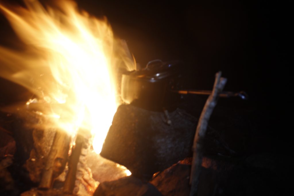
A fire with kayaks
And with dinner cooking

Because the bear can (mandated by the Park Service) only made room for my smallest pot, the meal was multiple courses, including pasta with bouillon cubes, an instant cup of pad thai, and some Spanish rice — with parsley garnish, fattened by the small canister of oil I’d brought along.

Jarrett took over fire duties, transforming my humble cook fire into a hearty camp blaze.

Venus flashed onto the scene first, leading the charge of the starlight brigade. Stars upon stars popped into existence above our fire — little sparks, the fine dusting of cosmic flame traced across the firmament.

The lake caught them, showed the sky its reflection. Even that still, dark water could not master the subtleties of heavenly detail. And I suppose it is the same with us, whether we aim our camera lenses skyward or try to encapsulate profundities with language. The thing itself, the present moment, holds the richest detail.

Earlier, I had watched the shifting gradients of color on the lake as the sun went down. Green blue in the west marched, seamless to the deep dark blues on the eastern shores. Wavelets crisscrossed themselves at the corner of the island, came to shore in the shape of diamonds. Gravel had moved away from this little place of interference and left a corridor of bare sand.

These and many other tiny aspects of the dynamic scene in front of me, danced inside my mind, which suddenly seemed a much bigger place than the night before, when I had been reading articles off a computer screen. The world seemed vaster and more full of possibilities.

And yet, the sunlight would banish the celestial tableaux from the lake’s surface. The delightful feeling that I had stepped closer to reality would also fade. It was an appreciation that required repetition, like Sunday Mass. If one can only fully appreciate the stars while under them, it is important to maximize that time.

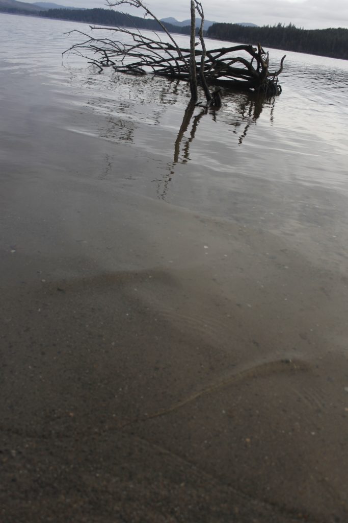
Crossing wavelets bend around a snag in the lake
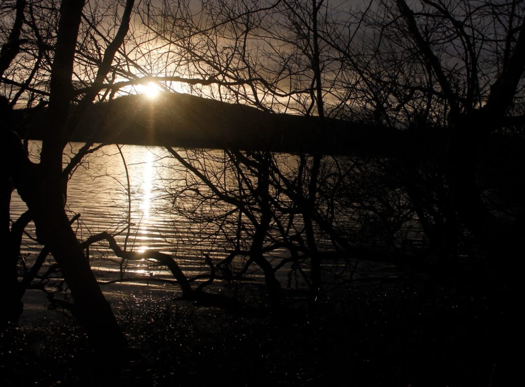
 Sunrise brings glitter paths to the lake surface
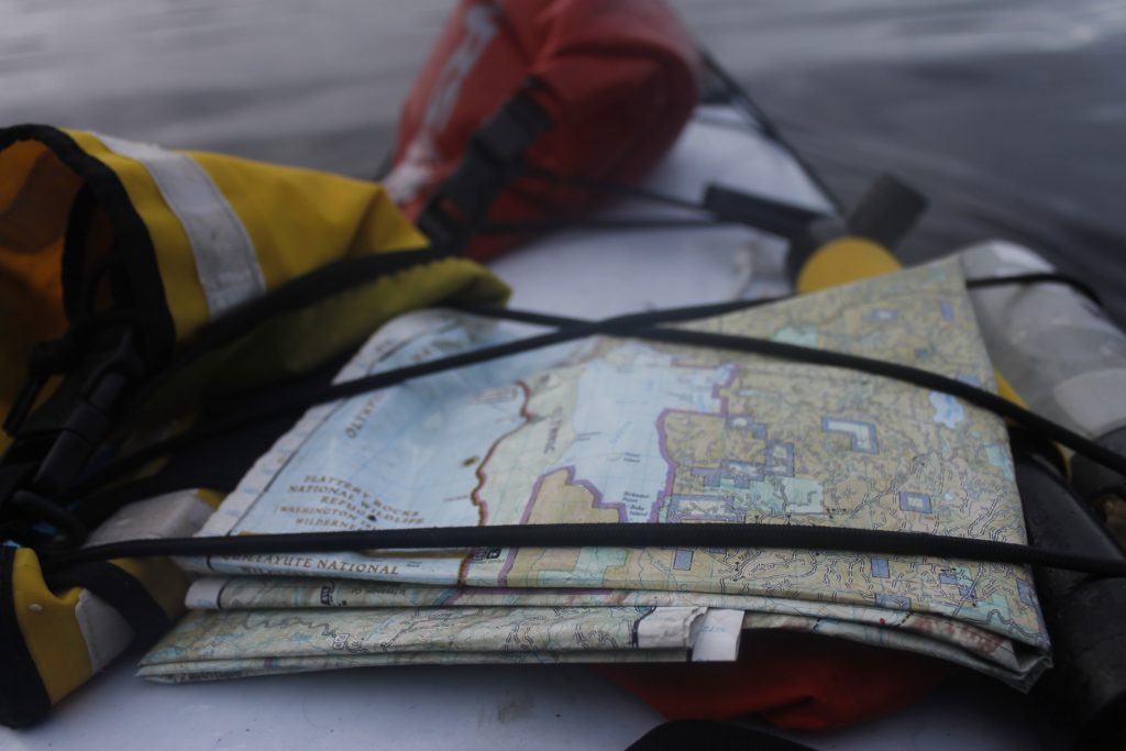
Kayak deck-mounted map showing Ozette and the nearby Pacific Ocean

Morning came with cloudy skies. It wasn’t raining, fortunately.

I went out to get the bear can holding our food. You wouldn’t expect the bears to be out in January, but I learned later that the bears on the part of the Peninsula didn’t really hibernate, because it never got deep cold. A local at a diner explained that the island had been visited by forest creatures. During calving season, local deer would swim out there to give birth, hoping to escape predators. But at least one bruin had gotten wise. The man had seen it swimming out there — probably with a hankering for some tender venison.

Sure enough, there were fresh deer tracks along the shore, but no sign, fortunately, of bears.

We made oatmeal with Jarrett’s stove, packed down the tent, loaded our boats and hit the water.

There was a strait shot across the water to where we would find our trail to the Pacific. Jarrett suggested we cut in a little sooner so we could paddle up the shore. In doing so, we saw what was easily a dozen bald eagles.

They perched in the branches of pines looking at the water. A couple of them took off as we got closer. Several were juveniles, lacking the distinctive bald head and white tail feathers and flashing white and brown beneath their wings. I thought back to January paddles with my dad and others on the Connecticut River, another place that draws eagles in wintertime.

Other signs of animal life included beaver-chewed branches along shore.

A sudden scurrying in the branches caught my attention. A small dark creature was running down the tree.

“Jarrett!” I hissed. “Come here and see this!”

By the time he had paddled up, the creature had vanished.

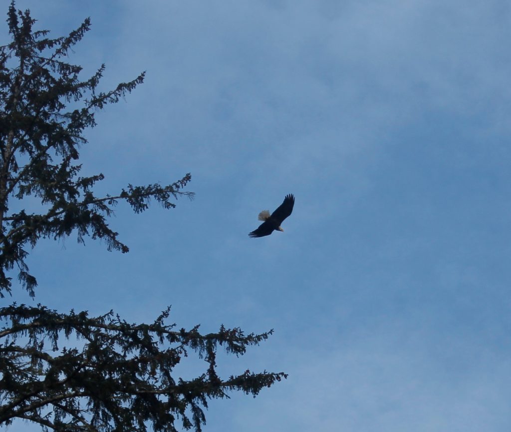
Eagle in flight
Perched Eagle

“It must have been a fisher cat,” I said. There has been a Park reintroduction program for these cagey weasel creatures, once hunted out of the Olympic Range. They are not something you spot often, and in fact, this was the second fisher, I’d seen in my life. The first time was in high school when I was running through the woods in Connecticut.

After I found out what a fisher was, I developed a respect for the little scrappers. They are tough, and will even go after porcupines.

Later, it occurred to me that I might have seen a bear cub, not a fisher. Still, the agility of the creature stuck out in my mind, and it may have been small for a bear cub this time of year. I believe that it was a fisher I saw in that tree.

The trailhead we wanted was in Ericson’s bay at the northwest corner of the lake. A small orange marker showed us where to park our boats.

We traded life vests and neoprene booties for sneakers and rain jackets. The rainforest trail was closed in by sword fern and salal shrub. A line of rotting boards offered a place to walk over the mud and soaking moss. The slick wood was as treacherous as black ice. We pushed our way through the salal, over and under fallen trees, put our feet through the oozing ground. Hemlocks, firs and giant cedars closed in  above our heads.


Trail challenges
The “dead end” is where our kayaks were

An hour of tromping gave way to an opening where we could see the gray waves of the Pacific.

Miles of lonely beach stretched to our north and south. Rock escarpments rose up in the distance. There was only one other hiker on the beach. He probably came in from a different trail and was far off anyhow. Another eagle cut through the sky overhead.

We ate a light lunch on a log. I went to mess around at the edge of the foamy waves.

There were so many patterns from nature here, including the lines of the waves, pods of bubbles, the arrangement of the small rocks along the sand, and the lines and dips that that the water carved around them.

There were also abandoned buoys, tangles of nylon rope, netting, globs of shattered styrofoam blown out over the sand, countless empty bottles. Here was one of the most remote beaches in the lower United States, and yet it too was part of our trash-heap ecosystem. As Jarrett pointed out, the remoteness of the beach also meant that it didn’t have the parks and recreation department, the local volunteers and other do-gooders who would clean up the refined sands in front of a block of beach hotels.

View of the Pacific
Foam and cliffs
Big box ‘o beach trash

The lot of this did detract from the wild beauty of the beach, but fortunately, there had been plenty of wild beauty to start with. As in the night before, I had the opportunity to bask in the wonder of a vast and natural place.

We left the beach, having not explored much of it and I was fine with that.

If left some time to explore some other islands and camp spots along the lake for the next time.

Though, really, sometimes you don’t know if there will be a next time. I don’t mean that in the apocalyptic, kayaking down Wall Street sense — though I am severely concerned about the health of our planet — but mainly in terms of the ups and downs of our lives: the sickness, the health, long workweeks and yes, the reality that life is a fragile thing, easy to snuff out.

To Jarrett, who has had some close calls in his day, getting out on the water or into the mountains affirms that he is doing it right. Time outdoors is an invaluable facet of a life that also involves work he takes pride in and a committed relationship.

Keep hitting high notes, and it will be more likely that you will end on one.

It’s something I’d do well to remember.
* https://www.nps.gov/olym/planyourvisit/loader.cfm?csModule=security/getfile&PageID=96997

Unsealable: A Battle to Keep Water Out Of a Drysuit Becomes Obsession

My drysuit

Whenever I felt the first icy trickle of sea-water going down my leg, my first instinct was denial.

Water couldn’t be getting in! Hadn’t I just spent the better part of a day inhaling toxic fumes as I re-glued and re-taped my drysuit seams?

Surely it was just sweat, or else moisture that was already in the suit. But I knew I was deluding myself. There was a leak somewhere. The suspicion became certainty when I’d stand up later and feel a cup of water sloshing at the bottom of each leg.

Such was the story of this summer and into fall. Every time I thought I had finally walled off every entry point, water found a way. Then I would go back with glue and tape to find the weak point in the seams, refortifying the battlements. My war against the ravages of entropy would take up much of my physical and mental energy for the months I guided kayaks.

The perfection of the drysuit was the goal that I could never quite achieve nor quite let go of.

I knew that if I finally sealed it off, it would open new horizons for my kayaking. I would be able to knock out Eskimo rolls, perform aggressive leans with my torso half-submerged, to fall out of my boat and swim through rapids — while maintaining a dry set of clothes. The old enemies, Cold, Wet and Hypothermia, would still be a threat, but I would be able to hold them off for much longer.


The freedom and security that drysuits offer comes with a hefty price tag: often around $1,000. I got mine for free by way of my dad — who’d also gotten it for free from a friend. I am not sure how old the drysuit is, though I did see a picture of the same drysuit in a book from 1999. The bulk of the suit is made from breathable Gore-Tex fabric and getting in means opening up the large waterproof chest zipper, then forcing hands, feet and head through the five different latex gaskets. The process takes several minutes, and is like giving birth in reverse. There is a relief zipper at the crotch, which is very helpful, though not so much if you’ve had a breakfast of hot oatmeal and feel a movement coming on.

When I picked up the drysuit this spring, all of the gaskets were brittle and cracked. My first project was cutting them out and then gluing new ones in their place with a special marine-grade glue called Aquaseal. This meant creating forms that mimicked wrists, ankles and neck. The place where I worked as a kayak guide had an old neck form lying around, which helped immensely. I stuffed the sleeves and legs full of newspaper.

The Aquaseal was damnably sticky and had a sharp turpentine odor. The tube warned of cancer and reproductive harm. I did the work outside to ventilate. After a few minutes of working with the stuff, I felt a bit lighter and loopy. It was good to walk away. I hoped I wouldn’t have to use it much.

I inaugurated the suit for its first test run in Port Angeles Harbor where I was teaching a friend how to Eskimo roll. The performance was spectacular. I’d put a heavy parka under the suit and was so warm that I wanted to roll over into the frigid water to cool down.

Remarkably, when I took the parka off later, I couldn’t find a drop of moisture on it! Success!


I began incorporating Eskimo rolls into my guided kayak tours. Gradually, I began to suspect that water was getting through. It’s just sweat, I tried to tell myself. Indeed, the suit was incredibly hot to work in before getting on the water, which was one reason it was good to roll over for a good soak.

Alas, my illusions vanished after a fateful run down the Elwha River. At a certain notorious rapids section, I found myself being tractor-beamed toward the exact standing wave that I had been determined to avoid. Over I went.

Though I tried desperately to come up into a roll, the thrashing water was having none of that. I pulled the sprayskirt and popped up just in time to fall over the first ledge. I spent several seconds inside a churning white room, then popped up again before yet another drop and another appointment with a white room. I came up gasping and saw a fallen tree right in my path. Swimming like mad, I almost cleared it, but not quite. I thudded against the end of the trunk with my live vest, and bounced around the last couple of feet. After I got on land and recovered my boat, I realized I was completely soaked.

It was time to twist open the tube of Aquaseal again.

Aquaseal, Tenacious Tape repair on a seam

My knowledgeable friend, Jarrett had a novel technique for finding the leak. Wearing the suit, I ran the tube of a bicycle pump into the ankle gasket and began inflating myself to sumo wrestler proportions. Then Jarrett walked around spraying the suit with a bottle full of soapy water. Sure enough, there were a couple places along the side of the suit where we could see tiny bubbles coming out.

The problem was in the seams, where the different pieces of waterproof Gore-Tex had been stitched together. The tape had begun to strip away.

I called up the people at Kokatat to ask how I might proceed. They put me through to the repair department, where a helpful man told me I was welcome to ship the suit to Arcata, California where they would take care of it. And no doubt they would do a beautiful job, but I was in no mood to wait a couple weeks.

What if I wanted to do it myself? I persisted.

The guy recommended stuff called Tenacious Tape which could be combined with Aquaseal (both products of the McNett Corporation) to make a fairly bomb-proof seam. He’d even heard of people re-taping seams with duct tape as a temporary measure.

I hung up the phone feeling encouraged. I turned my suit inside out and got to work, using scissors to cut away pieces of the peeling seam tape. I cleaned the area with alcohol and covered it over with the Tenacious Tape and Aquaseal.

The cool thing was that this worked at sealing off the area. The next time I rolled my kayak, I didn’t feel the water coming there.

However, I later discovered other leak points.


It usually took me a week or two of denying the problem to realize, yes, water was coming in through the ankle now, and then I would go back with the Tenacious Tape and Aquaseal. Both products are expensive, and I have no doubt that I spent well over a hundred dollars on them throughout the summer.

The kiss of death happened when a zipper pull tab came went off the rails. Both my boss at the kayak outfit and the people at Kokatat said that the suit was screwed. I could mail it to Kokatat and they would re-do it for $200. I had a suspicion that if I did this, they would take a look at the beater suit, laugh and tell me I should try a suit that had been manufactured in the last decade.

Meanwhile, a busted zipper meant that the drysuit was next to useless. I could buy a new one or I could go back to guiding in a Farmer John wetsuit as I had for two previous seasons. I did borrow a wetsuit for a couple of days, did an Eskimo roll, and realized that even my leaky drysuit was still way better then a Farmer John. I came up out of the water frigid, and determined to make the drysuit work.

I did a little searching online for zipper repair info with mixed results. I bought a zipper repair kit from the local outdoor store and realized that I could probably work with the zipper I had if I finagled it back on. Once I got it in place, I had to glob Aquaseal and some tape back onto the ends of the zipper to make my own stopper. The fix was crude, and it was questionable as to whether it would actually keep the water out, but the first results were encouraging. I also enjoyed having my friends ask me how the hell I’d managed to get the toasted zipper back together.

But later, I found more leakage coming in. Small amounts of moisture were infiltrating. Whether it was coming through the seams or through the zipper was a good question. I reinforced both with dollops of Aquaseal.


I also reflected on how I’d known multiple people who’d owned drysuits that leaked. Indeed, knowing that drysuits have a propensity to leak in one place or another had made me hesitate to buy one to begin with.

Another kayaking friends in Port Angeles explained that he basically assumed that any drysuit he’d owned was bound to leak at some point. They were sensitive. It was easy to mess up the seam tape or poke a hole somewhere. For that reason, he tended to wear his wetsuit on routine trips and only break out the drysuit on longer distance trips or on outings where capsizing posed a serious hypothermia threat.

Being a sensitive beast, the drysuit requires all kinds of delicate care, including applying and reapplying a substance called 303 to the different gaskets so that they don’t stiffen up and break (the way my neck gasket broke when I stuck my head through it earlier this year and forced me to replace it.) After any trip involving salt water, I’d blast the suit down with a hose to get the salt off. I’ve also reapplied waterproofing spray to the outside of the suit. Vaseline on zippers helps keep them waterproof and makes it more likely that the relief zipper will open during a moment of need.

Such mindfulness exercises have been helpful to me as I work to cultivate diligence in myself and resist the urge to throw the drysuit off in a soggy heap at the end of a long day on the water.


My attempts to fortify the suit have had some success but never perfection. Water is a pernicious and determined adversary, worthy of respect.

A medieval knight might have gazed fondly upon his armor, even treasured the dings and cracks that are reminders of old battles; so do I value this Gore-Tex and latex armor that protects me from life-destroying cold. The hours I’ve invested into repairing the suit has only increased its value

I think of all the time I’ve spent and the chemicals I’ve exposed myself to just to make repairs, and it makes me think about just how much more labor and resources are required to make one of these suits. Few people who wear a drysuit are going to see the machines and people who work to put them together, but by working to repair mine, I felt as though I got a small taste of this. How much work would I be flushing down the toilet if I were to scrap the suit and buy another one?

I haven’t put the suit on for a while. Most of my winter adventures have been off the water, but I can’t help but think it would be fun to go out and see the seals again, to tool around in some January waves.

There’s a drysuit in the basement, a tube of Aquaseal in the freezer. It looks like I’ve got work to do.

Aquaseal, Tenacious Tape repair to zipper. Hmm. Looks like it could use some reinforcement.

The Tides Beneath The Mountains: Three Days on The Hood Canal

unnamed-4
Paddling the Hood Canal. Photos by Jarrett Swan.

Launch

It was still dark outside when my friend Jarrett and I lifted two heavily-loaded kayaks onto the kayak rack had just built onto the roof of his weathered white pickup.

We had cinched the boats down tight with cam-straps and shaken them vigorously in their place to make sure they were immobile. We drove past the streets of Port Angeles under heavy rain. It was the kind of weather that doesn’t exactly make one eager for three days of exposed paddling, followed by nights cramped nights in a tent, where a few cups of moisture could mean the difference between comfort and misery.

Over those three days, we would paddle north for almost 60 miles of the Hood Canal, a salt water arm of Puget Sound.

November paddling. In a rainy part of the country.

We had packed for the wet, but knew that damp and cold were talented at evading the defenses we put up for them. We had gathered drysuits, windbreakers, miscellaneous and sundry camping items. We stuffed the gear into the narrow dry bags we would need to fit them in our kayaks. There were pounds of food that we’d use to keep our caloric furnaces in order.

Now they were very heavy kayaks that threatened to crush us when we lifted them.

We moved slow that morning stockpiling heat from cups of coffee. Killing time comes very naturally when you have reservations about starting a trip.

I drove behind the truck in my Civic, street lamps and neon flashing back at me from the rain-slick pavement. Gradually, the gray illumination spilled out of the east. It was a soggy cardboard sky. A scraggly remainder of ochre leaves rattled on skeletal roadside trees.

As the wind picked up, Jarrett stopped so that we could get reinforce the kayak straps. The wind whipped at the trees as we went about lashing down the boats. It felt like gale force conditions.

“Are you sure we should be paddling out in this kind of weather?” Jarrett asked.

I considered. The conditions did look perilous, but we were still close to a hundred miles away from the boat launch where it might be a different story. Having spent a whole day planning and packing, the idea of turning back left a bad taste in my mouth.

We pressed on, and in another forty minutes or so, we came to the takeout point at Quilcene Bay where there was the same strong, southerly wind that we’d encountered when we’d  stopped to fix the boats. Mean whitecaps were curling over the agitated water. The good news was that they were going in the direction we would be traveling. I parked my car and got in the truck with Jarrett. Hopefully, we would be back in this place in three days at the end of a successful journey.

Ice age glaciers up to 3,500 feet deep, carved out the complicated network of channels and islands west of Seattl, including the Strait of Juan de Fuca, Puget Sound and Hood Canal, which makes up Puget Sound’s westernmost arm with the Olympic Mountains rising up on the other side. If the glacier had carved a couple more miles to the east, it would have joined the Sound and turned the Kitsap Penninsula into an island we could boat around.

The Canal channels both wind and tides. Jarrett and I expected to make our best time paddling in the mornings when the tides were going out and the current was with us. The Canal also has a strong tendency for southerly winds however, and this was also in our favor.

unnamed
Setting off at the end of the canal near Belfair State Park

When we got to the Belfair State Park at the end of the canal, the high tide spared us the effort of carrying our boats out onto mudflats.

Next to us was Big Mission Creek, which came in running swift from the heavy rains. October had been a record month for much of Western Washington. In nearby Olympia, there had been 12.4 inches of rain, compared to the average of 4.6 inches for that month.* 

I watched a dark form thrash in the current, dorsal fin skittering above the water. It was trying to go upstream, but the current was too much. I saw the salmon fight its way higher where the water moved fast over loose gravel, then it gave up and let the current take it back down toward the salt water. Perhaps it would find another route. As I gazed around the pool, I saw other salmon sitting in the water, fighting the current now and then. None of them seemed to have much luck. A few scattered carcasses lay beached on the rocks. Hopefully, they had spawned already, but I wondered if the unusually high current had prevented them from getting where they needed to.

Our kayak journey looked like it would be less perilous then what the salmon had to deal with. The winds had miraculously stilled and the start of the Hood Canal looked glassy. The rains had diminished, although heavy clouds to the west promised more to come. The main challenge was hauling the heavily-loaded boats to the water. Then we had about 15 miles ahead of us to Potlatch Campground where we would stop for the night.
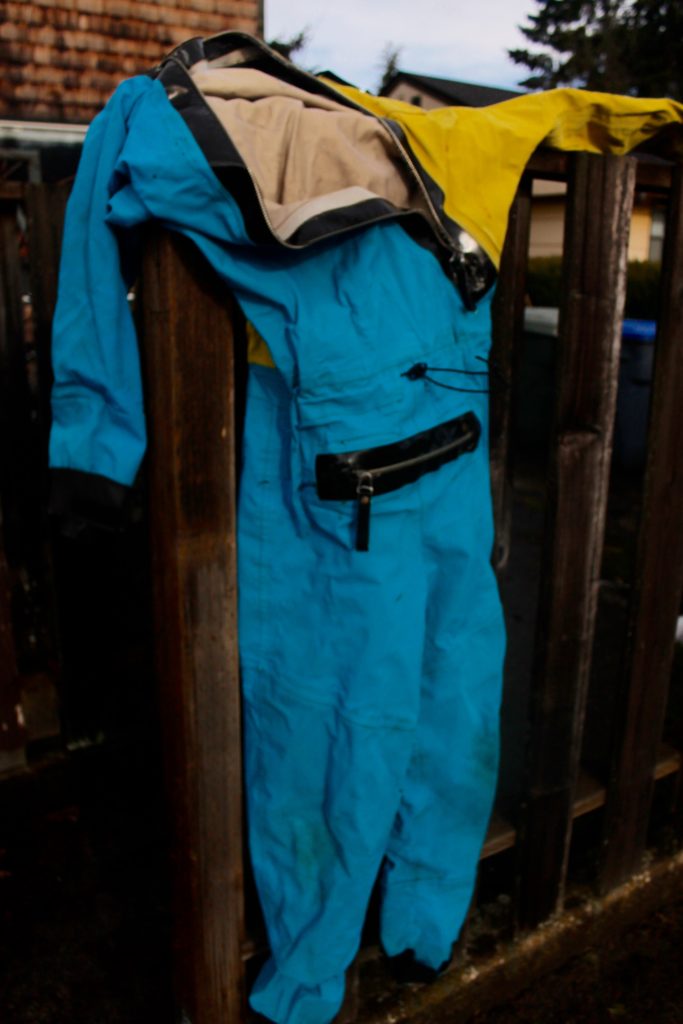
This section of the canal was just over a mile wide. We would be heading west all day, until we reached our campground at The Great Bend, where the Skokomish River comes in. There, the canal goes north and whither would go the kayakers.

The loaded boats handled differently in the water from what we were used to; they were slower and more reluctant to turn. Jarrett found his boat had a tendency to drift to the left for some reason and had to paddle harder on that side.

I was grateful for the skeg, basically a fin that drops down, which made the boat easier to stay on course. If I wanted to grab a water bottle off my deck or mess with some equipment, I could paddle hard for a second and then let myself drift, so that I was still making progress, even when I wasn’t paddling.

The outgoing tide, gave more oomph to out paddle strokes.

When we paddled hard, we got warm. The fleeces we wore under our drysuits were definitely overkill. If we broke a sweat, it would mean dealing with moist, clammy clothes, likely for the rest of the trip.

The water was a tannic brown like well-steeped tea, very different from the clear, cold water I was used to guiding on the Strait not far away. Neither were there the large clumps of bull kelp of Pacific giant kelp that flourish in that rougher, rockier water. In shallow spots, I could look down at the sand, and see the white blobs of oysters growing there, another critter that I don’t see when I paddle on the Strait.

Various diving birds populated the water surface, including merganser ducks, murres and grebes the size of geese

“Hey check it out, in that tree!” Jarrett shouted. There were two bald eagles watching us.

When we took a break at a state park, all the heat we had been saving up seemed to disappear. I threw on my balaclava for extra warmth, and we paced around eating sandwiches in the drizzle.

It was good to get moving again and get the warmth back. Soon I was dipping my hat in the water to cool off and was grateful when it started pouring.

Now and then, a small black head would pop out of the water and a harbor seal would regard us with curious eyes.

We made one more stop at the town of Union, before we crossed the large bay at the mouth of the Skokomish River, which is none for a massive salmon run. Though, we didn’t explore the river mouth itself, we likely would have encountered droves of salmon, and the nets that the Skokomish Tribe sets up to catch them.

The veil of clouds began to break in the west, revealing the jagged faces of the Olympic Mountains. Mighty snowfields looked down at us from the high ridges.

As if to herald this vision, the mournful cry of loons called out from in front of us, seemed to embody the essence of that powerful place.

Croaking Salmon

unnamed-2
Jarrett in hardcore rain gear

The Potlatch Campground was in the midst of a construction project, which meant that it took a moment to find the proper place to set up shelter.

It is worth mentioning that the we camped both nights of our trip on places made possible by the Washington Water Trails Association, which laid out the Cascadia Marine Trail from southern Puget Sound up to Canada and with a connector into Hood Canal. If there had been more time, the paddler-specific campsites along this trail would have given us many options for camping and adventuring in the region.

A small stream flowed through a human-dug drainage nearby. Dozens of flopping, struggling salmon thrashed there way over the shallow water. Several of the fish were stopped at one of the many logs lying in the ditch. Others were almost completely out of the water. lying seemingly dead, and then bursting into a frenzy of flapping effort that gained them an inch or two of progress, if any. I watched their beaked mouths, monstrous, opening and closing as if trying to take in the air they couldn’t breathe. Their sides looked bruised, even actively bleeding from the  effort of going upstream.

I walked further and further up the ditch, only to find more and more salmon that had somehow flopped their way up. Were they spawning successfully? Or was the drainage ditch only a cruel trick that led them to their doom? Of course all of the salmon would die, whether they reproduced or not. Same is true of humans, I suppose.

Bearing witness to the Amazing Cycle of Life was not getting our camp set up any faster. I helped Jarrett rig up the rainfly that we would sleep under and got to work cooking dinner beneath the handy pavilion nearby. It was nice having a dry place to eat when the rain started falling again.

There was no break in the precipitation that night. The staccato drops made a constant din on the outside of the rainfly. Thankfully, the soil where we had set up was loose and drained easily. We didn’t have to worry about it puddling up on us.
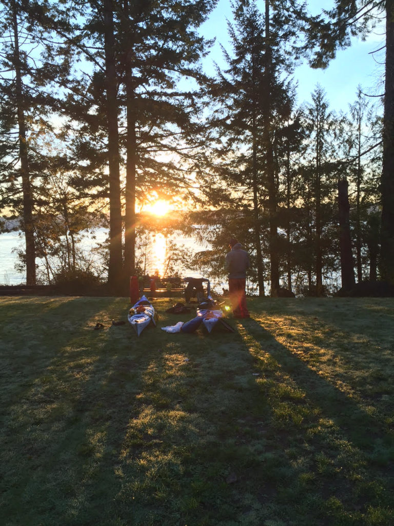
I had a couple of damp clothes items in my sleeping bag with me to dry them out for the morning, though this made sleeping far less pleasant.

“I hate sleeping in damp bags,” I muttered.

“Really? I’m completely dry in here,” Jarrett said, thwarting my attempt to give my misery some company.

Every now and then I heard splashing from the salmon in the ditch. There was also a low croaking sound from the same direction. I pictured those beaked mouths that I had seen in the stream earlier, opening and closing, opening and closing.

“The salmon are coming out of the water to eat us,” I announced.

When morning came, there was a dim glow on the horizon, and the sky appeared cloudless.

“Man! How about those salmon croaking last night?” Jarrett said.

“Oh yeah. That’s so weird. I had no idea they did that.”

I tried to make the sound.

“Eyeaghhhhh!”

“Aaaaggghhh!” Jarrett said.

“That’s going to be the rallying call for this trip,” I said. “You know, when the going gets tough. We’ve got to think like these salmon. Eyaaaggghhhh!”

We ate a bunch of oatmeal mixed with coconut butter as a pick me up.

As the sun rose, we set up gear to dry.

A couple of state employees came over to the stream to monitor the salmon. We found out that the state had dug the ditch for the salmon, who hadn’t been able to use the stream before.

Though the fish didn’t seem like they were having much luck to my untrained eye, apparently they had been getting far upstream, and even when they didn’t, many still had  still found room to spawn successfully. After the spawn had grown up in the ocean, they too would return to this place.

“We could hear them flopping around last night, even croaking,” Jarrett said.

The workers seemed surprised to hear salmon that salmon croaked, but we told them all about it.

So far, the stream mitigation work had been successful enough that members of the Skokomish Tribe had set up nets near the mouth of the stream. It was also a popular spot for seals, which had a taste for the fish. A group of seals were on a raft nearby, lounging in the sun. It was only after the workers left that we heard the seals start talking to each other.

“Eyaghhh!”

“Uhnnn!”

It looked like we had mistaken the sounds of the seals on the raft for salmon in the stream. Rookie mistake.

The Close Encounter

unnamed-8
Beach time

Drying clothes and talking gave us a late start onto the water. We aimed far out into the canal to take the best advantage of the tidal current and a light southerly wind. Under the full sun,  we’d traded out the warm fleeces we’d worn the day before for thinner synthetic layers. Now we could see several of the Olympic Mountains in sunny relief, including The Brothers and Ellinor.

We were about a mile offshore when we decided to raft up and take a break. I was eating some peanuts when I heard a sharp exhale from the water next to us.

I almost choked.

A massive sea lion head was poking up looking at me. Maybe it was 20 feet away. The head popped back down. At a glance, the sea lion was easily over 500 pounds, though  maybe a lot more than that. Male Stellar sea  lions can push 2,500. They can get much heavier than that, to basically the size of grizzly bears. While they are not necessarily as ornery as grizzlies, I’ve heard these sea lions can be pushy, including accounts of them grabbing hold of divers’ fins. * I’ve had one of them swim alongside me for a couple minutes, snorting and merging closer  to the point that I slapped the water with my paddle to ward it off.

We floated for a while longer, and the head came up next to us again.

“Pffffft!”

The sea lion breathed out. It gazed at us with large dark eyes.

Was it pissed with us or was I just projecting? Did I want to know for sure?

The head went down again.

A few moments later, it popped up again.

“Pfffffft!”

“OK, I’m about ready to take off now,” I said.

unnamed-7
Jarrett at anchor, waiting up for the author

We made good progress on the way to our camp at Triton Cove, in large part because of the current moving with us. I avoided taking an onshore bathroom break by way of a challenging maneuver, leaning my boat with Jarrett grabbing onto back deck. If the waves had been tall, it probably would have been a no go, but it turned out to be more convenient than using a bottle or adding a mile and a half to the trip distance. Learning new skills is part of the reason for adventure if you ask me.

In the miles before camp, we enjoyed views of Glacier Peak and Mount Baker in the Cascades to the north of us.

We ended at a boat ramp where we unloaded our kayaks and then hauled them up to a grassy campsite. It was just after 3 p.m., but the sun was already low in the sky. We took advantage of the light that was left to set up a clothes line to dry some of the clothes and gear.

While the sun set, we heard the sound of seals croaking from the water nearby. It was still cool, even if we had mistaken the same sound for salmon earlier. Eventually, the western light faded and the stars began to glimmer. Illumination from the distant cities of Seattle and Tacoma blobbed over the east like a false sunrise. The night brought dew as well. I felt some clothes on the line, and realized that they were already getting damp. Should have caught that earlier.

I through everything inside our shelter, packed my drysuit away in a kayak hatch. At least, knowing that there was only one day to go, I didn’t have to be so worried about damp layers, provided I had a spare in reserve.

The Last Day

unnamed-5
Ready for the morning

The night saw plenty of moisture accumulate beneath the rainfly, despite our best efforts to ventilate. The clear skies had made the morning that much colder, and the motivation to get out of our sleeping bags that much harder to summon.

We were out of the tent by 6:45 and I walked by headlamp to a nearby stream where I filled up water to start breakfast. The sun rose with a fiery corridor reflected over the Hood Canal. Warmth began to find us. Still, we didn’t take the time to hang stuff up the way that we had the previous morning. We were hot to get moving.

By the time we’d eaten, taken down the shelter, organized gears loaded everything into the hatches, put on drysuits and hauled the boats to the water, it was nine o’clock. We had the favorable current and some tailwind. Once again, we took far out into the canal, where we could see snowy peaks towering above us to the west, and the even larger Mount Baker and Glacier Peak rising up in front of us.

Briefly, for a few minutes only, I caught sight of the Great Grand Daddy of the Cascades: Mount Ranier. It always appears dreamlike to me and I struggle to tell myself that the thousands of feet of snow and ice there are real things, part of the same reality below where there were trees, parking lots, wet sand.

unnamed-10
Sunrise kayak portrait

Things were getting more interesting on the water, as the clouds began to fill the sky and a tailwind began kicking up two-foot waves. I caught some great surf rides, using the skeg to keep on track.

We pulled onto a marshy spit where we replenished with food. Jarrett unpeeled the top of his drysuit to put a fleece on. I decided that even though it had gotten a little cooler, a balaclava would be sufficient to keep me toasty. Sure enough, after we started paddling, the sun came back out. Soon Jarrett was roasting with his warm layer on but with no quick way to change clothes. I flipped my balaclava down and commented on how wonderful I felt.

We went by the Dosewallips river drainage, where we saw two bald eagles and at least a dozen harbor seals. They were, no doubt, gorging on the migrating salmon. I felt a greater understanding for why so many Northwesterners, including native tribes, express such reverence for the fish, seeing firsthand how much depends upon their bounty.

We took a break in a nearby marsh so Jarrett could utilize the bounty of a convenience store in nearby Brinnon.  I entertained myself by exploring a nearby culvert, too low to paddle through unless I sunk deep inside my cockpit. I handed my way up along the ceiling to the other side of 101, where the marsh came up against some farmland. Going back out was more fun since I had the tidal current going with me and sped through the dark passage like a torpedo — banging up against walls occasionally.

Jarrett and I snacked in the full sun, watching the marsh birds flit to and fro. He decided to ditch the fleece he’d put on earlier for our last push to Quilcene. It was clear that we were making great time. The fact that the wind was picking up from the south was just another bonus.

We sped away from the marsh and then across the water to a large point. The waves gifted me with many a surf ride. The Hood Canal forked in front of us. To the east went out toward the Strait of Juan de Fuca and the San Juan Islands; West lay Dabob Bay and, off of that, Quilcene Bay where my car was parked.

Fourteen knot winds pushed us along at a fast clip, with more assistance from the waves. It wasn’t long before we pulled into the Quilcene Marina: the end of our ride. We paddled in so that our boats hit the ramp at the same time, bumped fists.

Compared to what the salmon were doing, we had had an easy time of it, moving with the elements instead of against. It was also easier than carrying the stuff that we’d brought out on our backs as we would have on a hiking trip, The hardest part was managing the gear rodeo so we kept our stuff dry. There had been no massive waves, nor punishing gales, but their had been time to chill, tp contemplate the beauty of the mountains, the beauty of the water and the uniqueness of some of the creatures that made this place their home,

“Great trip, Man,” Jarrett said.

“Great trip,” I agreed.

unnamed-9
Hood Canal at morning

Notes:

*http://www.usclimatedata.com/climate/olympia/washington/united-states/uswa0318/2016/10 and http://q13fox.com/2016/10/26/soggy-nw-on-verge-of-breaking-october-rainfall-records/

** http://www.marinemammalcenter.org/education/marine-mammal-information/pinnipeds/steller-sea-lion/


Experiments in Snow Kayaking

_MG_8155
My kayak at the put in

Wipeout  in a whiteout

The kayak barely moved at first. I had to wriggle back and forth to inch it forward on the snow ledge I’d created. I saw the chunks of crust break away as gravity grabbed hold of the bow. Then the boat tilted over and we started tearing down the gully.

White powder sprayed up into my face. I could barely see what was happening, only that I was moving very fast. My efforts to steer with the paddle hardly mattered; down was the only direction my boat was interested in going — and it was going that way faster and faster. I squinted ahead to the fast approaching tree stand, wondering how the hell I was going to thread my way through.

Something bumped beneath my hull. The world instantly flipped upside-down and went white. My head was buried in the snow.

The ride was over.

I flipped myself right-side up, observed that my boat was almost completely buried in powder and that my paddle had flung out several yards down slope from me. To retrieve it, I had to take my sprayskirt off and wade through waist-deep snow. I’d need that paddle to get the rest of the way down the hill.

In the traditional model, I would wait to go kayaking until the snowmelt.

The powder on the mountains here in Routt County will begin feeding the rivers in a couple of months. Rivulets beneath the crust will merge, feed into drainage gullies, streams and willow fens, down to the Elk River in the Colorado River system. From the Yampa, to the Green River and eventually the Grand Canyon, the melting white stuff will build standing waves and hydraulics for whitewater kayaks and rafts to play in.

But just because the snow hasn’t melted, doesn’t mean that I can’t kayak over it. All it takes is a steep enough hill and a lot of powder.

Climbing with a paddle

_MG_8057
Kayak tow system for winter

Getting a kayak to that steep hill is the first challenge. My system involves snowshoes, a backpack, carabiner, rope, and a canoe paddle. I set the ascender bars on the snowshoes and start wallowing up the deep powder with the rope tied to the bow, clipped to the carabiner on my backpack. The first run is always the hardest because I’m breaking trail and pulling my kayak uphill through powder. I lean forward like some hobbled supplicant, praying that the kayak won’t yank me off my feet.

In some ways, the canoe paddle in my hands works even better than the hiking poles I typically use with snowshoes.  Paddling the powder on flat sections gives me a decent momentum boost from my upper body. The paddle also balances me. I can brace the flat of the blade against the snow, much as I would use a high brace to prevent a kayak from capsizing in waves. When the going gets steeper, I use the paddle more like an ice axe, sinking it deep into the snow above me and using it to pull myself up.

I often fall when the snow gives out from under me or my snowshoes lose their grip. Here, I can get back on my feet, pushing off the flat of the snow, like I’m doing an Eskimo roll.

The paddle can even dig out steps for me when I get to the steepest sections of the slope.

Going up the hill this way is one of the most physically grueling workouts I’ve ever done — a full body punishment system. My heart pounds like an express train when I finally get to the top of the ridge, maybe 150 feet above my start point. It’s a lot quicker on the way down.

Set up

_MG_8064
Kayak, pack and paddle

The climb was over. Finally.

I wiped sweat out of my eyes and surveyed the run. It was a south slope and the sun had just come out. Hence, a delicate crust was already forming on the powder.

I pulled my sprayskirt out from my jacket where I had stashed it in an attempt to keep it warm and stretchy.

There is something reassuring about this sprayskirt, a solid piece of neoprene that has stood up against the fury of waves and rivers. This pricey, “serious” piece of gear, helped me feel that, yes, I did know what I was doing up here, looking down a 35-degree snow slope through an aspen glen.

I used the paddle to dig out a notch in the slope where I could set the kayak down.

Getting the sprayskirt attached around the cockpit was a chore in the cold, even after I’d stashed it in my jacket to keep warm. The skirt wasn’t strictly necessary to go down the hill, but I did like how it kept the powder out of my lap. And I had that psychic comfort of knowing I was using a piece of gear that had served me well on past trips.

It did feel a little weird being in a kayak without a life vest however.

The backpack on my shoulders was another thing that was a little different from my standard kayak trip. I’d already given up trying to tie my snowshoes to the kayak for the way down. It was easier to put them into the nylon loops at the sides of my pack and fasten them together with a cam strap.

I put a ski helmet on and sunglasses. I wrapped a mesh t-shirt around my head  like a burka to deflect all the powder that was about to come flying up at my face.

I looked at the canoe paddle, a cheap wood thing I’d bought in Minnesota. Having already busted up a couple kayak paddles last year, I decided that I wasn’t ready to invest in quality piece of equipment only to smash it in while jackassing in the snow.

Making it work

The mantra for this run was “Lean that mother!”

Just as I had leaned kayaks on edge to turn them in whitewater or waves, I planned to use the same principles to make the boat work on the snow. Adrenaline had helped me forget this principle on my earlier runs and I had tried turning by using the paddle alone. It wasn’t enough.

With that in mind, I planned to lean far enough to put my whole body against the snow if need be.

I pushed off and the kayak began grinding downhill at a slow crawl. I leaned the boat way to the left and dug the paddle in on that side. Sure enough, the boat began to turn that way. The sound of crust breaking beneath the bow accelerated at a slow grind to a faster swoosh. Snow began flying up into my face. Now, I was moving at a skier’s speed. I leaned right toward a gap in the scrub oak and the boat responded in a neat arc.

I was carving!

The boat responded to the powder exactly the way it was designed to turn on the river, the same way a skier would cut graceful curves into the alpine slope. I’d stumbled into a unified theory between snow and water.

I shot through the gap in the shrub and the powder started flying up in my face. The view throuh my sunglasses became dim, then obscure. Then I could see only see white. My hands clutched the paddle, unwilling to let go. The best I could do, while flying blind was to lean hard and hope to avoid hitting anything.

After a couple seconds the kayak stopped. I took the sunglasses off and saw that the lean had dug the kayak deep into the snow and basically thrown on the braking power that I’d needed — that along with the fact that I’d steered into some shrubs.

I put the sunglasses in a pocket and analyzed the route down the hill. I pushed off again and carved the rest of the way to where I’d started.

_MG_8157
Buried kayak after a flip in snow

Can snow kayaking be the next hot sport?

Some witnesses have seen me going up and down the hill with my kayak and asked where I got the crazy idea.

No, I wasn’t the first person to think of it. There are some very entertaining online videos of others who have gone before me.

Nonetheless, this is hardly a popular sport yet. I’m enjoying something out which doesn’t necessarily have a large body of knowledge surrounding it and gives me the challenge of finding some things out on my own. Nor does snow kayaking (yet) have specialty products designed specifically for the job.

Note: If I were designing a kayak specifically for going down snow slopes, I would probably build metal edges into the sides for better carving. But that would subtract from the fun of doing something goofy in inadequate gear.

Snow kayaking is also a learning opportunity for boat technique

Many similarities between boating and snow sports became apparent after I started launching my down the hill.

Leaning for instance. I plan to steer with same aggressive edge that I used to carve the snow the next time I kayak in whitewater.

On the flip side,  now that I have tried using a canoe paddle with snowshoes, I’m considering ditching poles on my next snowshoe trip with steep hills. Being able to brace against the powder without plunging deep into it (as with poles) is a huge advantage while climbing. So is being able to carve steps quickly.

The paddle also proved instrumental an igloo building project that I will describe in a future post.

Kayak vs. Skis

When the fresh snow falls on the hills and I have to decide whether I’d rather strap boards to my feet or go rambling in my yak, there are considerations to weigh:

Kayaks are slower to move uphill

When it comes to kayaking down a hill vs skiing, the former is obviously far more laborious to haul up to the top, at least if ski lifts aren’t a part of the equation. This is however, a killer workout that I’d would recommend to anyone who wants to get in shape for mountain climbing or trail running.

Kayak gear is tougher to work with in winter

Other changes that I had to make to kayak the snow vs. on water included moving the foot pedals way back so that I could fit inside the boat it wearing winter boots. A sprayskirt is nice for keeping the snow out, but getting it on and off in the cold is a bear.

Because snow kayaking only puts my head a couple feet above the slope, even more powder flies up in my face than what I’d encounter skiing. I’d probably do well to invest in some ski goggles before snow kayaking full time.

Kayaks are more forgiving when they hit stuff, but will hit more stuff

One advantage of the low body position is that I can’t get knocked off my feet like I can skiing, though a flip is definitely possible.

If I hit a tree in a kayak, it will go better than if I hit a tree on skis because I’ll have a bunch of plastic protecting me. The fact that the kayak doesn’t steer as well as skis means that collisions are harder to avoid.

Kayaks excel when terrain is deep and steep

The kayak’s extra volume means that it floats very well on snow. I got some decent runs on a powder day when some of my friends snowboarding friends could barely move. They ended up using the kayak tracks to pick up speed.

On groomed trails, snowboards or skis are definitely faster and more exciting than a kayak run. If I put glide wax on the bottom of my boat, it may change the equation.

Without deep powder, steering is possible, but sketchier. I took a run down a south slope that had crusted over and found myself going down the hill backwards with next to no control.

So far, deep powder and steep slopes have equaled the most fun for me, including one run where I went down slope in a chest-deep mass of churning snow.

While deep and steep snow has made for the best kayak runs for me, that stuff is also the hardest to drag a kayak through.

What I’d like to try next:

At some point I’d like to graduate to a double-bladed kayak paddle, though I doubt I’ll find anything cheap enough that I’d be willing to sacrifice anytime soon.

I’d also like to try setting a luge track in the hill and build banked turns with a shovel. It’d be fun to get up some speed without having to worry about steering so much.

I’m both excited and terrified to see what happens when I finally melt some glide wax onto the bottom of the kayak. I have a feeling that it will be a wild ride.

_MG_8150
Kayak ready for the next run

A Day in the Waves: Part 2

_MG_7068

The second half of my big wave kayak adventure on Lake Superior:

The rising seas sent waves crashing into sea caves, mortar rounds of spray flying out from the cliffs.

A large stone archway guarded the entrance to a recess in the cliffs. I watched the waves slam against the sides, thought about what it would be like to rag-doll against the walls. I wouldn’t try to go through this one.

The Manitou River fell from the cliffs in a frothing yellow fury. The upper falls slammed into the side of the canyon, whereupon the onslaught redirected into a second, even more spectacular drop. There was a zone of smooth water in front of the falls, where the river flow was strong enough to beat back the lake, Further, the water boiled. Lake swells rose higher yet as they crashed and exploded into the face of the current. Birch leaves whirled in the agitation, flashing in and out of the darkness like strange fish.

It was an extremely tempting, if terrifying, place to try and surf a kayak.

The way to do it, was to aim for an eddy behind a sunken gravel bar. It was a spot that was slightly smaller than a modest kitchen, where the water was almost completely calm, a demilitarized zone between the warring lake and river.

I struggled to set up a good approach, wrestling with the river continually trying to push me back and the waves breaking at my stern. I half-surfed a couple waves, stopping to avoid getting thrown sideways or pushed down into the river. After a long struggle, I caught a wave that pushed me over the gravel bar and into the calm place.

It was one of the strangest places I have ever sat in a kayak.

Looking straight up, I could see 100-foot walls, curved amphitheater-like above my head. The falls couldn’t have been more than two kayak-lengths aways. And then there were the rollers coming in, crashing through the arch to the left.

I finally had the luxury of giving the view my complete attention, with no worries about the next breaking wave.

After I punched the kayak back through the breakers, Dave and I continued along the cliffs.

Mercifully, the profile of the North Shore has many projecting points, which create shelter zones where there will be calm water.

Fenstad’s Resort had one such protective point. We took a tranquil beach landing.

We were making great time down the shore with the waves pushing us, and even with the gathering seas, neither of us wanted to hurry.

“The point of a journey is not to arrive,” Dave said.

I nodded. The bigger waves? Let them come! Hopefully, they wouldn’t.

A guy with a mirrorless camera walked up to us to chat. There was some couple he’d heard about, who got swept out into the lake by an offshore wind and couldn’t get back. They died of hypothermia. We told him, we were experienced kayakers, guides actually, and that we’d paddled in these kind of conditions before. That seemed good enough for him, and we ended up talking about wildlife sightings in the area.

It turns out that there was a bear cub in a tree nearby, no mom. She had probably been shot by hunters. leaving the little guy to fend for itself this winter. The cub was probably a yearling, the guy thought, not a good prospect for survival.

The bear had been stuffing itself with apples from the resort’s trees, but the guy left it a fish he had caught so the growing youngster could experience some other sections on the food pyramid.

When the three of us went to see the bear, we found it looking down at us from a tall spruce. After more people went to look at him, he climbed higher and to the other side of the trunk. Then and again, he would peep out to look at us.

There were bright red apples hanging off of one tree, greens on another. They were delicious.

Trout swirled about in two streams nearby. The water levels had come down, leaving them trapped in pools.

Dave thought he might snatch one and leave it for the bear cub.. The guide and I watched skeptically as he waded in, but when he started throwing stones in strategic places, he managed to herd them into one place. Dave might have tried to swipe one out of the water, then thought better of it.

The waves kept building, but weren’t quite at the point where we wouldn’t fool around.

We deliberately took on a couple surf spots above the ledges, usually, opting to get near the downwind side of the ledge to make it easier to steer out of there if we encountered something too big to handle.

At one point, I’d thought I’d missed a wave, only to have the lake drop out from under me. Suddenly, I was surfing sideways, paddle jammed in the water. The stabilizing maneuver, known as the high brace, reminds me of 19th century whaling. I jab the paddle blade at the oncoming beast, lean the boat in and stick it. A Melville quote would have been appropriate here.

“From Hell’s heart, I stab at thee!”

This particular breaker took me on a 30-foot sleigh ride before I swung out of the break zone.

At another point, we were kayaking near shore, when a huge wave suddenly reared up next to me.

“I’d hate to be you right now,” Dave called.

But the wave ended up grabbing him too.

We stuck our paddles and rode, until the wave threw us up on a cobble beach. Dave might have been pissed because his fiberglass kayak had just taken a beating, but he laughed.

“That. Was. Awesome!”

The waves kept building.

After another hour on the water, we didn’t fool around much.

Every now and then, a 10-footer would rear up by our kayaks. I would try to angle my boat halfway into them, leaving room to brace and avoid getting flipped over backwards. Most terrifying of all were those monster waves, that broke at the top (but didn’t roll completely over, thank God.) These waves made their own break zones. I found that these half-breakers were technically easier to ride out than the breakers on shore or those that went over a shallow ledge. They just happened to be scarier than hell. If these massive waves started rolling over all the way, I couldn’t imagine how I could stay upright paddling through them.

The northeasterly swells kept me looking over my left shoulder constantly, with little time to appreciate some of the rock formations on shore.

This was a shame because we were going past Tettegouche State Park, home to a massive sea cave near Shovel Point.

I glanced at the formation with some regret. There was no way we would kayak into the cave now with this crazy surf.

Instead, we focused on getting around the cliffs at Shovel Point. Spectators at the rail got to see us taking on the swells and reflector waves.

The waves beyond the point were smaller, if still powerful, giving Dave and I some long-distance surfs.

Then we decided to take a shortcut through a small boulder garden. This turned out to be a mistake for me, when a wave crashed early and threw my boat against a rock. I steered away from the obstacle, only to get thrown up against yet another. I was almost out of danger when a third wave, hit me and flipped the front of my boat on top of a boulder.

Shit.

I tried to flip, back over, but the boulder got in the way of my paddle. Next, I tried pushing off the boulder itself, but I had to take my hand out from the pogies to do this. Just as I was ready to right the kayak, a mother of a wave came and blasted me, ejecting me out of the boat through the spray skirt.

Getting the boat emptied out on the rocks took at least 10 minutes. Submersion in the cold water brought up an urgent need to pee, which I did as discretely as possible (not very discretely) in front of the bystanders watching from the cliffs.

Dave came around and helped me get the last of the water out of the filled-up boat and get me back in. We were determined to get off the lake via the Baptism River, which meant that we would have to surf waves in against the current. The river shot out in an offset angle from between a cobble bar and a rock cliff.

The big-ass waves were crashing everywhere now. I let Dave go into the river first, slowly side-surfing one wave at a time in order to hit the sweet spot. When he got into the slack water, I brought my boat to bear.

The stern lifted on the crest of a huge breaker. As I plunged the paddle in, the wave shot the boat to a wild left and bounced its nose off the  cliff.  I back paddled on the right.

Here came the second breaker.

Again, I stabbed the paddle into my assailant. This time, the shaft snapped.

Of course, the wave pushed me back into the cliff, and I had to shove off with my left arm.

I held both ends of the busted paddle and paddled them like mad for the river mouth. Fighting the current this way gave me just enough momentum to stay ahead of the break zone, but it was like running top speed up a tilted treadmill. I wasn’t going any further forward and eventually, I knew the current would feed the boat back to the carnage.

Dave had already beached his kayak and jumped in the belly-deep current. He grabbed the loop on the nose of my kayak and got me the rest of the way home. Saved my ass.

We threw our kayaks up on the beach, where there was a corridor of rock piles and some inexplicably well-dressed people milling about. Some of them started asking to Dave about our journey. I stumbled into the shelter of some ledges where I could be out of the wind.

It was around this time that I realized that I was dumb to keep flailing at the water with two ends of the broken paddle. If I had just taken one end and paddled with it canoe-style I probably would have gotten enough momentum to go up current and get onto the beach on my own.

Some of the well dressed contingent came over to spread the cheer.

“We saw you almost die,”

“We didn’t almost die,” Dave said.

“Well, can you please move your boats, we’re going to have a ceremony here.”

A wedding!

And if we had come in ten minutes later, well, both of us would have absolutely surfed right into the marriage ceremony. What? You didn’t get the RSVP? Sorry guys, but these boats are coming in.

I can understand why many of those on shore, might have seen this all go down and thought, ‘Wow. What a couple of idiots to be out in that.’ Maybe some readers feel that way.

I do take issue with people who make rote judgements of how dangerous/safe, something I am doing is is based on a cursory, emotional assessment.

I’ve had people approach me after I get off the water with this automatically superior attitude. They don’t necessarily say, “You’re dumb.” Usually, they relate some passive-aggressive story about somebody who died. Not that it matters that the other guy had no life jacket, no wetsuit and several drinks in the tank. Never mind that I practice kayak rescues, practice rolling, practice bracing and practice in big waves. I constantly ask myself if I am allowing my enthusiasm to cloud judgement.

I’ve also been that guy on the beach. I’ve told a group in a canoe that the waves were going to be much bigger when they got around the point and tried to discourage them from going out on the 40-degree waters in jeans and cotton shirts.

Still, these others, just by knowing that someone has died on the lake, have gained this incredible perspective that I must lack. Thank you, Concerned Bystander, for your considered opinion.

While I don’t always make great decisions, I do resent others lumping me with the yahoos who have no idea what they are doing.

Dave and I used some judgement when we looked back out at the lake and saw mostly big breakers going out to Palisade Head. We had four miles of lake to cover to get back to my car. Could we make it? I thought we could do it if we had to.

But maybe we shouldn’t. Constant bracing had taken a toll on Dave’s back. I was feeling tightness as well. The lake showed every indication that the waves would continue to build.

Dave took out a cell phone and called a friend to pick us up. We hauled the boats up the long steps away from the lake.

The waves stayed rolling in my head for two nights in a row. I felt that I was moving with the swells, bracing into waves, surfing them. Some kind of unconscious learning was happening. Surely, the neurons were making new connections, preparing me for the next trip on the big water.

Here was the trip I will remember years from now: two kayaks, beneath the cliffs, through the waves, staying up.

A Day In The Waves: Part 1

_MG_7068
Lake Superior’s waves crash against the rocks in a red sunrise at Black Beach, near Silver Bay, Minnesota

Here was the red sky that we’d been warned about: a hot band of mango orange coalescing above the dark waves.

It was just past 6 a.m. and Dave and I were at Black Beach loading kayaks onto his truck for the 23 mile drive up the Superior shore to Taconite Harbor. That would the launch spot. Black Beach was, hopefully, the end of our expedition. I walked down to where the waves rattled the cobbles. Amber beads of spray caught the wind, shone briefly in the evil light.

I ran back to the truck.

“Sorry, I just had to grab some pictures.”

“It’s a beautiful sunrise,” Dave said, “You got everything?”

I went back to my car and double checked. Most of the stuff I would take on the drive to Connecticut was already loaded in there. My kayak guiding season was over, and it was it was time to pay a visit back east.

“I think I’m ready,” I said.

I got in the passenger seat and we rolled out on the gravel.

When I called Dave the night before, I got his voicemail.

“Either I’m kayaking or I’m kayaking,” the message declared. That sounded about right.

Dave, who cuts a wiry figure with a stern face offset by a silver goatee, has been in his paddling drysuit most times I’ve seen him. He goes out on the lake almost every month of the year, stopping only for when the ice gets makes paddling physically impossible.

He’ll be out there with a Greenland paddle in his hands, the traditional paddle of an arctic seal hunter. Such is his enthusiasm for the Greenland paddle that he has a “Rolling With Sticks” sticker on the side of his truck. which shows a stick figure executing an Eskimo roll with a Greenland paddle.

Dave told me he knows how to do 30 different rolls in his kayak, though I’ve never had the chance to watch this.

In fact, we hadn’t done a trip together yet. With me kayak guiding for a resort, and him at the nearby outfitters, most of our water time has been with customers.

Needless to say, neither of us get to take customers out for 20-plus miles in Small Craft Advisory conditions.

This was the kind of trip we hungered for as we wrapped up guided tours for the year. This was the Guide Tour.

We wanted to need our best technical skills, lake smarts and physical strength. We wanted to end the day beaten up — not from hauling boats or loading trailers — but from testing the actual, whoop-ass fury of the world’s largest lake.

Along the way, we were going to paddle a new section of lake for both of us, stretching past Sugarloaf Cove and out to the falls on the Manitou River. The Manitou is the only major North Shore waterfall that drops straight into the lake.  No convenient overlook and interpretive center parking lot here. Tall cliffs and private property keep this gem out of sight from the road. You have to paddle there.

Later, we planned to go past the sea caves at Tettegouche State Park, and then around the 200-foot cliffs of Palisade Head, which has its own tunnels.

I wondered how well I would handle playing in the big waves all day, also how I would stack up to Dave’s expertise. I hoped to show the kayak vet that I knew a few things too.

Orange light marched down the nearby trees and cliffs as the sun peaked above Gull Island at Taconite Harbor. Gull Island and its companion, Bear Island are linked by a long line of quarried stone, which creates a bulwark against the Superior’s waves. Further protection comes from a smaller ring of stones that creates an inner harbor around the small boat launch.

We put the boats down on the concrete and did a last gear check.

Crap! Where were my paddling gloves? Dave lent me some neoprene pogies — a type of glove that attaches to the paddle and you put your hands into.

_MG_7073
Dave in his drysuit, prepping for launch.

There were no ships in the harbor (there rarely are these days, now that most of the Taconite ore used to make iron goes out of Silver Bay.) Once upon a time, I stopped a tour near Gull Island to avoid crossing paths with the James R. Barker.  The Barker had just dropped off a coal shipment at the nearby power station.

The boat is over 800 feet long, and at least as tall as an eight-story building. It lurched, Leviathan-like out in front of our tiny kayak pod, trailing a brown line of haze from its enormous stacks.

Once upon another time, someone asked me just how much coal was onboard a moored barge. I paused in an attempt to calculate the size of the black mountains that pop up near the plant after every new delivery.

“That would be approximately one shit-ton,” I said.

Today’s wind gusts had whipped the outer harbor up with sharp little whitecaps.

The big swells came in from the northeast, cutting past Gull Island at an angle, and crashing into cliffs. Seen at a distance, these waves were slow, blue forms, squiggles on the pink horizon. Each paddle stroke brought us closer to them. Soon we began to feel the lake’s power.

Dave’s kayak appeared and disappeared beneath him between water ridges. As the waves built later in the day, Dave himself would flash in and out from sight as the walls of water crossed my vision.

We grinned wildly at each other. This was the ride we’d waited for all season.

Waves shattered up against 100-foot rock cliffs, broadcasting plumes of spray that dazzled in the orange light. The rhythm of the waves against the boats was offset by the counter-rhythm from the reflector waves bouncing back at us from the walls. Sometimes, one of the reflector waves would smack right up against one of the oncoming rollers and they would pop —their splashes flying into the air.

This dynamic environment required constant vigilance to keep the boat upright and going where it should. Body and mind had to mold to the movement of the water with fast micro-adjustments in the hips and with the paddle. I enjoy the trance-like concentration this demands. I would still feel myself bucking and rolling when I got off the water, would be going up and down the waves when I went to sleep that night.
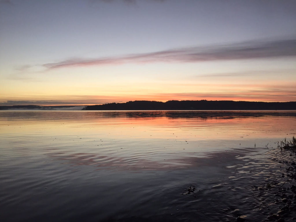
A golden eagle (or was it an immature bald?) looked down at us from over the cliffs. We would see several eagles along the trip, more than I had seen throughout the summer.

A 20-foot rock nob jutted out from the shoreline in front of our kayaks. It was the point at Sugarloaf Cove, a beautiful piece of parkland where I had led hikes earlier in the year. I was finally able to get a look at a sea cave that I’d often wondered about, though I could never see it clearly from the land. I maneuvered through the reflector waves to beneath the lip of rock where I could see an alcove, maybe 10-feet deep beneath the overlook. I wonder how many hikers stand up there, with no idea of the enormous opening beneath their feet.

Near the alcove, there was a cool rock feature on the cliffs that sent up tall whirlwinds of mist as the waves crashed past. The water made a “shush!” like a mighty exhale.

A nearby mini cave in the rock would take a wave and fire off spray with the thud of a cannon, sending spray out 20 feet into the lake. It looked like a dragon fire.

In fact there was a kind of explosion happening. As an oncoming wave slammed into the air inside the rock hollow, it compressed it, causing the air  to blow out at high pressure, blasting shreds of wave with it.

Another natural phenomenon to look for was the surf spot. The Lake Superior North Shore is chock full of underwater ledges that create shallows. A big wave rises up and curl over, as it marches past. These make for fun/dangerous spots for kayakers depending on the size of the waves and the kayaker’s experience.

I look for these surf spots for fun on most days, seeking to ride a good-sized wave in my kayak. Now, these waves were massive, and curling in much deeper water. It didn’t seem like I was looking for surf spots. They were looking for me.

Whale-sized waves crashed on the ledges around Sugarloaf Cove. Dave and I gave them wide berth. The water on the other side of the point was less intense but there were smaller, breaking waves, that carried us long-distance over the shallows near shore.

This was the first place on the trip where I got rocked.

In the semi-shelter of the point, Dave and I had let our guard down enough to swap stories of our adventures kayaking the Temperance River, including Dave’s trip down an upper section I hadn’t tried yet.

“Is that really crazy?” I asked.

“No it’s not too bad, but you definitely need to stay on your toes.”

“Hey, speaking of which…”

The wave was stacked up about six feet high, approaching from our left and getting ready to break. As it curled over, we jammed our paddles into its side so that we could lean into it and brace against.

We were immediately sideways surfing a frothy stampede of water. Though my kayak wobbled in the melee, it stayed upright. And I got a massive charge.
Unfortunately, the wave had also pushed us closer to the rocks, and in a bad place for the next wave. Dave, who was slightly further out, managed to paddle out through it while it crashed over. Not an option for me. I tried to set a decent brace, but  before I got there, the wave knocked my boat over like a bath toy. Submerged in the cold water, my immediate thought was, ‘Don’t let Dave see you screw up this roll.”

I fought my blade to the surface and swept it over the water. I got high enough out of the waves to take a breath, but the roll was sloppy and I went back under.

On my second attempt, I took my time getting things right under water (even as I started to feel pressure building in my head) and swept the blade again, flicking my hips and rolling my body to the surface.

I pointed the nose of my boat into the waves and paddled hard, slicing through the next wave of breakers.

Dave congratulated me. Sure, flipping the boat over was a bit of a noob move, but the roll redeemed it. If only everything in life were that simple.
Our course took us past the canyon of the Caribou River and to a sheltered cobble beach where we took a break to eat and go agate hunting. A rough day on Lake Superior is always good for searching out these little geological wonders because it brings a fresh crop onto shore. You know the other rock hounds haven’t been over it. I’m not much of an agate picker. My best find, was a pea-sized pebble, which did have some cool alternating red and white mineral stripes. Dave, who sells agates for a side income, snapped up several, beauties the size of golf-balls.

We were making great progress down the lake, and neither of us wanted to rush the day. Nonetheless, even in the half hour that we spent out of our boats, the number of whitecaps on the lake were building.

Dave turned on his weather radio, which announced that there were 4 to 6-foot waves (Wait, I thought they were supposed to be 3 to 5-footers!) which would build to 5 to 7 footers by evening. Of course, all bets were off when it came to underwater ledges and random mutant waves that rose much higher than their brethren. The Weather Service had issued a Small Craft Advisory for the North Shore, which we already knew about.

“The Small Craft Advisory advises me to go kayaking,” Dave said.

Not far off the beach, we could see an indentation in the cliffs up ahead. This, we guessed, was where the Manitou River dropped into Lake Superior. Soon we could see brown river water that swirled with yellow leaves and flowed out into the blue swells. Could we get up to the falls without getting thrashed?