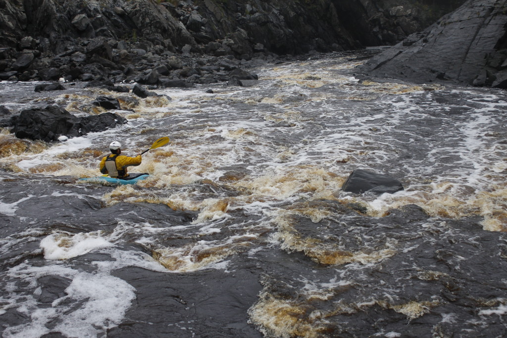
Between the razor edges of stone, through the labyrinth of dark canyons, there runs a river, treacherous and rusty brown, that thunders over falls and flies into narrow places that would crush a boat.
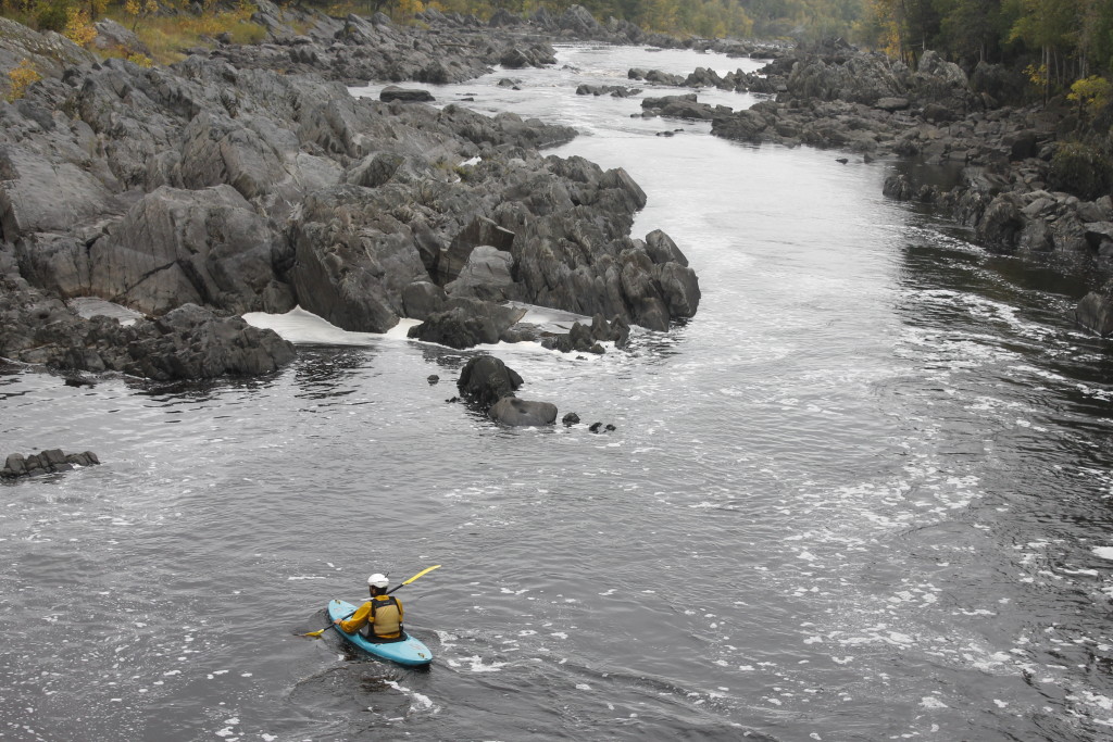
The St. Louis River is beautiful and sinister at once. Its water flows over a massive slate formation, exposing it in spiny rock projections that jut up at regular intervals and identical angles. This regularity, gives the rock a whiff of gothic architecture. It was not a little bit unnerving from the perspective of my tiny kayak.
The other rivers in Northeast Minnesota that I’ve paddled are glorified creeks compared to the wide and powerful St. Louis, which winds through acres of carved stone. The water was strong enough to build the world’s largest freshwater sandbar (It measures 10 miles long divided between the Minnesota and Wisconsin sides) in Lake Superior, which created Duluth’s shipping harbor.
British and French fur traders, descending out of the north country on their way to Superior, used to portage their canoes around the big rapids, following trails built by tribes before them.
Later, kayakers and rafters found out that those rapids could be pretty fun, if dangerous. The St. Louis is probably the most popular spot for whitewater sport on the North Shore, popular enough so that many guests on my guided sea kayaking trips have asked me if I had tried them out. My desire to try the St. Louis only increased as I built some skills on other North Shore Rivers like Temperance, Cascade, Popular, Baptism, Cross and Lester.
The section I wanted to try went through Jay Cooke State Park, starting at the dam below the Thompson Reservoir to the Swinging Bridge in Jay Cooke State Park, and thither down to Oldenburg Point if time allowed. This is the section where I’d seen kayakers taking on rapids during my ultra marathon back in July.
A storm earlier in the day had swollen nearby streams and increased the flow coming into the river. The sky hadn’t cleared, but left low clouds swollen overhead that felt like an oppression.
I drove out of Duluth with the boat on my roof and LeAnn sleeping in the passenger-seat. She was dozing after a 2 a.m. to early morning shift delivering newspapers for a friend. Although she could have stayed asleep at the apartment, she decided to be an awesome friend and go with me to shuttle the car and take pictures.
I was trying to get into the upbeat music coming from the college radio station. I couldn’t shake the feeling that what I was going to do wasn’t going to be fun exactly or that I was going through motions that somebody else had scripted.
As my third guiding season winds down, I have the same sense of malaise and uncertainty about what’s next. Some life questions were easier to push aside when every day was flat-out busy and planning for the future meant having boats and wetsuits ready for the next day.
It was already late, so LeAnn and I took an abbreviated approach to scouting. I checked out the falls near the dam, down to the Swinging Bridge and then went on to a section of river near Oldenburg Point. I parked the car on Highway 210 at one point to scramble along the rocks myself. The large fins of tilted slate made for tough footing; I found myself balancing on razor edges, slipping up and down rain-slicked slopes and into the puddles that formed between the ridges.
Moving with a kayak on one shoulder proved to be even trickier.
To make the sketchy hiking easier at the put-in, I attached a cam strap to my kayak and lowered it into the water, then I tugged it behind me like it was a reluctant dog on a leash. This made it easier to navigate the rocks than if I had the weight of the boat on one side.
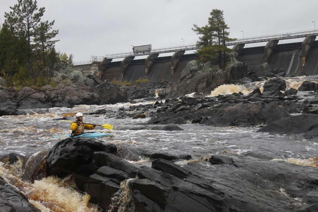
The going was still slow enough that I decided to start my voyage in an eddy beneath the dam, rather than taking on some of the bigger rapids up above. Besides being convenient, this move may well have prevented me from getting smashed against boulders.
Downstream, a dark canyon loomed, with an overpass and railroad trestle perched above the troubled water. I had some feeling of unease that wouldn’t settle down. These were small rapids here. I’d gone through tougher stuff before. What was the big deal?
Lazy foam matted the launch eddy, cut sheer as it met the river current. I paddled easily through this with the kayak pointed 45-degrees upstream and let the river swing me around toward the rapids below. I navigated some standing waves and a couple of small ledges where the boat nose plunged into the angry water, bobbed up again.
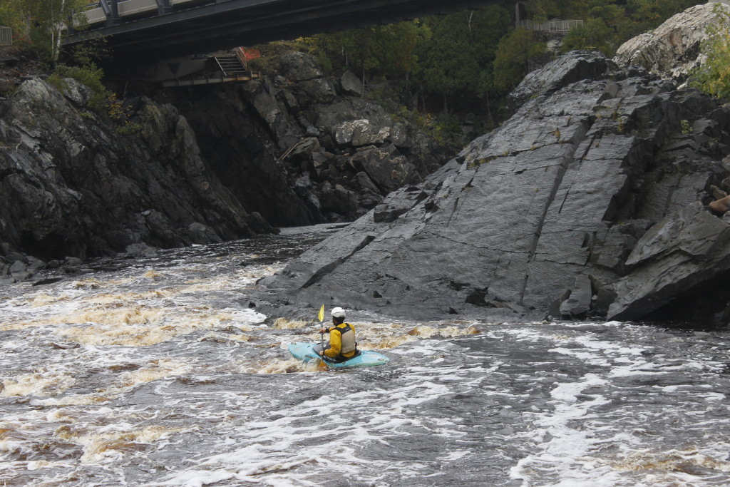
I went past the rock outcrop where LeAnn took pictures, then went through the boogie-water beneath the overpass.
Even though these were small rapids, the boat moved in unpredictable jolts. Some of this was no doubt influenced by the weird, angular geology below the current. My low confidence, no doubt, amplified the feeling of vulnerability. I deliberately hit the meat of a couple smaller rapids in order to tune up for the bigger stuff down river and to break my funk.
The canyon widened downstream, becoming skeletal landscape of slate outcrops. I felt that I was navigating something apocalyptic, the bones of the earth.
The rock formations consolidated into straight rows, like farmer’s furrows. When the rows were perpendicular to the river, they created still inlets of calm water, and sometimes dramatic drop-overs. When the rows ran parallel, they tended to split the water into narrows and create weird, sideways waterfalls.
Visitors to Jay Cooke State Park, get to see many different versions of this river, which exposes more geology when waters drop, and then takes new channels though the rock when the river rises anew. There were many empty channels along the river on the day I made my descent, indicating that the river was still low from the dry summer. The gauges readings posted on American Whitewater indicated about 1,800 cubic feet per second of flow.
Compare this to the massive floods that rocked the park in 2012. 55,000 cfs stampeding down the gorge slammed into the Swinging Bridge, destroying its span. Even now, sections of the park and of Highway 210 are off limits because of flood damage.
I found myself on stretches of calm that gave way to shelves where I would drop three and four feet at a time. I hit plenty of rocks concealed beneath murky water.
One particular drop gave off a steady thunder as I approached. I had neglected to scout this section, (and forgot to bring the notes I had scribbled down based on the description on American Whitewater.)
I had decent momentum going, and was loath to get out of the boat for scouting. Fortunately, my wiser self got the better of me. I steered into a convenient eddy between two rock ridges where I got out and hoisted my boat up.
I scrambled over the river rock formations to get in front of the rapid where I could look at it.
My first glance said, “No way.”
The water dropped into a narrow squeeze in the bedrock, where it raged in a frothy maelstrom of kinetic energy. The waves climbed higher downriver, indicating a powerful keeper hydraulic, maybe 8-feet of current flowed backward, toward the falls, meaning that after I flipped at the bottom, I’d probably get pulled back and sucked under, before popping up at the front of the hydraulic to start the cycle anew
This route was reassuringly fatal, in that I knew I could carry the kayak around it without feeling like a wuss.
But, then I had to go out further on the rock where I could see another channel. This one also looked freakin’ dangerous.
The moves started at the top of a divided falls. River left had a steep slope of high-speed water crashing down into a chasm, where it collided with a whitewater carnage train that fell down from river right and thundered out to where it exploded with the bedrock on its opposite side.
A paddler’s salvation depended on a very fast right turn, somehow maintaining stability while the water shoved against the cliff face and getting out of there. The likely flip foreshadowed a possible visit to the destructive keeper just above where the current met the wall. And I had no idea if I could swim out of that mess.
Then there were those Red Bull kayakers I’d been watching videos of. Those dudes in a broad brimmed hats and perma-dopey expressions who shucked for a robot piss corporation could do these moves. That wasn’t quite the reason, I decided to run the rapid. It also happened because I decided to get into my boat and decide how I felt about things.
I paddled out into the current, caught another eddy, looked at the pour over. Got out of the eddy, aimed my boat at the drop angling hard left. My hope was that the momentum would carry me through the carnage train and out of the rapid to safety. None of the planned route became visible until I started falling.
I don’t even know where I flipped, only that it happened very fast.
Next, I was getting thrashed around in high-velocity water, trying to do a roll, only one hard current or another to send me flailing. I feared that the current was carrying me toward the keeper zone so I bailed out. I popped up near a rock wall with no idea where I was in relation to anything else.
The water current was taking me downriver, and luck had kept me away from the keeper.
With upturned boat in one hand, and paddle in the other, I kicked toward an eddy between two slate ridges. Safety. My pounding heart felt like it would break my ribs and pop my skull. That would be the kicker, to swim out of the melee only to get zapped by a heart attack.
The eddy was filled with foam — fluffy, playful stuff that floated several inches above my head. I had to thrash my arm around to create breathing space. How heavenly and gentle the foam was, child of the hellish waters upstream. I was lucky to have ended up here.
I struggled with my water-filled boat to a ledge where I could flip it over and empty the contents.
If I hadn’t caught this eddy, I would have likely gone over the next rapid as a swimmer. I took a minute in my seat to get my breathing right and my head together, then pushed off.
When I made it through the drops and turns of the second rapid, the river mellowed to a slow boogie through the bone-fields, with small sunken rocks hiding beneath the murk.
LeAnn was waiting near the Swinging Bridge, and it had already me much longer to get there than I planned. I worried that she would be worried. It was already getting late and I decided that the bridge would be a great place to end the day. The rapids downstream from there had definite flip potential and I wasn’t feeling it.
There was one last rapid in the train, which featured a nice 14-ish foot drop into a pool.
I’d posted LeAnn near this edge to take photos.
I took my time setting up for the descent. There were some jagged rocks jutting out of the cliff where the water poured over. To avoid them, I aimed for a certain shrub on the opposite shore that I had scouted earlier, hoping that it was the correct trajectory.
Of course, I wouldn’t know if I got the approach right until I was falling.
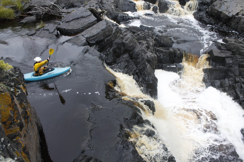
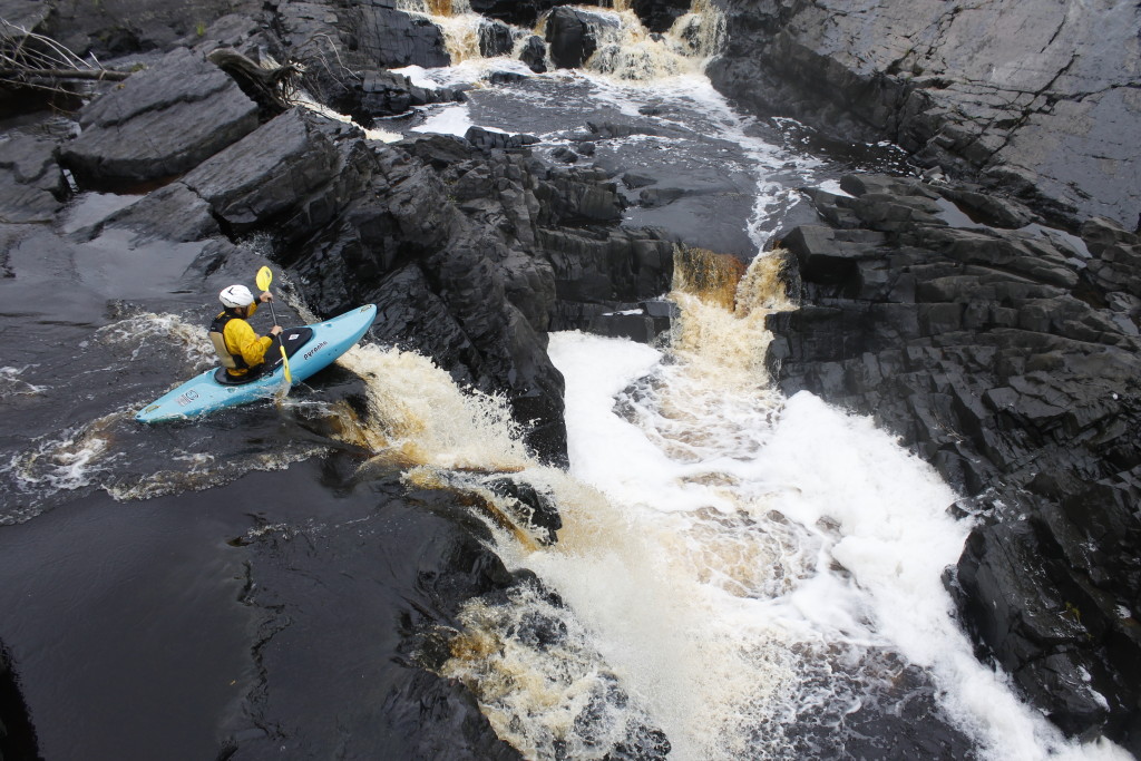
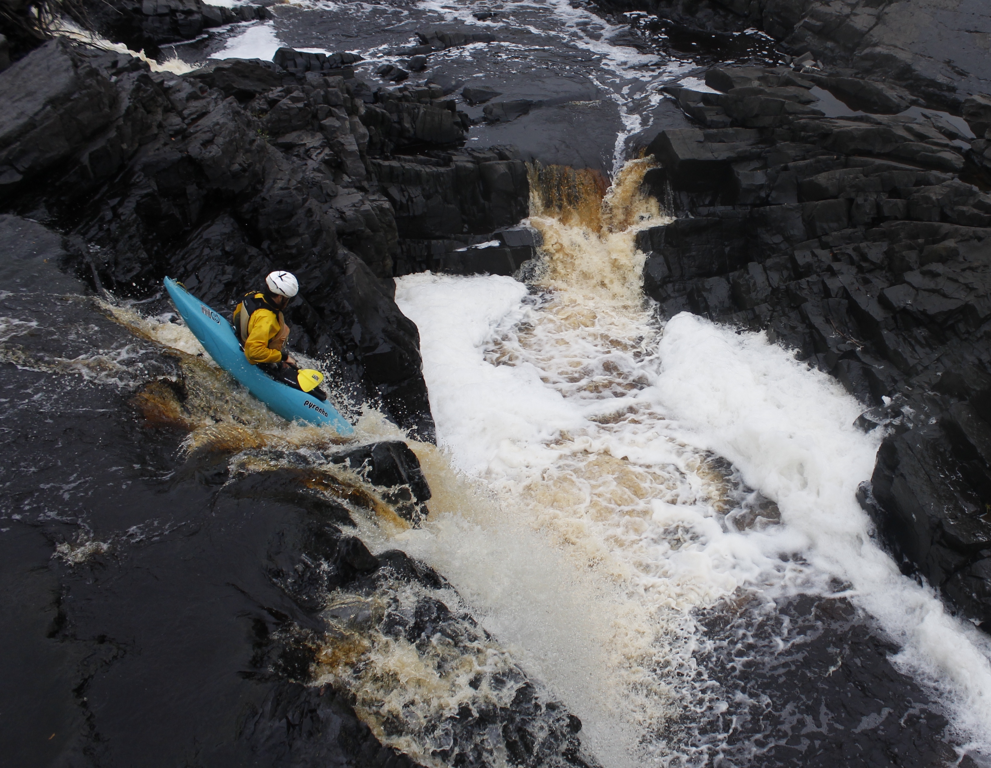
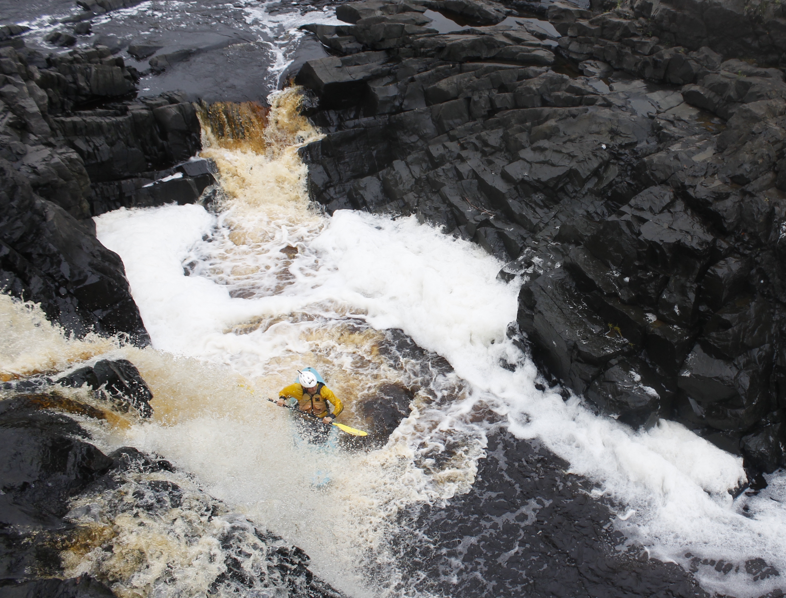
There was that roller coaster tug in my guts as the kayak’s nose sank. The brief moment of weightlessness followed by the smack of water against the bow, sinking in up to my chin, then a desperate paddle flail to keep the boat upright. It worked.
LeAnn cheered as I swung away from the small keeper created by falling water.
I pumped my fist.
There was a beach beneath Swinging Bridge where I could bail out.
I thought about keeping on the river, and seeing how I stacked up to some of the big rapids downstream.
My appetite for rapids was less than my appetite for dinner, however. I headed for the beach.
“Are you sure?” LeAnn called.
I wasn’t. But I committed to the decision.
Further Reading:
Info on park geology and history from the Minnesota Department of Natural Resources
http://www.dnr.state.mn.us/state_parks/jay_cooke/narrative.html
Info on rapid names and river levels from American Whitewater:
http://www.dnr.state.mn.us/state_parks/jay_cooke/narrative.html
Info on 2012 St. Louis River Flooding:
http://www.twincities.com/ci_20940630/duluth-flood-water-levels-dropping-along-st-louis
http://www.dnr.state.mn.us/state_parks/jay_cooke/narrative.html
http://www.dnr.state.mn.us/state_parks/jay_cooke/narrative.html
