The Doorstep Big Agnes Expedition

_MG_7966
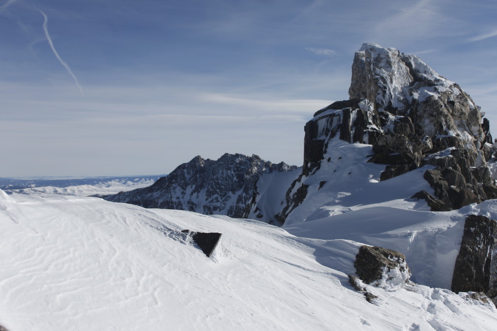
Summit ridge on Big Agnes, looking northeast toward Mt. Zirkel and Wyoming

What was amazing about my homemade pulk sled was that it worked.

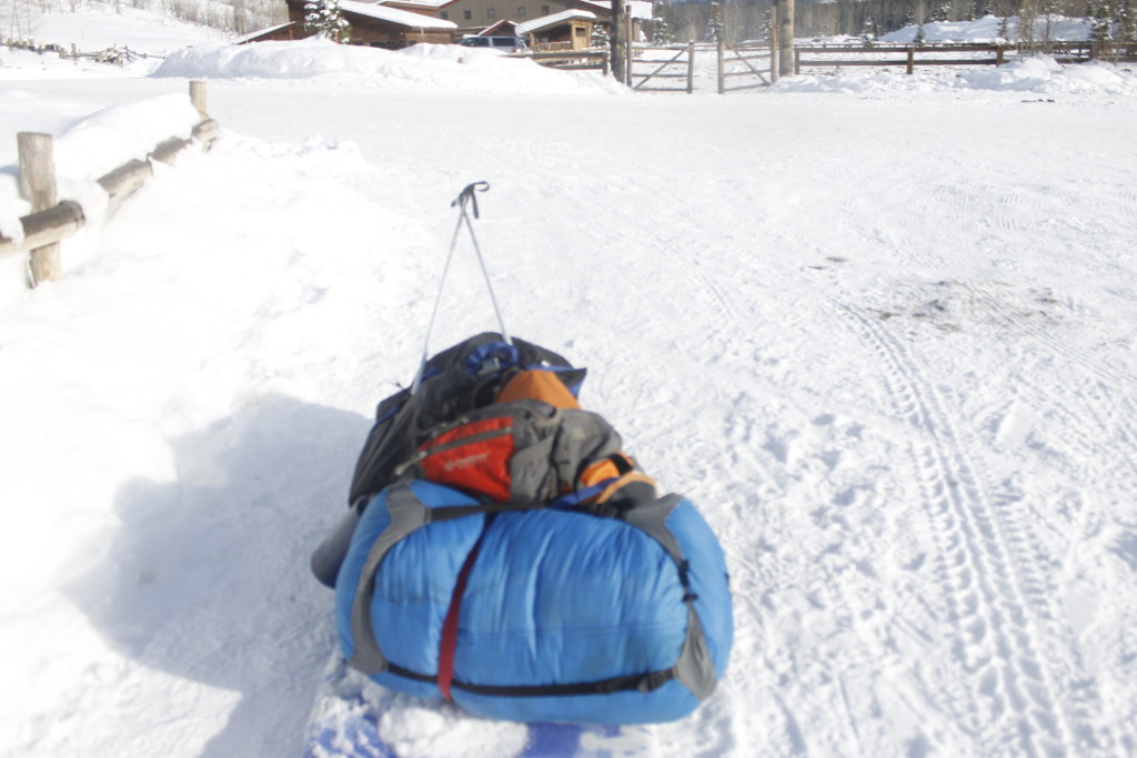
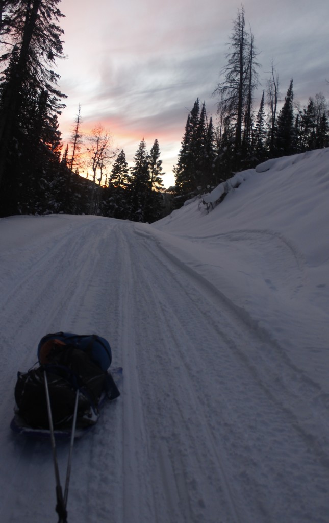
I’d dripped ski wax onto the bottom of the kid’s sled for maximize glide. From there, I loaded on jumbo snowshoes, a monster backpack, sleeping bag and separate dry bag full of food. I lashed ‘em all together with cam straps, affixed cam straps to ski poles, affixed other end of poles to a carabiner on a belt around my midsection.

When I moved on skis, the sled followed. Nothing fell off or skidded into the snow.

I skied east on the snowmobile trails toward Slavonia, a trailhead in the Zirkel Wilderness, which was on the way toward Big Agnes. This 12,000-foot mountain had become an obsession of mine for a couple of weeks. There were the usual symptoms: staring at the topo map, figuring routes, squinting at the distant mountain from the groomed ski trails.

Now, I was skipping out on a fun three day weekend with coworkers so I could be on this snowmobile trail in the fading light and dropping temperatures.
_MG_7838
Homemade pulk sled, at the start of the adventure

It was a six mile ski to Slavonia, started at 3 p.m

Occasionally, I moved myself and the whole rig out of the trail to make way for the snowmobiles, so I could breathe their exhaust fumes for the next couple minutes. The demented yowling of their engines bounced off distant ridges. To be fair, this trail wouldn’t have been here if not for the snowmobiles, but I was proud that I was planning this trip motorless from doorstep to mountaintop.

The pulk skittered over the broken snow crust behind me. Going uphill with this thing definitely upped my calorie consumption; going downhill with it boosted my adrenaline. I poled frantically to keep the fast-descending object from swinging in front of me and knocking me off balance.
_MG_7849
On the road to Slavonia

The fact that I’d attached the sled to me with stiff ski-poles instead of rope meant that at least I didn’t have to worry about it taking me out at the legs.

Fears about whether I could really make the homemade pulk work had been among my doubts about whether I could pull off this motorless expedition. I was thrilled to see that I could move everything smoothly enough

Tomorrow, I’d get to have all the weight on my back, and hopefully be able to haul it all uphill through deep powder to Mica Lake. The third day, I planned to go on with only bare essentials in my backpack. If I could steer clear of avalanche zones and fatal rock precipices, I could reward all these efforts with a smiling moment on a mountaintop.

It was dark by the time I pulled into Slavonia. The small wooden structure at the edge of the parking lot looked far more inviting than the tent I had yet to pitch.

Yes, that small building happened to be the trailhead bathroom, but so what? The shit was frozen anyway.

I wasn’t out to get the glamorous camping award, and if this saved time from taking the tent down in the morning, I was all for it.

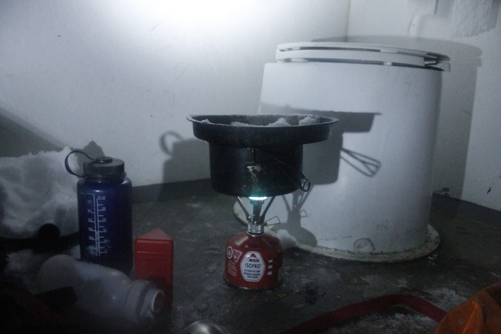
Another perk: I could set my stove up inside to cook dinner. I locked the door to offset the slim possibility of someone making a late-night visit to the facility. I later noticed a sign forbidding camping in the area. Well, lest I paint myself as a scofflaw, let’s just say that I was taking a very long dump, a dump that happened to last until the morning.

When people wake up on a bathroom floor, it is usually the product of hazy decision-making half-remembered, if at all. In this case the bathroom floor was a key part of my plan to make up the most distance possible the following morning.
_MG_7858
Dinner at the best seat in the house

The morning still sucked, as mornings winter camping will suck.

Sure there’s the beauty of the silent world, the promise of the untrammeled snow. Also there’s the numb fingers, numb feet, the intrusion of dampness where you don’t want it, the burden of leaving the marginal comfort of the sleeping bag for the thousand little camp tasks and packing.

There were no tracks on the trail, leaving me to break the powder. I’d left the sled behind — it’d have been useless in this stuff.

Leaving the skis behind had been the difficult decision. Even if I’d put climbing skins on the bottoms, I knew that I wouldn’t be able to make the same time that I would make in snowshoes. Strapping them to the pack would have added bulk to an already mighty load, and probably would have gotten tangled in trees on the climb up. It would have been hard to get a slick ride down with all the weight on my back anyhow.

My goal was the mountaintop, not a flashy descent. With skiing out of the picture, I could focus on tasks like route finding.

Locating the trail under the feet of snow in a willow drainage was no easy task. I meandered through the aspens in the valley, staying on an eastward course. I used my topo map to find the drainage between two mountain ridges that was my golden ladder to Mica Lake.
_MG_7881
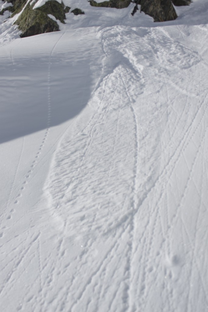
Snow slough with debris tracks in Mica Creek Basin

Finding the route and climbing it are not one and the same however.

My snowshoes, which are great for floating on loose powder, are less awesome on steep pitches. I found myself doing elaborate traverses, pulling myself up on tree trunks. This was a dangerous game because said trees were loaded with beachball-sized snow bombs, quick to drop when shaken. Sometimes the trees would drop their payloads for no good reason and white powder would explode over my head and shoulders.

The other kind of falling snow that I worried about was avalanches. Sources had told me that the east side of the valley was dangerous (windblown snow would accumulate on the west faces with the prevailing wind) so I tried my damnedest to stay on the opposite side of the drainage.

The task was not so easy because of Mica Creek, which sometimes cut up to 30 feet down into the bedrock. The topography in the basin forced me to cross the creek several times — walking oh-so-delicately over the snow bridges.

The water might have only been a couple feet deep, but if I soaked a boot, I would most likely have to turn the trip around.

There was also no easy way to get down to the water without falling into it. I refilled my water supplies by dangling a bottle off a cord from one of the snow bridges.

A narrows lay ahead, which included a steep climb between two steep snow-covered walls.

Here, the safe west wall had the most evidence of falling snow. However, the drop wasn’t so long and I didn’t worry about a light snow sloughing going over my boots. Nothing that I could see had fallen off the other side of the canyon, but if something did fall, it could have made for a minor avalanche. I stayed west.

At the top of the narrows, the drainage opened up into a valley. It was maybe half a mile wide, flanked by razor-like mountain tops.
_MG_7896
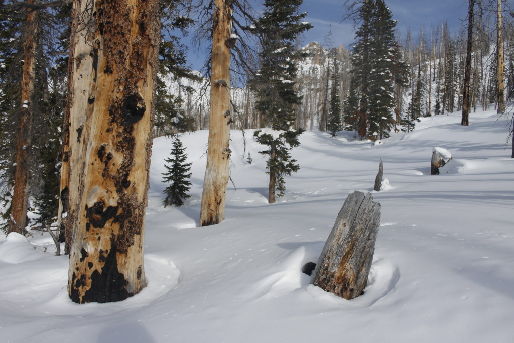
Burned trees near Mica Lake

The drainage forked and I chose to go right, climbing up a steep ridge between Big and Middle Agnes. Few trees grew on the high snow fields. Eventually there were none, just blank white snow and jagged rock. I scanned for a route that would keep me out of avalanche danger, but also keep me away from impossible rock spines and other hazards.

Two ominous tracks of busted snow streaked several hundred yards down the south face of Middle Agnes. Avalanches had fallen here.

The more I climbed, the more I expected to run into Mica Lake. Eventually, I realized that I had gone way too far to the east, and turned back downhill.

Water, food and warmth were the three priorities on my mind as I came into camp.

Light was already fading by the time I reached the lakes’s edge, meaning I had to hustle to do my chores.

I used my ice axe to bash a hole in the lake ice and get water (difficult because there was only a couple inch margin between the ice and the lake bottom). I climbed a slight hillock nearby where I dug a large pit in the snow where I pitched tent. I got another pit started for my fire.

The axe came out again for fuel gathering. I swung away at the spruce branches nearby by the light of my headlamp.

I took one mighty swing at a branch only to have the axe fly out of my hand. I heard the familiar, musical dong! as the axe bounced into something nearby. But where the hell did it land? I swept the snow and the tree branches nearby and found nothing. I tried recreating the trajectory of the lost axe by throwing sticks and seeing where they landed. Eventually, I dug around through the powder with a stick and still came up empty. I called off the search after a half hour and got to fire-making.

Say what you will about the romance of woodsmoke rising up in cold winter air, I’d have probably just used my cookstove if I’d known what a royal pain the campfire was going to give me.

I had some Vaseline-soaked cotton balls with me, excellent fire-starters, but my supply was low, and I decided to save them for an emergency.

Another challenge was that the lodgepole pine didn’t grow up here. This meant that I no longer had the ubiquitous, highly flammable, red needles that I’d used to start fires easily at lower elevations.

I tried lighting notebook paper and drier lint that I’d brought with me. The licks of flame rose like a promise — and sputtered out as I hacked smoke. Finally, I broke off a piece of candle and added it to the lint. When the lint ignited, the burning wax kept the whole shebang going long enough for me to ignite some dead spruce twigs.

Cooking on the wood fire was like getting teargassed. Every time I reached in to shift the pot over the flames, I got a throat-wracking, eye-burning draught of smoke. By the time I’d softened the lentils enough to be palatable, I had a dull headache and a sore throat.

I ate as quickly as possible, as the fire wound down. I put another pot of water on to pour into my metal bottle to heat the foot of my sleeping bag.

I had put spruce boughs under the tent for extra insulation against the cold. I propped my backpack under my sleep pad, and put the sleep bag into an emergency bivvy. I felt confident that I would be warm enough this evening. What I was having a hard time imagining was getting up at 4 a.m. to fetch water and prepare my gear with numb fingers and toes. I knew it would be best to get up early if I wanted to do anything before the snow softened, became harder to walk on, and more likely to avalanche
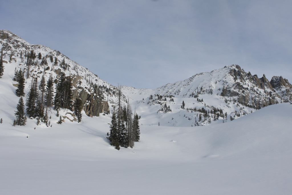
_MG_7900
My route, as seen in daylight, went behind the trees, into the valley and to the left behind the rocky ridge line to a snowfield that went to the summit ridge..

I dreamed that I woke up in a blizzard, with snowmobiles wheeling around camp. I hated that the whining machines had made it to the lake I had worked so hard to get to on my own, but the falling snow meant that I probably wasn’t going to try the mountain. This thought felt like a relief.

I woke up at 3:49 a.m. thoroughly confused, unzipped my tent to look up into a clear, cold sky. Stars glittered like ice shards on black water. A crescent moon cast its pale light upon the snow world.

Body and mind might not have been motivated, but my bladder had a strong motivation of its own. Once it had motivated me out of my sleeping bag, the hardest part was over.

I decided to pretend that I really was stoked that I was getting up this early. The fake motivation helped me to wrangle gear together, strap snowshoes on my boots and trudge down to the ice hole on the lake to fill water bottles.

Fortunately, I’d put snow back on top of the hole after I’d filled up the last time. This insulation had prevented the ice from completely reforming. I was able to bash the hole back open with the tip of my ski pole and a liberal dose of profanity.  The water was slushed with ice shards. It would refreeze quickly in the cold air. I put one bottle in my pocket and stuffed the other two into my jacket. In this way, I kept my water supply close to my body heat.

Unmotivated to start any fires, I opted to skip the hot breakfast  for a Clif Bar.

As soon as all the camp duties were over, it was almost 6 a.m.

I retraced my snowshoe tracks to the basin above the lake and then chose a route going up a valley on the south side of the mountain.

The world was painted in deep dark blues and the pale hues from the moonlight. In a world that seemed half-real, the cold felt real enough. I had the iciness of the water bottles near my skin, frigid air moving through my nostrils. Movement was the way to stay warm now that I was out of the sleeping bag. As I toed up the first snowfield, the sense of purpose that I had been faking earlier began to gel into the genuine object. Movement was what fought back against the vulnerable feeling walking alone in cold darkness.

I knew my confidence would grow when the sun came out, and that I would be glad that I decided to begin this early hike when I had the chance. I knew that I had already invested a lot in this hike, and that if I backed down, it would be hard to rally the courage or the fortitude needed for future adventures, and that I would be giving up on some of the qualities that I value most in myself.
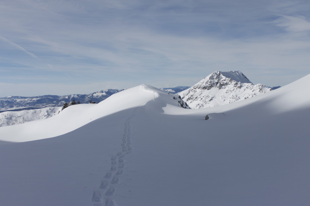
_MG_7976
My path up along a snowy ridge as seen on the return trip. Little Agnes is in the background.

One shooting star raced across the sky. Another flicked by a couple minutes later. Then there was another, and another.

A set of lights from the distant town of Clark twinkled far below. I raised the climbing bars on my snowshoes for extra support as the route steepened.

Paranoia about avalanches kept bubbling into my consciousness.

I kept inside the trees as much as possible — there was less likely to be snowfall there. I inspected the tree trunks for broken branches or snow accumulated on the uphill side.

I topped out on a sinuous ridge of snow, walked the edge down into a treeless basin. A dim green glow gathered above the ridge-line to the east.

Avalanche-wise, two factors were in my favor: there had been no new snowfalls in the past couple weeks, which meant that the snow that was on the slopes had had time to stabilize. Also, it was still very early in the morning, which meant that the snow was far more stable than it would be in the afternoon.

Looking up at the face I planned to climb, I could see no avalanche tracks. Still, I planned to weave around as I climbed to avoid the steepest pitches and to move in the shelter of some boulder-fields. If things began to look truly sketchy, I’d turn around, I promised myself.

Climbing the steeper pitch in my over-sized snowshoes did turn out to be a challenge. I found myself sliding back at least half as much as I could step forward.

Finally, I swapped out the snowshoes for crampons. The crampons gripped exquisitely, but didn’t do jack to keep me from falling through knee-deep snow.

I leaned forward into the slope so I could put more weight on the ski-poles — even flopping them flat onto the snow in front of me like some bizarre climbing flipper. I approached the top in this awkward crawl, suitable behavior for a supplicant. Now and then I looked out or down. A radiance swelled above the eastern ridge. The sky went from dark to gray. I watched as first sunlight burned on the high peaks, marching like fire down the slopes to ignite the darkened world below.

The pitch got steeper and steeper. My heart beat like crazy as I fumbled along. I got to a second set of boulders and jabbed the crampon points into the rocks to haul myself up. The thought of avalanches reverberated through my brain. Was this snow too steep? Should I head back. The snow was getting crustier here. I watched tiny snow chunks dance out from beneath my crampons and roll, roll, roll, roll, down the hill, leaving particle accelerator tracks in their wake. One chunk of crust wheeled down the mountain like a runaway buzzsaw
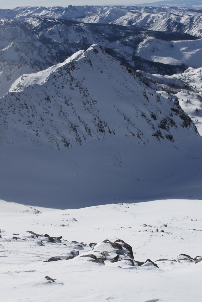
_MG_7970
View down the snowfield I climbed. My tracks are between the clumps of stones on the bottom right.

.

When I tried to kick out some larger slabs, however, they only went for a couple feet before they stopped. The slope seemed too gradual and the snow too cold to really rumble. I still felt unease in the pit of my gut. My awareness also went to my right foot, which had gone numb with cold despite the climbing workout.

For the last forty minutes, I’d had my eyes set on a leaning boulder, that was higher than anything I could see on the mountain. It had seemed like only a quick jaunt to get there, but my approach was painfully slow. I struggled to lift the crampons above the crust so I could fall back into it. I worked my fingers into tiny holds in the rocks in order to flop myself over. I stumbled, drunken to that ridge, looked out and gasped.

I’d gone from looking ahead inches past my nose, to looking out over unfathomable miles. Boulder projections stabbed the sky off knife edge ridges. They glinted in the orange illumination. The Zirkel range rose up in a defiant bulwark on the other east of the valley. Further south, mountains followed mountains like shark teeth. There was a gap at North Park, on the other side of the Continental Divide, and then the mountains rose again. Miles of empty table land lay to the north in Wyoming.
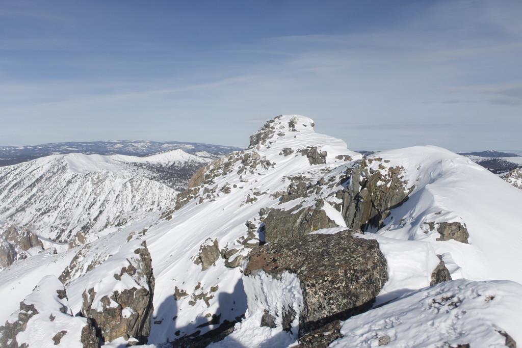
_MG_7956
View of peaks along summit ridge looking northwest

I instinctively recoiled from the edge. Indeed, I could see places where cornices of overhanging snow dangled over the the cliffs like trapdoors to the abyss. I could also see, unhappily, that there were two other peaks on the ridgeline before I truly reached the top, and these peaks were separated by a narrow, dangerous-looking ridge with a thousand-foot drop on either side.

“Well screw that,” I thought.

I turned around and began tramping down the crusted snow.

At one point, I heard a rumble overhead and my heart lurched.

I whirled around to realize that it was only an airplane.

Another glance at the snow face, made me reconsider the avalanche danger. I took a slope measurement using a trekking pole and a compass as a protractor. I estimated that the slope was only about 30 degrees, if that, which was about the least steep angle that an avalanche would happen.*

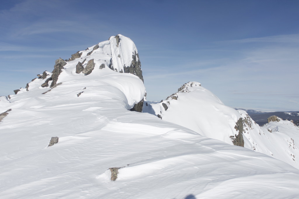
I also saw that there was a way to cut to the west side of the summit ridge, which might take me to the highest peak while avoiding a walk on the knife edge.
_MG_7955
Two more peaks on Big Agnes

I had already committed 20 minutes to walking down the ridge and it would take a lot longer than that to get high again. After standing in place for a minute, I started trudging back up the way I’d come. It was far easier going up the already broken snow. Finally, at a boulder-field just above the summit, I made a dogleg to the west. Again, I stuck crampon points against hard stone. I maneuvered around the first peak and over to the second. I topped out with another view into the vast gulf stretched out to the north of the peak. The third and final peak was maybe two football fields away.

But the knife edge was even sharper between these two peaks, and if that wasn’t sketchy enough there was a tall vertical rock outcrop standing right in the middle. Climbing over wasn’t even a possibility.

If I wanted to get beneath the outcrop, I would have to crawl out onto one of the absurdly tilted snowfields on either side. If my crampons could grip into the champagne powder snow and my hands could grasp some tiny chink in the slippery rock, I could see a minute chance that I could crawl out to this final peak. But when I tried to visualize this possibility, what I saw was a tumbling, thousand-foot death ride that got faster and faster until that sudden stop at the end.

I realized that I had to turn around again, just a couple snowball throws away from the summit. Knowing that I had exhausted all my options, made it easier to turn around without pesky second guesses to haunt my descent.

It is likely that if I had gone the standard summer route, approaching the peak from the east side, that I might have found a way to this final peak. Then again, going this far to the east would have added many miles of unbroken powder to my trip, and for all I knew, there may have been avalanche risk that would have fudged my chances there.

Half an hour into my descent, I was close to the shadow of the ridge line, where the sun still hadn’t risen. I crouched in the shelter of a boulder so I could swap out my crampons back into snowshoes where there was solar warmth. This was where I discovered that the water bottle in my right pocket was empty. Where had the water gone? Mostly into my right boot. No wonder why that foot had been so cold.
_MG_7974
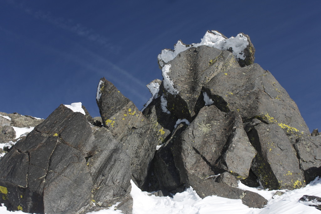
Rock, ice and lichen near the top of Big Agnes

It was my fault. When I’d filled the bottle in the slushy water, there had been ice crust on the screw threads and I had failed to twist the cap all the way shut.

I squeezed out of the sock and set it in the sun, warming the foot as best as I could with my hands.

It took another hour and a half or so to get back to camp.

I’d knocked out the fulfillment part for this trip’s hierarchy of needs (OK, almost fulfilled them. I didn’t quite reach the summit did I?) now it was back to basics: water, warmth and food.

It was a beautiful sunny day on  the snow and I felt no need to hurry back down to Slavonia for another night in the bathroom. It was nice to take care of camp chores at a leisurely pace.

I walked out on the lake ice to where I found a mushy patch near where a stream came in. I was able to use my snow shovel to dig out a generous hole to fill my bottles. I took the rainfly off my tent so that the sun could burn away the humidity, and threw my damp sleeping bag over a spruce sapling.

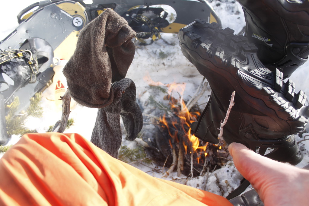
I had snagged some dead red needles on the way back to camp, which I used to set a new fire on my cook-pot lid. My boots hung out on sticks jabbed into the snow, so that the most amount of warmth could get into the toes. After a while, I started some pasta mixed with coconut butter. I was out of patience for the slow-cooking lentils. I watched the steam rise from my boots and socks. I put my metal water bottle near the fire so I would have something hot to put in the toe of my sleeping bag.

It would be a good night’s sleep.
_MG_7993
Taking care of the basics at camp


* https://utahavalanchecenter.org/blog-steepness. Here is one source, amongst others that explains the relationship between slope angle and avalanche risk. Though this blog describes me doing my best to use what I’ve read and picked up from others to stay out of avalanche danger, I haven’t taken any classes, and don’t want to give the impression that I am an expert on the subject.
 

Lessons in Snow Travel for Moose and Humans

_MG_7785

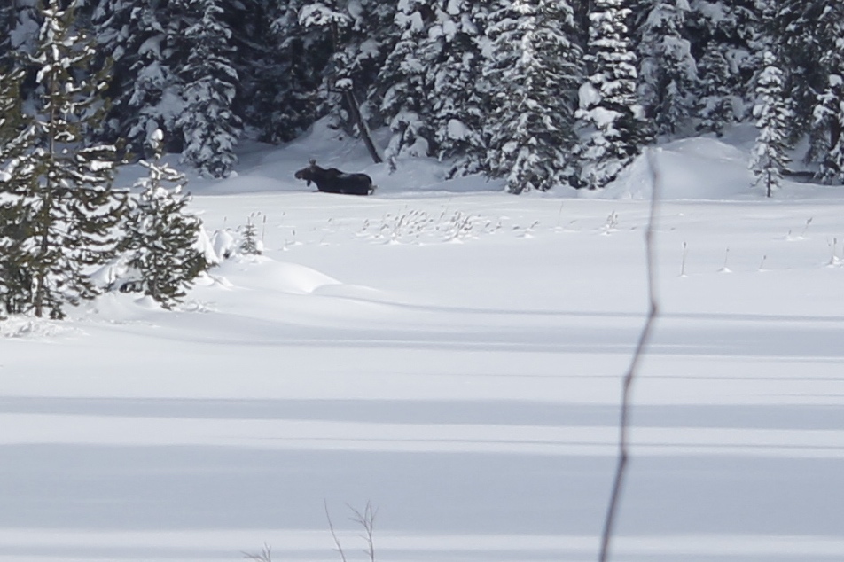
The moose moved through the deep powder in an awkward, bucking lurch.

There was nothing elegant in its stride, but it was movement, and that was what counted out here.

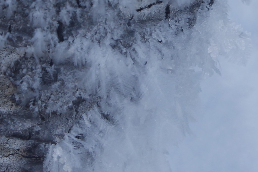
Stillness seemed to be the rule in this Rocky Mountain valley — its contoured architecture of snowdrifts, the pendulous gobs of powder hanging like oversized Christmas ornaments off the branches of the pines, frost feathers creeping out of aspen bark in minute increments, the stolid cliff walls rising above it all, going up to where the distant white monuments of Big Agnes and Mt. Zirkel shone indifferent to the blue sky.

Even though it was hardly a speck in my field of vision, the thrashing moose was a distinctive element against the otherwise quiet tableaux. No, the moose was not charging at me; It was merely crossing from one side of a frozen lake to another. I have no way of knowing if it was aware of my presence, though when I consider that I have seen moose stare at me with blank indifference, I doubt that my arrival was scary enough to spook one this time. Some other business…

The animal’s long, spindly legs were meant for exactly the kind of deep snow that lay in the valley. The long legs allowed its hooves to sink down to solid purchase while keeping the bulk of its frame above the surface. Even with this engineering, it still rocked up and down like a boat in rough water. No doubt, the moose was burning many of its hard-earned winter calories to get anywhere.

The skis on my feet were another way to get around in the snow, one with respective advantages and disadvantages.

I had spent the last couple hours figuring them out as I made my way up a drainage coming off the Elk River.

My backcountry Nordic skis were chattery on the packed trail, and badly wanted to backslide. When I cruised out into the powder, however, the ride smoothed. It was a slow, steady progress through the  foot or so of snow that lay above a stiff, crusty layer. Fallen trees that would have been no big deal on a summer hike became strategy problems that required me to take awkward, potentially compromising steps around sharp branches.

There was no elegant stride and glide here. I moved nothing like the way a track skier would tackle a groomed trail, more like a snow-shoer, taking big waffle-stomping steps. I got a little extra glide here and there when I got lucky.

I found a patch of sunlight in a clearing where I ate lunch, shed a jacket and attached climbing skins to the kick zones at the bottom of my skis.

The friction of these synthetic fibers gave my skis a better brake against gravity, allowing them to kick downward to glide upward. The skins not only helped with the inclines but added much needed purchase when I needed to get over dropped trees. The trade-off was that I had even less forward glide than before.

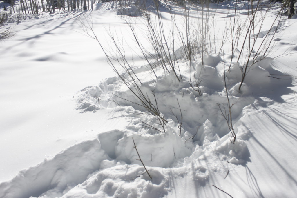
A band of willow shrubs marked the buried watercourse I was following. Here and there the moose and elk had gnawed at the young tips. I slid over their icy footprints as I climbed.

_MG_7762
Elk or moose tracks wind through some willow shrubs in a drainage area

Hunters, sliding on skis with animal skins attached to the bottoms, have pursued big game this way for millennia, traditions that live on in places like northwest China. Mark Jenkins accompanied one group that still uses skis to pursue elk, and wrote about his experience in a fascinating article for National Geographic: http://ngm.nationalgeographic.com/2013/12/first-skiers/jenkins-text.

Because the skis gave the hunters the ability to float above the snow, they were able to chase an animal down to exhaustion, then attack at close quarters.

A 21st century vegan like me is unlikely to use such techniques anytime soon. I nonetheless respect the consideration and engineering that the ancient skiers used to conceive a tool that would enable them to master an environment that human bodies weren’t designed for. When human ingenuity took a seat in the designer’s chair, it came up with a myriad of different models, ways to make awkward bipeds as at home in the snow as an elk or snowshoe hare.

It may seem basic to modern skiers that their equipment consists of should use two skis of equal length, along with two poles, but there are old models where travelers used a long glide ski and a shorter kick ski covered with rough animal hide that enabled the skier to move around like a kid on a scooter. The hunters Jenkins travelled with used only one long wooden pole instead of two, and — going against everything I teach beginning skiers — they leaned backwards with it going downslope.

What matters most about technique is whether it works, and in the hunters’ case it did, refined through centuries of observation, practice and thought. Jenkins, an accomplished adventurer with a modern set of Telemark skis, had trouble keeping up.


As I went up the willow drainage, I wanted to approach my adventure with the hunters’ mindfulness of the environment, if not the horsehair skis and single wooden pole.

The snowy landscape forced me to consider questions: How I could get up a steep wooded slope without pointing the skis past the threshold where they would slide backward? Was it was worth the improved speed if I took the skins off in order to glide over a half-mile of flatlands before I came to the next incline? Would the skis catch slush beneath the snow if I travelled out onto the frozen lake? Would there be a slippery ice crust waiting on a south-facing slope?

_MG_7781
Frost feathers grow out of the north side of an aspen tree

The mental acrobatics would have been even more rigorous if I’d gone out on waxable skis*, which require the skiers to match the wax they use with the properties of the snow crystals so that they can get the best grip and glide.

All of these considerations are part of reading the language of snow. Reading snow means being able to travel over where the moose plunges through. It makes it possible to get far into the backcountry and come back safely and knowing when to expect ice on the slopes or where an avalanche is brewing.

Learning this language may not have seemed important to me when I needed to scrape said snow off the windshield of my car and rely on the internal combustion engine for transportation. Indeed, the language may not seem so important to anyone when once reliable snow recedes (like the moose) from places like New England, Minnesota and all but the highest mountains and the northernmost reaches of the continent. Knowing kick waxes is already about as relevant to most people as knowing how to chase an elk down in the powder.

_MG_7798
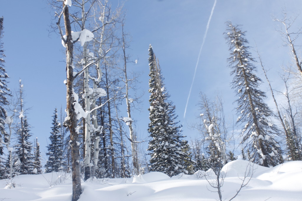
Contrail cuts across the sky. Who needs to know how to ride over snow when you can ride on air?

Given all the time and effort that human beings have put into perfecting skiing, it seems especially tragic to think that technology and climate change may someday render such knowledge irrelevant.

After the moose pond, I came to a steep ridge, impossible to ascend even in my climbing skins. Maybe, I could have pulled it off in snowshoes, the kind native tribes used for travel in North America. When I took my skis off, I found that I couldn’t climb the mountain; for each step I took up, I sank down exactly the same distance. It was time to get down from the hills.

I skied back inside my tracks. Only at the steepest sections did I veer into the unbroken powder to break speed. A couple days later, some friends were able to use the tracks I’d left on their own adventure. I hope we keep the trail broken all winter.

  •     The term “waxless skis,” in reference to the type of skis I was using, is a bit of a misnomer. Skiers in waxless skis still put glide wax at that tips and tails of these skis to boost speed. What makes these skis different from traditional waxable ones is that the waxless skis have scales or other groove patterns in the kick zone, an area beneath and in front of the ski boot. When the skier kicks down and back, the grooves stick in the snow and provide the friction needed to push off and move forward. Waxable skis also use glide wax at the tips and tails, but the kick zone is smooth and there is a stickier kick wax that goes there, also designed to stick into the snow.
    One advantage of waxable skis is that you can tweak the grip of the kick zone depending on how spiky or round the snow crystals are. A hard kick wax will work well on a cold day when the snow crystals have sharp points to drive into it. A softer wax becomes necessary not to slide backward as the temperature warms or the snow gets worn down — leading to rounder crystals that don’t like to stick into wax.
    If this sounds easy to screw up, it is. But, it appeals to the wonk in people the way many still enjoy the control that manual transmissions have over automatics (with an equivalent risk of stalling and grinding gears.) I had a bunch of “fun” playing around with my new pair of waxable skis in Minnesota last winter. I learned the importance of bringing extra kick wax on trips after I stripped out the bottoms of my skis five miles out from home and had to learn how to skate ski in order to get back.

    _MG_7814
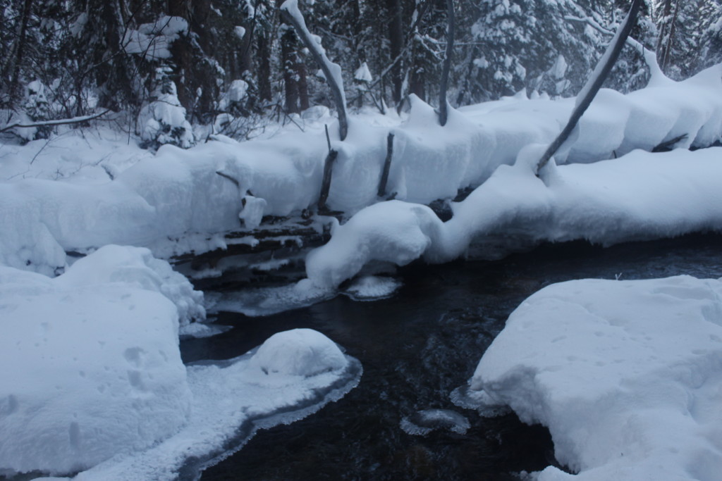
    Snow along the south fork of the Elk River exhibits some of the funky contortions and graceful shapes within the winter landscape.

The Moon and The Badlands


_MG_7519


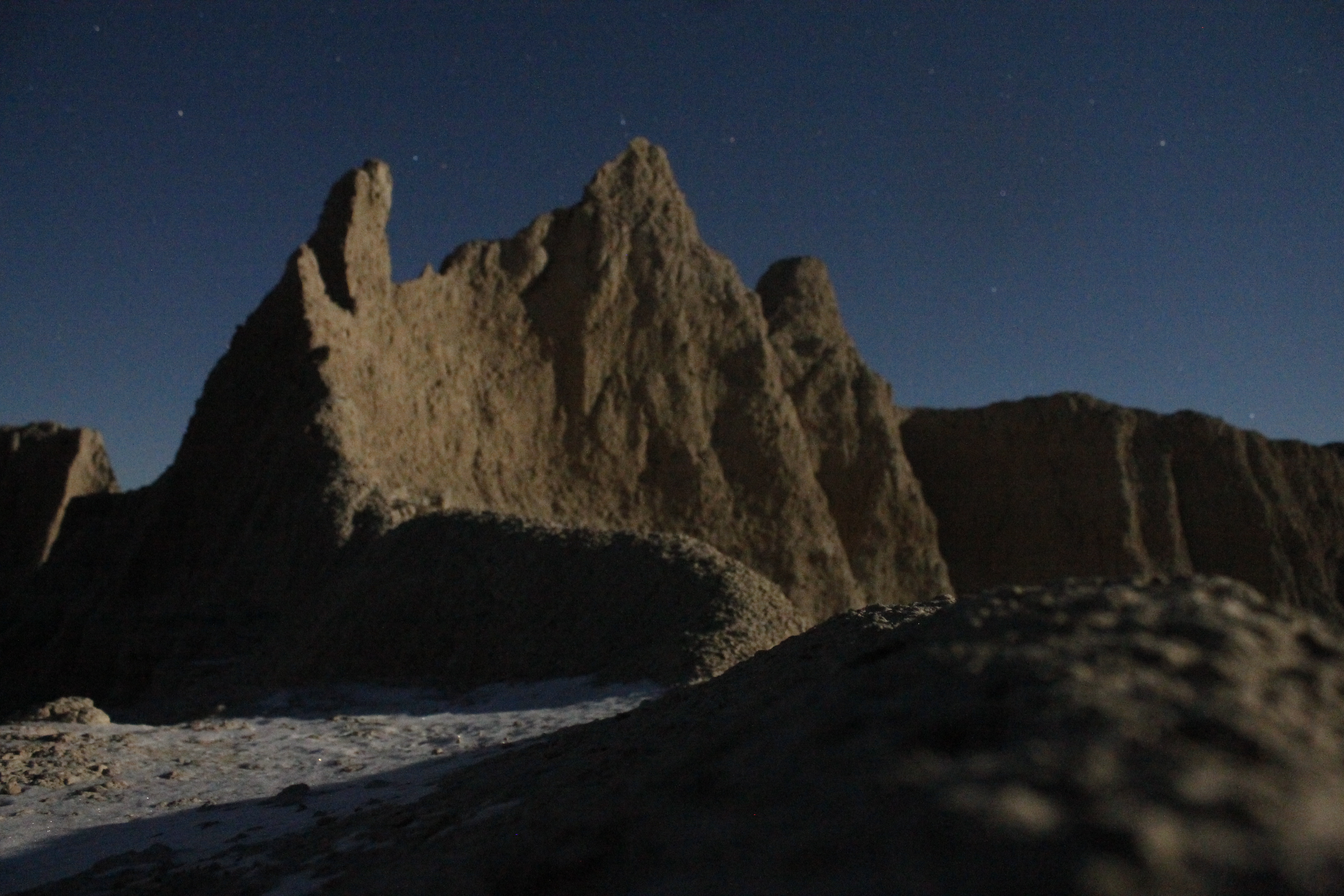
Beneath the cold moon, the silent architecture of buttes and canyon washes within South Dakota’s Badlands created a compelling landscape. The white light only emphasized the coldness of the frosty ground along with the snow that had blown in from the plains.

A yipping coyote chorus rose up from somewhere out in the sagebrush plains. Numbness set into my fingers and toes soon after I left the car.

_MG_7535


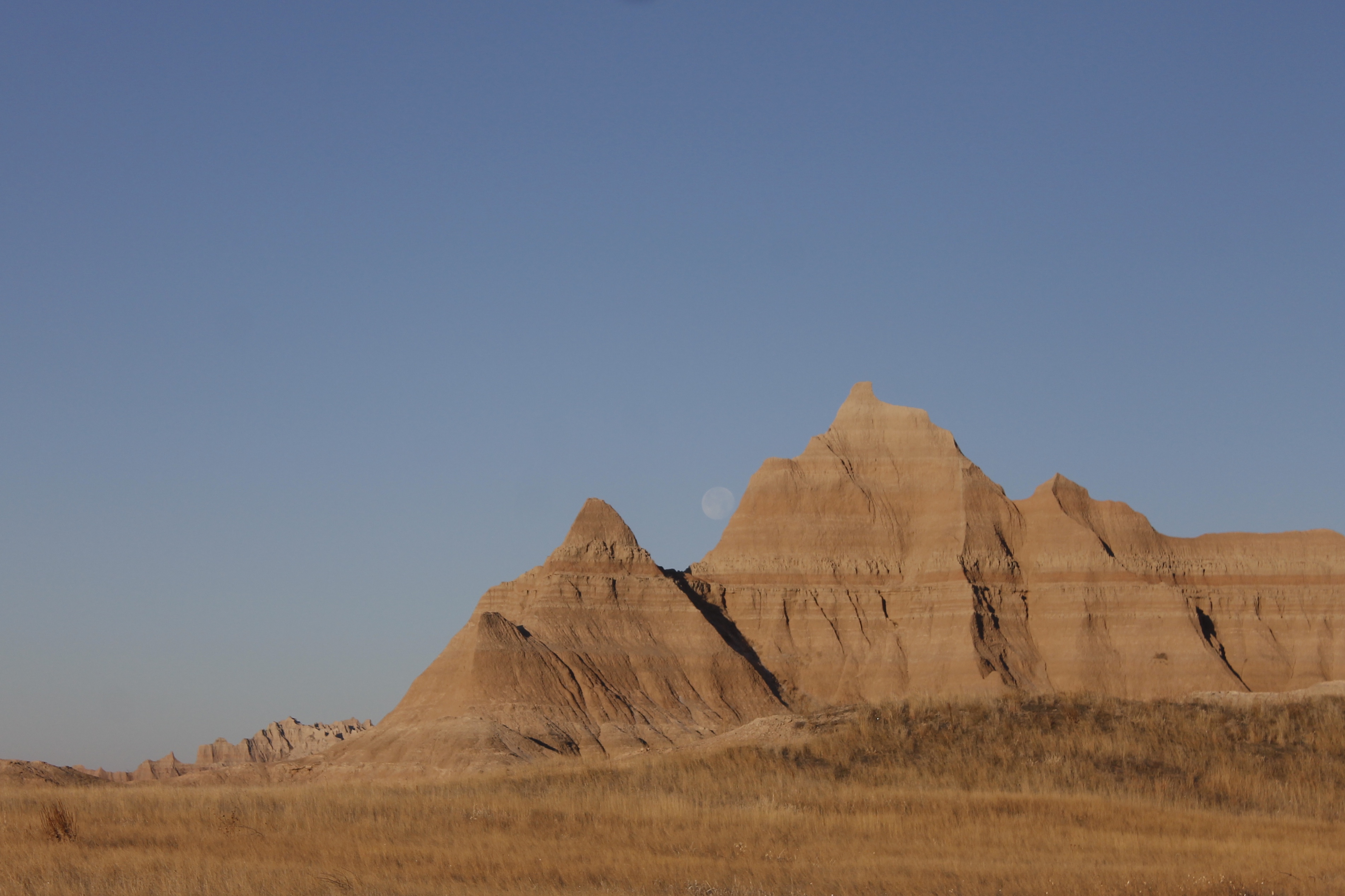
I pitched tent at the same campground I had visited four years ago when I moved out to Wyoming. I slept through another freezing night, woke up in the morning, to run out furiously along the road in my parka and wind-shell, summoning all the heat I could. The moon was still in the sky but not for long. I photographed it in front of one of the buttes, imagined it was rolling down the hill.


_MG_7554

There was one other tent at the campground. When I finished running, I went over and introduced myself to a guy named Shaun, who was traveling from Idaho to Iowa where he was due at a Christening ceremony.

We got to talking, and it turned out that we had a few things in common, namely that we’d both explored mountains and canyons throughout the west.

Shaun was getting ready to set out on some of the Park Service trails. I said I was planning on exploring the canyon washes off trail and he was welcome to join.


_MG_7567

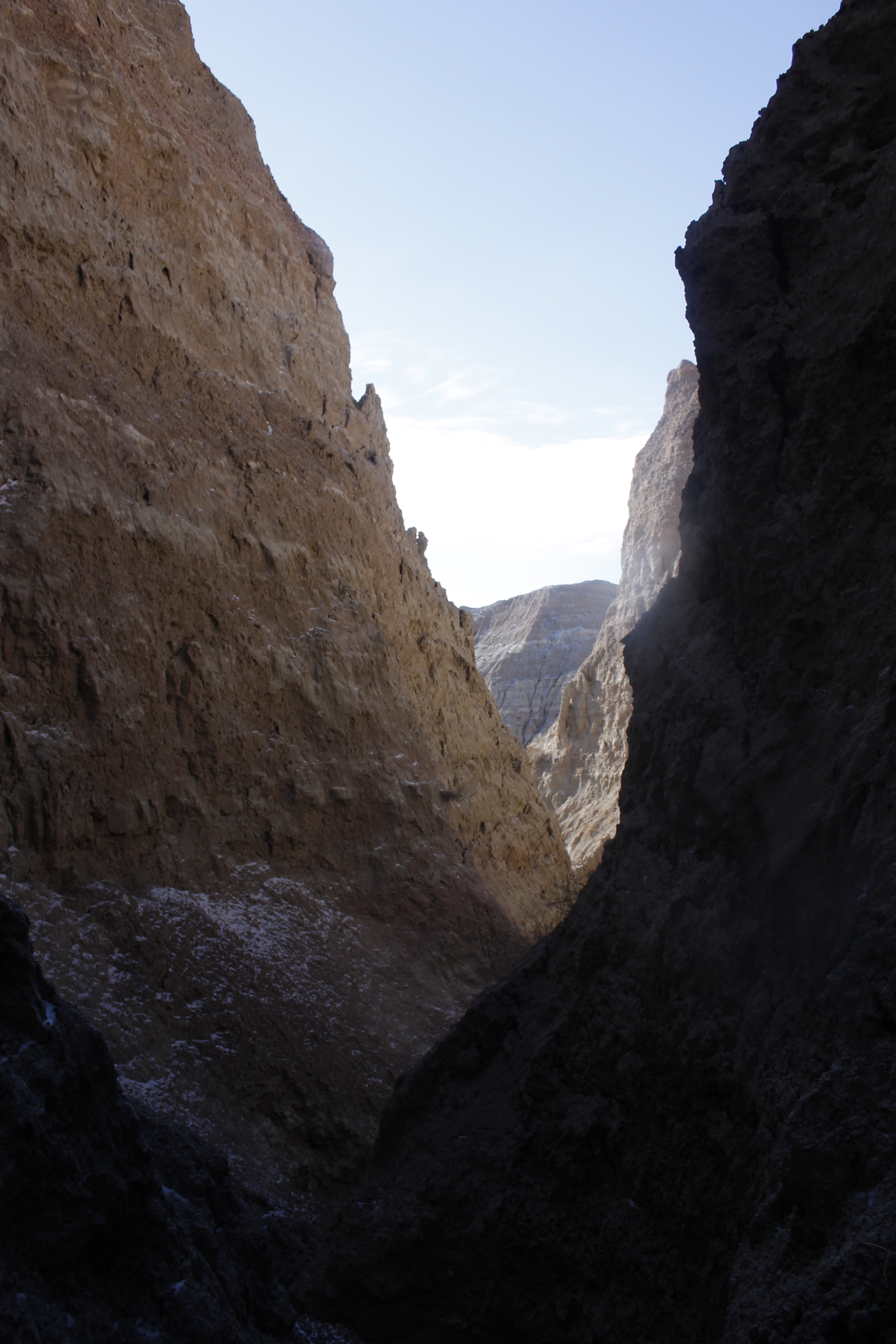
We started up a wash from the Saddle Pass trailhead going northwest. The canyons within the Badlands are instant wilderness. Within a couple of turns, there was no hint of the road, human life, or for that manner, much natural life — at least not the kind that is obvious at first glance. The eye goes to the arches and pinnacles up above, the sinuous curves of a dissolving landscape.

The Badlands topology is a portrait of erosion, millions of years of it. The layers of mud-like stone contain fossils of dinosaurs and ice age creatures.

Wind and rain carve the byzantine canyons and bizarre buttes.  It is a subtractive process. What gets subtracted is as important as what remains.

As I progress further and further into what might be called adulthood, I am always pressing myself to add more to myself: new skills, new life experiences, new income, new stories and new relationships. But as I meditated on the shapes of canyons and buttes, I considered that subtraction can be valuable too. Artists use blank space to emphasize what remains.

It is easier to focus on one project on an uncluttered desk. More gear in the backpack can just add weight. Those who can hush the chorus of distraction — whether in nature, in art or meditation — have the opportunity to cultivate clear thought and form a sense of self.


_MG_7571

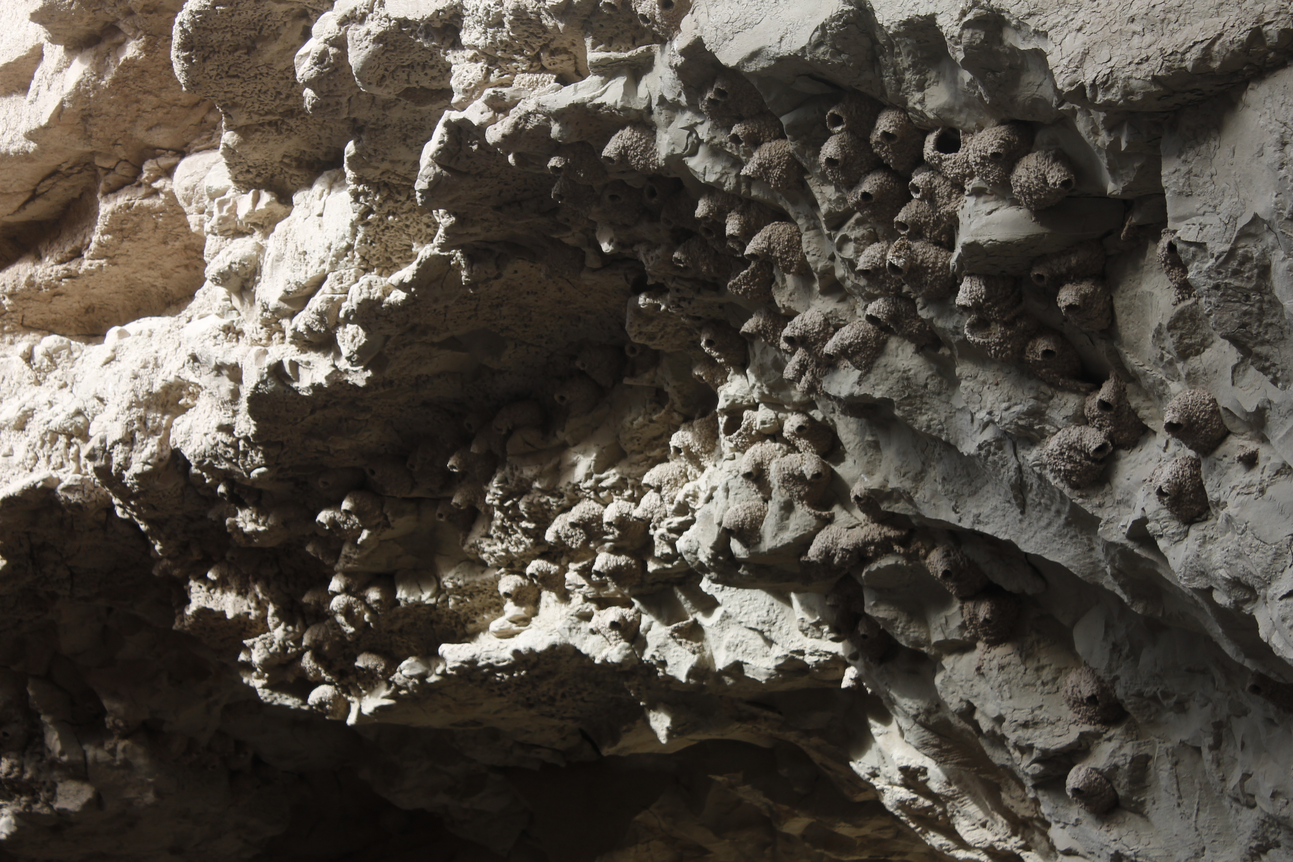
Cliff swallows build beautiful mud nests on impossible-seeming overhangs in the canyons. It is safe to say that these dwellings won’t have to worry about a visit from a fox or rattlesnake.


_MG_7575

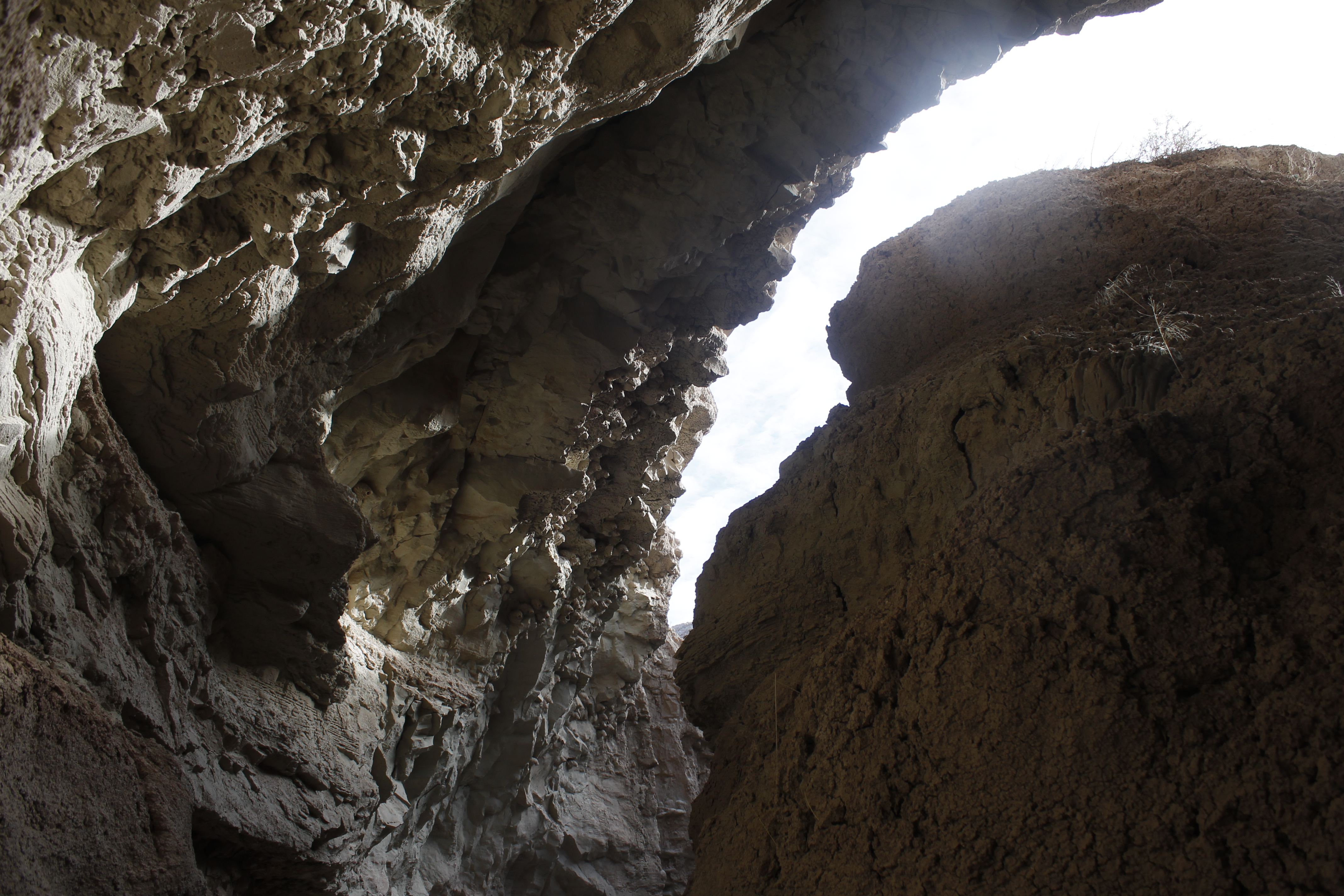
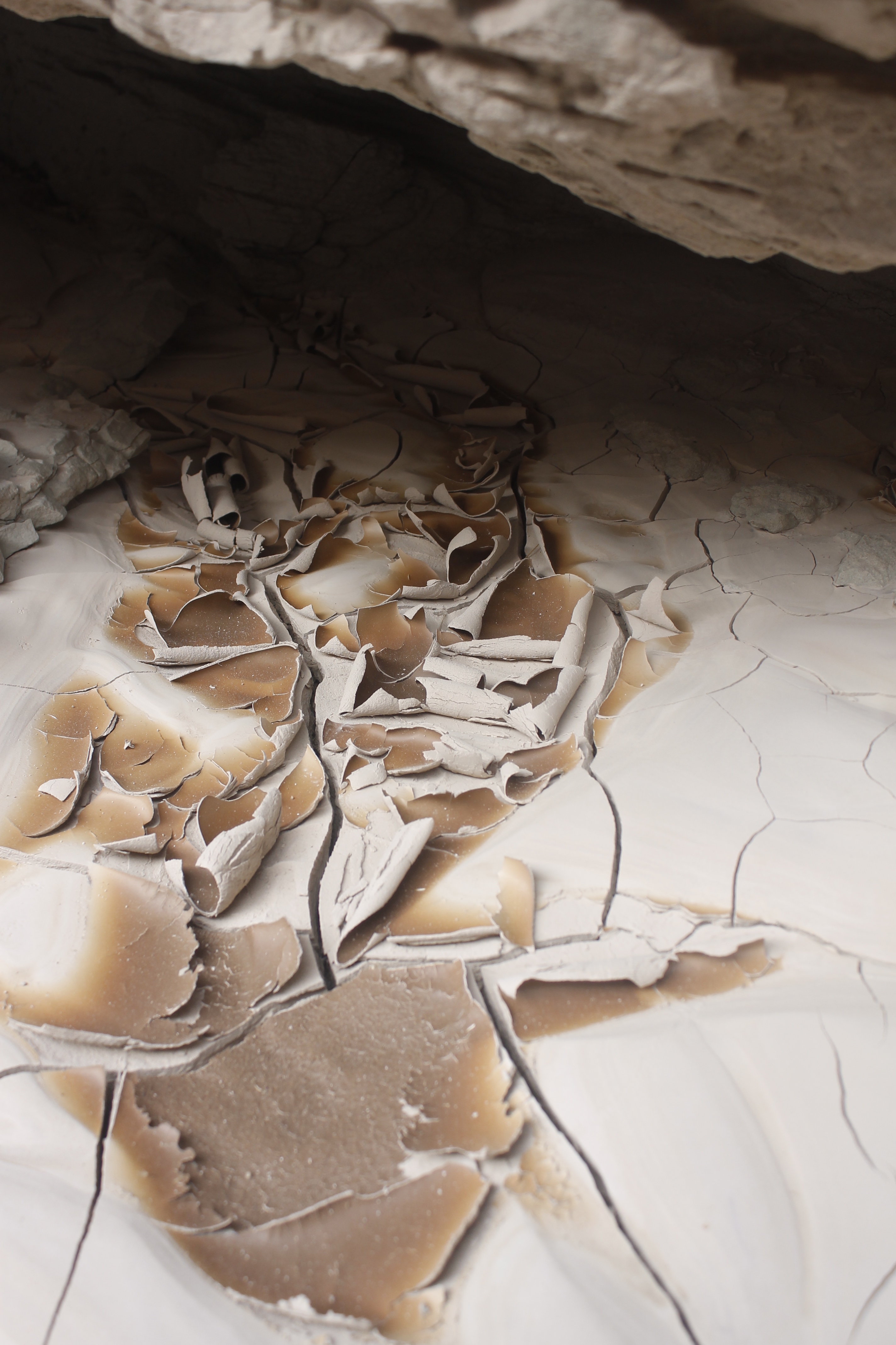
I stopped to admire some drying mud curled up like parchment  paper in this small canyon grotto.


_MG_7577

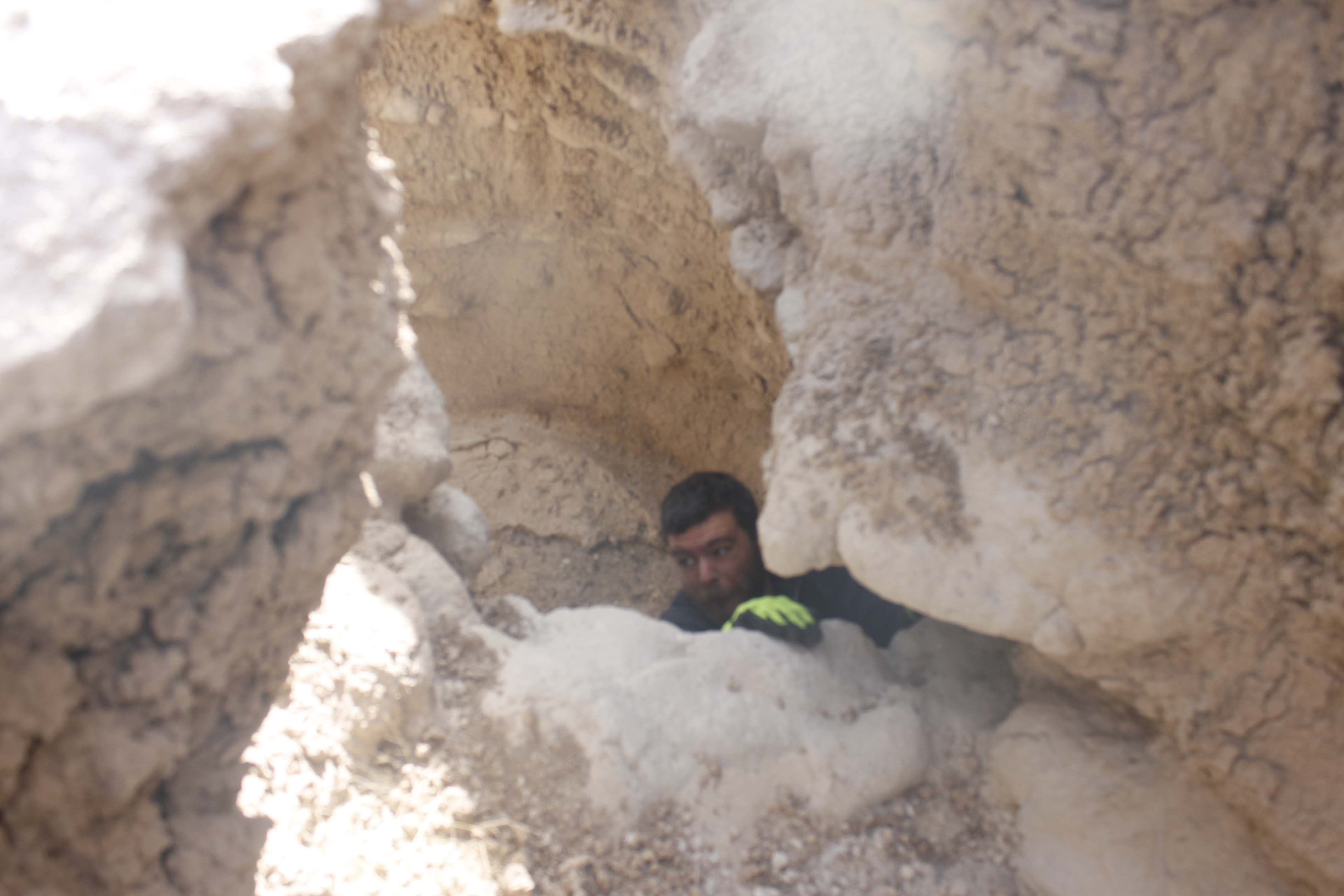
Shaun and I found a side-canyon which involved a tricky chimney climb up the crumbly sidewalls. It took me a couple of attempts to get to the place where he took this picture.

Scrambling in the canyons and on the buttes is definitely sketchy due to the crumbliness. I rarely placed a foot or handhold that I felt 100 percent sure of.

_MG_7583

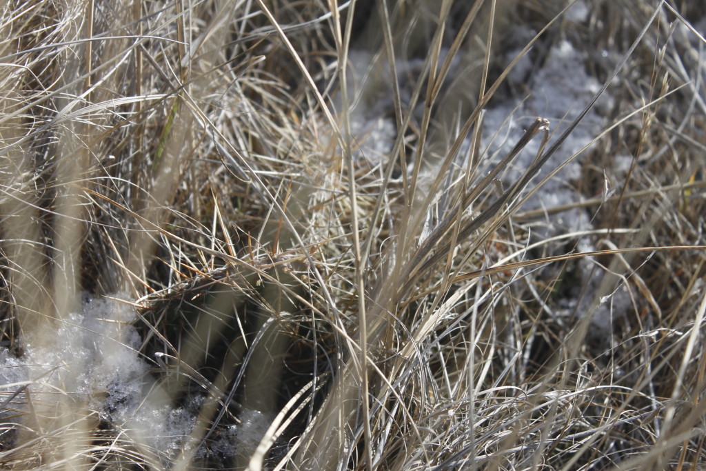
Can you spot the prickly pear cactus in this photo? This is one challenge of running off trail that I’ve encountered in western states. I’ve stabbed my feet plenty of times while running through innocent-seeming grass.


_MG_7584

I love the contrast between the corrugated-weirdness of the canyons and the flat expanse of planes. Shaun and I found some bighorn sheep horns lying in the field here.


_MG_7588

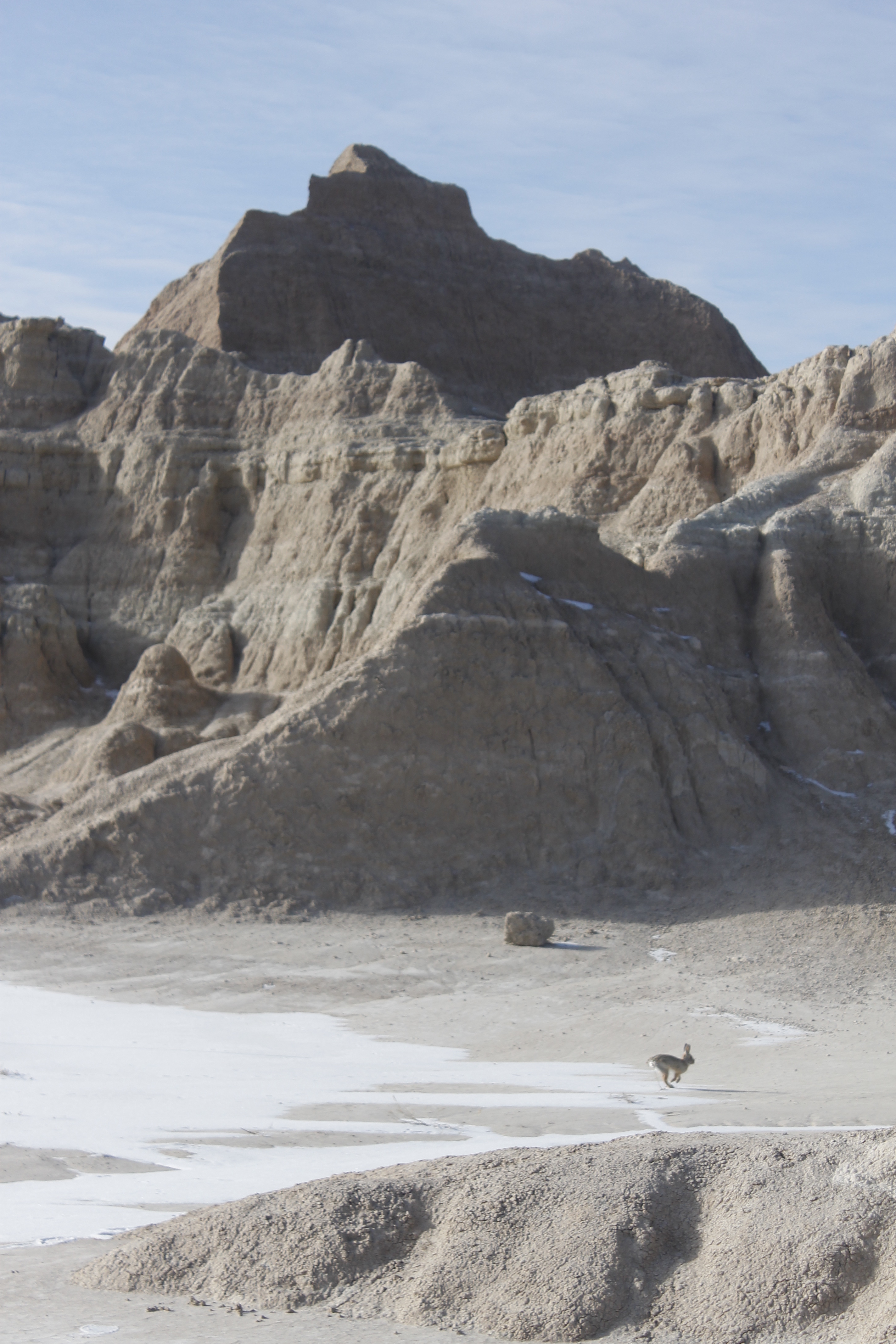
A jack rabbit passes through.


_MG_7600

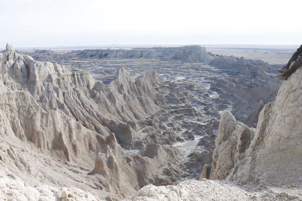
Shaun and I climbed up one of the buttes to get this view looking down toward the fossil exhibit trail. We didn’t quite make it to the top due to the crumbly substrate and the steep pitches. The top layer of the buttes is called the Sharps Formation, which is appropriate given the knife-like aretes and spires that mark the Badlands skyline.


_MG_7605

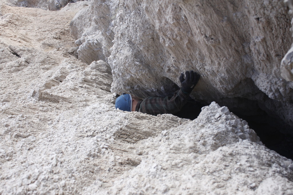
We down climbed through a canyon, which required some of the same same chimneying and stemming moves I’d used canyoneering in Utah. Then Shaun dropped his balaclava into a crevasse and had to get skinny in order to rescue it.

We later tried to use a topographic map to feed into another canyon system, but found the terrain to be completely disorienting and difficult. We crawled through mud tunnels gopher-like in the canyons, risked walking over a couple archways. Finally we took a steep drainage down to the road, about a mile away from where we’d parked.

_MG_7612

A bighorn sheep checks us out from one of the buttes.

_MG_7615

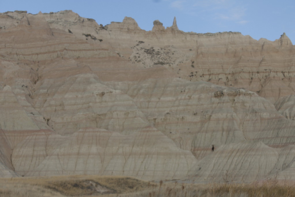
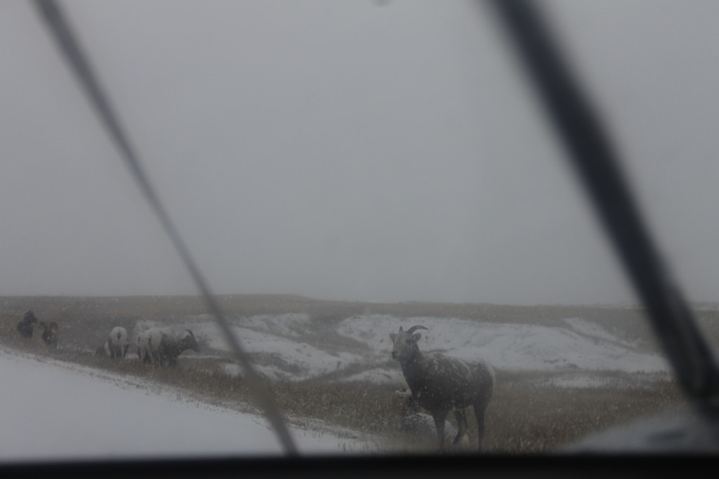
I had a backcountry permit allowing me camp in a secluded part of the park overnight. The snow was falling as I drove out the next day and I got a parting shot of this group of bighorns.

Of Mice and Mountains: A November Mount Washington Ascent

_MG_7379
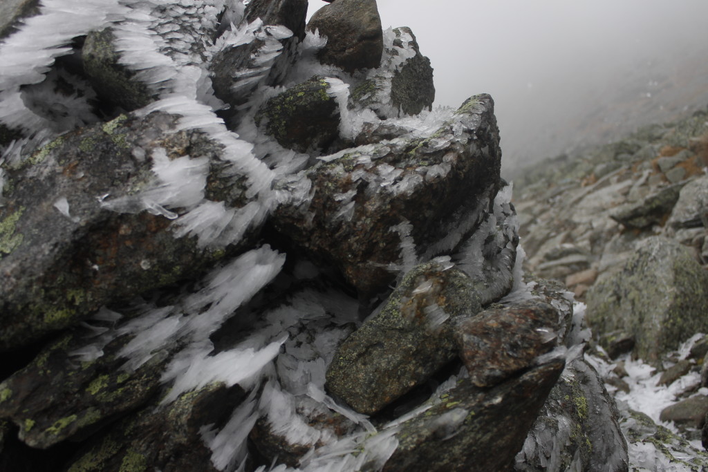
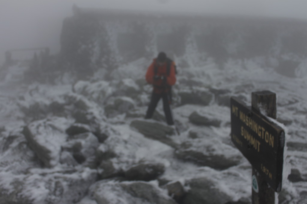
Hoar frost decorates a cairn on the trail to the Mount Washington summit

The high slopes of Mount Washington don’t look so far away from the trailhead at Pinkham Notch — the same way that  on some nights it looks like you could reach out and pluck the moon out of the sky.

It’s close, but not that close.

There are over four miles and 4,000 feet of hike between the start-point and the rocky, ice encrusted waste where New England’s tallest mountain tops out.

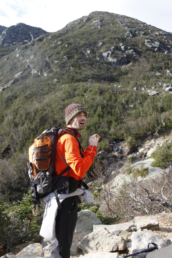
Ben and I wrangled our gear together in the parking lot. I crammed an old windbreaker into my pack with a puffy parka, secured my jumbo polyester sleeping bag to the outside with a cam strap.

“Do you really think I’ll need a parka?” Ben asked. “This fleece is pretty warm.”

“Trust me. You’ll be glad to have it when we get to camp and stop moving. Your temperature is going to drop.”

The packs were already bulging with the trappings of our hastily-assembled trip. I had got back to Connecticut from my friends’ wedding on the afternoon before the trip, while Ben had worked until midnight on the previous night. We’d made the drive from Connecticut to New Hampshire that day, stopping to pick up groceries and other trip necessities.

“You sure you want to carry that beer up the mountain?” I asked Ben.

“Of course!”

It was the first hiking trip for the two of us since Ben had come out to visit me in Wyoming back in 2012. It was also his first time going up Washington, a hike I recommend for any able-bodied Northeasterner. I’ve been lucky enough to stand on the top of this mountain several times over the years, starting with my first ascent with my dad back when I was seven.

On a good day, it is an easy climb. The trick is finding a good day.

The mountain is notorious for gale winds, snow in the summer months, avalanches in winter and some disorienting fog for good measure. Fortunately, the forecast in the days before our trip called for unseasonably warm weather and relatively mild 50 mph summit winds. I still loaded on the warm clothes and gear, along with plenty of food to keep the internal furnace running. I had no desire for the mountain to catch me off guard.

_MG_7446
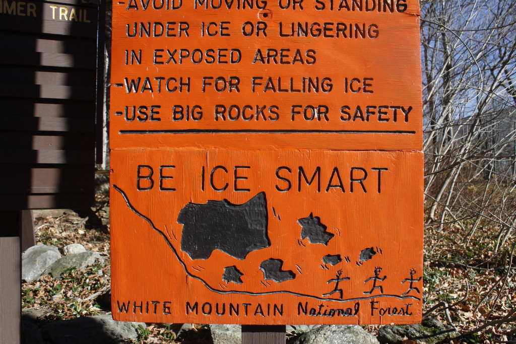
One of the helpful warnings for winter travelers. It was too early in the season for Ben and I to worry about avalanches.

The sun had already set beneath the cliffs of Boott Spur as we started up the Tuckerman Ravine Trail. We had about two and a half miles uphill to get to the camp at Hermit Lake.

The trail was a rugged course of bare rock and boulders, worn clean of dirt by generations of footsteps along one of the most popular hikes in the Northeast. The Cutler River swirled alongside.

We stopped at an overlook to admire the Crystal Cascade, then continued our climb beneath the fall leaves. A deciduous mix of birch, beech and maple trees began to give away to spruce and balsam fir with altitude.

That, I told Ben, was one of my favorite things about climbing mountains: it only takes a handful of miles to cross into different worlds. The next day, we would ascend past alpine garden and into tundra.

Light was fading as we approached camp. The trees were already shorter and thin here. The dark headwall of Tuckerman Ravine appeared above us, a cross section of a 1,000-foot tall bowl. At either end stand the twin outcrops of Lion Head to the north and Boott Spur to the south. Above us, the tiny points of stars emerged out from dusk.

The Hermit Lake camp takes up the base of the ravine with interspersed tent sites and lean-tos. The place gets hopping in the summer months and again in the winter when the skiers come out to take on one of the most intense slopes in the east. In November, there aren’t so many people. In fact, no one else was staying there that night aside from the caretaker, giving Ben and I first pick of campsites.

We chose one of the few structures that was closed in on all sides. After we set up our mats and sleeping bags on the floor, I started cooking up some lentils and pasta.

_MG_7285
Ben enjoying some of our gourmet trail fare

That was when we had our visitation. A small gray form crept out from a gap in the doorway, and scurried over our clothes.

“Hey! Get out of here!”

The mouse looked at me with marginal concern. Then I made like I was going to rush it, and it ran back through the gap. I placed a rock to hold the door tight against the wall, but a moment later the mouse simply crawled through a new gap underneath. It perched on top of Ben’s hiking boot before I waved it away again.

“We’re going to have to hang everything up,” I announced. “It probably wants to chew the leather.”

We made use of the pegs inside the building to hang clothes and shoes. Food went into a bear bin near some outhouses.

Later, we went outside to check out the star show above the ravine. There was only a small breeze where we were standing, but we could hear blasts of wind, roaring through the boulder field atop the headwall. The clear night air revealed the misty trail of the milky way.

Periodically, we would see a shooting star make a brief streak across the sky.

“I wonder if that is happening more than usual tonight, or if we just don’t bother looking up most of the time,” Ben said.

I didn’t know.

Our concerns turned back to earth, where we were getting cold. And then there was the specter of the marauding mouse waiting for us back at the lean to.

Right after I got into my sleeping bag and turned off my headlamp, I heard Ben grunt,

“He crawled right over my face!”

I turned on the headlamp just in time to see the mouse scurry under the door. This time, I took out our trekking poles and extended them to fill the gap. Laughable defense against a critter small enough to crawl through a quarter-sized opening, but it was something.

I went back to sleep with my broad-brimmed hat over my face. At least, if the mouse crawled over me, he wouldn’t fall into my open mouth.

The next morning, we did an oatmeal breakfast and began our hike up through the ravine.

Thin waterfalls sprouted out along the granite cliffs in front of us. Steps of quarried stone made the ascent easier, but the steep climb had us puffing. Added to that, it was freakishly warm for the season, warm enough so that I stripped to shorts and a long-sleeve t-shirt. I’ve experienced colder conditions on the mountain in July.

_MG_7335
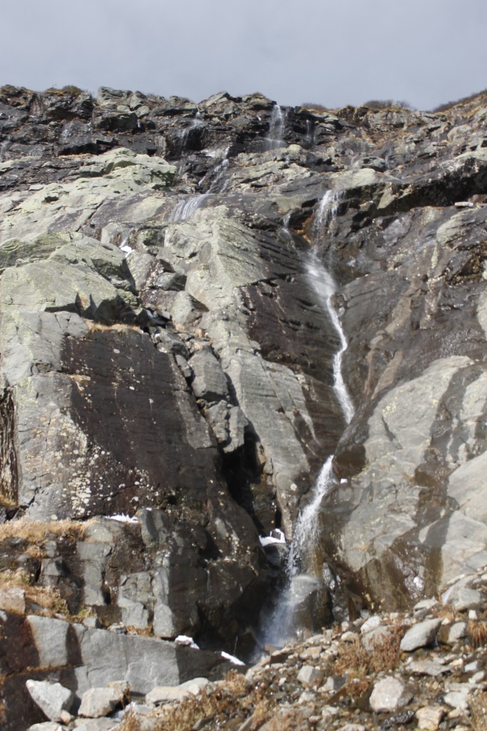
Water coming down the headwall
_MG_7349
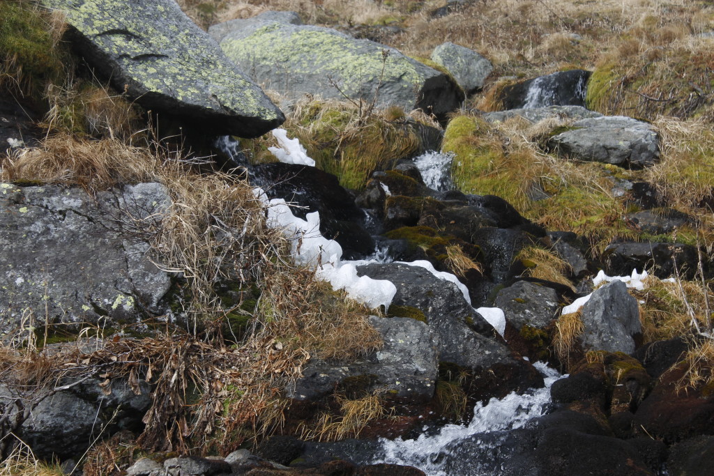
Ice-filled stream cuts through alpine garden above Tuckerman
_MG_7351
View of Lion Head from within the ravine
_MG_7313
Cool views! Hiking up  the ravine with Boott Spur in the background.

Here and there, patches of snow and ice lurked in the shadows. A small frozen falls clung to the north face of the bowl. There were clouds racing over the headwall, but the cliffs sheltered us from the wind — for now. Scrub trees along the trail, were bowed permanently into awkward shapes from downdrafts.

The air got colder as we got higher. We stopped to re-layer right before we summited the headwall where the wind was blowing. When we got to the top, the temperature must have dropped 15 degrees. Gusts of wind buffeted us periodically, but we were had the semi-shelter of the summit cone. Now there were no trees, just broken boulders with lichen growing over. We had about .8 miles of this terrain to cover before the we got to the weather station that marks the top of Mount Washington.

We began to make our way over the rocks, stopping periodically, to glance over at Lion Head and down to Tuckerman. We wouldn’t be enjoying views for much longer. A dark plane of cloud cut the top of the mountain out of view. Soon, we were engulfed in that swirling mist.

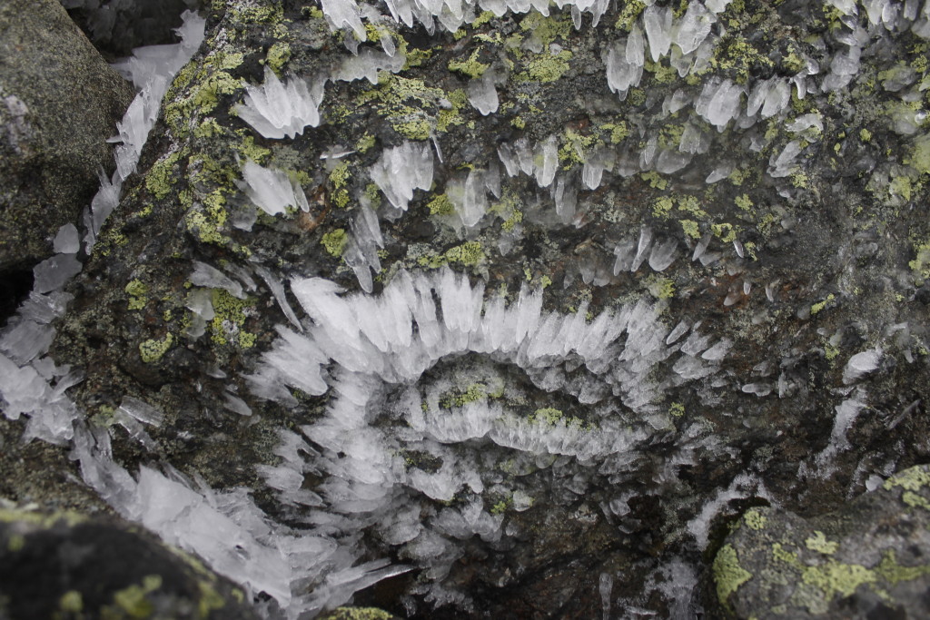
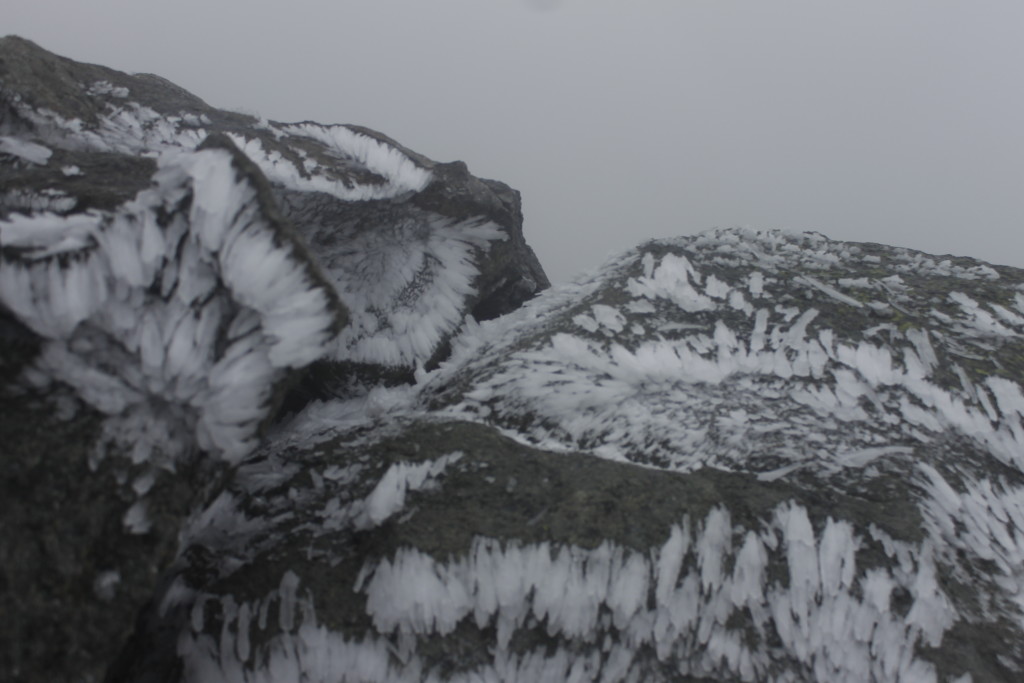
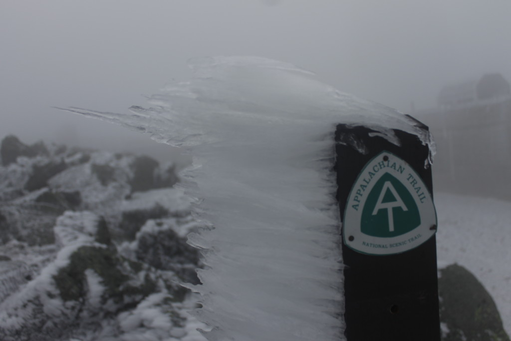
Blast patterns of hoar frost decorated stony outcrops and trail cairns, a spiny mosaic mapping the wind currents and eddies.

_MG_7373

_MG_7410

_MG_7404
Frost feathers on Appalachian Trail marker near the summit


We scrambled up the boulders, using the cairns to follow the trail.

A short ways in front of us, it went over a lip.

“I think I know what that is,” I said.

Sure enough it was the auto road to the summit. We walked along the pavement to the weather station. Here, at the top of the cone, we finally felt the full force of the wind blowing over the mountain. An icy path led to the pile of rocks where there were no higher rocks. A sign marked the summit. We lurched like drunks as the wind shoved us this way and that. We got to the top and slapped high fives through our gloves.

Recorded wind gusts for the day fell in the 50 to 75 mph range — unexceptional for a mountain that once set a world record 231 mph wind speed and had been predicted to gust 130 mph the day earlier.

Whatever speed the winds were blowing, the conditions did not inspire us to linger about the summit.  We got our pictures and got off the top. We sought the shelter of one of the weather observatory buildings to layer up into parkas and windbreakers, then started our descent.

_MG_7396
Ben at the top

To mix things up, Ben and I opted to take the Lion Head Trail on the descent. This route kept us in the wind a little longer, but it also afforded some excellent views down into Tuckerman. Our quads were feeling it by the time we got down the rocks to Hermit Lake.

Ben was ready to call it a day, but I opted to take a quick run up the steep boulders of the Boott Spur Link to get a different view of Tuckerman and fill my daily masochism quota.

It was near dark when we got back, Ben already had pasta going for dinner. The beer was out, of course, a fine Smuttynose imperial red that did credit to The Granite State.

Our main objective complete, we would have a leisurely hike back to Pinkham Notch the next day.

As an added bonus, the mouse kept his distance that night.

In many ways, Ben and I had been like that troublesome rodent. We’d challenged the giant, and got out of the way before it  had the chance to swipe at us.

_MG_7431
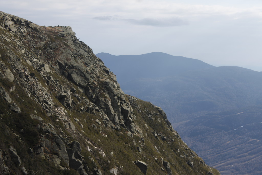
View into Tuckerman Ravine from Lion Head Trail


Enter The Boundary Waters

_MG_7126
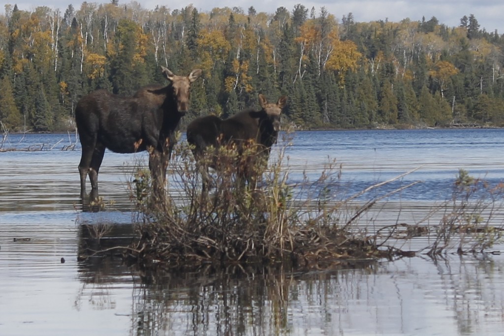
A moose cow and her calf wading near the entrance to Cherokee Lake

Here’s an interesting exercise:

Open another window in your browser and go to Google Maps or some other mapping software of your choice. Zoom in on northeastern Minnesota, where you will see the many, many lakes within the Boundary Waters Canoe Area Wilderness. Note that these lakes continue north to Canada. Lakes next to lakes next to lakes.

They go north through the Quetico Provincial Park, all the way to Hudson Bay.Follow the map around, and you will see that most of the northern reaches of this continent consists of lake country — a zone that begins in Labrador, continues west to the Rocky Mountains. The lakes pick up again along Alaska’s north coast.

When my dad and I loaded gear into a canoe on Sawbill Lake at the edge of the Boundary Waters, we were preparing for a brief foray into a vast expanse of water.

The four to five days that we’d allotted ourselves in the Boundary Waters weren’t really enough for us to reach Hudson Bay. Because we were visiting in October, however, our trip was an opportunity for us to experience a measure of solitude.

“You’re out of rhythm. Try to match my paddling,” my dad told me.

“Well then you’re going to have to slow down. I can’t J-stroke that fast. Or pry stroke. Whichever stroke I’m doing right now.”

We are a kayaking family, dammit. I’ll leave it to more experienced hands like Boundary Waters bard, Sigurd Olson to explicate on the finer points of canoeing technique.

This was my first multi-day canoe trip with my father, though in high school, I’d accompanied him on kayak trips on Lake Champlain and the Erie Canal. Though kayaking is clearly what we do best, we found our rhythm in the canoe eventually, the boat cutting north along Sawbill Lake toward our first portage.

For those of you who haven’t been to the Boundary Waters,  aren’t among the bazillions of Minnesotans who drive north each summer  with Winona Canoes strapped to the roof,  you can understand exploring the area if you imagine tracing a connect the dots, but with lakes. You paddle to a portage trail, and then move yourself, your boat and your stuff along the trail to the next lake. Resume paddling to the next portage.

There are a lot of lakes and a lot of trails, but we’d heard that Cherokee Lake was a beautiful destination, and not too far off from the launch site.

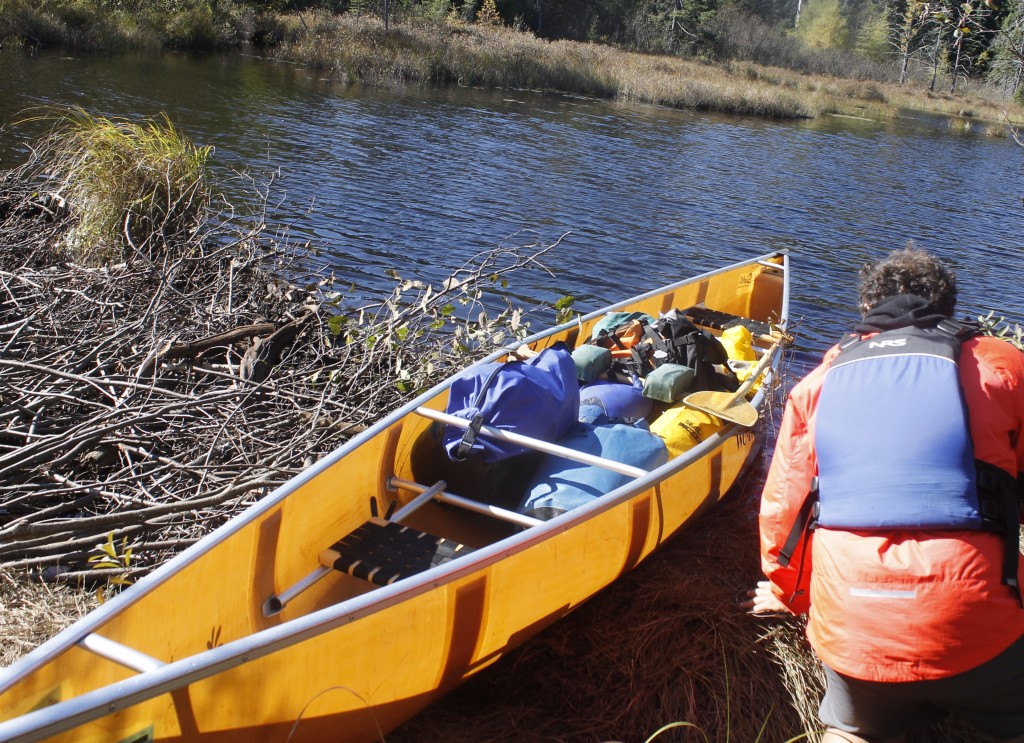
To get there we had to paddle a few lakes and make some portages — the later being anywhere from 100 yards to just over a half mile. That might not sound like much, but when the portage requires unloading and reloading a canoe, hoisting said canoe over your head to walk with it, and making two trips to gather up all your stuff, the portages add up. This included going over some fairly rocky terrain, and sometimes sinking into thigh-deep ooze when we got out of the canoe. At least the portages were marked on the map, usually we had no idea about a beaver dam until we saw it right in front of us. Then the game was getting out of the canoe in the muck, working the canoe over the obstruction, and then walking into the muck on the other side of the dam in order to get back into the boat.

_MG_7115
My dad helping me get the canoe past a beaver dam

The first night, we ate couscous and tempeh along with some kale from my garden. We spent about half an hour wrangling together a bear hang between two jack pines. After it became pitch dark, my dad and I sat by the lake’s edge, talking about what it meant to be getting further from the car, further into the wilderness where there was no telephone service, no medical help close by.

What about getting lost? Getting lost seemed very possible.

There were no marker flags or other handy icons that we could use to identify where to find a portage among the uniformity of trees lining the lakes. It paid to keep a sharp eye on the map as I paddled the canoe, looking out for landmarks like coves and islands that I could use to identify our position.

_MG_7178
A place for beautiful disorientation. View of Cherokee Lake.

When a lake had several islands, figuring out which one was which inevitably became guess-work.

“I think that’s the island I’m looking at …”  I would say.

Sometimes the best thing was just to know that you were heading in the right direction and hope that you recognized the roadsigns in the terrain when they emerged.

What I did appreciate was how this navigation forced the two of us to be attentive to the landscape. We would notice something like a whale-shaped rock, and our noting it would not be a passing curiosity, it would be a vital guide post for us to recognize on the return journey as we sought to hold the right course.

What would be superfluous detail a mile from the car, gained key importance as we moved further out.

It was a relief to put the canoe down after a half-mile portage to Cherokee Creek. It was the morning of our second day. My dad and I took a moment to relish the warming sun as we ate Clif bars and downed peanuts.

I welcomed the creek because the forest would frame us on both sides. One of the best things about being on water is that it gives you a different perspective on the land. We paddled down a golden corridor, with the coniferous tamarack trees turning color before they shed their needles. The creek reflected the tamaracks and the blue sky.

It was a time to paddle as quietly as possible and to simply absorb the quiet beauty of everything around.

The creek opened out to Cherokee Lake.

“Whoa!” my dad exclaimed.

Two moose, a mom and her calf waded through the water.

These were the first of these big creatures I’d seen in Minnesota. Tragically, moose used to be common in the north woods, but are becoming difficult to find. A lot of research has gone into the decline. Guests on my kayak tours will often talk about how they had seen a bear or seen a wolf, but how they would really like to see a moose sometime.

I, like many, believe our warming planet is playing a role in the decline, though the research is complicated, and involves studying how the moose have handled brainworm, ticks, predators and temperatures in high summer.

These moose looked a little scraggly to me, with patchy fur. It had been at least two years since I’d seen a moose. Who knows how long it will be until I see my next?

We floated for a while watching them.


_MG_7206
On Cherokee Creek

Notes:

Some cursory information on the moose decline:
http://www.dnr.state.mn.us/moose/index.html

My Dad has already written two blogs about this trip, so I’m the slacker here. Some great reading for you if you get the chance.

http://www.theday.com/the-great-outdoors-blog/20151015/—-serenity-solitude-and-soggy-socks-in-the-boundary-waters-canoe-area-wilderness

http://www.theday.com/the-great-outdoors-blog/20151022/part-ii-serenity-solitude-and-soggy-socks-in-the-boundary-waters-canoe-area-wilderness

A Day in the Waves: Part 2

_MG_7068

The second half of my big wave kayak adventure on Lake Superior:

The rising seas sent waves crashing into sea caves, mortar rounds of spray flying out from the cliffs.

A large stone archway guarded the entrance to a recess in the cliffs. I watched the waves slam against the sides, thought about what it would be like to rag-doll against the walls. I wouldn’t try to go through this one.

The Manitou River fell from the cliffs in a frothing yellow fury. The upper falls slammed into the side of the canyon, whereupon the onslaught redirected into a second, even more spectacular drop. There was a zone of smooth water in front of the falls, where the river flow was strong enough to beat back the lake, Further, the water boiled. Lake swells rose higher yet as they crashed and exploded into the face of the current. Birch leaves whirled in the agitation, flashing in and out of the darkness like strange fish.

It was an extremely tempting, if terrifying, place to try and surf a kayak.

The way to do it, was to aim for an eddy behind a sunken gravel bar. It was a spot that was slightly smaller than a modest kitchen, where the water was almost completely calm, a demilitarized zone between the warring lake and river.

I struggled to set up a good approach, wrestling with the river continually trying to push me back and the waves breaking at my stern. I half-surfed a couple waves, stopping to avoid getting thrown sideways or pushed down into the river. After a long struggle, I caught a wave that pushed me over the gravel bar and into the calm place.

It was one of the strangest places I have ever sat in a kayak.

Looking straight up, I could see 100-foot walls, curved amphitheater-like above my head. The falls couldn’t have been more than two kayak-lengths aways. And then there were the rollers coming in, crashing through the arch to the left.

I finally had the luxury of giving the view my complete attention, with no worries about the next breaking wave.

After I punched the kayak back through the breakers, Dave and I continued along the cliffs.

Mercifully, the profile of the North Shore has many projecting points, which create shelter zones where there will be calm water.

Fenstad’s Resort had one such protective point. We took a tranquil beach landing.

We were making great time down the shore with the waves pushing us, and even with the gathering seas, neither of us wanted to hurry.

“The point of a journey is not to arrive,” Dave said.

I nodded. The bigger waves? Let them come! Hopefully, they wouldn’t.

A guy with a mirrorless camera walked up to us to chat. There was some couple he’d heard about, who got swept out into the lake by an offshore wind and couldn’t get back. They died of hypothermia. We told him, we were experienced kayakers, guides actually, and that we’d paddled in these kind of conditions before. That seemed good enough for him, and we ended up talking about wildlife sightings in the area.

It turns out that there was a bear cub in a tree nearby, no mom. She had probably been shot by hunters. leaving the little guy to fend for itself this winter. The cub was probably a yearling, the guy thought, not a good prospect for survival.

The bear had been stuffing itself with apples from the resort’s trees, but the guy left it a fish he had caught so the growing youngster could experience some other sections on the food pyramid.

When the three of us went to see the bear, we found it looking down at us from a tall spruce. After more people went to look at him, he climbed higher and to the other side of the trunk. Then and again, he would peep out to look at us.

There were bright red apples hanging off of one tree, greens on another. They were delicious.

Trout swirled about in two streams nearby. The water levels had come down, leaving them trapped in pools.

Dave thought he might snatch one and leave it for the bear cub.. The guide and I watched skeptically as he waded in, but when he started throwing stones in strategic places, he managed to herd them into one place. Dave might have tried to swipe one out of the water, then thought better of it.

The waves kept building, but weren’t quite at the point where we wouldn’t fool around.

We deliberately took on a couple surf spots above the ledges, usually, opting to get near the downwind side of the ledge to make it easier to steer out of there if we encountered something too big to handle.

At one point, I’d thought I’d missed a wave, only to have the lake drop out from under me. Suddenly, I was surfing sideways, paddle jammed in the water. The stabilizing maneuver, known as the high brace, reminds me of 19th century whaling. I jab the paddle blade at the oncoming beast, lean the boat in and stick it. A Melville quote would have been appropriate here.

“From Hell’s heart, I stab at thee!”

This particular breaker took me on a 30-foot sleigh ride before I swung out of the break zone.

At another point, we were kayaking near shore, when a huge wave suddenly reared up next to me.

“I’d hate to be you right now,” Dave called.

But the wave ended up grabbing him too.

We stuck our paddles and rode, until the wave threw us up on a cobble beach. Dave might have been pissed because his fiberglass kayak had just taken a beating, but he laughed.

“That. Was. Awesome!”

The waves kept building.

After another hour on the water, we didn’t fool around much.

Every now and then, a 10-footer would rear up by our kayaks. I would try to angle my boat halfway into them, leaving room to brace and avoid getting flipped over backwards. Most terrifying of all were those monster waves, that broke at the top (but didn’t roll completely over, thank God.) These waves made their own break zones. I found that these half-breakers were technically easier to ride out than the breakers on shore or those that went over a shallow ledge. They just happened to be scarier than hell. If these massive waves started rolling over all the way, I couldn’t imagine how I could stay upright paddling through them.

The northeasterly swells kept me looking over my left shoulder constantly, with little time to appreciate some of the rock formations on shore.

This was a shame because we were going past Tettegouche State Park, home to a massive sea cave near Shovel Point.

I glanced at the formation with some regret. There was no way we would kayak into the cave now with this crazy surf.

Instead, we focused on getting around the cliffs at Shovel Point. Spectators at the rail got to see us taking on the swells and reflector waves.

The waves beyond the point were smaller, if still powerful, giving Dave and I some long-distance surfs.

Then we decided to take a shortcut through a small boulder garden. This turned out to be a mistake for me, when a wave crashed early and threw my boat against a rock. I steered away from the obstacle, only to get thrown up against yet another. I was almost out of danger when a third wave, hit me and flipped the front of my boat on top of a boulder.

Shit.

I tried to flip, back over, but the boulder got in the way of my paddle. Next, I tried pushing off the boulder itself, but I had to take my hand out from the pogies to do this. Just as I was ready to right the kayak, a mother of a wave came and blasted me, ejecting me out of the boat through the spray skirt.

Getting the boat emptied out on the rocks took at least 10 minutes. Submersion in the cold water brought up an urgent need to pee, which I did as discretely as possible (not very discretely) in front of the bystanders watching from the cliffs.

Dave came around and helped me get the last of the water out of the filled-up boat and get me back in. We were determined to get off the lake via the Baptism River, which meant that we would have to surf waves in against the current. The river shot out in an offset angle from between a cobble bar and a rock cliff.

The big-ass waves were crashing everywhere now. I let Dave go into the river first, slowly side-surfing one wave at a time in order to hit the sweet spot. When he got into the slack water, I brought my boat to bear.

The stern lifted on the crest of a huge breaker. As I plunged the paddle in, the wave shot the boat to a wild left and bounced its nose off the  cliff.  I back paddled on the right.

Here came the second breaker.

Again, I stabbed the paddle into my assailant. This time, the shaft snapped.

Of course, the wave pushed me back into the cliff, and I had to shove off with my left arm.

I held both ends of the busted paddle and paddled them like mad for the river mouth. Fighting the current this way gave me just enough momentum to stay ahead of the break zone, but it was like running top speed up a tilted treadmill. I wasn’t going any further forward and eventually, I knew the current would feed the boat back to the carnage.

Dave had already beached his kayak and jumped in the belly-deep current. He grabbed the loop on the nose of my kayak and got me the rest of the way home. Saved my ass.

We threw our kayaks up on the beach, where there was a corridor of rock piles and some inexplicably well-dressed people milling about. Some of them started asking to Dave about our journey. I stumbled into the shelter of some ledges where I could be out of the wind.

It was around this time that I realized that I was dumb to keep flailing at the water with two ends of the broken paddle. If I had just taken one end and paddled with it canoe-style I probably would have gotten enough momentum to go up current and get onto the beach on my own.

Some of the well dressed contingent came over to spread the cheer.

“We saw you almost die,”

“We didn’t almost die,” Dave said.

“Well, can you please move your boats, we’re going to have a ceremony here.”

A wedding!

And if we had come in ten minutes later, well, both of us would have absolutely surfed right into the marriage ceremony. What? You didn’t get the RSVP? Sorry guys, but these boats are coming in.

I can understand why many of those on shore, might have seen this all go down and thought, ‘Wow. What a couple of idiots to be out in that.’ Maybe some readers feel that way.

I do take issue with people who make rote judgements of how dangerous/safe, something I am doing is is based on a cursory, emotional assessment.

I’ve had people approach me after I get off the water with this automatically superior attitude. They don’t necessarily say, “You’re dumb.” Usually, they relate some passive-aggressive story about somebody who died. Not that it matters that the other guy had no life jacket, no wetsuit and several drinks in the tank. Never mind that I practice kayak rescues, practice rolling, practice bracing and practice in big waves. I constantly ask myself if I am allowing my enthusiasm to cloud judgement.

I’ve also been that guy on the beach. I’ve told a group in a canoe that the waves were going to be much bigger when they got around the point and tried to discourage them from going out on the 40-degree waters in jeans and cotton shirts.

Still, these others, just by knowing that someone has died on the lake, have gained this incredible perspective that I must lack. Thank you, Concerned Bystander, for your considered opinion.

While I don’t always make great decisions, I do resent others lumping me with the yahoos who have no idea what they are doing.

Dave and I used some judgement when we looked back out at the lake and saw mostly big breakers going out to Palisade Head. We had four miles of lake to cover to get back to my car. Could we make it? I thought we could do it if we had to.

But maybe we shouldn’t. Constant bracing had taken a toll on Dave’s back. I was feeling tightness as well. The lake showed every indication that the waves would continue to build.

Dave took out a cell phone and called a friend to pick us up. We hauled the boats up the long steps away from the lake.

The waves stayed rolling in my head for two nights in a row. I felt that I was moving with the swells, bracing into waves, surfing them. Some kind of unconscious learning was happening. Surely, the neurons were making new connections, preparing me for the next trip on the big water.

Here was the trip I will remember years from now: two kayaks, beneath the cliffs, through the waves, staying up.

A Day In The Waves: Part 1

_MG_7068
Lake Superior’s waves crash against the rocks in a red sunrise at Black Beach, near Silver Bay, Minnesota

Here was the red sky that we’d been warned about: a hot band of mango orange coalescing above the dark waves.

It was just past 6 a.m. and Dave and I were at Black Beach loading kayaks onto his truck for the 23 mile drive up the Superior shore to Taconite Harbor. That would the launch spot. Black Beach was, hopefully, the end of our expedition. I walked down to where the waves rattled the cobbles. Amber beads of spray caught the wind, shone briefly in the evil light.

I ran back to the truck.

“Sorry, I just had to grab some pictures.”

“It’s a beautiful sunrise,” Dave said, “You got everything?”

I went back to my car and double checked. Most of the stuff I would take on the drive to Connecticut was already loaded in there. My kayak guiding season was over, and it was it was time to pay a visit back east.

“I think I’m ready,” I said.

I got in the passenger seat and we rolled out on the gravel.

When I called Dave the night before, I got his voicemail.

“Either I’m kayaking or I’m kayaking,” the message declared. That sounded about right.

Dave, who cuts a wiry figure with a stern face offset by a silver goatee, has been in his paddling drysuit most times I’ve seen him. He goes out on the lake almost every month of the year, stopping only for when the ice gets makes paddling physically impossible.

He’ll be out there with a Greenland paddle in his hands, the traditional paddle of an arctic seal hunter. Such is his enthusiasm for the Greenland paddle that he has a “Rolling With Sticks” sticker on the side of his truck. which shows a stick figure executing an Eskimo roll with a Greenland paddle.

Dave told me he knows how to do 30 different rolls in his kayak, though I’ve never had the chance to watch this.

In fact, we hadn’t done a trip together yet. With me kayak guiding for a resort, and him at the nearby outfitters, most of our water time has been with customers.

Needless to say, neither of us get to take customers out for 20-plus miles in Small Craft Advisory conditions.

This was the kind of trip we hungered for as we wrapped up guided tours for the year. This was the Guide Tour.

We wanted to need our best technical skills, lake smarts and physical strength. We wanted to end the day beaten up — not from hauling boats or loading trailers — but from testing the actual, whoop-ass fury of the world’s largest lake.

Along the way, we were going to paddle a new section of lake for both of us, stretching past Sugarloaf Cove and out to the falls on the Manitou River. The Manitou is the only major North Shore waterfall that drops straight into the lake.  No convenient overlook and interpretive center parking lot here. Tall cliffs and private property keep this gem out of sight from the road. You have to paddle there.

Later, we planned to go past the sea caves at Tettegouche State Park, and then around the 200-foot cliffs of Palisade Head, which has its own tunnels.

I wondered how well I would handle playing in the big waves all day, also how I would stack up to Dave’s expertise. I hoped to show the kayak vet that I knew a few things too.

Orange light marched down the nearby trees and cliffs as the sun peaked above Gull Island at Taconite Harbor. Gull Island and its companion, Bear Island are linked by a long line of quarried stone, which creates a bulwark against the Superior’s waves. Further protection comes from a smaller ring of stones that creates an inner harbor around the small boat launch.

We put the boats down on the concrete and did a last gear check.

Crap! Where were my paddling gloves? Dave lent me some neoprene pogies — a type of glove that attaches to the paddle and you put your hands into.

_MG_7073
Dave in his drysuit, prepping for launch.

There were no ships in the harbor (there rarely are these days, now that most of the Taconite ore used to make iron goes out of Silver Bay.) Once upon a time, I stopped a tour near Gull Island to avoid crossing paths with the James R. Barker.  The Barker had just dropped off a coal shipment at the nearby power station.

The boat is over 800 feet long, and at least as tall as an eight-story building. It lurched, Leviathan-like out in front of our tiny kayak pod, trailing a brown line of haze from its enormous stacks.

Once upon another time, someone asked me just how much coal was onboard a moored barge. I paused in an attempt to calculate the size of the black mountains that pop up near the plant after every new delivery.

“That would be approximately one shit-ton,” I said.

Today’s wind gusts had whipped the outer harbor up with sharp little whitecaps.

The big swells came in from the northeast, cutting past Gull Island at an angle, and crashing into cliffs. Seen at a distance, these waves were slow, blue forms, squiggles on the pink horizon. Each paddle stroke brought us closer to them. Soon we began to feel the lake’s power.

Dave’s kayak appeared and disappeared beneath him between water ridges. As the waves built later in the day, Dave himself would flash in and out from sight as the walls of water crossed my vision.

We grinned wildly at each other. This was the ride we’d waited for all season.

Waves shattered up against 100-foot rock cliffs, broadcasting plumes of spray that dazzled in the orange light. The rhythm of the waves against the boats was offset by the counter-rhythm from the reflector waves bouncing back at us from the walls. Sometimes, one of the reflector waves would smack right up against one of the oncoming rollers and they would pop —their splashes flying into the air.

This dynamic environment required constant vigilance to keep the boat upright and going where it should. Body and mind had to mold to the movement of the water with fast micro-adjustments in the hips and with the paddle. I enjoy the trance-like concentration this demands. I would still feel myself bucking and rolling when I got off the water, would be going up and down the waves when I went to sleep that night.

A golden eagle (or was it an immature bald?) looked down at us from over the cliffs. We would see several eagles along the trip, more than I had seen throughout the summer.

A 20-foot rock nob jutted out from the shoreline in front of our kayaks. It was the point at Sugarloaf Cove, a beautiful piece of parkland where I had led hikes earlier in the year. I was finally able to get a look at a sea cave that I’d often wondered about, though I could never see it clearly from the land. I maneuvered through the reflector waves to beneath the lip of rock where I could see an alcove, maybe 10-feet deep beneath the overlook. I wonder how many hikers stand up there, with no idea of the enormous opening beneath their feet.

Near the alcove, there was a cool rock feature on the cliffs that sent up tall whirlwinds of mist as the waves crashed past. The water made a “shush!” like a mighty exhale.

A nearby mini cave in the rock would take a wave and fire off spray with the thud of a cannon, sending spray out 20 feet into the lake. It looked like a dragon fire.

In fact there was a kind of explosion happening. As an oncoming wave slammed into the air inside the rock hollow, it compressed it, causing the air  to blow out at high pressure, blasting shreds of wave with it.

Another natural phenomenon to look for was the surf spot. The Lake Superior North Shore is chock full of underwater ledges that create shallows. A big wave rises up and curl over, as it marches past. These make for fun/dangerous spots for kayakers depending on the size of the waves and the kayaker’s experience.

I look for these surf spots for fun on most days, seeking to ride a good-sized wave in my kayak. Now, these waves were massive, and curling in much deeper water. It didn’t seem like I was looking for surf spots. They were looking for me.

Whale-sized waves crashed on the ledges around Sugarloaf Cove. Dave and I gave them wide berth. The water on the other side of the point was less intense but there were smaller, breaking waves, that carried us long-distance over the shallows near shore.

This was the first place on the trip where I got rocked.

In the semi-shelter of the point, Dave and I had let our guard down enough to swap stories of our adventures kayaking the Temperance River, including Dave’s trip down an upper section I hadn’t tried yet.

“Is that really crazy?” I asked.

“No it’s not too bad, but you definitely need to stay on your toes.”

“Hey, speaking of which…”

The wave was stacked up about six feet high, approaching from our left and getting ready to break. As it curled over, we jammed our paddles into its side so that we could lean into it and brace against.

We were immediately sideways surfing a frothy stampede of water. Though my kayak wobbled in the melee, it stayed upright. And I got a massive charge.

Unfortunately, the wave had also pushed us closer to the rocks, and in a bad place for the next wave. Dave, who was slightly further out, managed to paddle out through it while it crashed over. Not an option for me. I tried to set a decent brace, but  before I got there, the wave knocked my boat over like a bath toy. Submerged in the cold water, my immediate thought was, ‘Don’t let Dave see you screw up this roll.”

I fought my blade to the surface and swept it over the water. I got high enough out of the waves to take a breath, but the roll was sloppy and I went back under.

On my second attempt, I took my time getting things right under water (even as I started to feel pressure building in my head) and swept the blade again, flicking my hips and rolling my body to the surface.

I pointed the nose of my boat into the waves and paddled hard, slicing through the next wave of breakers.

Dave congratulated me. Sure, flipping the boat over was a bit of a noob move, but the roll redeemed it. If only everything in life were that simple.

Our course took us past the canyon of the Caribou River and to a sheltered cobble beach where we took a break to eat and go agate hunting. A rough day on Lake Superior is always good for searching out these little geological wonders because it brings a fresh crop onto shore. You know the other rock hounds haven’t been over it. I’m not much of an agate picker. My best find, was a pea-sized pebble, which did have some cool alternating red and white mineral stripes. Dave, who sells agates for a side income, snapped up several, beauties the size of golf-balls.

We were making great progress down the lake, and neither of us wanted to rush the day. Nonetheless, even in the half hour that we spent out of our boats, the number of whitecaps on the lake were building.

Dave turned on his weather radio, which announced that there were 4 to 6-foot waves (Wait, I thought they were supposed to be 3 to 5-footers!) which would build to 5 to 7 footers by evening. Of course, all bets were off when it came to underwater ledges and random mutant waves that rose much higher than their brethren. The Weather Service had issued a Small Craft Advisory for the North Shore, which we already knew about.

“The Small Craft Advisory advises me to go kayaking,” Dave said.

Not far off the beach, we could see an indentation in the cliffs up ahead. This, we guessed, was where the Manitou River dropped into Lake Superior. Soon we could see brown river water that swirled with yellow leaves and flowed out into the blue swells. Could we get up to the falls without getting thrashed?


On A Dark River

_MG_7019
Starting my trip on the St. Louis River on the rapids below Thomson Reservoir. Photos by LeAnn.

Between the razor edges of stone, through the labyrinth of dark canyons, there runs a river, treacherous and rusty brown, that thunders over falls and flies into narrow places that would crush a boat.

The St. Louis River is beautiful and sinister at once. Its water flows over a massive slate formation, exposing it in spiny rock projections that jut up at regular intervals and identical angles. This regularity, gives the rock a whiff of gothic architecture. It was not a little bit unnerving from the perspective of my tiny kayak.

The other rivers in Northeast Minnesota that I’ve paddled are glorified creeks compared to the wide and powerful  St. Louis, which winds through acres of carved stone. The water was strong enough to build the world’s largest freshwater sandbar (It measures 10 miles long divided between the Minnesota and Wisconsin sides) in Lake Superior, which created Duluth’s shipping harbor.

British and French fur traders, descending out of the north country on their way to Superior, used to portage their canoes around the big rapids, following trails built by tribes before them.

Later, kayakers and rafters found out that those rapids could be pretty fun, if dangerous. The St. Louis is probably the most popular spot for whitewater sport on the North Shore, popular enough so that many guests on my guided sea kayaking trips have asked me if I had tried them out. My desire to try the St. Louis only increased as I built some skills on other North Shore Rivers like Temperance, Cascade, Popular, Baptism, Cross and Lester.

The section I wanted to try went through Jay Cooke State Park, starting  at the dam below the Thompson Reservoir to the Swinging Bridge in Jay Cooke State Park, and thither down to Oldenburg Point if time allowed. This is the section where I’d seen kayakers taking on rapids during  my ultra marathon back in July.

_MG_7015
Put in below the dam. Check out the huge rooster tail of water coming off the rocks on middle right.

A storm earlier in the day had swollen nearby streams and increased the flow coming into the river. The sky hadn’t cleared, but left low clouds swollen overhead that felt like an oppression.

I drove out of Duluth with the boat on my roof and LeAnn sleeping in the passenger-seat. She was dozing after a 2 a.m. to early morning shift delivering newspapers for a friend. Although she could have stayed asleep at the apartment, she decided to be an awesome friend and go with me to shuttle the car and take pictures.

I was trying to get into the upbeat music coming from the college radio station. I couldn’t shake the feeling that what I was going to do wasn’t going to be fun exactly or that I was going through motions that somebody else had scripted.

As my third guiding season winds down, I have the same sense of malaise and uncertainty about what’s next. Some life questions were easier to push aside when every day was flat-out busy and planning for the future meant having boats and wetsuits ready for the next day.

It was already late, so LeAnn and I took an abbreviated approach to scouting. I checked out the falls near the dam, down to the Swinging Bridge and then went on to a section of river near Oldenburg Point. I parked the car on Highway 210 at one point to scramble along the rocks myself. The large fins of tilted slate made for tough footing; I found myself balancing on razor edges, slipping up and down rain-slicked slopes and into the puddles that formed between the ridges.

Moving with a kayak on one shoulder proved to be even trickier.

To make the sketchy hiking easier at the put-in, I attached a cam strap to my kayak and lowered it into the water, then I tugged it behind me like it was a reluctant dog on a leash. This made it easier to navigate the rocks than if I had the weight of the boat on one side.

The going was still slow enough that I decided to start my voyage in an eddy beneath the dam, rather than taking on some of the bigger rapids up above. Besides being convenient, this move may well have prevented me from getting smashed against boulders.

Downstream, a dark canyon loomed, with an overpass and railroad trestle perched above the troubled water. I had some feeling of unease that wouldn’t settle down. These were small rapids here. I’d gone through tougher stuff before. What was the big deal?

Lazy foam matted the launch eddy, cut sheer as it met the river current. I paddled easily through this with the kayak pointed 45-degrees upstream and let the river swing me around toward the rapids below. I navigated some standing waves and a couple of small ledges where the boat nose plunged into the angry water, bobbed up again.

I went past the rock outcrop where LeAnn took pictures, then went through the boogie-water beneath the overpass.

Even though these were small rapids, the boat moved in unpredictable jolts. Some of this was no doubt influenced by the weird, angular geology below the current. My low confidence, no doubt, amplified the feeling of vulnerability. I deliberately hit the meat of a couple smaller rapids in order to tune up for the bigger stuff down river and to break my funk.

_MG_7020
Beneath the Highway 210 Bridge

The canyon widened downstream, becoming skeletal landscape of slate outcrops. I felt that I was navigating something apocalyptic, the bones of the earth.

The rock formations consolidated into straight rows, like farmer’s furrows. When the rows were perpendicular to the river, they created still inlets of calm water, and sometimes dramatic drop-overs. When the rows ran parallel, they tended to split the water into narrows and create weird, sideways waterfalls.

Visitors to Jay Cooke State Park, get to see many different versions of this river, which exposes more geology when waters drop, and then takes new channels though the rock when the river rises anew. There were many empty channels along the river on the day I made my descent, indicating that the river was still low from the dry summer. The gauges readings posted on American Whitewater indicated about 1,800 cubic feet per second of flow.

Compare this to the massive floods that rocked the park in 2012.  55,000 cfs  stampeding down the gorge slammed into the Swinging Bridge, destroying its span. Even now, sections of the park and of Highway 210 are off limits because of flood damage.

I found myself on stretches of calm that gave way to shelves where I would drop three and four feet at a time. I hit plenty of rocks concealed beneath murky water.

One particular drop gave off a steady thunder as I approached. I had neglected to scout this section, (and forgot to bring the notes I had scribbled down based on the description on American Whitewater.)

I had decent momentum going, and was loath to get out of the boat for scouting. Fortunately, my wiser self got the better of me. I steered into a convenient eddy between two rock ridges  where I got out and hoisted my boat up.

I scrambled over the river rock formations to get in front of the rapid where I could look at it.

My first glance said, “No way.”

The water dropped into a narrow squeeze in the bedrock, where it raged in a frothy maelstrom of kinetic energy. The waves climbed higher downriver, indicating a powerful keeper hydraulic, maybe 8-feet of current flowed backward, toward the falls, meaning that after I flipped at the bottom, I’d probably get pulled back and sucked under, before popping up at the front of the hydraulic to start the cycle anew

This route was reassuringly fatal, in that I knew I could carry the kayak around it without feeling like a wuss.

But, then I had to go out further on the rock where I could see another channel. This one also looked freakin’ dangerous.

The moves started at the top of a divided falls. River left had a steep slope of high-speed water crashing down into a chasm, where it collided with a whitewater carnage train that fell down from river right and thundered out to where it exploded with the bedrock on its opposite side.

A paddler’s salvation depended on a very fast right turn, somehow maintaining stability while the water shoved against the cliff face and getting out of there. The likely flip foreshadowed a possible visit to the destructive keeper just  above where the current met the wall. And I had no idea if I could swim out of that mess.

Then there were those Red Bull kayakers I’d been watching videos of. Those dudes in a broad brimmed hats and perma-dopey expressions who shucked for a robot piss corporation could do these moves. That wasn’t quite the reason, I decided to run the rapid. It also happened because I decided to get into my boat and decide how I felt about things.

I paddled out into the current, caught another eddy, looked at the pour over. Got out of the eddy,  aimed my boat at the drop angling hard left. My hope was that the momentum would carry me through the carnage train and out of the rapid to safety. None of the planned route became visible until I started falling.

I don’t even know where I flipped, only that it happened very fast.

Next, I was getting thrashed around in high-velocity water, trying to do a roll, only one hard current or another to send me flailing. I feared that the current was carrying me toward the keeper zone so I bailed out. I popped up near a rock wall with no idea where I was in relation to anything else.

The water current was taking me downriver, and luck had kept me away from the keeper.

With upturned boat in one hand, and paddle in the other, I kicked toward an eddy between two slate ridges. Safety. My pounding heart felt like it would break my ribs and pop my skull. That would be the kicker, to swim out of the melee only to get zapped by a heart attack.

The eddy was filled with foam — fluffy, playful stuff that floated several inches above my head. I had to thrash my arm around to create breathing space. How heavenly and gentle the foam was, child of the hellish waters upstream. I was lucky to have ended up here.

I struggled with my water-filled boat to a ledge where I could flip it over and empty the contents.

If I hadn’t caught this eddy, I would have likely gone over the next rapid as a swimmer. I took a minute in my seat to get my breathing right and my head together, then pushed off.

When I made it through the drops and turns of the second rapid, the river mellowed to a slow boogie through the bone-fields, with small sunken rocks hiding beneath the murk.

LeAnn was waiting near the Swinging Bridge, and it had already me much longer to get there than I planned. I worried that she would be worried. It was already getting late and I decided that the bridge would be a great place to end the day. The rapids downstream from there had definite flip potential and I wasn’t feeling it.

There was one last rapid in the train, which featured a nice 14-ish foot drop into a pool.

I’d posted LeAnn near this edge to take photos.

I took my time setting up for the descent. There were some jagged rocks jutting out of the cliff where the water poured over. To avoid them, I aimed for a certain shrub on the opposite shore that I had scouted earlier, hoping that it was the correct trajectory.

Of course, I wouldn’t know if I got the approach right until I was falling.


_MG_7025

_MG_7026

_MG_7027

_MG_7028
Made it! I did use a pretty bad habit of leaning backwards however, which increases back injury risk. It did  reduce the risk of breaking my nose when I hit the water.

There was that roller coaster tug in my guts as the kayak’s nose sank. The brief moment of weightlessness followed by the smack of water against the bow, sinking in up to my chin, then a desperate paddle flail to keep the boat upright. It worked.

LeAnn cheered as I swung away from the small keeper created by falling water.

I pumped my fist.

There was a beach beneath Swinging Bridge where I could bail out.

I thought about keeping on the river, and seeing how I stacked up to some of the big rapids downstream.

My appetite for rapids was less than my appetite for dinner, however. I headed for the beach.

“Are you sure?” LeAnn called.

I wasn’t. But I committed to the decision.

_MG_7037
Here is a shot of me from the Swinging Bridge that shows some of the bizarre rock formations in the river. Check out how all the slate is tilted to one side.


Further Reading:

Info on park geology and history from the Minnesota Department of Natural Resources

http://www.dnr.state.mn.us/state_parks/jay_cooke/narrative.html

Info on rapid names and river levels from American Whitewater:

http://www.dnr.state.mn.us/state_parks/jay_cooke/narrative.html

Info on 2012 St. Louis River Flooding:

http://www.twincities.com/ci_20940630/duluth-flood-water-levels-dropping-along-st-louis

http://www.dnr.state.mn.us/state_parks/jay_cooke/narrative.html

http://www.dnr.state.mn.us/state_parks/jay_cooke/narrative.html

The Lazy Gardener and His Yield

_MG_6942
Fresh cherry tomatoes ripen on the vine within in my small garden

I’m not a huge fan of the caterpillar holes in my kale, the little green turds that the caterpillars leave, or the sight of their fat, green bodies crawling around the leaves as they chew out sections.

I pluck the leaves anyway, washing them thoroughly before I chop them into my stir-fry.

I’m such a half-assed gardener.

I take my bike out in the morning, peddling over to the greenhouse that my neighbor built, fill watering cans in the rain-barrels and wave them recklessly over the tumbled greenery. If I should cross an unlucky caterpillar, I’ll crush it between my fingers. I acknowledge the invasive Canada thistle and the inroads that it has made among the useful plants. I should take care of that before it gets out of hand. 

Two-thirds of the greenhouse is actually weeds. My neighbor, who set up most of the infrastructure I’m using, is taking a year off from organic farming so that he can catch up with other business commitments. I have commitments too: to work, to the ultra marathon training earlier this summer, as well as my  recreation and leisure time. The latter can be demanding.

Hence, I’d thought it wise not to try and take the entire greenhouse under my management. The weeds get their portion and I work to make a decent garden out of mine.

Maintaining a small empire allows me to improve on domestic policy rather than wage costly (in effort) foreign wars on the weeds outside my borders. I provide my subjects with water, pruning and some weeding and insect pulling. I tax them by harvesting their leaves and fruit.

I walk among the ranks of kale when I get back from work in the early evening.

If my garden were Dubai, the kale would be the oil coming out of the ground. It keeps on giving. I’d emptied out the entire packet of kale seeds at the start of the season when I figured that this would be the best way to make sure that something grew. Also, I don’t mind eating kale all the time. In fact, I eat it almost every night.

Behind the kale in productivity, I have my cherry tomatoes, which add color and panache to my cooking. The fruit grows in orange clusters — and I’m not just using the technical sense of the word when I call it fruit. It is deliciously sweet, the way an orange or apricot is sweet, but in its own tomato-y way. I’ll eat them off the vine, or put them in a stir-fry, leaving them whole in the frying pan to trap the flavor beneath the skin.

The peppers are small and few,  an occasional treat.  Small cantaloupes and muskmelons fatten on the vine.There were about a dozen ears of sweet corn also. Not the best yield by Monsanto’s standards, indeed not a  great yield for the standards a dedicated gardener, but for I’ll take what I have.

It can be hard to find the chance to tend garden when you live life on the move. Because I rent in this state, haven’t been here long, and plan to move again soon, it is hard to motivate myself to build soil beds, erect fences, or undertake any such long-range improvements that can only benefit me for one season.

If I stayed in one place, I could allow improvement to build upon improvement. The work put into bettering the soil one year can improve yields for years to come.

On the flip side, it is harder to build on success when you are starting over each season. There are the many hours of repeat work that goes into new fencing, new pots, new work clearing a plot of land for planting. The gardener who stays rooted in one place has more time to learn the challenges and character of the land.

The rooted gardner is also in a better position to comment about the changing environment. Such people have an investment to protect. They develop what naturalist Aldo Leopold describes as a “Land Ethic,” wherein farmers, hunters and gatherers learn to protect the land not only because they profit from it, but of the love they develop for it over time. That relationship drives them to stay and fight where others would look for new soil to dig up.
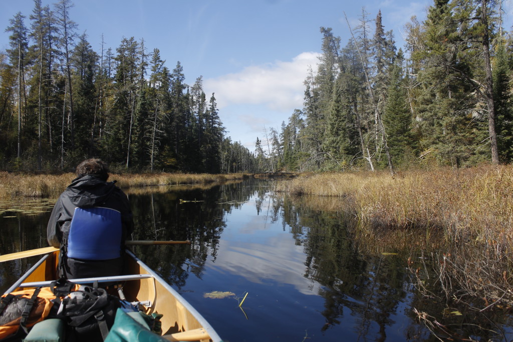
It is easy for rooted folks to distrust the drifter, someone who could chop down the family orchard for a quick buck, and move on to the next venture.

Now, more than ever, our money and our sense of gratification, move at light speed. A package from Amazon arrives far quicker than the time it takes a flower to become a fruit. We can reward ourselves with a thousand clicks online with less effort than it takes to cook dinner.
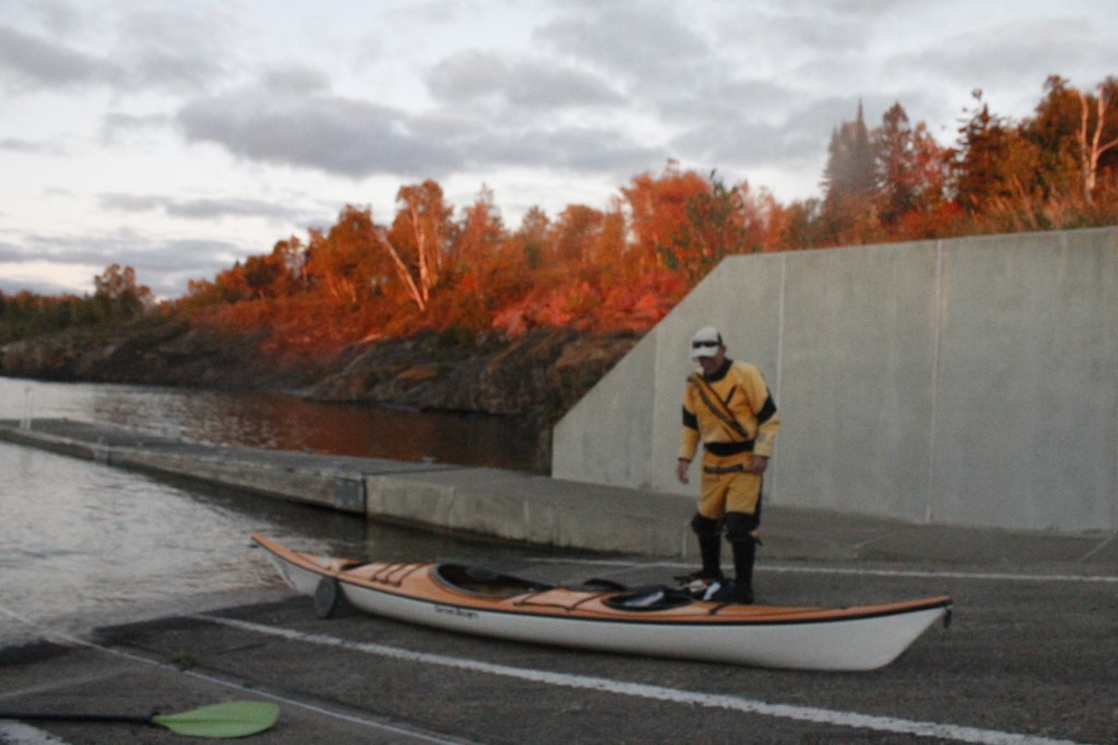
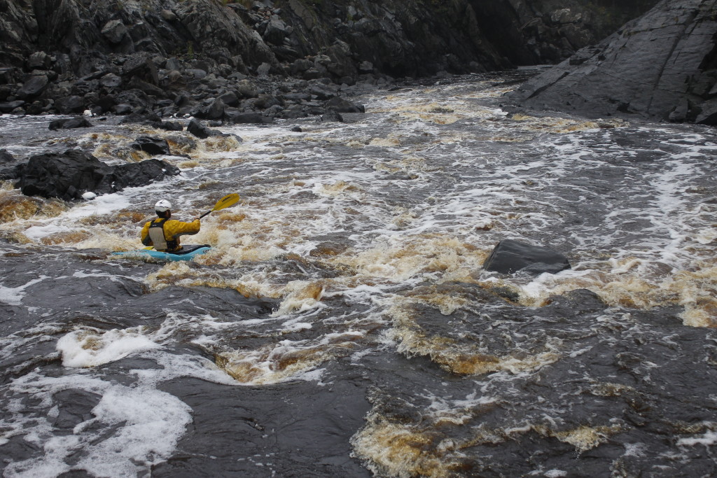
I realize, though I loathe admitting it, that this impatience is very much a part of me. Many times, when I was digging the ground or putting seeds in, I wondered if I would get distracted by something and let the garden fall by the wayside.

It was the sight of those first green shoots pushing up through the dirt that built my commitment. If I neglected the garden then, I would be failing the life that I had propagated. I needed to keep it around long enough so I could eat it.

One blessing I found in the garden, was that the plants I’d put in the ground had their own interest in being alive. As the plants began asserting themselves, I had less work to do. Perhaps, I had put the kale seedlings a little closer together than ideal for growth, but this helped crowd out the weeds.

And eventually, even my half-assed gardening yielded food, mostly the kale, which has come in fast enough so that I can eat it every night. And why not? It tastes great in stir-fry, it’s healthy, and a few bug holes don’t ruin it.

Fresh veggies are expensive here in Northeast Minnesota. Taking this one expensive item off my grocery list has saved me hundreds of dollars without compromising healthy eating.  The cherry tomatoes, which develop quicker than full-sized ones, are a nice investment too. If one cherry tomato goes bad, it’s far less of a loss, than if it had been a beefsteak.

Which isn’t to say that I don’t think about how much more the garden could have given if I’d put more time into it. The other day, I helped tend a garden at a nearby home where potatoes, beets and onions grew in abundance. Such root vegetables, seemed like a pretty good investment for a small amount of time.

I can look at that well-manicured garden and think, “good job,” reflecting that hard work was rewarded in kind by nice yields. Those fruits are worth more than mine, because they were tended with an abundance of love, focus and dedication.

My garden could be a parable of human failure, how our throwaway society has instilled in us the fallacy of expecting much reward for little work. But I am in no mood to expound upon the garden I don’t have. The treasures from the real  garden, however modest, motivate me better. It is a lazy yield, but it is my own. Therefore, I will take that bite of caterpillar-damaged kale, stir-fried with cherry tomato, and I’ll think, “Not bad.”


The Lester Test

_MG_6906
The first drop on my run down the Lester River. Photo credit to LeAnn.

The Lester River was the first stretch of whitewater that I’d encountered  in Minnesota.

I was just driving out of Duluth on the way to start my sea kayak guiding job last June, when I happened to look to the left side of the road to see an angry slice of high-velocity water churning through a   rock canyon.

“Whoa!”

I pulled my car into a puddle-strewn parking lot nearby and got out to look at the rapids.

The water ran reckless through narrow channels in the basalt, going over drops and throwing itself up several feet into the air whenever it encountered an obstacle. The late 2014 snowmelt fed the beast, as did the heavy rains of the last two days. I felt humbled but also energized by the river’s raw power. Just walking around the slippery banks, peering into the maw of one of the mean hydraulics gave me all the adrenaline I needed for one day.

It would be over a year later before I finally ran the section in a kayak.

Labor Day. The so-called last day of summer brought the crowds out to Lester Park. Situated on the eastern edge of Duluth, the park offers miles of trails for mountain biking, cross country skiing, running and hiking beneath tall stands of white pine. And then of course, there’s the river itself. The swimming holes beneath the falls were an attractive draw on a day when temperatures were in the 80s. Teenagers took to the cliffs for jumping, high enough to put a knot in my stomach and even more nerve wracking when they climbed up on trees so they could get higher yet.

I arrived with my friends LeAnn and Tammy, with whitewater yak cam-strapped with a cardboard sheet onto the roof of my ’93 Mazda Protege. Watch out world. Here comes the pro.

Since it was such a warm day, the three of us decided to take a dip in one of the pools. We opted to avoid the place with the crowds and found a smaller pool upstream that was below a falls. The rainfall during the last couple days had brought the river level up considerably, (though not as high as it had been on my first visit.) Brown tannins and sediment slushed together in the current, created a swirling eddy where we jumped in.

Rafts of foam spun around us. I gathered some into my beard. It smelled like dirty pine needles. I found out that I could climb to the top of a small falls and slide down on my butt. LeAnn and I took turns going over the drop, until I was so cold that I had to lie down on some black river rock to get warm again.

I did not volunteer to try any of the cliff jumps.

Finally, it was time for me to grab my boat. I did a quick scout along 3/4 of a mile of river, stopping to go out on a railroad trestle where kids were (again) jumping into the river. The gnarliest rapids were between Superior Street and the trestle and I spent a good time looking them over. Unlike the first time that I’d gazed upon them however, they no longer seemed impossibly dangerous.

There was a 6-foot drop before this, which looked fun, if not particularly hazardous to life and limb, and then there was a small drop after the main rapids, which I didn’t pay much attention. After that, the river smoothed out and flowed the rest of the way to Lake Superior.

I got LeAnn to volunteer with the camera, took the boat off my cardboard carrying rack and started walking up a trail along the river. It was hard to determine where to bring the boat down because the banks were steep and the further I went, the more tempting rapids I saw. Nonetheless, I knew I couldn’t keep everyone waiting forever, and ended up taking a fishing path down to a broken dam.

I put the yak down on some shattered rocks and eased myself into the water.

There were no big rapids yet, but the river moved fast. I shot between the pine trees on the banks, past boulders where the water pushed itself over the tops. There were a couple small drops that sent the water splashing up to my waist, up to my t-shirt. It was unbelievable that I was doing this in a cotton top instead of my usual wet suit and nylon splash jacket. The air and water were that warm.

Finally, I shot beneath a foot bridge and down the 6-foot drop into a pool. A crowd of onlookers cheered. I hung around in the eddy for a while so that LeAnn could get further downstream with the camera.

_MG_6907
Dropping off the with a convenient eddy waiting on my right side.

This was where the river got narrower, where it put the fear in me.

I tumbled over a concrete weir, paddling hard to get past any keeper hydraulics that might be waiting there. On the overpass ahead of me I saw LeAnn aiming the camera down to the river That was where the rapids started. The shadow of the bridge cast the river into a darkness, as if I were entering a gaping mouth.

I took a quick look up to LeAnn, and then put all my focus on maneuvering.

The sky disappeared. I steered my boat through the twists and drop-offs in dark water.

The light at the end of the tunnel was the sun glinting off the waves and foam of the big rapid. The one that I had spent long minutes staring at last spring, wondering if I could pull it off.

A nice thing about being on the water, is that once you’re moving, there is little time for morbid contemplation.

Here was the steep slope and narrow slope of water with a drop-off on the righthand side. Now I was going down it.

My trajectory was taking me straight for a massive wall, but I had planned for this. I paddled upstream and to the right, (overcompensating) and was briefly fascinated with the fact that I was trying to paddle uphill. If I could just muscle it a couple feet to the drop-off, I would be home free. Somehow, I got there. The nose of the kayak dropped away and sent me plunging down into the pool below. I went neck-deep in water, then bobbed neatly to the surface in a still patch of river.

_MG_6915
Coming out from the bridge and into the rapid, I need to turn right, and fast.
_MG_6916
I paddle for all I’m worth to avoid getting shoved up against the wall on my left side.
_MG_6917
Over the drop

I looked up at where I’d come from. It had been way to the right of the route, I’d planned originally, but it had worked.

I looked up to the bridge, and pumped my fist for LeAnn who was cheering.

I relished the moment, then turned to the last drop on the river which lay beneath the railroad trestle. It was a short little thing. No big deal. I lined up and shot over the edge.

I plunged into the water, expecting the momentum to carry me easily toward the finish line.

But, hey, that was funny. I wasn’t moving forward. Actually, I was moving backward. The rapid had fixed      a tractor beam on my boat’s rear end. I felt more annoyed than anything when I started paddling hard to get out of it. The next thing that happened was that the nose of my kayak went into the air, and I plopped backwards into the water.

Upside down in the swirling river, I had a moment to reflect on the value of staying vigilant. I also set my paddle for a roll, taking the time to get my paddle right so I didn’t screw it up. I dug with the blade and flicked my hips. I was back in the sunshine. The trestle jumpers were cheering. The keeper had relinquished its hold so I could float down the river like it was no big deal.

Beautiful willows sprawled out across the placid water here. The Highway 61 bridge framed the water of Lake Superior in a welcoming arch. I let the muddy current carry me out into the lake, where I could look across to the grain silos in Wisconsin, the tall buildings in Duluth’s downtown.

I got out on the beach, and walked the kayak up toward LeAnn, who met me by the road.