Amidst the chain stores, traffic and scalding asphalt that was Roosevelt, Utah on a late May afternoon, the snowy peaks of the Uintas Mountains to the north looked two-dimensional, a movie prop instead of a real landform.
The real world was an eternity of autos grinding down Highway 40, idling at the traffic lights, flashing blinding sun off their windshields. Stop. Go. Breathe the fumes.
I watched shoppers break sweat in the time it took for them to travel from air-conditioned truck cabs to air conditioned supermarket and fantasized about the high-country, that improbable territory where snow still lay on the slopes, ice on the lakes.
The Uintas are the tallest range going east to west in the continental US. The peaks form a wall between northern Utah and southern Wyoming, blocking roads and creating sanctuary for moose, elk and black bear — not the kind of animals people typically associate with Utah. There are even miles of tundra and muskeg — landscapes that would look right at home in an Alaska photo-album. Crowds that flock to Rocky Mountain National Park or the Tetons don’t bother with the Uintas, probably haven’t even heard of them.
Andrew, Jon and I wanted to spend four days up there, including an ascent of the 13,440-foot Mount. Emmons. Our cart was stacked with cheap, dehydrated, high-calorie food; a cornucopia of wheat bread, nuts, dried cranberries, raisins, potato flakes, pasta and flatbread. Judging by the amount of beans and broccoli we’d be hauling, the trip was bound to be a celebration of flatulence.
The whole adventure from trailhead, to summit and back would be a mere 24 miles and about 5,000 feet of elevation gain. We would camp near tree line at the Chain Lakes, which lay at Emmons’s base. As for the conditions on and around the mountain, that was anyone’s guess.
No one had been up to the Lakes so far this season, the ranger at the National Forest headquarters in Duschene told me. We could expect to find deep snow, and a good number of downed trees across the trail, she said. The trail crews would clear things out after Memorial Day.
In the meantime, no one knew how many trees had come down, exactly how many inches of snow were on the ground (going east to west there was anything from a couple inches to a couple feet at other locations) or what the snow crust was like so far. That last bit of information would be key. A strong crust would mean easy travel above the snow; weak crust could mean an exhausting slog through powder or slush.
“I’d be really interested to know what you find up there,” the ranger told me.
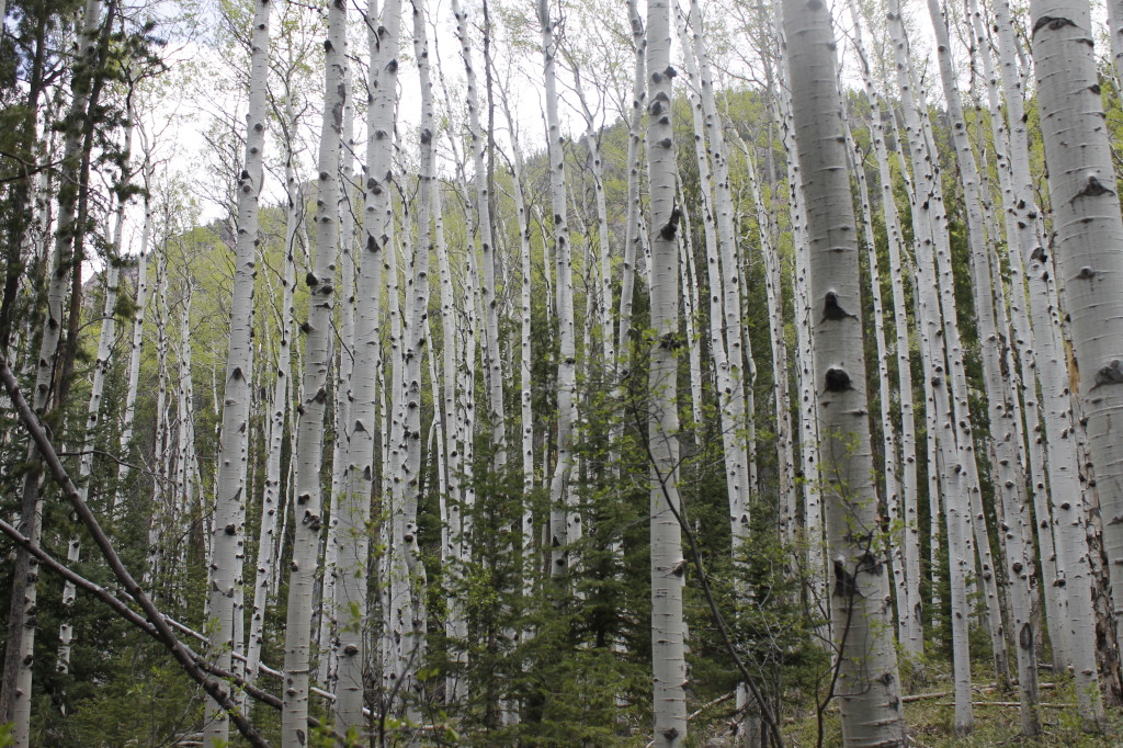
The highway from the city into the foothills took us through irrigated cropland and cattle range to clumps of aspen and lodgepole pine. The trees closed in as we got higher, until they formed an undulating mat upon the hills. Clear, cold water from the Uinta River ran with snowmelt toward the farmer’s fields below. No longer did the mountain landscape seem like the two-dimensional abstraction on the Roosevelt skyline.
I stepped out of the car into crisp alpine air, rich with pinesap perfume. The campsite at the Uinta Canyon Trailhead was deserted, excepting a couple of pickups that turned around in the parking lot. Birds chirped quiet melodies from the trees. The Uinta River gurgled unseen from somewhere in the forest. Evening brought the whine of mosquitoes, persistent, rapacious. We swatted at them constantly as we went through our supplies.
I elected myself to carry dinner food, while Jon and Andrew took lunch and breakfast respectively. We sorted food and gear by headlamp, our efforts punctuated with slaps and vows against the insects.
I finished packing at 10 p.m.. I still had my tent and enormous negative 40-degree sleeping bag to take care of in the morning.
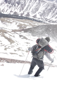
None of us would have light packs on this trip. After food, tent and clothes went in my pack, I lashed sleeping bag and water jug to the outside, pulling them tight with a shoelace. I cinched my snowshoes to the sides with nylon straps. They towered over my head like moose antlers. The whole conglomeration of stuff sagged outward like it wanted to fall apart already. I swung the pack up to my shoulders, almost fell over with the damn thing. The weight put steady pressure on my vertebrae. I was sure I’d be an inch shorter by the trip’s end.
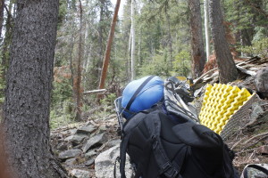
I carried the most monstrous sleeping bag in the group and heaviest tent. Jon’s pack, also weighted with snowshoes, looked heavy as hell, but seemed almost reasonable in proportions. Andrew took the cheese, though. He carried his backcountry skies, plus the weighty plastic boots.
A hot sun and muggy temperatures by 9 a.m. made the three of us look perfectly ridiculous tromping up the trail weighted down with winter gear.
We walked in silence. The compression on my spine and pack straps cutting into my shoulders like steel bands didn’t bring out the conversationalist in me. I was dimly aware of the new aspen leaves, which simmered like gold coins on the branches overhead, though aforementioned spine compression dimmed of my appreciation of the aesthetics.
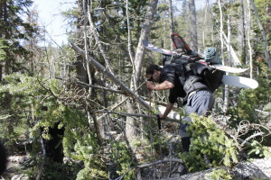
Fallen trunks and branches confirmed the ranger’s prediction about blow downs in the trail. Sometimes there would be space for us to walk around; more often, we would have to ease ourselves over the obstacles, watching out for limbs that wanted to spear our flesh and the weight on our backs that wanted to swing us, crashing into the mess of branches.
Two miles into the hike, my back and shoulders howled with pain. The real climb hadn’t even started. We rested by stream and ate food, less for energy, more for the psychological comfort against the grim toil of the pack slog.
A bridge above the river, marked the start of a thousand-foot climb out of the canyon along a series of switchbacks.
Sweat poured down my face, drenched my back. The first patches of snow appeared in the shadow of the trees.
Jon, who was walking in front, turned around and whipped a snowball. The missile flew over my head, flinging a couple ice crystals into my face. I raised my ski pole at him menacingly, but he was smiling.
“I got him!”
I looked behind me to where Andrew was brushing snow off his shirt. It had been a direct hit.
“Asshole,” he said.
The ocaissional snow patches became longer, deeper stretches along the trail after we crossed into the High Uintas Wilderness. We started sinking in.
Nylon gaiters above our boots helped keep snow out, but not forever. Melting slush near the ground found its way to our feet. Mine sloshed in an icy bath within half a mile.
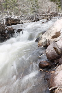
We stopped briefly next to the roaring Krebs Creek where Jon discovered that the bottom of his boot had begun peeling off. We walked on.
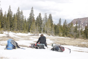
Snow made the trail hard to see, and hindered progress. If the ground had been completely covered, we might have put snowshoes on, but there was still enough bare dirt and rock that we didn’t want to try it.
Andrew pointed out a stream that looked like the one on the map leading out of the Chain Lakes. If we left the trail to follow it, there would be less snow than we would find in the trees, which harbored troublesome drifts in their shade. At least that was the theory.
Unfortunately, even the bare ground around the stream was soggy with snowmelt. Pools and runoff lurked beneath the grasses, creating ice-water booby traps for our feet. We stumbled along snowy cobbles with brush slapping at our eyes.
We stopped more than once to check our position on the map. It was already getting on toward early evening and it seemed like we should be in the neighborhood of the Chain Lakes. A mountain of bare gray rock and desolate flanks of snow rose emerged from the pines in front of us. It could only have been Mount Emmons.
When we came to Lower Chain Lake, we found several dozen acres of dark blue waves and flat, white ice. The water was low, and the sun-warmed rocks along the shore had melted off most of the snow so we could walk easily there.
The grace period ended when we climbed up to Middle Chain Lake. We pushed through a grove of trees, sinking thigh-deep in snow, fighting branches and clambering over logs.
A pine branch whacked against the top of my pack. Down came snowshoes, sleeping bag and water jug. I loosed a string of profanity. My frustration with the hours of fighting drifts and terrain boiled over into fury at a low hanging branch, whose only crime was growing out at the perfect height to fuck up all my careful rigging. I fought to reattach the items quickly, angry that I was delaying the group. Of course I did a shitty job, and it all swung down again. I put the pack back on the ground, calling it many things that were unfair; tied everything properly, and set off to catch Andrew and Jon.
They were at Middle Chain Lake, making their way through the deep drifts gathered at the southern end. It dawned on me that I no longer heard the familiar sloshing sound behind me.
Christ! The water jug!
I had forgotten to reattach it.
I threw my pack down and went back into the woods, where I found it about 200 yards away. 26 years old and apparently, I’m already doddering on the precipice of senility.
Meanwhile, Andrew and Jon settled on a campsite on a dry area near the woods. We set up tents and cooked dinner on my stove. The game plan was to wake up early and start along the path to Emmons before the heat of the day softened up the snow crust.
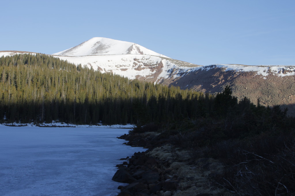
We had an oatmeal breakfast and a late start. It was almost 9 a.m. by the time we set out. Jon and I wore our snowshoes, Andrew slid on his skis with skins on the bottom so that he could climb uphill. By the time we reached the north end of Upper Chain Lake, there wasn’t much now so we shifted out of our snowshoes. For Andrew this mean switching out of his skis and boots and putting their weight on his back, a lengthy process.
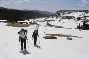
By the time we made it to Fourth Chain Lake, it was around 10 a.m. and we still hadn’t begun the main part of the climb. We’d had two ideas about how to get up the mountain. There was a southerly route up a bowl and then up the east face of the mountain. This was the route a Summit Post contributor recommended for the summer months, but I had my doubts as to whether we wanted to try the steep ascent in ice and snow. Our other option was a ridgeline to the north, which would involve a short, very steep ascent followed by a moderate ascent to the summit between two cliffs.
We’d been leaning toward the first option because the map showed a very steep climb to the top of the ridge. The climb looked more doable when we actually saw it. There would be a scramble up a tilted boulder field for about 500 feet to a steep cornice of hardened snow at the top. I thought I could see some moderate sections where we could climb over.
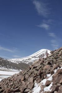
Boulders the size of refrigerators shifted beneath my boots as I picked my way up the slope.
I heard a thunder fall of rocks down below, Jon’s cries, “Andrew! Look out! Look out!” Nobody was hurt, but it was a reminder that we walked upon uncertain ground.
The cornice was perhaps 10 feet tall, with a couple sections that were sloped gently enough to climb. I went to one of these spots and kick-stepped my way up the snow crust. Eventually the slope got steeper and I had to punch my fists in for more purchase. After I topped out, I made sure to get away from the edge right quick.
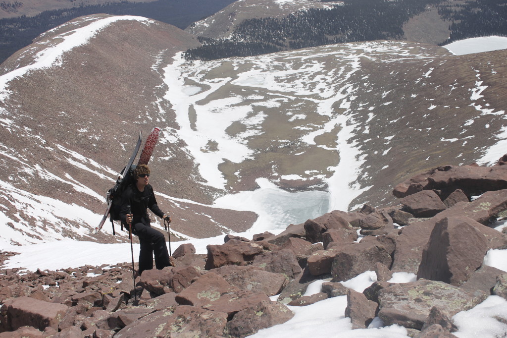
Andrew and Jon followed. The ridgeline afforded stunning views of the Uintas to the north, which included Kings Peak, the tallest mountain in Utah (Emmons is fourth, according to Peakbagger.com, and less than 100 feet shy of Kings in elevation, though much easier to access.)
We were well above the trees now, utterly exposed to the wind. I began to feel the altitude too. All of us slowed as we wound among the snowfields and up the rocks. More than once, I thought we had reached the top, only to find a false summit.
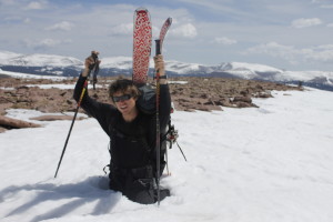
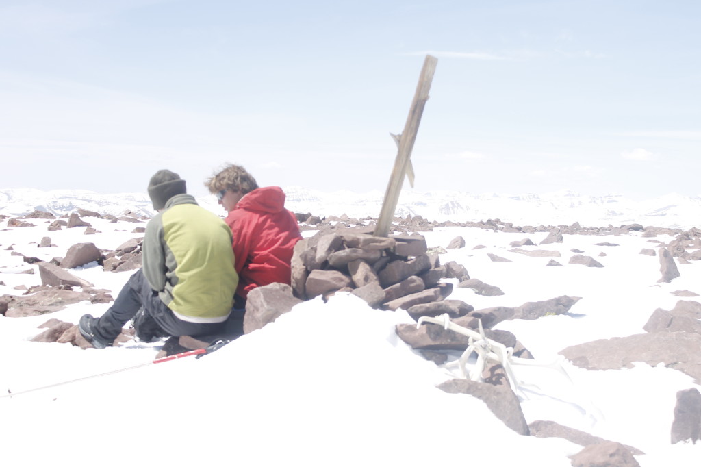
Almost two hours after we reached the ridge, we came upon the pile of rocks a battered wooden stick, and elk antlers that marked the highest point. There was a steel ammo can nearby containing a poncho, Gatorade powder and dehydrated food.
Take what you need, someone had written, feel free to donate your own stuff.
A ziplock bag held a logbook of past expeditions. The last entry was in September, 2013. Our entry: May 17. It had been about 9 months since anyone had summited, according to the records.
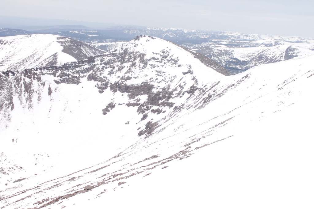
From on high we could gaze upon the slopes below us, down to the tundra wastes of grass and bog. I could replay our journey up from the Chain Lakes. The gutter of Uinta drained out to the green fields above Roosevelt, the gray-brown sage landscape south of Highway 40. Maybe someone in town was looking up at the movie set mountains, wondering if anything was up there.
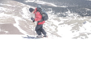
Andrew who had hauled his backcountry skis this far, was determined to ride them down. Jon and I didn’t have this speedy option, but could still descend rapidly if we glissaded down the east face. I just didn’t want us to descend too rapidly — not falling end over end, not in an avalanche.
A couple miles away we could see streaks going down the side of a bowl, where a couple tons of snow had broken off and plunged toward the bottom. The incline was much steeper there, but it was still something to watch out for.
The two of us without skis walked carefully down the steepest, most hazardous part of the slope, while Andrew glided in a conservative traverse. When the slope lessened, he let her rip for several hundred yards, in a tight series of turns. Jon and I went straight down on our feet and butts, with kicking up trails of loose powder.
The slope became too gradual for sliding, so I ended up running with big sliding steps, chasing after Andrew who was already at the bottom of the pitch.
“My shoe came apart,” Jon said.
Sure enough, the heel was completely detached from the rest. Fortunately the strap at the bottom of Jon’s gaiter helped hold it in place. I reinforced this with a shoelace cinched over top and bottom. It wasn’t pretty, but good enough to hold.
Shortly after, Andrew started back up the slope, looking for keys that had fallen out of his pack further up the slope. Shoe, keys, and water jug: none of us would walk away from the trip without owning some calamity.
Andrew found the keys about a third of the mile up the slope. We’d barely lost half an hour, but still faced the challenge of slopping through thigh-deep corn mush snow the remaining miles to camp.
A set of zig-zags and two parallel gouges marked our passage down the slope of the mountain behind us, the first tracks of the year.
