The Big Spit

Kayaks beneath cliffs west of Dungeness Spit. You can see the erosion coming down on the right side. Photos by Jarrett Swan.


The houses along the cliffs in Dungeness, Washington are beautiful and doomed.

Erosion marches slow and steady toward these stately manors. For now, they stand at the brink of the approaching edge looking out over world class views of the Strait of Juan de Fuca, Vancouver Island, Mount Baker — and that vast strip of sand jutting out into the water: The Dungeness Spit. At 5.5 miles long, it is the longest of its kind in the United States. The eventual destruction of those houses and the creation of the spit are linked in a fascinating Yin-Yang relationship.

More on that later.

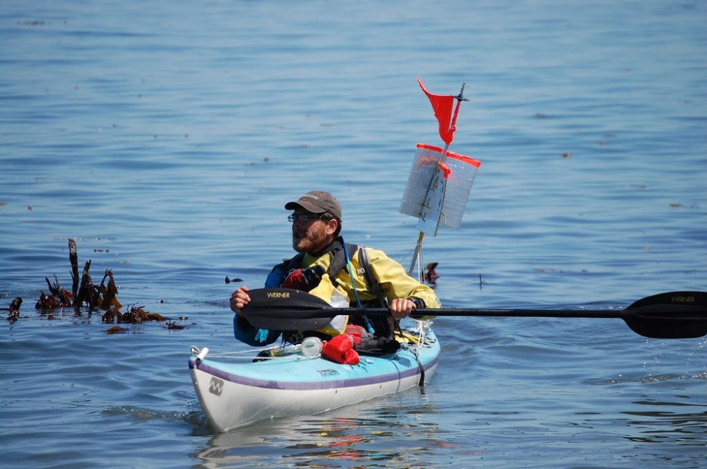
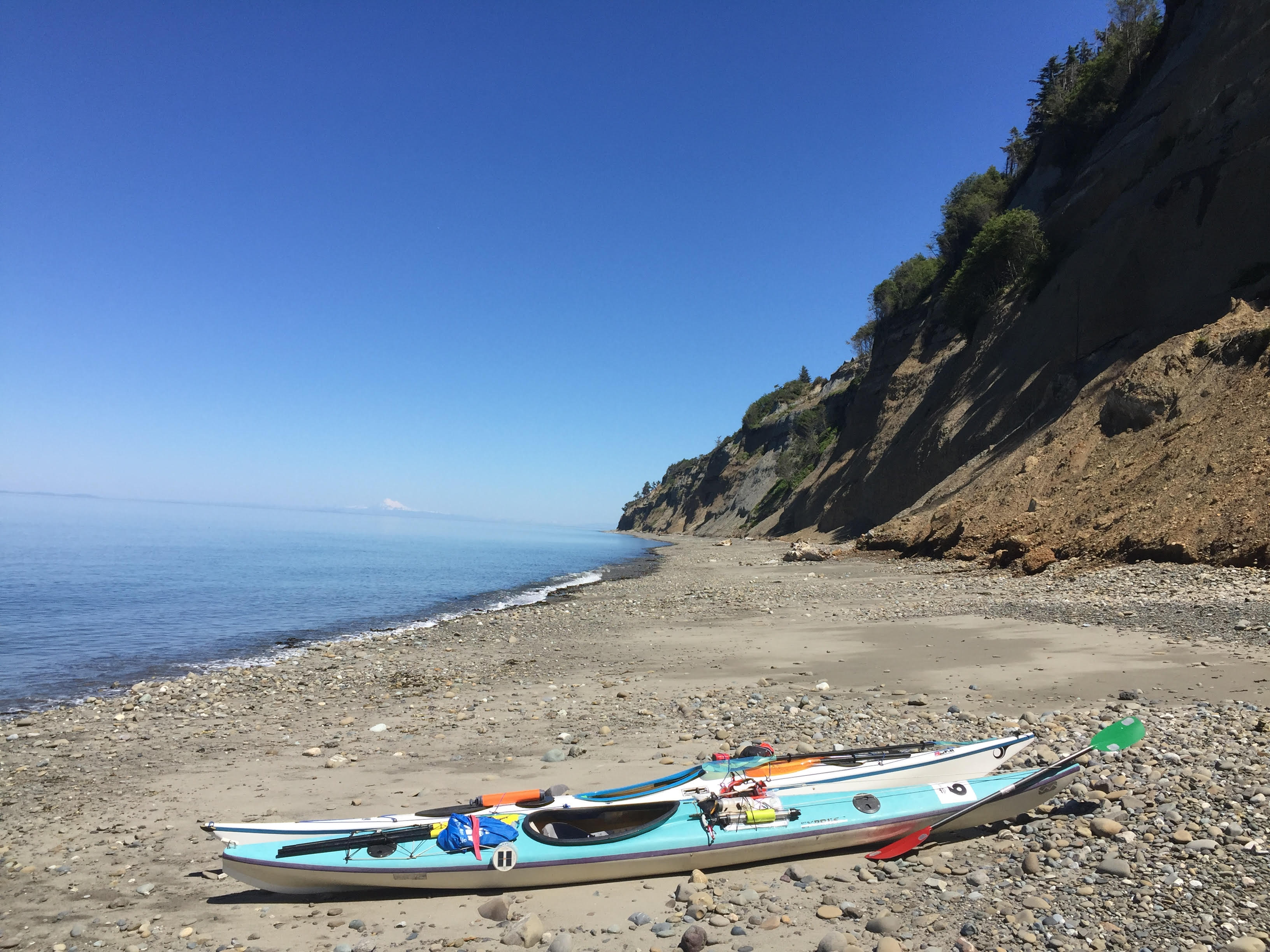
On a recent sunny day, I was also taking in the view of the Spit from my bicycle saddle. I was pedaling 17 miles back to Port Angeles to meet my friend Jarrett where our kayaks would be loaded on his truck. We would put the boats in the water out of Hollywood Beach downtown and paddle east with until we got to where my car was parked at Cline Spit in Dungeness Bay. It would be an 11 mile paddle with a short boat portage. If we went all the way around the spit instead of portaging, it would be a 21 mile paddle. You can probably guess which option I preferred.

The day was serenely beautiful, in a way that made me feel that, somehow, all was right with the world. I pedaled against a light breeze that cooled me nicely against the warm sun. Looking out from the sea-cliffs, I saw that half the water in Dungeness Bay was gone, vanished with the low tide of a new moon. In a couple hours, the powerful flood tide would start refilling the basin as our boats took advantage of the eastbound current in the strait.

Mature and juvenile bald eagles wheeled above the shallow waters. I saw them take turns harassing ducks. A small crowd had gathered on on the cliff to ogle a large juvenile perched in the branches of a fir. Signs nearby warned them not to get too close to the edge. It was eroding rapidly.

Even the road I was biking seemed uncomfortably near to the edge of destruction. I wondered how many years it had left.

A couple miles later, I was biking through the amber fields outside of Sequim. Earlier, I’d  planned to bike to nearby Carlsborg and catch a bus to Port Angeles. This plan would have involved sitting in a bus stop for forty-five minutes breathing exhaust from Highway 101. If I pedaled a little faster, however, I could still get to Port Angeles in time for Jarrett and I to catch the flood tide.

I took backroads to the Old Olympic Highway and connected with the Olympic Discovery Trail. The trail was blissfully un-busy, weaving in and out of forest where the leaves cast dapples on the pavement.

Instead of highway exhaust, I breathed the cool scent of ferns and moss as I maneuvered switchbacks into creek gullies. A couple miles later, the trail popped out at the coastline, where acres of kelp and sea lettuce steamed on the hot cobbles.

By the time I reached Jarrett’s place, he was still packing/eating breakfast.


“So what do you think about wearing drysuits today,” he said.

“It’s going to be rough with this heat,” I said. “I’m probably going to end up splashing myself a lot. But it’s worth it having the extra safety.”

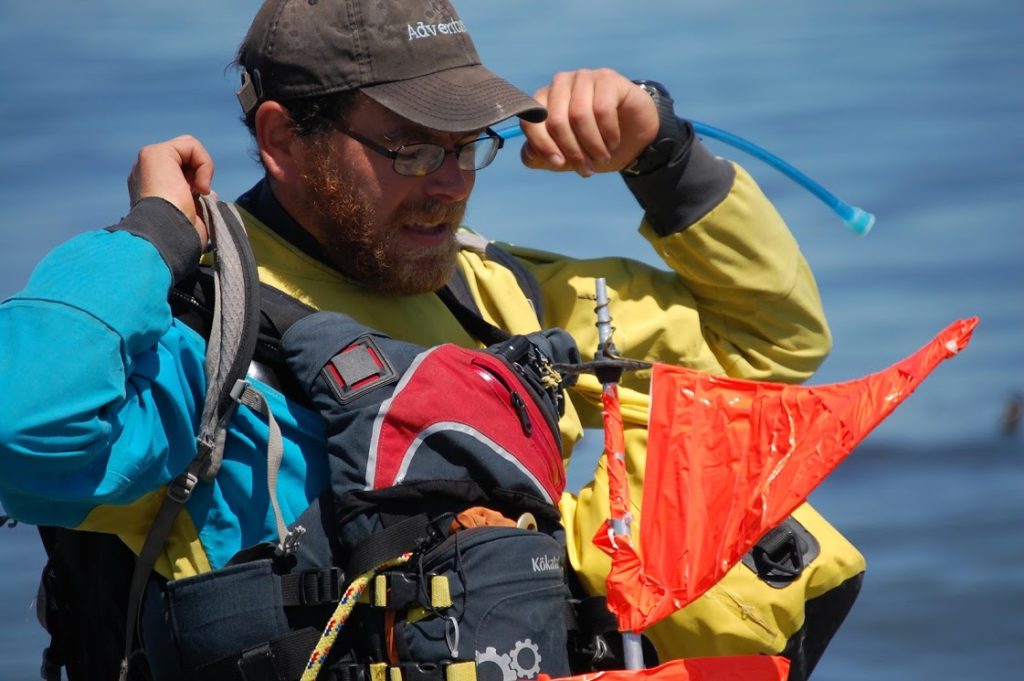
“Yeah,” he said. “Though, I was thinking about just wearing my Farmer John today.” As it happened, he had two of the sleeveless wetsuits at his place. One would fit me.

The only thing was, I had this awesome drysuit that really worked at keeping the water out. A prolonged immersion in the water was extremely unlikely, but I liked to think that I could be immersed in the water for a long time and turn out fine, thanks to my drysuit. Was that really the best course of action? Heat exhaustion from paddling in the full sun was another risk. I had to weigh.

As I looked at that beautiful orange suit of waterproof fabric, leaving it behind felt like a betrayal.

“I mean … I love my drysuit,” I said.

“Yeah, I love mine too,” Jarrett said. Both of us were wavering. “But I don’t think it’s going to be any fun paddling in it today.”

“Screw it. I’ll take the wetsuit.”

Emotional attachment is not the best rationale for choosing gear anyway. Take it from a guy who’s had (too) much loved hiking boots fall apart on him on the second day hiking the Hundred Mile Wilderness.

Our drysuits stayed on their hangars.

Padding beneath the pilings at the abandoned Rayonier Mill site


The hot sun and warm air at Hollywood Beach reinforced our certainty: We had made the right decision. Before I got in my boat, I deliberately dropped in the mucky shallow water to get myself soaked. The cool water evaporating off my trunk was most welcome as I started paddling.

The beginning of our trip stayed close to shore, following the riprap barrier below the Olympic Discovery Trail where bicyclists zipped past our boats on the way to Morse Creek.

“Bikes move faster than kayaks,” I observed.

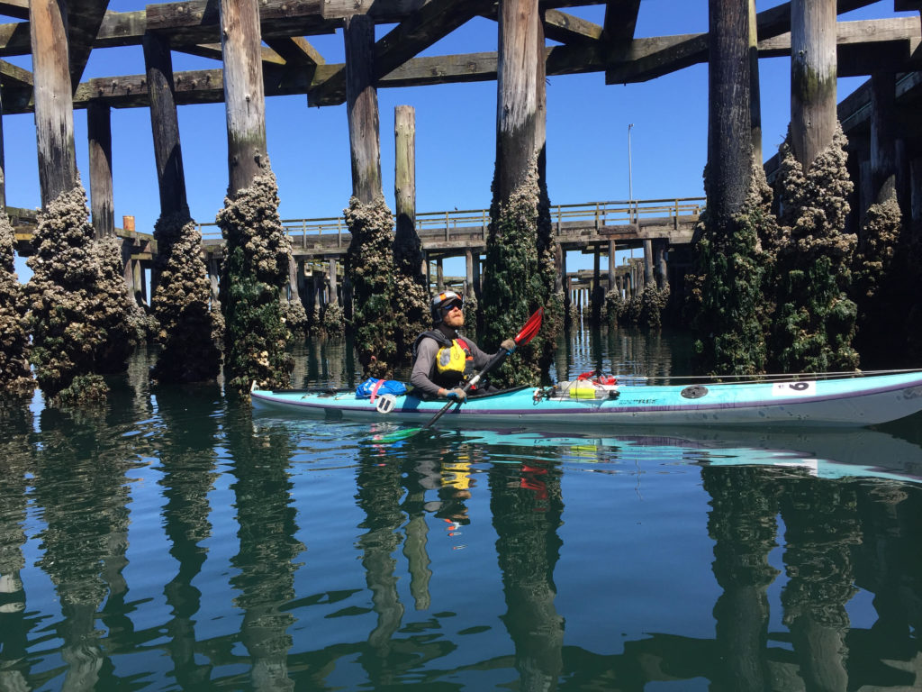
Though we may have been lagging behind the bike trail traffic, we had more opportunities to explore, including the haunted remains of the Rayonier Mill. An abandoned wood pier with tall pilings jutted out in front of us, offering dark narrow places where we could squeeze our boats through.

Closed since 1997, the mill recently marked its 20 year anniversary as a Superfund cleanup site. The mill had been a major paper goods manufacturer that processed wood chips into consumer products like film, cigarette filters and diapers. The business also left behind some less desirable products, such as PCBs and dioxins. The EPA labeled Rayonier as the biggest polluter in Washington State in 1993.

In the film, “The Memory of Fish,” former employee Dick Goin recalls seeing fish coming down Ennis Creek turning belly up as soon as they came in contact with the mill discharge.

Tons of toxic soil have been hauled away but the cleanup is ongoing. A chainlink fence separates it from the bike path.

It is scheduled to be completely cleaned up (at least by the government’s standards) by the year 2026. Meanwhile, Rayonier, headquartered in Jacksonville, Fla, still owns the site and has paid out millions to clean the site. I have been running and biking past the site for over a year now, and have yet to see any work that looks like cleanup.

The large wooden pilings jutting out from the pier represent another hazard.  Within a hundred feet of them, I could smell the tarry scent of creosote. As it happens, the county’s latest shoreline strategic plan proposal bans this type of piling, presumably due to the fact that creosote is toxic and will eventually leach out into the environment.

The spaces beneath the piers had the subterranean feel of a subway station, with pilings instead of pillars, the flutter of cormorants’ wings instead of pigeons. More alien were ochre sea stars the size of medium pizzas feeding on the mussels along the posts. They hadn’t gotten the memo about the toxic creosote, I guess, though I’d hesitate to say that the presence of life precludes the possibility of environmental harm.

Clearly the pilings provided a large amount of surface area for clinging life.

Northern feather duster tube worms jutted out like mummified cinnamon sticks. Below the water, the worms released their delicate red fans of feeder cilia at their ends — about the size of silver dollars. I couldn’t resist letting my fingers brush up against one. The reaction was immediate: the cilia shot in, sending a blob of bubbles upward.

White plumose anemone’s wafted in green water further down, trolling for bits of plankton.

The next couple miles of paddling took us past a coast that was armored by riprap. The busted stone kept the shoreline from eroding, though there were still a couple landslide zones behind the bike path After Morse Creek, the riprap went away. Massive earthen sea cliffs jutted up, cutting off access to the headlands except for in the occasional creek gully.


The blissful day called for a lack of hurry, and small explorations. Jarrett and I took a stop at one of these gullies and found a small campground on what appeared to be private property. We ate lunch, paddled for half an hour, got out again so I could explore another gully. There is supposed to be a large cavern hidden somewhere in these cliffs, but I couldn’t find it.

At one point,we heard a crack and a few pounds worth of stones and dirt clattered off the cliff onto the beach below. Further on, we saw where someone had built an elaborate sequence of wooden steps down to the water from above. The only problem was, the cliffs had given out and the steps were mangled, half fallen off.

A week before this paddle, a woman hiking along the beach below of one of these cliffs stumbled upon a giant wooly mammoth molar that eroded out of the substrate above. Over the years, locals have found pieces of mammoth skulls as well as tusks from these bluffs. Jarrett has collected (legally) a few pieces of petrified wood in these places also.

The cliffs were so interesting to look at that we stayed close, even though we could have caught a faster current out in the strait. They were just damn interesting to look at, these weird conglomerations that were neither stone, nor sand exactly. There was symmetry between the delta shaped drainages and the pyramidal deposits at their base. They formed hourglass shapes, and like hour glasses, they marked time by the passage of sand.

The warm colors and the bleakness of the walls was desert-like, reminiscent of African coastline.

All I had to do was ignore the pine trees along the top. It certainly felt hot enough for us to be pulling out of Algiers .

“Thank God, we didn’t wear the drysuits,” I remarked.


When we started getting hot, we had the 54 degree Strait water to cool down.

We got out of our boats and waded in the water along the beach. I practiced getting back into the boat from my kayak, and got a couple pointers from Jarrett, who made it look easy despite his high center of gravity.

“See the lighthouse?”

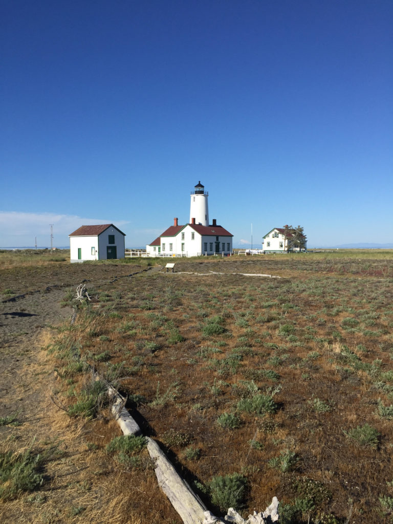
He pointed, and I could see the New Dungeness Lighthouse, built near the end of the Dungeness Spit.

We were getting close.

The cliffs became even more unstable as we paddled along, so much so that they now tilted forty-five degrees, with enormous piles of sand and gravel accumulated at their bases. We stopped our kayaks for a moment to watch erosion in action. There would be a sudden tinkling noise and a flow would start moving down the cliffs. It looked kind of like a waterfall, it was falling sediment. The flow would continue for a minute or so before it ran out. Then another flow would begin somewhere else.

“It’s like the cliffs are taking a leak,” I said.

These must have been the “feeder” cliffs that I had been hearing about. The super-fast eroding ones were moving backward at a a rate of three feet a year. Watch out!

Why are they called feeder cliffs though?

Because they feed important ecosystems and landforms in the local environment. That sediment leaking out from the cliffs would eventually reach the water, creating the ideal substrate for eelgrass beds, which are habitat for juvenile salmon and other small marine critters. Longshore currents and tides carry much of the sediment further, and it deposits on the Dungeness Spit. The spit is born out of the destruction of these cliffs.

A similar deposition process helped form the three mile long Ediz Hook, which gives Port Angeles its harbor and is home to the local Coast Guard base. The Hook has faced erosion over the decades however, partly because of the dams on the Elwha River, partly because of all the riprap around Port Angeles. The dams (now demolished) plugged up useful sediment coming down the Elwha from the mountains. The riprap, still plugs up the useful erosion coming down from the sea cliffs around Port Angeles, and diminishes a supply that could still be used to rebuild the Hook. Last year, the U.S. Army Corps of Engineers contracted with a construction company to expedite that building process by dumping several tons of cobbles off the Hook. In 1995, the Corps was paying up to $100,000 a year moving rocks out onto the Hook. It is ironic considering that the Hook is threatened precisely because of the tons of rock laid out along the Port Angeles shoreline.

The falling sand beside my kayak reminded me of dead trees in a forest or compost in a garden. Something needed to die for rebirth to happen. Humans with their usual impulses to leash the unruly universe had mucked the system well.

A mantra entered my head as I paddled: “Don’t resist the rot of this world.”

The cliff, is falling away, so don’t build there. Let the sand slip out of your grasp, let dead leaves crumble into dirt. There’s a place for it all. Don’t interfere until you really know what you’re doing. If you don’t figure out this much, maybe it’s better to sit back, slow down and see how nature can do it better than you do.

The undeveloped beaches around Dungeness Spit are far nicer to paddle than those around the Hook. There are easy places to land a kayak, fewer power boats to dodge.

The Hook is crowded with its access road, boat launch and the navy docks under construction. The Dungeness Spit has no roads, only the lonely lighthouse at the end.


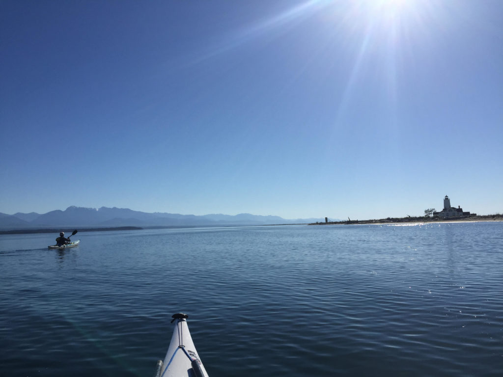
If we paddled all the way around the lighthouse, we would essentially double our trip, making it about 21 miles. The other option would be to portage over the spit and paddle directly to my car, shaving 11 miles of travel.

Jarrett was in favor of the later plan. I wanted to change his mind, but didn’t want to be pushy about it.

“So…” I said. “What would you think about going around?”

“No man. I’ve been doing kayak tours all week. I think I’m done today.”

I was bummed, but didn’t want to end the trip on a sour note by arguing into getting my way.

“No sweat, Man. It’s been a great trip. Where should we portage?”

Jarrett scanned the beach where tourists and day hikers were thick on the the sand.

“We’ll go down a little ways to get to somewhere where there aren’t as many people,” Jarrett said.

The lighthouse was drifting closer into view.

Jarrett kicked his kayak into high gear. My muscles ached to keep up. I was glad he was in front though, because I had a feeling that he actually wanted to go around the lighthouse. It was my job to shut up and let him decide it for himself.

For half an hour we raced down the spit with the wind behind us, saying nothing. Finally, Jarrett put his paddle down on the deck.

“That lighthouse is getting pretty close.”

“It is,” I said.

“Alright. I could go around. You game?”

I pumped my fist.

“Hell yes!”

The New Dungeness Lighthouse. Glacier Peak is visible between the lighthouse and the building to the right.


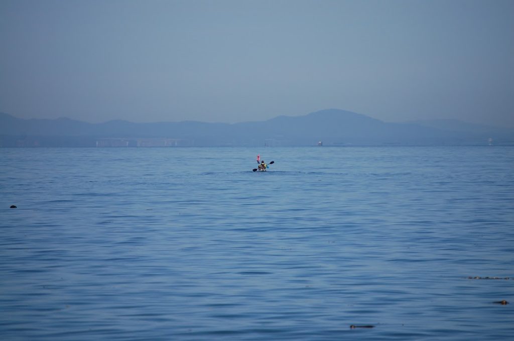
We celebrated our decision by pulling off and grabbing some food on the beach. The Cascade mountains had grown taller and better defined. My view included Glacier Peak and Mount Baker and the smaller mountains on the San Juan Islands. Behind us we had a view up into the Obstruction Point Ridge area and Elk Mountain where there 1,000-foot snowfields clung to the north faces (Stay tuned for news of my next Doorstep Adventure.)

Time was no longer on our side. After we launched the boats back out, I saw the strands of bull kelp were straining against an ebb current. We were fighting the tide now.

The current only got stiffer as we rounded the spit into Dungeness Bay, slowing progress to a crawl. The tidal grip weakened as we got further into the bay, however. We pulled our boats up on the bay side of the lighthouse to do some more exploring.

A small footpath led us up toward the white building, with its red roof and central lighthouse and tower. It dates back to 1857.

Faded laundry flapped on a line above the lawn. I saw one man reading a book outside. The scene looked peaceful and old-fashioned. I felt that I could drop in, find a seat, put my feet up on the railing and argue about whether one of those newfangled steam engines would ever really outrun a clipper ship on a broad reach.

I’d accept the invitation to stay at the lighthouse, where I would write at hardwood desks, gather salt in my beard, look out at waves, wear sweaters.

In fact several people reserve places for the of staying at the lighthouse. 2018 reservations are going for $375 per person per week or $2,250 for the whole house. To earn your lighthouse keep, you also tend to chores like tending the lawn and polishing (daily) the brass inside the tower.

A small driftwood sign pointed an arrow back down the Spit to where it connected to the mainland. “Real World: Five miles.” I saw the appeal.

The spit stretched west as a sandy ribbon down the middle of our sightline, diminishing with distance. There were breaking waves from the Strait to the north and calm water inside the bay. The proud houses on the mainland were distant, superfluous seeming. You could see the worried world from this dreamy perch on the sand, but the worries were at arm’s length.

Empty beach replaced the large crowds we’d seen at the west end.

Few people hiked all the way out, not only because of the 10 mile round trip, but also because it meant trudging that 10 miles over soft sand at a tilted angle.

This long stretch of land doesn’t just isolate lighthouse keepers from the bustle of the mainland. It is also a popular spot for birds, who benefit from being able to nest in an isolated spot where predators are less likely to come and get them. The south side of the Spit is a national wildlife refuge, which is off limits to human visitors. Signs warn boats not to get too close to the land.

We got back in our kayaks and started paddling back to the “Real World” with its email, riprap and superfund sites. Part of me wanted to stay out on the spit away from the noise waiting on the mainland. On the other hand, I was hungry and had eaten my last Clif bar. The lighthouse keepers come back to mainland for similar reasons, I imagine.

As the sun got lower, we started seeing eagles wheeling across the sky. I saw the cliffs where I had biked earlier, my car parked in the lot.

Jarrett and I high-fived at the boat ramp. 21 miles on the water. No regrets.

Thankfully, the road hadn’t crumbled off the cliffs by the time it was time to drive back home.

Paddling into Dungeness Bay. The Olympic Mountains rise up to the left.


FURTHER READING

Mammoth finds around Port Angeles sources:

Who’da thunk it? Those crumbly cliffs around Sequim are full of mammoth parts!

A big find: Locals stumble upon mammoth molar on Sequim beach

http://www.burkemuseum.org/blog/mammoth-find-sequim

Feeder cliffs sources:

Clallam County, Washington is in the middle of updating its Shoreline Master Plan document. Much of the document is policy proposal (i.e. a prohibition against creosote treated pilings as seen at the Rayonier site.) The document also talks about how feeder cliffs work by depositing their erosion into the sea, which eventually helps build up sandy deposits like Dungeness Spit

http://www.clallam.net/LandUse/documents/CCSMP_dftSRP0213.pdf

Ediz Hook rebuilding sources:

This Peninsula Daily News article discusses the recent Army Corps of Engineers project of dumping cobbles onto the northwest side of Ediz Hook in order to shore up the hook against erosion. Come to think of it, this is exactly where I had struggled to land my kayak against the crashing seas on my recent Lyre River trip. A sandy beach would have been nice.

http://www.peninsuladailynews.com/news/rocky-additions-to-cut-ediz-hook-erosion/

The cobbles were only of many attempts to save Ediz Hook from erosion. This source reveals the $100,000 a year that the Army Corps of Engineers spent (as of 1995) to rebuild Ediz Hook. While the report points to the  Elwha River dams as one of the main reasons that the Hook is no longer rebuilding itself, it also points to the problem of shoreline armoring, which has prevented valuable cliff erosion from going into the sea and rebuilding.

https://play.google.com/books/reader?id=dC03AQAAMAAJ&printsec=frontcover&output=reader&hl=en&pg=GBS.PA92

Information on the Rayonier superfund cleanup site:

This Peninsula Daily News article talked about the 20-year history of the Rayonier Mill as a Superfund site.

http://www.peninsuladailynews.com/news/rayonier-20-year-anniversary-sees-site-still-dormant-with-2026-as-cleanup-target/

I watched a screening for the film Memory of Fish a couple months ago. The film explores the decades fly fisherman Dick Goin spent on the Elwha River, the decline of the salmon that he watched over the years, and his push for dam removal on the Elwha River. Shortly before his death, he got to see the Glines Canyon dam come down. Goin was also a former Rayonier employee. The film explores his ambivalence about his role working for a company that polluted fish habitat.

http://www.thememoryoffish.com/#intro

Information on the New Dungeness Lighthouse:

If you want to live on a lighthouse for a while, the folks at New Dungeness would like to talk to you.

http://newdungenesslighthouse.com

Oh yeah, why is it called the New Dungeness lighthouse? Was the old one destroyed by a storm?

Nope? The old one is actually back in Dungeness, England. George Vancouver named the Dungeness Spit after Dungeness, England because it reminded him of back home. Thanks Wikipedia!

https://en.wikipedia.org/wiki/Dungeness_Spit

A lot of stuff around the Northwest got named by or after Vancouver’s expedition. See Mount Baker, Mount Ranier, Puget Sound, Port Townsend, Discovery Bay, Protection Island, Vancouver Island, Whidbey Island…etc.

Bike Climbing and Snow Sliding: A Doorstep Mount Angeles Expedition

There was the world of the pavement and there was everything else.

Pavement was the Hurricane Ridge Road, an asphalt tendril climbing out from Port Angeles, and penetrating into the Olympic Mountains. was is the accommodation that allowed the river of internal combustion to flow uphill — the shuddering swarms of Harley’s, Subarus, Tahoes and other vehicles to convey their day-trip passengers toward the snow realm up above.

They looked out of windows, and saw the other world: the treacherous stands of stinging nettles and shoots of devil’s club armed with vicious barbs, diaphanous leaves of the big leaf maple shifting iridescent in the sun mist. They were just starting the climb, these visitors. So was I.

I too, grunted and shuddered my up the pavement, and I did it in the lowest gear on my bike. The plan was to notch another entry in the doorstep chronicles with a doorstep ascent of Klahhane Ridge.

The ridge is 6,000 feet above Port Angeles Harbor. It forms what I think of as the most impressive feature you can see from town. Torturous layers of jagged stone jut up out of the ridge’s west side to create the 6,400 foot summit of Mount Angeles. Snow clings to the shadowed north slope, even in July and August.

I knew I was going to pedal long and hard to get there. I knew my back was going to ache and that I would loathe the traffic going past my bike. The bike ride was the part I wanted to get over with before I traipsed merrily up the trail toward Mount Angeles. I thought of all the cars going by as I kept the bike tires on the narrow margin.

But sometimes you sweat the climb a thousand times before the wheels start turning. As I started up the hill, I found myself in a pleasant frame of mind, enjoying the sun on my face. I let my eyes wander off the road and up the narrow gullies where pearly-white freshets cascaded over moss. Fat orange salmonberries grew in the roadside thickets, though they were not quite ripe enough to eat.

An occasional vehicle did perturb my reverie, but the traffic was far lighter than what I had feared. It had been dumb to spend so much energy climbing the mountain in my mind earlier.

After over an hour of climbing, I had knocked out about five miles, which brought me to the entrance station to Olympic National Park. I found a place in a rumbling line of vehicles, then kicked my bike along with the rest of the traffic inching its way toward the kiosk.

Eighty dollars later, I had a crisp new National Parks Pass in my wallet and was pedaling past thick-trunked Douglas Firs. The investment felt good, especially knowing the threat national parks throughout America face from the current president and others who follow his brand of thug-ignorance.

A vehicle stopped ahead of me so that passengers could click at a doe and her two fawns — the size of puppies with delicate white spots along their flanks. These park deer registered minimal concern about my bicycle or the other traffic along the road. I hoped no one had been feeding them, but the world is rich in well-meaning fools.

The lush understory from the lower elevations dropped away to thinner pine forest, with long views across the valley to Blue Mountain and the snow covered face of the Obstruction Point ridge. Day-trippers wandered from their cars to get in front of the views.

“You must be a glutton for punishment,” one woman called after me as I chugged by with my heavy pack.

“I’m loving it out here,” I called back.

Fifteen miles and 4,000 feet after I left my doorstep, I pulled my bicycle up to the trailhead for the Switchback Trail. I immediately peeled out of my soaked shirt and replaced it. A couple of peanut butter banana wraps were the calories I needed before the hike. Water gushed down the mountain valley, melting off the thick patches of snow higher up the way. A guy plodded down the trail with a pair of skis on his back. A minute later, his daughters caught up with him, also with skis.

“How was it out there?” I asked.

It was skiing for the sake of novelty at this point, the man admitted. They had found mushy snow that tended to cave in near rock outcrops. The biggest worry was the fog, which was still wrapped around the mountains higher up. There were no regrets about getting up there though.

The beginning of the Switchback Trail was a muddy line zigging up between stands of Alaska yellow cedar and mountain meadow. Tiny alpine flowers were coming into bloom. Groups of black-tailed deer meandered lazily through their forage, with velvet on their antlers.

I encountered snow gradually, then all at once. A few patches over the trail, became large swaths where other hikers had kicked steps in for traction. No need for me to get the crampons out yet. I did use an ice axe to cut up a couple of switchbacks on the snow.

Typically, cutting switchbacks is a hiking sin, because it tramps out vegetation and can cause erosion. In this case, the snow absorbed the impact of my waffle stomping feet and I could proceed guiltless.

Still, the axe and crampons proved to be overkill for the expedition, where the majority of the climb was snow free.

By the time I reached the crest of Klahhane Ridge, the clouds had closed in thoroughly. This was my turnaround goal, Climbing to 6,000 feet from my home at 300 feet above sea level wasn’t such a bad day. Yet, I knew I could go further. Last year, I had taken a little used side trail up to one of the peaks of Mount Angeles. The tallest peak (which I’d also climbed last year) would be out of reach from this approach, but I would still be at almost the same height of 6,400.

The ridge divided the mostly snow-free area where I hiked, from an entirely different world on the north face. Here, in the shadows, I could peer over a 45 degree slope, where a chest-deep slab of winter snow held onto the rock. Peering down, the white snow blended seamless into the nothingness of the cloud layers. It was impossible to tell where one ended and the other began. The depthless white concealed danger as well as or better than darkness would. I understood why the skiers had been freaked out.

Still…what a ride it would be. All I had to do is hop over the edge, and start sliding on my butt. I’d gather speed — tremendous speed — as I flew into that great white unknown with the ice axe as my only brake. It was a thought that was as terrifying as it was appealing. I thought of Herman Melville who wrote a whole chapter in Moby Dick regarding the terror of white:

“…there yet lurks an elusive something in the innermost idea of this hue, which strikes more of panic to the soul than that redness which affrights in blood.”

The rock scree on the south side of the mountain was enough excitement for the blood right then. The slope looked like a cake turned on its side, with various shales, sandstones and basalts that were bastard children of volcanism and ocean floor upheaval. The rock was pulverized into bits and pieces. I kicked my boots in for purchase in pencil shards of shale.

The basalt was more solid, but still dicey. I test wiggled every hand hold before I put weight on it. Often I would find a toaster-sized rock, just waiting to tumble down slope. When I had the chance, I used my axe to “dry tool” out holds in the rock above me. There were even a couple of snow slopes, that I used the axe for, though I didn’t bother putting the crampons on. Carrying them up 6,000 feet of mountain was just my way of making sure I got the proper dose of exercise that day.

Eventually, the rock got more technical — as in technically, it was class IV climbing if that sounds impressive. I ditched the backpack, and scrambled my way up the last section to a lookout slab.

The clouds hid plenty, but I also saw a good amount of the June snow slopes to my north. The concealing nature of the fog made the jagged landscape more mysterious and menacing. I grinned in the wind for a couple minutes, then started down.

Descending the scree was predictably unpleasant. I placed little trust in any one footfall. Still, I got a little fun out of glissading down a couple snow slopes. I got a little too ebullient on one of these jaunts, and missed my chance to sink my axe in before the snow went out. The result was a bit like coming to the end of a waterslide to find that someone had replaced the pool with a gravel pit.

I emerged slightly battered and slightly humbled, to hike the rest of the way down the Switchback Trail (and glissade a few more snow slopes.) Though I had hauled heavy snow pants up this far, I didn’t bother putting them on. Instead, I worked on a new glissade technique, sliding backwards on my hands and feet with the axe twisted sideways. When it was time to hit the brakes, I turned the axe into the snow. The method worked OK, for the short sections that I had to deal with, though my hands were thoroughly chilled in their thin gloves.

Near the bottom of the trail, I took a moment to sit on a boulder, while clouds parted and mountains strobed in and out of the early evening light. I let myself breathe in satisfaction. These are moments that reaffirm that adventures, even day trips, have unfathomable worth to me. More and more, I have begun to believe in the Doorstep Adventure and I want to take more of them. If I cannot be in the places I love most, without putting money in the pockets of the people that destroy them, perhaps I don’t deserve to be there.

And it is important to find an equal measure of joy to the hardship that comes with getting into wild places without an automobile. Otherwise, why the hell did you bother coming out?

If you drive up to Hurricane Ridge and have a crappy time, you wasted a couple hours and a few dollars’ worth of gas. No biggie. Hey, let’s catch a movie sequel at the theater.

If you bike, hike or run from sea level, you better enjoy yourself out there, or else you just squandered a day’s worth of time and effort. So you have a good time.

The bike ride up had been fun for sure. The ride down was a complete blast:  14 miles of (almost) unadulterated descent. I leaned my way past curves and through mountain tunnels, white knuckling it with fingers on the brakes. I used the brakes as little as possible.

I Kayaked to Canada

Me in my kayak with radar reflector mounted on back as I prepare to cross the Strait of Juan de Fuca. It’s a new kayak, by the way. Like it? — Photo Credits to Emma Lanham.


Ah, Victoria. How many nights have I seen your lights shimmer like so many jewels above the dark water?

How many windless days have I squinted over the pale miles in the Strait of Juan de Fuca that lie between — days when I thought I should launch a boat and pay a visit?

How many times have I watched whitecaps rage out of the west, or watched you disappear behind cold fogs — fogs where unseen ships, tall as buildings, moan out warnings?

It has always seemed so easy to get there, yet also impossible.

But I got tired of waiting.

Eventually, I pushed my boat off shore, and put my paddle in the water.


As a straight line journey, it is possible to kayak north from Port Angeles, Washington to Victoria, British Columbia in about 18-miles.

The journey crosses a couple of busy shipping lanes, patrolled by seven story cargo ships, supertankers and cruise ships. The tides go west to east on the flood, and east to west on the ebb, so it is easy to get pushed well off course — not to mention the difficulties of what would happen when a wind picks up. There are plenty of shallow banks out there that create choppy, confused seas.

It wasn’t the distance of the paddle that intimidated me; it was the exposure to hazard, the fact that I would be a long way from shore if something went wrong. But this would only be a training run.

I recently signed up for the first leg of Race To Alaska, a motorless boat race starting in Port Townsend, Washington and ending 40 miles later in Victoria. Competitors who do the full race go all the way to Ketchikan, Alaska.) Even though I was only going only a short fraction of the 750 miles to Ketchikan, it was still a longer open-water crossing than anything I had attempted before. I was nervous about it.

I recently had a dream that I was out there in the middle of the crossing in 15-foot waves breaking around my boat. I remember asking my kayak buddy what the hell we were doing out there.

Dreams are typically inaccurate though. What kayak buddy? I was making the crossing alone.


I stood on Ediz Hook, north of Port Angeles, looking across to Vancouver island, trying to see Victoria out of the smudgy haze. The plan was to let the ebb current carry me to the west. Then at around 1:30 pm the tide would turn around and start carrying me northeast toward Victoria. This course had the advantage of spending less time in a north-south shipping lane, but it brought the total trip distance to 22 miles.

I almost put the kibosh on the whole voyage when I realized that the slack tide (the window where there is no significant current) in the middle of the Strait would be a couple hours later than I’d planned — pushing my departure time toward midday.

The winds were supposed to pick up slightly later in the afternoon. It was nothing near high enough to be a big deal. I would only worry if I happened to be alone in a kayak in the middle of the Strait, miles from land.

In the event of an emergency, I had a new hand-operated bilge pump, a spare paddle, a paddle float (which would help me get back into the cockpit if I got flipped out of the kayak) and some extra warm clothes, stuffed into a dry bag. I was also borrowing a flare gun and a VHF radio that I could use to signal for help if necessary.

My latest creation was a signal flag/radar reflector mounted on the kayak’s back deck. I fashioned it from an old ski pole, orange duct tape and some reflective foam I cut off of a windshield cover. The thing added visibility so ships could see my boat. Kayaks tend to hide out in the crests of waves, concealed to vessel operators and their radar systems. My jury-rigged contraption gave me a better chance of being seen, but also made my boat more vulnerable to wind, and made the prospect of rolling a capsized kayak back upright more dubious. I secured the pole upright with guy-lines attached to the deck cords. There was an awkward lean to the array, but I didn’t spend much time trying to fix it. The tides were going to turn around soon and I needed to hustle.

As I got ready to push the boat into the water, a voice called out, and I was surprised and happy to see my friends Jarrett and Emma coming down the beach to see me off.

“That’s Victoria, over there right?” I asked Jarrett, pointing towards the hazy smudge of land on the other side.

“It hope so” Jarrett said. “You have that new compass on your deck you should use.”

He helped me carry the boat down the last stretch of slimy rocks into the water. Emma took photographs.

I was glad to hear later that my duct tape flag stayed visible long after my kayak faded from sight.

With everything else loaded into the boat, putting myself in it was the last challenge, made more difficult by the seat sliding forward. It took a minute to stuff my leg into the cockpit and to find the pedals.


Final preparations onshore.

I paddled a slow loop around the bull kelp and then I pointed my bow northwest.

There water was glassy smooth. I paddled with my sprayskirt off so that I could vent heat from the cockpit. I paddled with fast, light strokes out into the open water.

About a half-mile out, I found an enormous stipe of bull kelp from last year, lolling on the surface like a rotting anaconda. I grabbed hold and broke two feet off the end of the tube, grimaced, and bit a hole in the top end. I lifted my new bugle to my lips and blew out a loud note: “Heeyaaaaawhnk!” It was about as loud as a ship’s horn and would be another way I could make my presence known on the Strait.

For the first miles of paddling I kept my eyes trained on Canada, occasionally looking left and right to watch for ships. I saw one cargo ship moving in from the east, but was comfortable that it would pass well in front of me.

Later, I passed within two miles of a large container ship, and cut about four miles in front of another one. There were a couple smaller boats out there also, but none got uncomfortably close.

I set my course toward a small white point on shore that turned out to be the lighthouse at Race Rocks. When I got there, I would have gone past the southernmost point of Vancouver Island and halfway to Victoria. I would keep well away from the rocks though; the area was known for dangerous currents.

Meanwhile, my kayak began to undulate up and down in four-foot swells. I swung my boat around rough patches where the water danced in swirls and sharp little ridges. The swells were still too round to crash over the front deck, but I worried that I would get nauseous if I stayed out in them too long. After about half an hour, the water smoothed again.

I was starting to see the Canadian coast in better definition: gently rolling hills, populated by pines.

I heard a short puff of breath, and looked to my left to watch a harbor porpoise roll out of the water. A second later, its companion popped up behind it.

“You are so awesome!” I declared. The porpoises went back under, but reemerged a moment later.

15 minutes went by, and then I saw another pair of porpoises come up to breathe on the other side, blowing out their puffs of air.

My nervousness about the trip began to subside, and I paddled with confidence.

I passed by Race Rocks without incident and started turning the boat more to the east so that I could take advantage of the flood tide.

Seeing no other large ships coming out of Victoria harbor, I decided not to worry as much about the shipping lanes. A buoy nearby revealed that the current was already flowing in my favor. I took a break to eat some food I’d squirreled away into my fanny pack as I cruised toward the final destination.

A large cruise ship marked the harbor entrance. A sharp current was moving into the harbor now and I swung quickly past a group of people hanging out on the jetty nearby.

The place was busy. There was a whole neighborhood of houseboats moored on some nearby piers. Tiny yellow taxi boats took people back and forth across the harbor while sea planes landed in and out. People on pleasure cruisers played tunes and lounged in board shorts and bikinis. I felt like a spaceman in my drysuit, out of place as usual.

Well, I was an alien here after all. I was legally obliged to report my presence as a foreign visitor to the local authorities. I tied up at the dock in Raymur Marina where there was a courtesy phone and a number to call Customs. I read out my passport number to one of the officials, announced my plans and received my own special number that indicated I had permission to be in Canada. That was it.

I sat down on the dock with an orange, watching a woman lead a kayak paddling class. The snowy reaches of the Olympic Mountains rose up above the buildings. I was starting to like this place. It would have to be a brief visit though.

I had about 20 minutes to enjoy paddling before I needed to haul my boat up and get to U.S. Customs at the ferry terminal so I could make the return journey.

The harbor went through a sharp narrows before it opened up again into the downtown. I flew through on the current.

The really tricky part was figuring out how to get my boat up to the ferry terminal. The only public docks in the harbor were a good distance away and metal retaining walls around the harbor cut off access.

The best way I could find to get on shore was a small park where I could get out of the water and lift my boat over a jumble of rocks. Two Canadians helped me out.

“Holy shit man!” one of them exclaimed when I told him where I’d come from.

They asked me how long it took me to get across the Strait, and I figured it was just about four and a half hours.

“That’s faster than the sailers make it sometimes,” one of them remarked.

Unfortunately, my awesome kayak is a lot less of a swift machine when it is out of water.

I was still nowhere near the ferry terminal and had to walk with my kayak and its radar reflector for about a quarter mile of busy sidewalk to get to the ticket booth and when I got there my spine was killing me.


Going through customs with my kayak was nowhere near as scary as I had worried   — no one checked the hatches for contraband maple syrup or hockey pucks. But I still had to wait 90 minutes to get on board the ferry back to the States.

One of the customs guys was a kayak fisherman and we talked for a while about our boating experiences.

I watched a tractor trailer get off the ferry and cut the corner a little too close around the customs pavilion. Crunch! Several pieces of board fell to the asphalt and a bunch of government employees went to chat with the driver while others took photos of the scene.

Poor bastard.

And poor me. I had to pick the kayak up and bring it back onto the ferry.

I went above decks and watched as the boat pulled out of Victoria Harbour. I paced around the deck in my spaceman suit, making note of different landmarks I would want to remember for the Race To Alaska finish.

Eventually I went downstairs for a victory beer. The greater challenge still lies ahead.

Victoria, it was a good visit, if a short one. Hope to see you again soon!


Me beginning my crossing. Vancouver Island is in the background. You can’t see Victoria, but if you squint, you might notice the large cargo ship  on the horizon in front of my kayak.

Birthday Miles

“But at my back I always hear/ Time’s winged chariot hurrying near;” — Andrew Marvell, To His Coy Mistress

The day I turned 29 last week, I slipped into some running shoes, clipped on a lightweight backpack and ran out into the dawn streets toward the bus station. I felt tightness in my tendons already. Would I be able to run the miles this year?

Most of us follow some birthday traditions in our lives: blowing out candles, accepting presents, getting together with friends for drinks. Such rituals foster good times, but also lend significance to the otherwise capricious passage of time. They put a brave face on the reality that each birthday brings us one year closer to that inevitable appointment with the reaper. Well-rounded and wholesome-minded souls might be unperturbed by this truth — for them a birthday is another milestone in a roadside built up with monuments to their accomplishments.

For those of us who are prone to rumination, for questions about the road not taken, there is something irrevocable and unsettling about suddenly becoming a year older. It’s the feeling of walking down the hall and hearing a thousand doors slamming shut behind.

So, I am not this person that I was supposed to be. Why haven’t I done that yet.

In the face of such questions, my solution is to inject significance into the day with a challenge: running the distance, in miles, of my age in years.

This is a challenge that my dad has been doing for a while now — albeit these days, he is also biking and kayaking to finish the miles. When he turned 50, he did run 50 birthday miles.

He started me running, biking and kayaking on my birthdays as I grew up.

I tried my first all running day when I turned 19, freshman year of college. I had meticulously planned an out and back course, only to find a freight train parked on the tracks, 8 miles into the run. There was no way around, and the fact that I could here the train engines running made crawling under the cars a sketchy prospect at best.

I reluctantly turned around, staggered up to my dorm room with 16 miles logged, and went online to map out the last three miles that I had to run.

I went on to run birthday’s 20, 21 and 22 on that same bike path, though I went in the opposite direction to avoid the possibility of getting hung up in the same way.

The experience of running the birthday miles built my confidence for my first marathon, which I ran at age 22.

For the next couple years, I skipped the birthday miles because I’d have a marathon within a month or so, and counted a marathon distance instead.

Once I turned 27, I had to run more than a 26.2 marathon course. I was in North Carolina, not in great running shape, and camping with some friends on the Appalachian Trail. I planned to skip the miles, and yet, when I woke up early, I found myself in running shoes, with plans for a short run along the trail. The trail run turned into 17 miles with a big climb above the Nantahala River valley. Then when I got back to the tent, with everyone starting to wonder what the hell had happened to me, I announced that I would be running 10 more miles later that day, which I managed to hobble through in Smokey Mountain National Park.

I turned 28 while I was visiting Yosemite with my Dad, who I recruited into being my support driver. This time, I added a 2,000 foot climb on the road out of the park, and though I ran slowly, I ended up feeling fine right afterward.

A month later I was in Washington, and tried my hand at the North Olympic Discovery Marathon, which follows a bike path along the coast. There are no 2,000-foot climbs, but there are some steep little creek valleys to climb out of, and it can get hot.  My 2:55 finish was a personal worst out of seven marathons, but it was fast enough to win the race.

I am going to run the race again this June, but I am terrified that some running hotshot is going to swoop in out of left field to kick my butt.

My birthday miles plan incorporated the marathon course so that I could get a psychological edge for next month. It helps to know the enemy ahead of time.

After I ran down to the bus station (1.6 miles), I made a connection that took me to the marathon start line at 7 Cedars Casino.

The casino was still closed up as I ran beneath the awning where the race had started last year, and clicked my watch. I had 2 liters of water on my back (too much), a couple Clif bars and a banana for fuel, as well as rain jacket squirreled away to guard against the possibility of precipitation. Luxury! If it rained on race day, I planned to tough it out in my race singlet and try running myself warm.

The fact that I had all this weight on my back, wasn’t really racing, etc. should have dialed down my competitive side, but I had set the watch, and couldn’t ignore its judgement. I didn’t allow myself to turn the watch off when I made bathroom breaks or went to grab food.

I chided myself for my brittle stride. Groin and achilles tendons were tightened up after a week of faster, longer, runs. Try as I might, I simply couldn’t will my legs to turn themselves over as fast as I wanted. I checked my watch with growing trepidation. I’ve gotten slower! I’m going to lose this damn marathon next month.

The course left the woods for the town of Sequim, where I brushed past high schoolers going to school on foot, bike and skateboard. There were also a number of elderly walkers — Sequim is extremely popular with retirees. On the outskirts of town, a sign announced that the trees overhead were frequented by bald eagles. I looked up, and saw none, though the snowy peaks nearby fir the bill as far as inspirational scenery I saw plenty of more gray-haired pedestrians negotiating the pavement with canes and walkers.

Yep, I thought. Keep moving. That’s the thing. 

Movement is an obvious metaphor for life. Our feet can take us in many directions, dictated by circumstance, dictated by whims. As a runner I think of the fact that just about any long distance I’ve undertaken has had both highs and lows, moments of drudgery, thrills of discovery, disappointments and sometimes the realization that I am more capable than I had imagined.

I’ve often thought of the birthday miles as important because they recreate hardship, represent, overcoming the weight of years. Yet as I ran past the farm fields outside Sequim, I thought of how oppositional this thinking was. Some miles are better savored than conquered. If you aren’t having at least a little fun out there, you are doing something wrong.

On this particular run, I enjoyed seeing the buds coming out a little bit more on the trees. I enjoyed crossing the bridge above the Dungeness River, the waters running swift with snowmelt. Inevitably, I came back to the stiffness in my tendons and my strides.

Unfortunately, the hardest part of the course was still ahead. For a couple miles, creek drainages form a series of deep cuts into the landscape, creating severe ups and downs. I lost all semblance of graceful stride as I ground my way though the inclines. Finally, I emerged at the top of the last climb, about 6 miles out from the finish line. I was too shot to enjoy running down the hill.

I crossed the trestle above Morse Creek, and in another mile I was running along the shoreline for the final stretch to Port Angeles.

I took a quick stop to admire an enormous river otter that was frolicking out in the waves.

When I started up again, it was at an awkward lurch.

My watch was at 3:37 when I hit the finish line. If nothing else, it was still faster than Paul Ryan’s  personal best marathon, so that was something. I clicked the watch off.

I still had to run 1.6 miles, climbing 300 feet of streets to get to my apartment.

This climb can be a bear after a long run. Nonetheless, I used the same motivation I’ve been using all year, which is to imagine the big Cascadia Subduction earthquake rattling the ground beneath my feet with tsunami sirens howling in my ears. As the vengeful wave curls toward the city, I keep running. I race the surging water as it climbs the streets after me. Sometimes, it races past my ankles at fifth street, but I always make high ground just before it knocks me down and rips me out to sea.

It may seem morbid that I enact this little scenario literally every time I run up that hill, just as dark, that I have the inevitability of death on the mind when I run birthday miles. Yet it is strong motivation for me to know that I can only do these things so long before I slow down and eventually stop. When I ran up the hill fleeing death in the form of an insurmountable wave crashing at my feet, I had a goal: to get home with a minimum of screwing around. Sometimes that’s the best you can ask for.

On Blasted Seas: A February Kayak Surfing Safari in Washington

“Ahh, I’m hoping to avoid that happening to me,” John said.

He was looking at the back of a heavy-set man in a plaid jacket, lurching awkwardly, painfully, from his vehicle across the gas station parking lot toward the doors of the convenience store.

The vision was quickly gone, as we were speeding down the highway out of Port Angeles, two beautiful fiberglass kayaks strapped to the roof of John’s truck. There was no way to assess whether we had seen a man who’d eaten a few too many convenience store Twinkies over the years, or whether other factors like injury or illness had robbed him of the ability to walk easily.

Either way, even the brief sight of those tortured steps made an impression on John who, at 65, has seen plenty of his peers go down the road of decreasing ability and decreasing will to be active. He’s nowhere near slowing down though, keeping active through mountain biking, road biking and going dancing with his wife.

And he still hits the water in his sweet fleet of kayaks multiple times a week, winter weather be damned. He logs eight-mile downwind runs in a dagger-fast surf skis on Lake Crescent, regularly plies Port Angeles Harbor, amidst the log booms and harbor seals. Last fall, he and a friend paddled across the Strait of Juan de Fuca to Vancouver Island and Victoria, British Columbia. (some 30+ miles.) When he needs a little more adrenaline, he’ll take his squat 14-foot plastic kayak, “rock gardening” — a pastime that involves veering the boat into, out of and over rocks when the waves are crashing in.

The waves would be crashing in today, alright. The forecast called for a strong wind flowing out of the Fraser Valley in Canada, howling down the Haro Strait to our launch at Freshwater Bay — a few miles west of Port Angeles. The National Weather Service had posted a Small Craft Advisory. Even so, the weather in Port Angeles was mild and windless. Feeling complacent, I only put a thin layer on beneath my drysuit before I headed out the door.

The tree branches did not clash, nor was there any other sign of wind as we drove along the road down to the put-in. It was only the last turn in the road, before I saw the trees begin to sway. Then I looked at the sea.

“Whoa!”

There were six-foot slabs of water rolling in, toppling over themselves in blasts of angry foam. The shallow, tidal beach only extended the violent interplay between land and water — row, upon row of breakers snarling into shore. When strong westerlies trouble the Strait of Juan de Fuca in the summertime, Freshwater Bay is usually a patch of calm. On this first day of February, it was the rodeo.

Further out, the sea hardly seemed kinder, with the waves rebounding off of Bachelor Rock creating more tumult. Even mightier waves loomed up and broke over themselves just beyond the bay.

To the north lay the snowy flanks of Mount Baker. It seemed to me that some hoary war god was pointing his finger at us from the summit, whipping up the armies of the sea against our launch.

John and I consulted. The waves were bigger than we’d expected, but we were confident we could punch our way off the beach in his 16-foot fiberglass kayaks. Maybe we wouldn’t be doing any rock gardening today. Maybe we wouldn’t even go out of the bay, but just getting on the water would be a worthy adventure, one with an exciting opportunity for surfing off the beach.

Before we headed out, both of us put some extra layers on beneath our drysuits for warmth. I slapped on a rain jacket too so that I could use it’s hood. John didn’t bring any head gear, but I gave him a wraparound hood, that I’d salvaged from one of my old jackets.

“Only trouble with these hoods is that they cut out peripheral vision,” I said.

Nonetheless, we agreed that it was going to be helpful to have as many warm layers as possible on this blowy February day.

I was also glad to have someone like John on board, who has spent years kayak surfing off the Olympic Peninsula and has experience in kayak rescue and other gnarly situations. An ex-prison guard (you would never guess from his easy smile or ready laughter), his job required that he be able and willing to restrain, incapacitate or kill violent inmates. This reality didn’t make him into anyone’s hardhearted authoritarian. In fact, he sympathized for the prisoners he watched, and thought it was all too easy for people in desperate circumstances to make the wrong decision. He is passionate about the marine environment and worries about what global  warming is doing to the waters that he plays on.

For the first part of the day’s game, we set our boats on the damp sand, just within reach of the waves, got in, snapped sprayskirts into place, started scooting ourselves toward the melee.


The tide in shallow Freshwater Bay goes out  quite quickly, and we had to scoot ourselves after it. Finally, a big swell of water lifted me off the sand, and I started paddling immediately, taking no time to put my hands into the insulating neoprene pogies on the paddle shaft. At first, the kayak’s upturned bow sliced easily through the sub-waves. Then, one of the larger breakers crashed right in front of me, burying me chest-deep in frothing water.

The kayak slowed, but I dug back in with the paddle, pushing myself forward. To lose momentum was to give up the game and get thrashed back into the beach.

I got to the face of the next wave — a taller one — just as it steepened before the break. This time my bow pointed up at the sky, and I dug in against gravity with ferocious strokes. The kayak nosed over the top, and bellyflopped onto the water on the other side. The wave exploded behind me. The next few waves were in varying stages of collapse, either allowing me to paddle over them, or else breaking over my deck.


Once we were away from the main break-zone, we were in less immediate danger of getting smashed up by a wave, but the waves were still steep, and more than a few of the bigger ones were still still break over themselves unpredictably — a nasty surprise for a kayaker.

“Keep looking to your left,” John advised.

Aye aye, Captain. I flipped my hood down so I could get a wider arc of vision.

The prettiest kayaking out of Freshwater Bay is arguably along the rock cliffs and sea caves to the west, but in these conditions, that area was sure to be a breeding ground for treacherous reflector waves and sneaky breakers coming over the reefs.

We opted to go east toward the mouth of the Elwha River, where there would be a sandy shore. Before our bows, Klahhane Ridge rose up in a snowy 6,000 foot wall above Port Angeles. It was backlit, but spectacular as always.

I kept looking to the left. The steep waves were forever on the cusp of rolling over. I would lean into them, and support myself by sinking my paddle into their sides with a high brace. Here and there I would accelerate my boat or slow down to avoid a surprise breaker. As I watched John’s boat disappear and reappear behind waves, I contemplated how difficult it would actually be for one of us to rescue the other if one of us capsized. Yes, it was safer that there were two of us, but as the seas got more wild, we had look out for ourselves, and keep an eagle eye on the water.

“There’s a break zone above that reef over there,” John called.

That patch of sea on our right was a place I knew because it usually offered calm. During the summer months, bull kelp growing off the sunken rocks there tended to dampen the incoming waves. Now the kelp was gone, and the waves were stacking up over the shallow water. Bathymetry was no academic concern here. Water depth had everything to do with whether we could glide over the waves or whether they would crash on top of us.

On our other side, there was another line of breakers, easily-eight feet high. Impossible to tell whether there was another reef there, or else some weird wave convergence/amplification happening in that zone. What was clear was that we were paddling a shaky corridor of relative safety between two much more violent zones. There was little to suggest that the big violent breakers further out couldn’t push their way in toward our current position, making for dangerous paddling.

John and I opted to turn about. The current in the strait was going west with the ebbing tide, carrying us back toward Bachelor Rock quickly.

Here and there were patches of fizzy water where tiny bubbles danced to the surface. Danger! These marked places where waves had broken recently and were likely to do so again quickly. I swerved my boat around one of these bubble patches, just before another wave came up and crashed in the exact spot.

“Wind’s dying down!” John announced.

The air was calmer now and warmer, though the sea was still bucked and heaved.

Perfect surfing conditions. We pointed our bows at the shore and waited to catch a ride. I flipped my tracking skeg down for better handling (John’s was disabled from gravel that had clogged the mechanism during  our seal launch off the beach,) started paddling tentatively in the wave direction..

The first wave nudged my boat along for a couple yards before it surged past me, but no matter, it gave me the acceleration I needed to catch the next one. I felt the back of the boat lift up as the bow sunk down into the trough. Leaning forward, to bring the weight of the boat to the bow, I paddled hard, then cut my speed so I wouldn’t overshoot. In no time, the wave was whipping me into a broach — turning me sideways in spite of the skeg and a hard stern rudder stroke.

I flipped my weight onto the other side, leaning straight into the wave face as it broke around me. The paddle fought for purchase in the aerated water. My head and torso were horizontal now. I jammed hard on the paddle and instinctively flipped my hips, sending myself back upright to finish my ride in triumph.

“Whoooo!”

The wave petered out and I quickly swung my boat around so that I could meet the next one head on. I noted that I had a slight ache in my shoulder blade due because of my sloppy high brace. Shoulder dislocation is one of the most common injuries that happens to kayak surfer. The risk is lessened by making sure to keep the paddle well in front of your torso while bracing, however. John and I paddled back out a few more times to catch some more waves. I had some good rides, but none as adrenaline filled as the first.


The wind began to blow again, knocking down the swells and diminishing their surfability. John and I paddled further off shore to check out the water around Bachelor Rock. The small sea-stack, with its lone, wind-snarled pine at the top, creates the western boundary of the bay. It is often a place where the currents muddle into each other and the waves get weird.

Today, Bachelor was sending out reflector waves — almost as tall as the primary waves — out at a right angle into the wave direction. Where the crests overlapped, it created steep, short-lived towers of water, followed by a sudden drop-off. The water was difficult to predict or brace off of.

I intended to get a small piece of the action by cutting close, but not too close, to Bachelor and then turning back into the bay. But circumstances were going to give me a closer look than I wanted.

As I approached the rock, I realized that the tidal current was beginning to push me into the worst water. A jolt of adrenaline went through my system along with the realization I needed to act quickly and precisely to get out. I swung my bow to the northeast and paddled hard. Meanwhile, I had to make constant micro-braces with my paddle blade as the water rose and fell randomly around me. John matched my course from a distance, though I could only catch glimpses of his boat through the waves. The only path back into the bay was through a break zone, which I traversed diagonally with strokes timed to avoid the breaks. Luckily, nothing crashed on top of me and I got back into the safer water unscathed.

But where was John?

I swung my boat 180 degrees, and saw him very close to Bachelor, his kayak rising and dropping in the chop. His expression was etched in concentration as he made quick adjustments with his paddle, reading and responding to the chaotic water. Eventually, he spat himself back out from the danger zone.

He, like me, had drifted closer to the action than intended, and gotten a nice shakeup out of the deal. With the hood cutting down his peripheral vision, he’d been caught unawares while turning his boat around, looked up to find himself right up next to Bachelor and in extremely chaotic water.


Both of us had adrenaline pumping through our systems. Once we were out of the danger zone, the fear had left and reckless joy rose in its place.

We surfed back into the beach, loaded the boats, cold but triumphant.

John had met plenty of young people, he said, that look down on sea kayaking as a slow, boring sport. But he knows better.

True, many of John’s friends prefer to go out on the calm days and take their time. They don’t necessarily jump to join him when there is a small craft advisory or gale warning. Nor does he mind such easy days.  He  takes satisfaction from the calm concentration required for the perfect paddle stroke — the torso twist, the pressure on the foot pegs, the timing of the blade.  Even when nothing seems to happen on the water, he is not bored.

The crystal calm days and small craft advisories, each have their virtues and opportunities for play. Play, as he has frequently told me, gets top priority in his retirement.

After we unloaded the kayaks at his house, I’d be getting to work, while he had plans to go biking while the sun was shining and the sky was bright. We drove away from the boat ramp with Mount Baker and the churning seas in the rearview.

There would be other days for quiet paddling.


A Doorstep Adventure From Port Angeles to the Hills


This is my first doorstep adventure post of the new year.

Starting in Port Angeles, I ran up to get some skis that I’d stashed up in the hills and climbed to the top of the foothills below the Olympic Mountains for a beautiful view and then a wild and wooly ride back down.

Since this was a doorstep adventure, I used no motors on my journey there and back again. Bringing the skis and boots up the day before was arguably the most harrowing part of the plan, wherein I pedaled an awkwardly weighted road bike over snow and ice.

This is also the first time I’ve tried adding video to my blog. The final product ain’t Herzog, but I already learned some stuff that I hope to try on the next go around. Setting up the camera and running back for it was actually kind of fun and added a new dimension to my time out.

I hope to add more video and definitely more doorstep adventure to the blog in the new year.