The houses along the cliffs in Dungeness, Washington are beautiful and doomed.
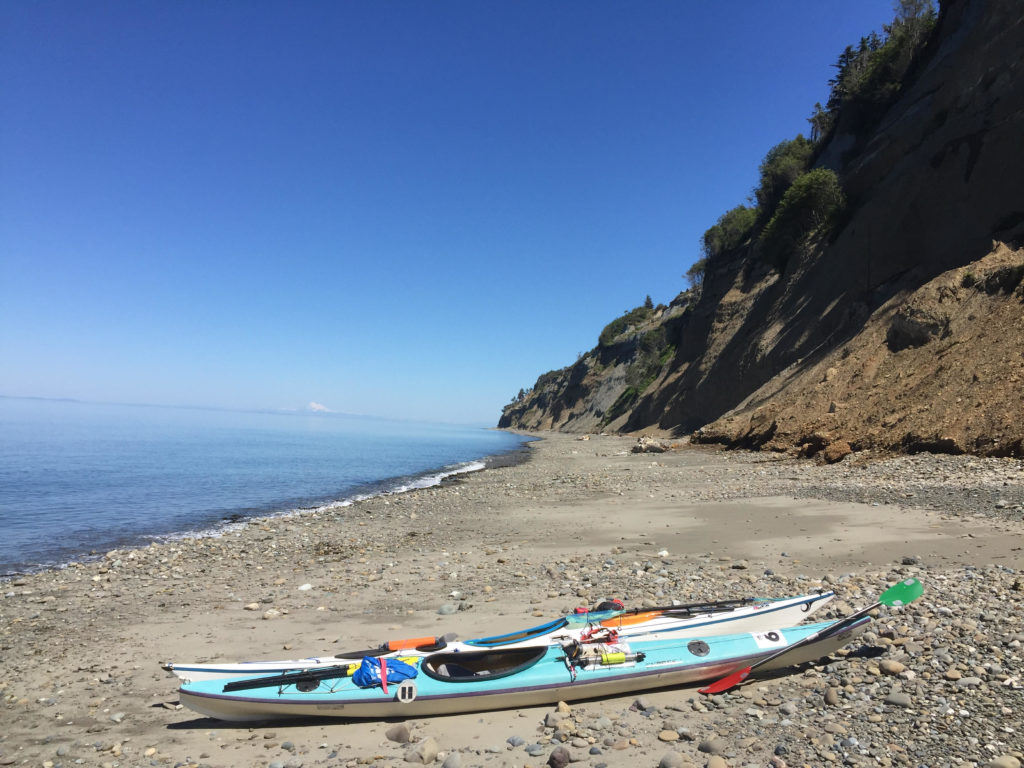
Erosion marches slow and steady toward these stately manors. For now, they stand at the brink of the approaching edge looking out over world class views of the Strait of Juan de Fuca, Vancouver Island, Mount Baker — and that vast strip of sand jutting out into the water: The Dungeness Spit. At 5.5 miles long, it is the longest of its kind in the United States. The eventual destruction of those houses and the creation of the spit are linked in a fascinating Yin-Yang relationship.
More on that later.
On a recent sunny day, I was also taking in the view of the Spit from my bicycle saddle. I was pedaling 17 miles back to Port Angeles to meet my friend Jarrett where our kayaks would be loaded on his truck. We would put the boats in the water out of Hollywood Beach downtown and paddle east with until we got to where my car was parked at Cline Spit in Dungeness Bay. It would be an 11 mile paddle with a short boat portage. If we went all the way around the spit instead of portaging, it would be a 21 mile paddle. You can probably guess which option I preferred.
The day was serenely beautiful, in a way that made me feel that, somehow, all was right with the world. I pedaled against a light breeze that cooled me nicely against the warm sun. Looking out from the sea-cliffs, I saw that half the water in Dungeness Bay was gone, vanished with the low tide of a new moon. In a couple hours, the powerful flood tide would start refilling the basin as our boats took advantage of the eastbound current in the strait.
Mature and juvenile bald eagles wheeled above the shallow waters. I saw them take turns harassing ducks. A small crowd had gathered on on the cliff to ogle a large juvenile perched in the branches of a fir. Signs nearby warned them not to get too close to the edge. It was eroding rapidly.
Even the road I was biking seemed uncomfortably near to the edge of destruction. I wondered how many years it had left.
A couple miles later, I was biking through the amber fields outside of Sequim. Earlier, I’d planned to bike to nearby Carlsborg and catch a bus to Port Angeles. This plan would have involved sitting in a bus stop for forty-five minutes breathing exhaust from Highway 101. If I pedaled a little faster, however, I could still get to Port Angeles in time for Jarrett and I to catch the flood tide.
I took backroads to the Old Olympic Highway and connected with the Olympic Discovery Trail. The trail was blissfully un-busy, weaving in and out of forest where the leaves cast dapples on the pavement.
Instead of highway exhaust, I breathed the cool scent of ferns and moss as I maneuvered switchbacks into creek gullies. A couple miles later, the trail popped out at the coastline, where acres of kelp and sea lettuce steamed on the hot cobbles.
By the time I reached Jarrett’s place, he was still packing/eating breakfast.
“So what do you think about wearing drysuits today,” he said.
“It’s going to be rough with this heat,” I said. “I’m probably going to end up splashing myself a lot. But it’s worth it having the extra safety.”
“Yeah,” he said. “Though, I was thinking about just wearing my Farmer John today.” As it happened, he had two of the sleeveless wetsuits at his place. One would fit me.
The only thing was, I had this awesome drysuit that really worked at keeping the water out. A prolonged immersion in the water was extremely unlikely, but I liked to think that I could be immersed in the water for a long time and turn out fine, thanks to my drysuit. Was that really the best course of action? Heat exhaustion from paddling in the full sun was another risk. I had to weigh.
As I looked at that beautiful orange suit of waterproof fabric, leaving it behind felt like a betrayal.
“I mean … I love my drysuit,” I said.
“Yeah, I love mine too,” Jarrett said. Both of us were wavering. “But I don’t think it’s going to be any fun paddling in it today.”
“Screw it. I’ll take the wetsuit.”
Emotional attachment is not the best rationale for choosing gear anyway. Take it from a guy who’s had (too) much loved hiking boots fall apart on him on the second day hiking the Hundred Mile Wilderness.
Our drysuits stayed on their hangars.
The hot sun and warm air at Hollywood Beach reinforced our certainty: We had made the right decision. Before I got in my boat, I deliberately dropped in the mucky shallow water to get myself soaked. The cool water evaporating off my trunk was most welcome as I started paddling.
The beginning of our trip stayed close to shore, following the riprap barrier below the Olympic Discovery Trail where bicyclists zipped past our boats on the way to Morse Creek.
“Bikes move faster than kayaks,” I observed.
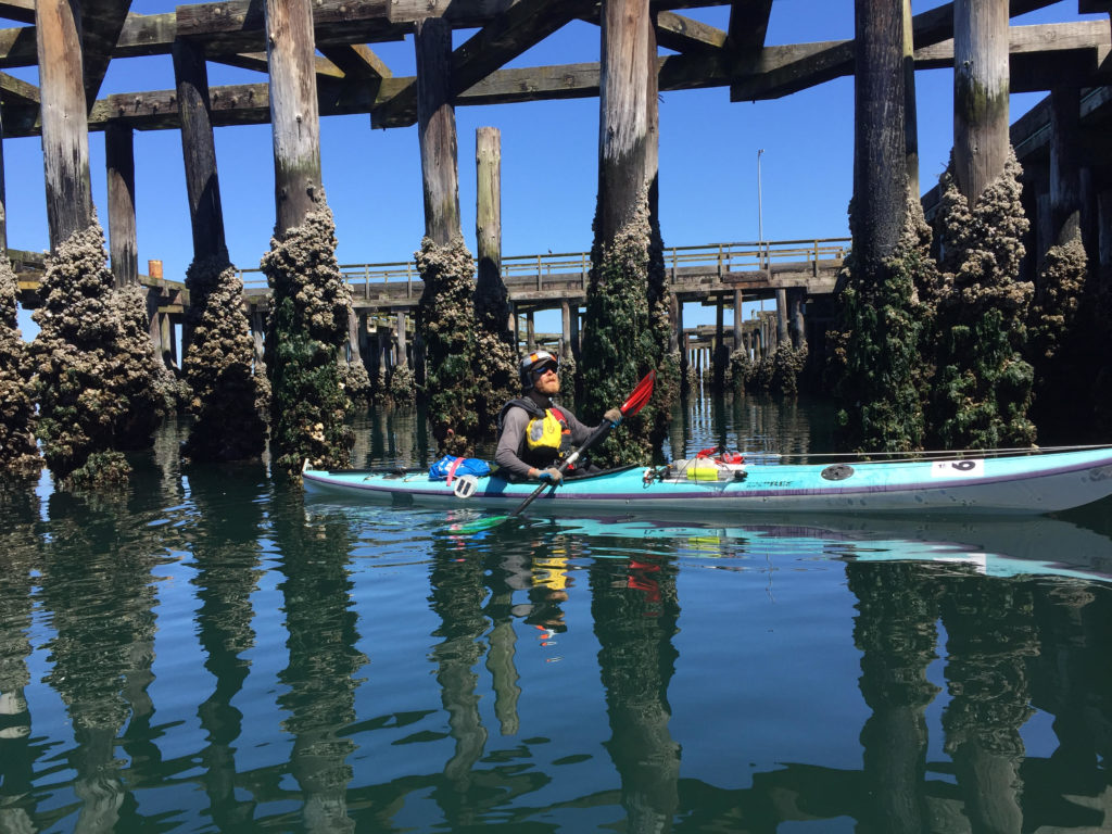
Though we may have been lagging behind the bike trail traffic, we had more opportunities to explore, including the haunted remains of the Rayonier Mill. An abandoned wood pier with tall pilings jutted out in front of us, offering dark narrow places where we could squeeze our boats through.
Closed since 1997, the mill recently marked its 20 year anniversary as a Superfund cleanup site. The mill had been a major paper goods manufacturer that processed wood chips into consumer products like film, cigarette filters and diapers. The business also left behind some less desirable products, such as PCBs and dioxins. The EPA labeled Rayonier as the biggest polluter in Washington State in 1993.
In the film, “The Memory of Fish,” former employee Dick Goin recalls seeing fish coming down Ennis Creek turning belly up as soon as they came in contact with the mill discharge.
Tons of toxic soil have been hauled away but the cleanup is ongoing. A chainlink fence separates it from the bike path.
It is scheduled to be completely cleaned up (at least by the government’s standards) by the year 2026. Meanwhile, Rayonier, headquartered in Jacksonville, Fla, still owns the site and has paid out millions to clean the site. I have been running and biking past the site for over a year now, and have yet to see any work that looks like cleanup.
The large wooden pilings jutting out from the pier represent another hazard. Within a hundred feet of them, I could smell the tarry scent of creosote. As it happens, the county’s latest shoreline strategic plan proposal bans this type of piling, presumably due to the fact that creosote is toxic and will eventually leach out into the environment.
The spaces beneath the piers had the subterranean feel of a subway station, with pilings instead of pillars, the flutter of cormorants’ wings instead of pigeons. More alien were ochre sea stars the size of medium pizzas feeding on the mussels along the posts. They hadn’t gotten the memo about the toxic creosote, I guess, though I’d hesitate to say that the presence of life precludes the possibility of environmental harm.
Clearly the pilings provided a large amount of surface area for clinging life.
Northern feather duster tube worms jutted out like mummified cinnamon sticks. Below the water, the worms released their delicate red fans of feeder cilia at their ends — about the size of silver dollars. I couldn’t resist letting my fingers brush up against one. The reaction was immediate: the cilia shot in, sending a blob of bubbles upward.
White plumose anemone’s wafted in green water further down, trolling for bits of plankton.
The next couple miles of paddling took us past a coast that was armored by riprap. The busted stone kept the shoreline from eroding, though there were still a couple landslide zones behind the bike path After Morse Creek, the riprap went away. Massive earthen sea cliffs jutted up, cutting off access to the headlands except for in the occasional creek gully.
The blissful day called for a lack of hurry, and small explorations. Jarrett and I took a stop at one of these gullies and found a small campground on what appeared to be private property. We ate lunch, paddled for half an hour, got out again so I could explore another gully. There is supposed to be a large cavern hidden somewhere in these cliffs, but I couldn’t find it.
At one point,we heard a crack and a few pounds worth of stones and dirt clattered off the cliff onto the beach below. Further on, we saw where someone had built an elaborate sequence of wooden steps down to the water from above. The only problem was, the cliffs had given out and the steps were mangled, half fallen off.
A week before this paddle, a woman hiking along the beach below of one of these cliffs stumbled upon a giant wooly mammoth molar that eroded out of the substrate above. Over the years, locals have found pieces of mammoth skulls as well as tusks from these bluffs. Jarrett has collected (legally) a few pieces of petrified wood in these places also.
The cliffs were so interesting to look at that we stayed close, even though we could have caught a faster current out in the strait. They were just damn interesting to look at, these weird conglomerations that were neither stone, nor sand exactly. There was symmetry between the delta shaped drainages and the pyramidal deposits at their base. They formed hourglass shapes, and like hour glasses, they marked time by the passage of sand.
The warm colors and the bleakness of the walls was desert-like, reminiscent of African coastline.
All I had to do was ignore the pine trees along the top. It certainly felt hot enough for us to be pulling out of Algiers .
“Thank God, we didn’t wear the drysuits,” I remarked.
When we started getting hot, we had the 54 degree Strait water to cool down.
We got out of our boats and waded in the water along the beach. I practiced getting back into the boat from my kayak, and got a couple pointers from Jarrett, who made it look easy despite his high center of gravity.
“See the lighthouse?”
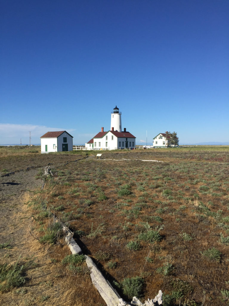
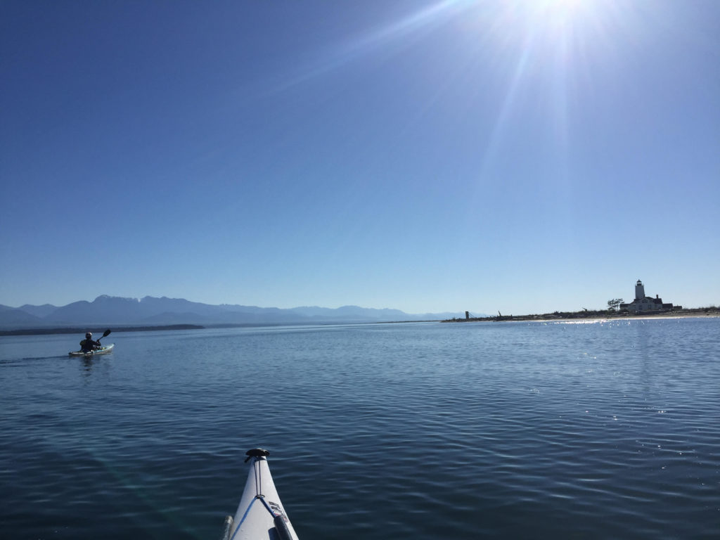
He pointed, and I could see the New Dungeness Lighthouse, built near the end of the Dungeness Spit.
We were getting close.
The cliffs became even more unstable as we paddled along, so much so that they now tilted forty-five degrees, with enormous piles of sand and gravel accumulated at their bases. We stopped our kayaks for a moment to watch erosion in action. There would be a sudden tinkling noise and a flow would start moving down the cliffs. It looked kind of like a waterfall, it was falling sediment. The flow would continue for a minute or so before it ran out. Then another flow would begin somewhere else.
“It’s like the cliffs are taking a leak,” I said.
These must have been the “feeder” cliffs that I had been hearing about. The super-fast eroding ones were moving backward at a a rate of three feet a year. Watch out!
Why are they called feeder cliffs though?
Because they feed important ecosystems and landforms in the local environment. That sediment leaking out from the cliffs would eventually reach the water, creating the ideal substrate for eelgrass beds, which are habitat for juvenile salmon and other small marine critters. Longshore currents and tides carry much of the sediment further, and it deposits on the Dungeness Spit. The spit is born out of the destruction of these cliffs.
A similar deposition process helped form the three mile long Ediz Hook, which gives Port Angeles its harbor and is home to the local Coast Guard base. The Hook has faced erosion over the decades however, partly because of the dams on the Elwha River, partly because of all the riprap around Port Angeles. The dams (now demolished) plugged up useful sediment coming down the Elwha from the mountains. The riprap, still plugs up the useful erosion coming down from the sea cliffs around Port Angeles, and diminishes a supply that could still be used to rebuild the Hook. Last year, the U.S. Army Corps of Engineers contracted with a construction company to expedite that building process by dumping several tons of cobbles off the Hook. In 1995, the Corps was paying up to $100,000 a year moving rocks out onto the Hook. It is ironic considering that the Hook is threatened precisely because of the tons of rock laid out along the Port Angeles shoreline.
The falling sand beside my kayak reminded me of dead trees in a forest or compost in a garden. Something needed to die for rebirth to happen. Humans with their usual impulses to leash the unruly universe had mucked the system well.
A mantra entered my head as I paddled: “Don’t resist the rot of this world.”
The cliff, is falling away, so don’t build there. Let the sand slip out of your grasp, let dead leaves crumble into dirt. There’s a place for it all. Don’t interfere until you really know what you’re doing. If you don’t figure out this much, maybe it’s better to sit back, slow down and see how nature can do it better than you do.
The undeveloped beaches around Dungeness Spit are far nicer to paddle than those around the Hook. There are easy places to land a kayak, fewer power boats to dodge.
The Hook is crowded with its access road, boat launch and the navy docks under construction. The Dungeness Spit has no roads, only the lonely lighthouse at the end.
If we paddled all the way around the lighthouse, we would essentially double our trip, making it about 21 miles. The other option would be to portage over the spit and paddle directly to my car, shaving 11 miles of travel.
Jarrett was in favor of the later plan. I wanted to change his mind, but didn’t want to be pushy about it.
“So…” I said. “What would you think about going around?”
“No man. I’ve been doing kayak tours all week. I think I’m done today.”
I was bummed, but didn’t want to end the trip on a sour note by arguing into getting my way.
“No sweat, Man. It’s been a great trip. Where should we portage?”
Jarrett scanned the beach where tourists and day hikers were thick on the the sand.
“We’ll go down a little ways to get to somewhere where there aren’t as many people,” Jarrett said.
The lighthouse was drifting closer into view.
Jarrett kicked his kayak into high gear. My muscles ached to keep up. I was glad he was in front though, because I had a feeling that he actually wanted to go around the lighthouse. It was my job to shut up and let him decide it for himself.
For half an hour we raced down the spit with the wind behind us, saying nothing. Finally, Jarrett put his paddle down on the deck.
“That lighthouse is getting pretty close.”
“It is,” I said.
“Alright. I could go around. You game?”
I pumped my fist.
“Hell yes!”
We celebrated our decision by pulling off and grabbing some food on the beach. The Cascade mountains had grown taller and better defined. My view included Glacier Peak and Mount Baker and the smaller mountains on the San Juan Islands. Behind us we had a view up into the Obstruction Point Ridge area and Elk Mountain where there 1,000-foot snowfields clung to the north faces (Stay tuned for news of my next Doorstep Adventure.)
Time was no longer on our side. After we launched the boats back out, I saw the strands of bull kelp were straining against an ebb current. We were fighting the tide now.
The current only got stiffer as we rounded the spit into Dungeness Bay, slowing progress to a crawl. The tidal grip weakened as we got further into the bay, however. We pulled our boats up on the bay side of the lighthouse to do some more exploring.
A small footpath led us up toward the white building, with its red roof and central lighthouse and tower. It dates back to 1857.
Faded laundry flapped on a line above the lawn. I saw one man reading a book outside. The scene looked peaceful and old-fashioned. I felt that I could drop in, find a seat, put my feet up on the railing and argue about whether one of those newfangled steam engines would ever really outrun a clipper ship on a broad reach.
I’d accept the invitation to stay at the lighthouse, where I would write at hardwood desks, gather salt in my beard, look out at waves, wear sweaters.
In fact several people reserve places for the of staying at the lighthouse. 2018 reservations are going for $375 per person per week or $2,250 for the whole house. To earn your lighthouse keep, you also tend to chores like tending the lawn and polishing (daily) the brass inside the tower.
A small driftwood sign pointed an arrow back down the Spit to where it connected to the mainland. “Real World: Five miles.” I saw the appeal.
The spit stretched west as a sandy ribbon down the middle of our sightline, diminishing with distance. There were breaking waves from the Strait to the north and calm water inside the bay. The proud houses on the mainland were distant, superfluous seeming. You could see the worried world from this dreamy perch on the sand, but the worries were at arm’s length.
Empty beach replaced the large crowds we’d seen at the west end.
Few people hiked all the way out, not only because of the 10 mile round trip, but also because it meant trudging that 10 miles over soft sand at a tilted angle.
This long stretch of land doesn’t just isolate lighthouse keepers from the bustle of the mainland. It is also a popular spot for birds, who benefit from being able to nest in an isolated spot where predators are less likely to come and get them. The south side of the Spit is a national wildlife refuge, which is off limits to human visitors. Signs warn boats not to get too close to the land.
We got back in our kayaks and started paddling back to the “Real World” with its email, riprap and superfund sites. Part of me wanted to stay out on the spit away from the noise waiting on the mainland. On the other hand, I was hungry and had eaten my last Clif bar. The lighthouse keepers come back to mainland for similar reasons, I imagine.
As the sun got lower, we started seeing eagles wheeling across the sky. I saw the cliffs where I had biked earlier, my car parked in the lot.
Jarrett and I high-fived at the boat ramp. 21 miles on the water. No regrets.
Thankfully, the road hadn’t crumbled off the cliffs by the time it was time to drive back home.
FURTHER READING
Mammoth finds around Port Angeles sources:
Who’da thunk it? Those crumbly cliffs around Sequim are full of mammoth parts!
A big find: Locals stumble upon mammoth molar on Sequim beach
http://www.burkemuseum.org/blog/mammoth-find-sequim
Feeder cliffs sources:
Clallam County, Washington is in the middle of updating its Shoreline Master Plan document. Much of the document is policy proposal (i.e. a prohibition against creosote treated pilings as seen at the Rayonier site.) The document also talks about how feeder cliffs work by depositing their erosion into the sea, which eventually helps build up sandy deposits like Dungeness Spit
http://www.clallam.net/LandUse/documents/CCSMP_dftSRP0213.pdf
Ediz Hook rebuilding sources:
This Peninsula Daily News article discusses the recent Army Corps of Engineers project of dumping cobbles onto the northwest side of Ediz Hook in order to shore up the hook against erosion. Come to think of it, this is exactly where I had struggled to land my kayak against the crashing seas on my recent Lyre River trip. A sandy beach would have been nice.
http://www.peninsuladailynews.com/news/rocky-additions-to-cut-ediz-hook-erosion/
The cobbles were only of many attempts to save Ediz Hook from erosion. This source reveals the $100,000 a year that the Army Corps of Engineers spent (as of 1995) to rebuild Ediz Hook. While the report points to the Elwha River dams as one of the main reasons that the Hook is no longer rebuilding itself, it also points to the problem of shoreline armoring, which has prevented valuable cliff erosion from going into the sea and rebuilding.
Information on the Rayonier superfund cleanup site:
This Peninsula Daily News article talked about the 20-year history of the Rayonier Mill as a Superfund site.
I watched a screening for the film Memory of Fish a couple months ago. The film explores the decades fly fisherman Dick Goin spent on the Elwha River, the decline of the salmon that he watched over the years, and his push for dam removal on the Elwha River. Shortly before his death, he got to see the Glines Canyon dam come down. Goin was also a former Rayonier employee. The film explores his ambivalence about his role working for a company that polluted fish habitat.
http://www.thememoryoffish.com/#intro
Information on the New Dungeness Lighthouse:
If you want to live on a lighthouse for a while, the folks at New Dungeness would like to talk to you.
http://newdungenesslighthouse.com
Oh yeah, why is it called the New Dungeness lighthouse? Was the old one destroyed by a storm?
Nope? The old one is actually back in Dungeness, England. George Vancouver named the Dungeness Spit after Dungeness, England because it reminded him of back home. Thanks Wikipedia!
https://en.wikipedia.org/wiki/Dungeness_Spit
A lot of stuff around the Northwest got named by or after Vancouver’s expedition. See Mount Baker, Mount Ranier, Puget Sound, Port Townsend, Discovery Bay, Protection Island, Vancouver Island, Whidbey Island…etc.
