Spine vs. Slime: Our deteriorating politics mirror our deteriorating planet

A fried egg jellyfish floats in the Strait of Juan de Fuca off the coast of Washington

Slime.

You don’t need to go far to find it these day.

If you’ve been around kids, you’ve probably seen them stretching it and rolling into balls — it was one of the most popular DIY toys last year, thanks to the internet

Speaking of the internet, the slime is alive and well there too, but not so innocent. Slime ideologies of racism, anti-intellectualism and fascism, rolled into the textures of our memes, social media and (oh yeah) the federal government which has lately incubated amoebic ideology of toxicity and hard-core selfishness.

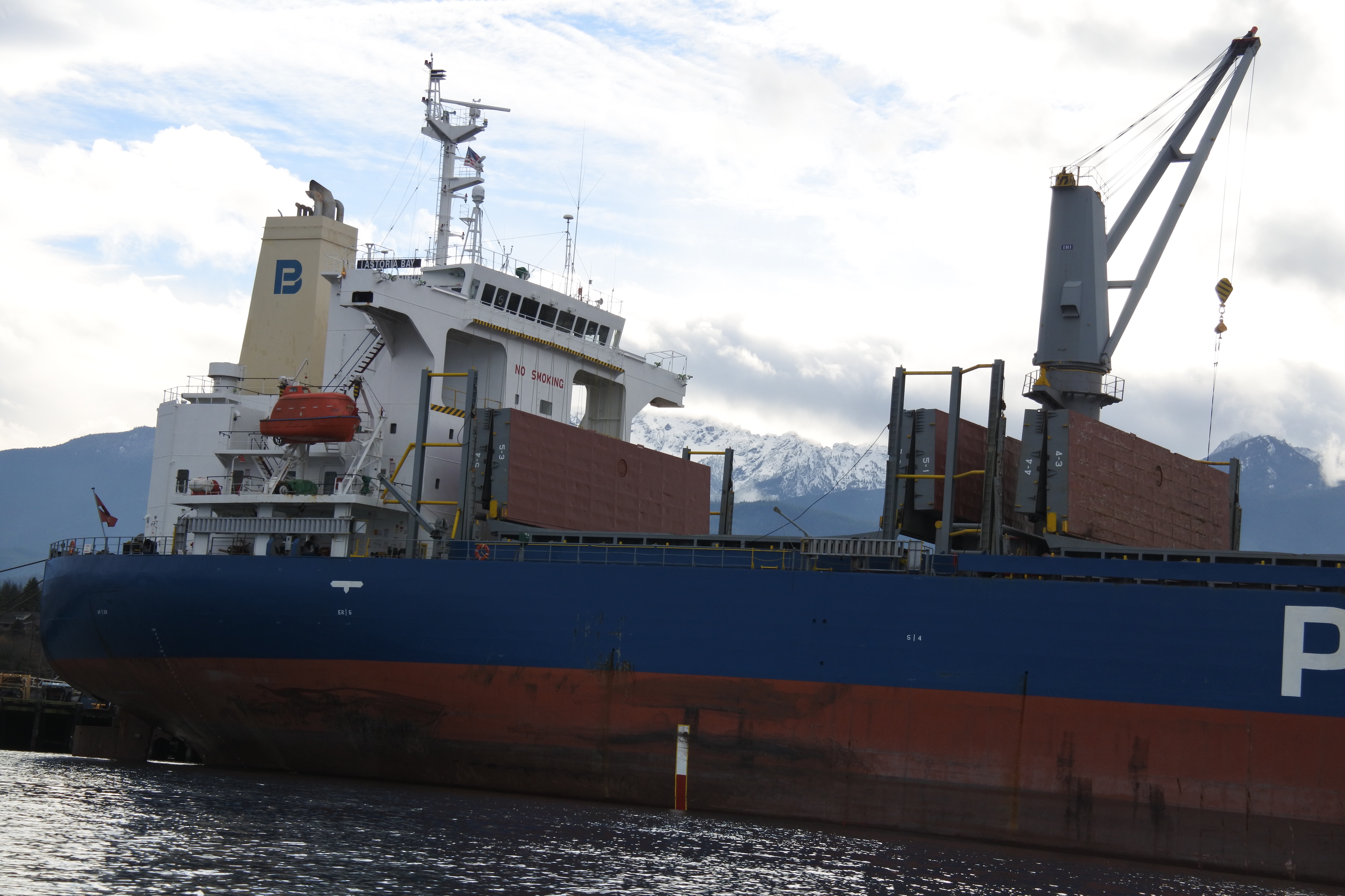
Where else can you find slime these days? Tar sands, a poisonous black sludge that oil companies are trying, ceaselessly trying, to move south and west out of Alberta, Canada to the Gulf Coast and to ports along the Salish Sea near where I live.

The Salish Sea, which includes Puget Sound, the Strait of Georgia and the Strait of Juan de Fuca, is another battlefront in the slime invasion, this time the jellyfish and algae that have begun to choke out complex vertebrate lifeforms like salmon and orcas.

Infinitely pliable, slime is passive, non-resistant to external forces. Yet, when there is enough of it, it overwhelms everything. Jellyfish, like fascists, thrive in toxic environments that degrade more sophisticated organisms.

I believe that all these forms of slime are linked together (excepting, probably, the kids’ slime.) Big Oil brings in the money that shapes Trump administration policy and Big Oil brings in the money that fills the war chests of pro-oil members of the US House and Senate. The slimy souls, who prefer dollars over democracy, have demonstrated their willingness to sell land and sea for drilling, to cut away the safeguards that slowed climate change. And now we link to the slimification of the ocean, where jellyfish and other simple organisms choke out other life.

All of these slimeforms are a lot to fight, yet, I believe that those of us with spinal columns  have the tools and drive needed to win the battle. We can join others who say “no” to the oil that powers the slime machine. It is also within our ability, as sophisticated, social vertebrates, to create relationships and groups that push the slime back through cooperation. Victory has emerged out of environmentalist and Native American groups’ dogged resistance to major fossil fuel projects here in the Pacific Northwest. Groups like Black Lives Matter and #MeToo have turned individual abuses into a national conversation about justice and equality — a broader challenge to the abusive, bigoted men who remain in seats of power.

The Rise of Slime

Rise of Slime, is the name for a trend noticed by the oceanologist Jeremy Jackson that as the oceans became warmer, polluted and overfished, they are becoming slimier too. Algae is one organism that does just fine in warm, polluted water. It has filled in where coral reefs, which couldn’t survive the changing sea conditions, have died. Here in Clallam County, Washington, you aren’t so likely to see algae in the water. Nonetheless, poisonous algal blooms have closed off mussel gathering two years running. The Washington Department of Health warns shellfish gatherers to expect more of these harmful blooms as the sea continues to warm.

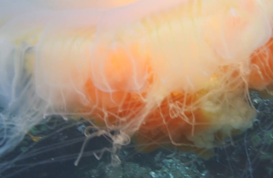
More visible, than the algae are the jellyfish that clot the water throughout the warmer months. Cross jellies and comb jellies bloom numerous enough so that it can be difficult to look down without seeing through one of them.

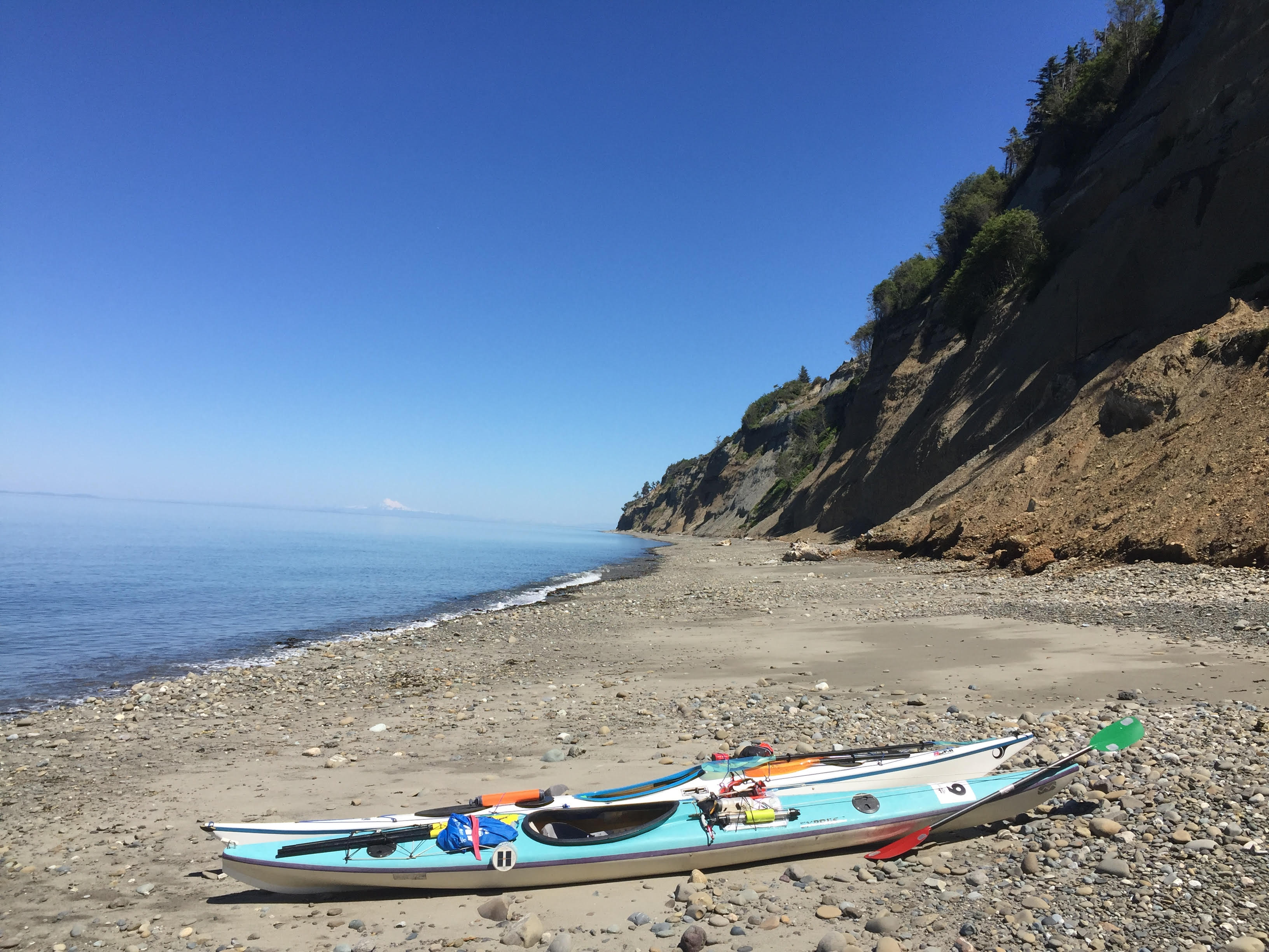
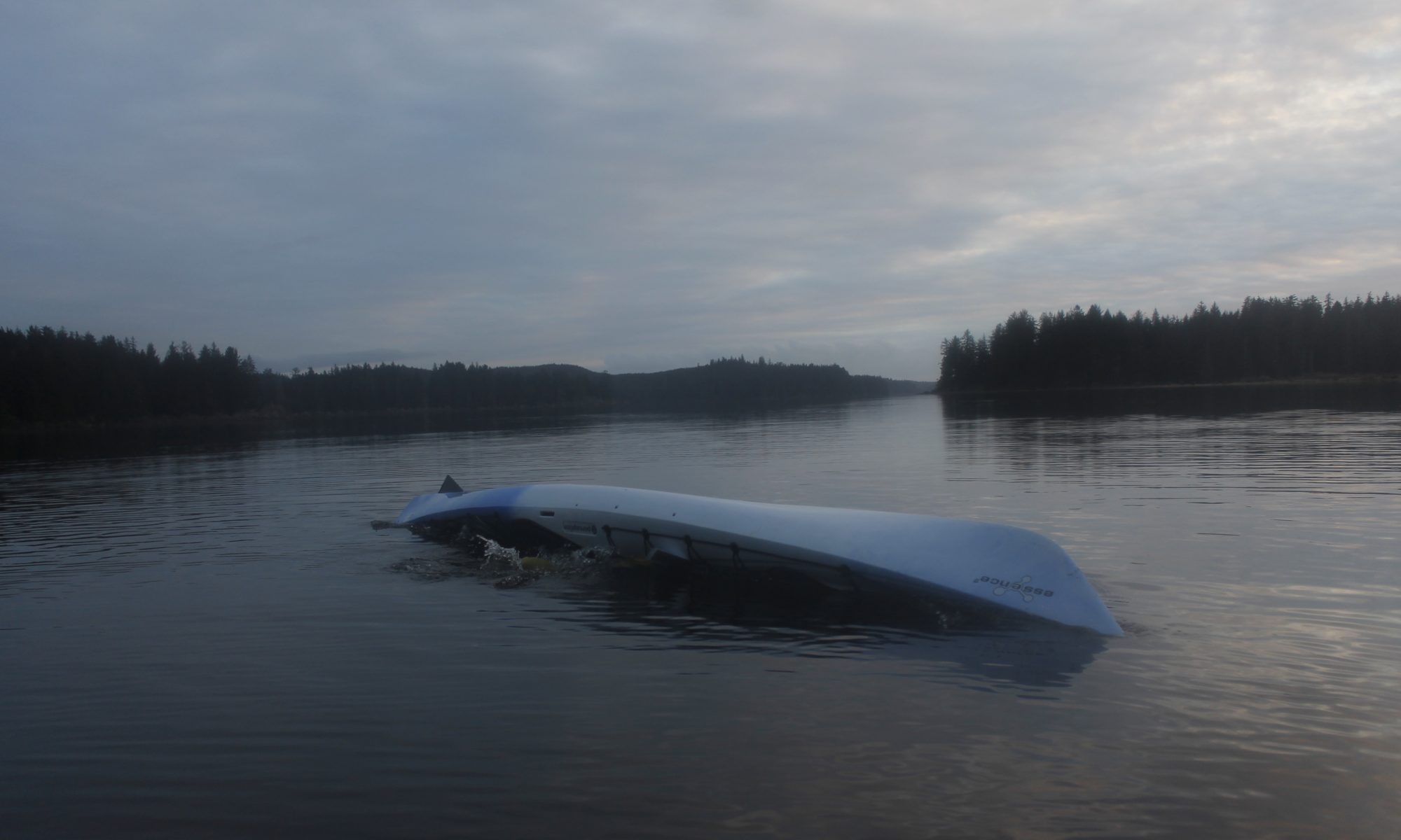
There have been many occasions while kayaking when I could blindly dip my hand off my boat and be sure to come up with a clear, quivering blob. Whether or not this preponderance I saw is nature’s old way or climate reality, we could argue. Yet people have been seeing jellyfish on the rise the world over and evidence is beginning to point to jellies as a result of of pollution, overfishing and climate change.

Slimy jellyfish, with their simple needs can better withstand toxins than a more complicated organism such as an orca or salmon. The cnidarians may drift passively with the currents, but they are fast to reproduce and grow.

I think about these simple bags of slime, expected to do so well amidst the floating garbage. Then I think about the stunted ways our society communicates with one another now, how a couple hours of wading through internet news and social media will bring me to a similar protoplasmic, directionless feeling. Complex thought requires a diet of complex thought, before we bring our developed ideas into the world through gestation and nurture — not too dissimilar from the way mammalian creatures raise their young. Yet, in the toxic environment, it doesn’t pay to develop your thoughts, but to spew them out fast. Divide, multiply and overwhelm; that’s the viral strategy, the slime strategy.

Complex thought, like complicated, multicellular life is disadvantaged in the polluted environment, likely to be choked out by memes or plastic bags.

Witness the slimers like Sean Hannity, Steve Bannon or message board trolls who have flourished in the tide of toxic bullshit that flowed into the national discourse. At the center of it, quivering orange protoplasm oozing brain effluent out through a Twitter feed.

What about Hillary’s emails? Climate change is not the problem. Bigotry is not the problem. Skyrocketing inequality is not the problem. Fake News. Political correctness is the problem that we’re dealing with. Press conference over. Here’s your tiki torch/deportation papers.

Thinking people retain the wherewithal to see bullshit for what it is. Yet the sheer quantity of it  still has the power to overwhelm. If we take the time to address each new outrage, we spread ourselves thin and fall into involuntary myopia. There’s less time to go deep any more; it’s harder to settle down with a book when the news is blowing up yet again.

Paying for gas is paying for Trump

One way that I have tried to push back against the slime tide has been to watch my carbon footprint.

The act of riding a bike to work may not feel as cathartic as blocking a tank (or tanker ship) but for me it is less about riding my bike and more about not turning the ignition. The deep consequences of climate change have emerged out of seemingly trivial decisions such as driving or leaving the lights on.

Every time I fill up my tank, I feed the climate crisis. Compounding that, I know my gas money also feeds the ideological crisis of our time.

The dollar flows from the pump to the oil company, to the political action committee to the vicious petro-Republican agenda that oozes like tar sand over the fabric of our rights. The administration is soaked in fossil fuel — from Tillerson to Zinke to Pruitt. Oil companies may have hesitated to go all in with a racist liar in the general election, but then he won and they realized they were sitting atop a rich vein of opportunity. They pitched in millions for the inauguration; no doubt they are prepared to loosen their purse strings for the 2020 campaign.

A look at the obscene pro-oil, pro coal agenda pushed by the Trump team shows that the companies’ investment in them has been well placed. This year’s horrors included the administration pulling the country out of the Paris climate agreement and a move to declassify Capitol Reef and Bears Ears as National Monuments — to open the land to drilling. Further outrages include Zinke’s proposals to permit offshore drilling rigs in the Atlantic and Pacific.

The money from the Gas n’ Go doesn’t just prop Trump though. Thanks to Citizens United nourishing currents of money from companies like Exxon-Mobile and BP help feed the slime organisms that rule the swamp Congress. Witness the language of the newest tax plan that opens the Arctic National Wildlife Refuge to drilling, saving money for billionaires so they could get the tax break they don’t need. Trump swiftly approved.

At the state level, the American Legislative Exchange Council also leverages Exxon-Mobile and Koch Industries donations to write the proposed legislation that the state senators and reps vote for. It is convenient when companies lean on politicians for results and have a bill conveniently pre-written that reflects their agenda, whether that agenda is about fracking standards or Stand Your Ground laws.

If any of what I have described above outrages you, just remember that we pay the bastards.

We support them every time we drive. The daily commute, visits with friends, a last minute trip out to buy dinner all put money in the pockets of those who have threatened our climate — helped feed the tumor growing on the face of democracy, equality and human decency.

A question of my own culpability

I continue to ask myself how much should I should use Tom’s on The Move to talk about the destruction of life as we know it on our planet. How much should I mention the climate crisis in my writing? Is it fiddling while Rome burns that I might admire dewdrops on the moss, while villainy is afoot?

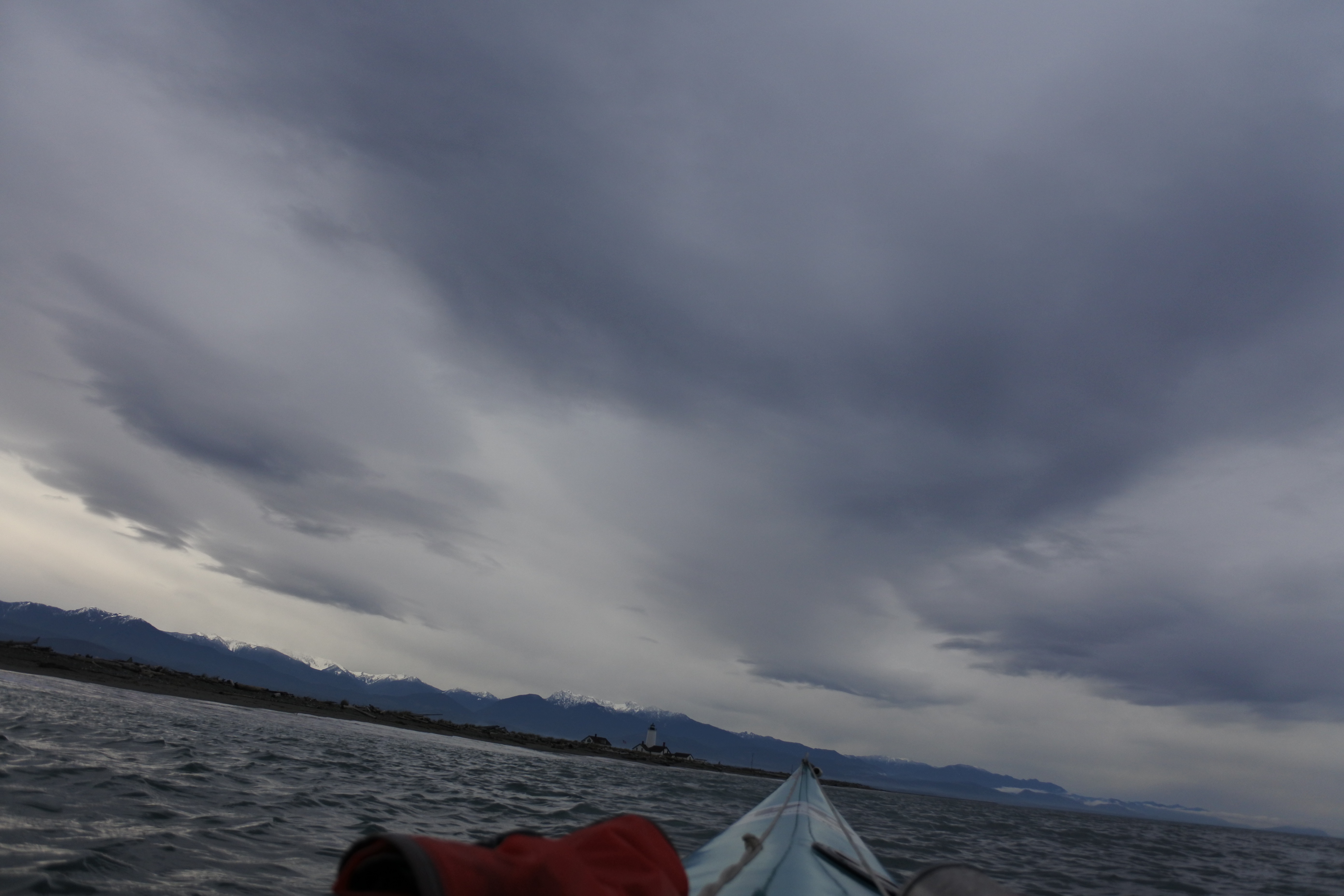
I think of the balance between nature appreciation and advocacy when I look back on a summer  hike that I took with a couple friends who are heavily involved with environmental activism. Naturally, we had made this a gas free trip — having biked from Port Angeles to the trailhead, and then walked up to Lake Angeles at 4,000 feet. The lake was flanked by 2,000-foot cliffs of monumental stone. Even in the height of summer, the shadows held large swaths of snow. Snow gave way to braids of roaring water cascading down down to lake-level.

Throughout our hike, our group had talked about the latest outrages from the administration, dire indications of how climate would worsen drought and fires in the Olympic Mountains. Protests, petitions and letters to the policymakers awaited back down in Port Angeles, and my friend felt guilty about going above it all to admire the scenery.

Though I admired the commitment, it seemed wrong to me that someone who worked so hard to protect nature would doubt himself because he was taking time to enjoy it. I came up with Edward Abbey, who wrote in Desert Solitaire, “Where there is no joy, there can be no courage, and without courage all other virtues are useless.”

It is unthinkable for me to cut myself off from nature, which has been one of the greatest joys of my life. Yet the natural world remains under dire threat. I fear I may let my love of nature become a narcissistic relationship. If it enriches my life, shouldn’t I do something in return?

I wish I could say that I felt like a member of good standing with this relationship to the natural world, but I feel more and more like a freeloader who needs to do more.

It’s not that I don’t try. I have taken a few steps that most people around me have not, including adopting a vegan diet, buying the majority of my food in bulk so I can use reusable containers and driving my car with extreme parsimony. I use my bike for commuting, grocery runs and most other errands.

I cut down on the amount of produce I had to buy from out of state by making stir fries from stinging nettles I harvested, also going several months where the only fruit I ate was the berries, apples and pears I’d picked around Port Angeles.

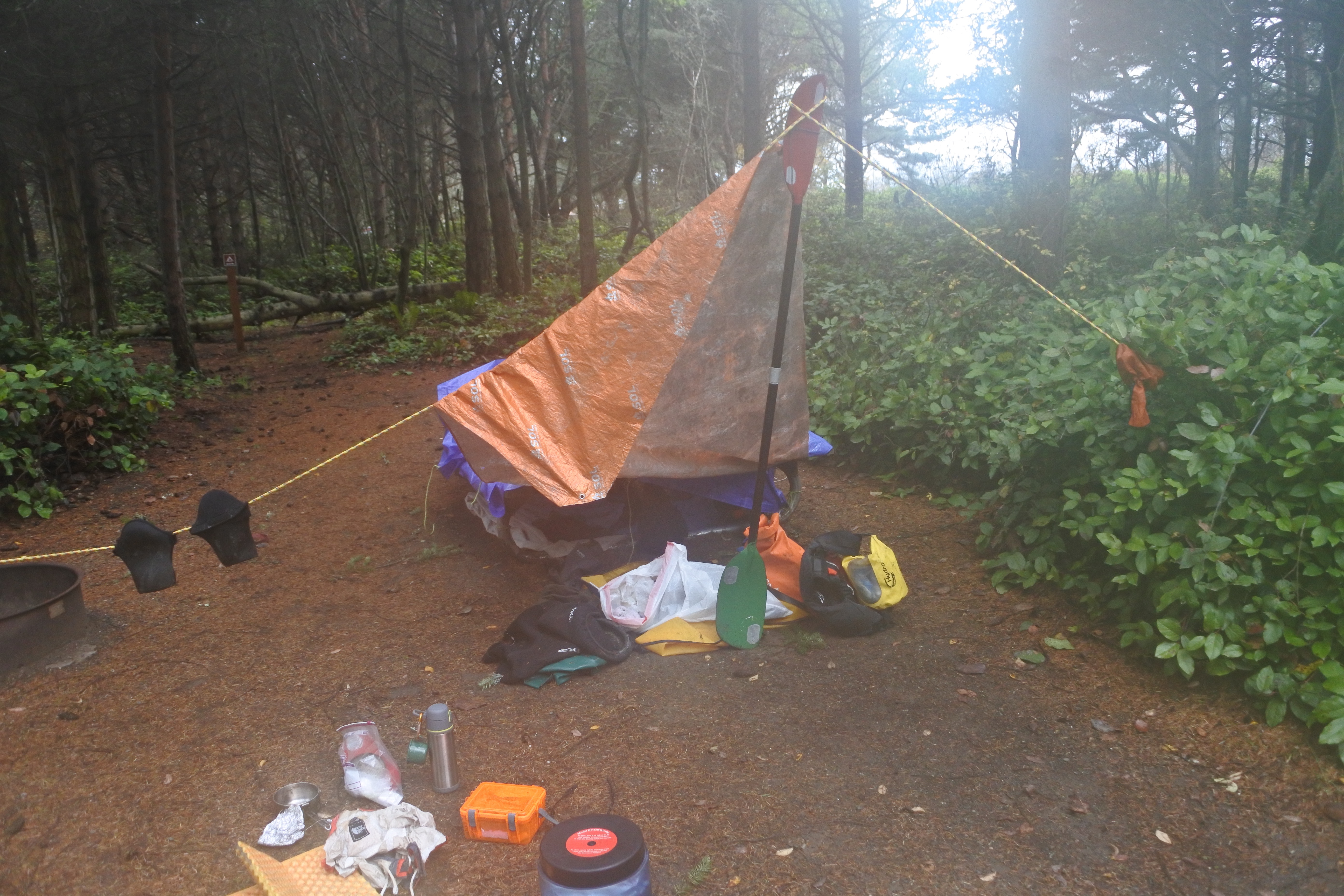
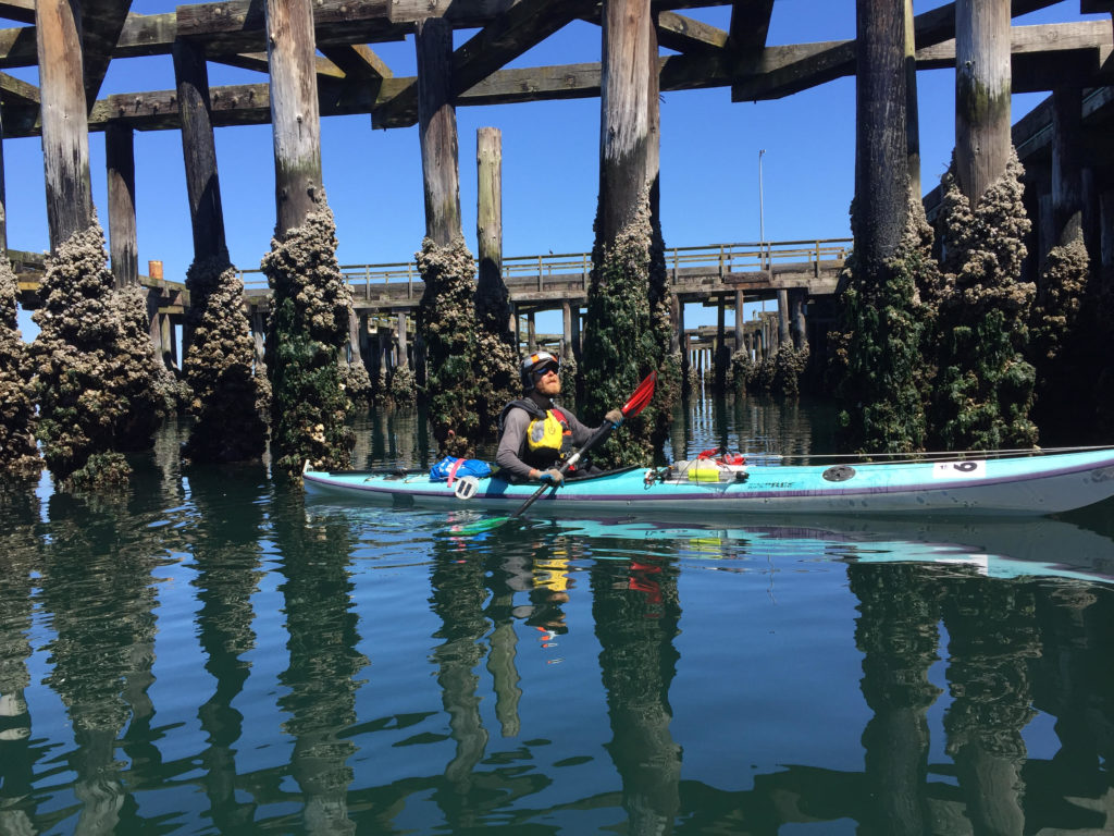
The doorstep adventure remains my favorite way to travel. I consider it important that I have spent the past summer traveling throughout the Olympic Peninsula on bike and foot. It is my way of saying that I will not make an exception, even for doing the adventures that I love, that I would rather stay close and push myself near home, than fly out to some exotic locale, on the wings of a carbon blasting machine.

A cross country plane trip to visit family back home was my biggest carbon expenditure of 2017, and for all my other efforts, it likely tilted the scales beyond what would be sustainable for one person over one year.

Even if I disregarded that trip, my (mostly) grounded vegetable existence would still feel inadequate to address the task at hand.

Do vs. Don’t

Why inadequate? Inadequate because the bulk of my actions have seemed to start with “I don’t,”  as in “I don’t eat meat” or “I don’t drive my car to work.” I began thinking that if I wanted to have a meaningful place in the world, I needed to have some “I do” statements about myself as well.

Naomi Klein, the environmental activist and author, puts words to the feeling in her book No is Not Enough, which came out a couple months after Trump’s inauguration. Klein argues that if the opposition can only say no to things that Trump does, they will fail. There needs to be an alternate vision that they can say yes to. This vision would be a progressive agenda that stands up for human rights, corporate responsibility and sustainable energy.

The agenda Klein believes in resonates with me, but I want to say yes with actions as well as words.

Over the past year, I have tried to use actions to build my commitment to the environment. I haven’t done anything spectacular, just little steps that include volunteering time at some restoration sites, going out to help monitor stream quality around Port Angeles every month and spending time working with Olympic Climate Action. The later has included helping at a fundraiser against the Trans Mountain Pipeline, work compiling a weekly list of news stories for members, and speaking out at a county hearing about the need for shoreline zoning to represent climate change reality. These small actions have made me aware of those who do so much more.

Take Michael Foster, one of a group of five “valve turners” who broke into pipeline substations near the U.S. Canadian border and shut down 15 percent of the oil imports entering the United States in one day. Foster could now face more than two decades in prison for his actions. His sentencing is in North Dakota, the state where he shut the wheel on the Keystone 1 pipe and cut off the tar sands crude it was bringing into the U.S..

Not a compromising kind of guy, Foster. In a Seattle Met interview, he tells the reporter that fellow activists who fly in planes to vacation overseas are “actively destroying the planet — for fun.” He is also one of the kayaktavists who have blocked oil tankers and drilling platforms on the sea using sea kayaks as buffers.

When I saw Foster speak in Port Angeles, it was regarding the Trans Mountain pipeline proposal, a line that would haul more tar sands oil than even the Keystone XL project would and increase oil ship traffic by 700 percent on the Strait of Juan de Fuca between the U.S. and Canada. The sheer audacity of this project, the scale and money that would be involved was staggering to consider. Foster, the former mental health practitioner, had a message for our group: he may have seemed crazy that he was willing to trade away his freedom in order to turn a valve, but it was even crazier to believe that half-measures would save us from the climate crisis.

Coming together

Native groups have been another dogged and inspiring resistance to the fossil fuel industry. Tribes throughout North America have forced corporations to backpedal projects and the government to respect the old treaties giving them rights to fishing and healthy lands. The  fronts are too numerous to name, but include a stunning 2016 court victory where the Lummi Tribe used treaty rights to win against what would have been the largest coal shipping terminal in the United States at Cherry Point, Washington. Tribes in Washington and British Columbia are united against the Trans Mountain pipeline proposed by the Kinder Morgan Corporation. The Puyallup tribe continues to push back with lawsuits and protests against a proposed natural gas terminal alongside their reservation land at the Port of Tacoma.

Like Foster, citizens in these groups have been willing to face arrest for what they believe in. They, who stand witness to generations of exploitation, know the stakes.

Those who toed the line at the Dakota Access Pipeline protests in North Dakota are coming back to fight projects in their homelands. I have heard the Lakota phrase “Mni Wiconi,” — “water is life” —  here in Washington, where it applies to the life within the Salish Sea just as aptly as it would apply to the Missouri River in North Dakota.

The theme of common struggle is not just geographic, however. It reflects the burden climate change puts on people across all walks of life — though the burden is shouldered disproportionally by the poor, the marginalized and the disenfranchised. Environmentalism is entering a coming of age moment where the public image of the movement is far more than just a group of concerned white guys like me.

Tribes that fight oil pipes also fight centuries of racist treatment and a prevailing attitude that their existence doesn’t matter. History shows them they cannot expect benevolence from those in power.

Every place where there is a fight to protect the environment, there is also a fight for human rights and dignity.

See the superfund sites, flush with oil refinery toxins, that flooded out when Hurricane Harvey slammed Houston, Most of the sites were put around working class black or Hispanic neighborhoods.

Another jarring image from 2017 — the President of the United States free throwing paper towels at a crowd of Puerto Rican hurricane victims. The moment demanded a leader who would acknowledge the need to do more to halt climate change, a leader who would see the need for massive and uninhibited aid to fellow Americans who happened speak Spanish and be majority Hispanic.

Instead, the supposed leader of the free world gave the Puerto Ricans a golf trophy dedication that they could share with the Texas and Florida hurricane victims.

Lack of empathy for these groups, the victims of climate change from flooded Bangladesh to the melting native Alaskan village to the strip mined Appalachian community, fits into what Klein would describes as a “sacrifice zone” mentality, an attitude where whole communities, entire regions, can be seen as necessary losses for the sake of business.

The ugly concept of the sacrifice zone is a product of the same mindset that accepts civilian deaths from an indiscriminate bombing, a mindset that not only accepts grotesque disparity between haves and have nots, but demands walls to keep the have-nots out.

Sacrifice zones have a way of creeping through anyway. One day you may be grateful to be inside the border with the sacrifice zone out of view; the next day, the pipeline is coming through your land, the storm has come for your city. That’s when you realize that your best hope isn’t setting yourself apart but stepping up,making connections. Now that you need someone else to have your back, you can ask yourself: Did you have theirs when it counted?

The idea of strength through unity runs through the “Join or Die” motto of the American Revolution, up through the Pull Together movement among Northwest tribes fighting the Trans Mountain Pipeline. More outreach equals more support from those who will sign your petition, or else put their bodies on the line with you.

Thus, the wise environmentalists know that their fight is with groups like Black Lives Matter, for gay rights groups, anti-poverty activists, those who speak for immigrants and refugees and the burgeoning #MeToo movement — all of whom are working to prevent people from being treated like disposable sacrifice zones.

The power of diversity is confirmed by study of nature: the most beautiful, complex systems exist with diverse actors fulfilling different roles. A healthy forest has a range of trees and shrubs, worms, bugs, helpful fungi nourishing the roots.

Organisms themselves are built on the harmonious relationships between types of life systems. This is true, even for simpler, slimier organisms like jellyfish. They are not altogether simple, boasting nerve nets, tentacles for feeding, tentacles for stinging, innumerable stinging nematocysts. Jellies may bloom into thousands, yet still drift with the currents — with little control or care regarding the agenda.

Far more complicated, far more threatened, we have the Chinook salmon that delivers nutrients from the sea through the rivers, back into the shadow of the northwest forest where it was born to propagate itself anew. Its brain allows it to follow the cues it needs to navigate back to its birthplace, its muscles allow it to thrash up currents that would splat a jellyfish to the wall.

The strength is reinforced by an agglomeration of differentiated tissue below the dorsal fin. Nerve and bone comes together to give the fish that feature that gives it membership in our shared phylum: chordata. The current goes one way, but the salmon has the power to resist (just like we do) — because of its spine.

Video: Drops in the stream


Over the last couple of months I have been collecting footage of moving water. I came up with a soundtrack to go with it: my song “Drops in the stream” on the guitar.

I am eternally fascinated by how water moves, in its ripples, vortices and eddies. The video is all shot in Clallam County near Port Angeles, Wash. and includes Lake Angeles, Lake Creek, Valley Creek, Morse Creek, The Elwha River and the coast around the Strait of Juan de Fuca.

Nordic Tracks: An early season skinny ski jaunt on Obstruction Point Road

At the start of December, a warm spell had meted much of the big snows from earlier in the year  off the southern slopes above Port Angeles. The Obstruction Point Road was a lumpy mess of drifts and boot tracks. It was a fun time to throw a pack on, get onto my skinny nordic skis from Minnesota and test my balance. This was just above the return point of my botched bike/ski doorstep adventure in November. This time, I got a ride up to elevation.

If the sky looks hazy in pictures, it is due to an atmospheric inversion that kept  local air pollution trapped in place. It was a nice demonstration of what happens when the gasses that come out from our tailpipes stick around the neighborhood. I felt my chest tightening up at times.

Kayak camping with pumpkin pie: a November adventure on the Strait

The turn of the season had brought change to the waters in the Strait of Juan de Fuca.

On the day after Thanksgiving, the bull kelp had grown thick as my arm. The transparent brown leaves undulated like a mermaid’s hair dozens of feet out. Fully developed, at the end of life, they were not so succulent a snack as they had been in early summer. Age had hardened their flesh. The hollow stipe and bulblike tubes were cloaked in sea lettuce, a tissue-like green algae which provided lighter, saltier fare.

Cold currents had already clearcut the kelp forests so that only the heartiest stalks remained. Soon the others would break off from their holdfasts on the cobble bar dozens of feet below. The snake-like tubes would wash up on the beach the following spring, rigid as PVC pipe, crusted with barnacles.

A pair of Pacific loons floated in Port Angeles Harbor near where I launched my kayak. Their pale color was unfamiliar, but their mournful trill stoked old memories. So did the V-shaped gaggle of geese honking past on the wing and woodsmoke climbing out of chimneys on the hill.

The message should have been clear: Summer was long gone. Gone with it were the days of pleasant paddling and carefree camping. The sun would set around 4:15, but I wouldn’t see it through the heavy clouds (It’s always cloudy or raining now) that hung around the mountain tops. The sunset would chill the air and make the dark water more menacing.

Astoria Bay with Klahhane Ridge

If these were the circumstances of my departure, you might think that it would have affected the kind of plans I’d make for a kayak trip. But I had set the bar high again, my mind set on a months old ambition.

I wanted to paddle east to Port Townsend and back to Port Angeles in three days — about 70 miles of kayaking with a portage over the Dungeness Spit. I would also camp on the bluffs above the spit for two nights.

My other aim was to avoid sleeping in the outhouse like I had on my last trip hiking in the Sol Duc Valley. I wanted to prove to myself that I could launch a trip with creature comforts and a decent quality of life.

Noble goals, Port Townsend and creature comforts, but the 4:15 sunset wasn’t the only thing working against me.

Boat launch to tarp camp

Before I started paddling I spent the morning filling dry bags with warm clothes, wrangling camping equipment and packing food. The goodies going into my bear-proof bin included vegan pumpkin pie that I’d made the day before. The aluminum pie pan didn’t quite fit into the opening, so I folded it into pumpkin taco.

It’d been a good Thanksgiving with friends in town. Now, hitting the water on a three day solo-trip, I felt loneliness. The lifeless gray skies did little to boost spirits. The pie gave me something to look forward to, a dinnertime treat that would brighten my time at camp.

There was a dozen miles of paddling between me and the camp when I hit the water at noon. That closing window between light and dark was on my mind, though I didn’t hurry at first.

I dawdled in the harbor, where the massive industrial infrastructure dwarfed my kayak.

Mega-cranes above the Astoria Bay perched over the docks, waiting to snatch up piles of tree trunks off the docks and load them aboard. Only the mountains were big enough to outrank these massive machines of commerce. The gray-white flanks of Klahhane Ridge rose taller than the radar arrays, snowfields merging into the dull cloud ceiling.

I cut through the pier at the old Rayonier Mill site, where a mature bald eagle sat perched upon a light fixture. Further on, there was Morse Creek, flushed with weeks of rain and snow melt. The easterly swells climbed against the current, peaked and crashed over the surging water.

I surfed a couple waves upstream, and thrashed my way up the current for a couple hundred yards to an eddy by a pedestrian bridge.

I spun myself back into the swift water, leaning downstream with a low brace turn. Paddling a narrow sea kayak with a river current behind me was fast and fun. The scenic detour ended with my bow slapping over the sharp waves at the river mouth.

My paddling became brisker and more business-like after Morse. The shoreline climbed up into inaccessible bluffs. The high tide was right up to the bottom of the cliffs, providing scant opportunity to land. High above, I saw the only patch of blue sky for the day. A swath of golden snow lit up along the Gray Wolf range with purple cloud behind. I paused for a minute, regarding the distant sunlight like holy vision. I also noted how low the light was above the mountains.

It was close to dark by the time I landed on the beach at Dungeness Spit. I still had to hike three quarters of a mile to get to my campsite up on the bluffs. I poured myself a couple of cups of hot chocolate out of my Thermos. If the sunlight wasn’t going to warm my bones anymore, I would have to get heat elsewhere.

I used a bike lock to secure my kayak to a sign post nearby, clipped my gear to my paddle and lifted it up like it was a hobo stick. Thus arrayed, I slouched up the hill toward camp. Darkness was complete by the time I reached the picnic table where I would sleep. I lashed a tarp down over the top of it, rigged another tarp at the front with my kayak paddle — my cooking area and mud room. I peeled my drysuit and damp underclothes, cloaked myself in fleece and polyester batting.

“Let there be fire!” I proclaimed. And my butane stove issued fire. The fire was good — so was the hot pea soup, made rich with coconut oil. I topped my feast with two smushed pumpkin pie slabs.

Warm and flushed with calories, I opted not to crawl immediately into my sleeping bag, but walk around camp instead, coming out to a footpath along the bluffs. Port Angeles lights twinkled in the west, Victoria to the north. The Strait of Juan de Fuca was the dark passage between the islands of light. Restless waters rolled onto the beach below me in their endless surges and retreats.

Orange man with orange pie

The east wind

Light flowed back slow into the gray morning.

I took my breakfast, ensconced myself into the drysuit and lifted the gear that I needed back onto my paddle for the trip into Port Townsend. It was a slow start with all the gear wrangling, and the  hike back down to the water. After I had re-geared my kayak and pushed it out, it was 11 a.m.. The late start already not so good; added to that, it looked like I needed to change the course I’d planned.

I had intended to carry my kayak over the Dungeness Spit to the calm waters of the harbor on the other side. Alas, the National Wildlife Refuge had put up signs recently forbidding people from crossing over the strip of sand. It was to protect the migrating birds coming through. There was a place on the margins where signage was ambiguous enough that I might have at least maintained plausible deniability carrying my kayak through. Still, the site of birds floating in a lagoon nearby gave me pause. Maybe they would abandon the site if I barged through.

Dungeness Camp.

Finally, I decided I would just paddle a couple extra miles and go on the outside of the spit, past New Dungeness Lighthouse.

The spit juts out for over five miles and is in fact the longest sand spit in the United States — the geographical uniqueness is one reason it’s so important to migrating birds. The westerly waves provided an extra push from behind my boat. When the waves come in from that angle, the spit creates a longshore current (little brother to the more infamous riptide phenomenon.) I stayed as close to shore as I could to get the most out of the longshore, though this also meant weaving in and out of the break zone. I looked constantly over my left shoulder as the waves stacked up, and then got the hell out of there before they crashed. When I messed up, the cold frothing water exploded over the top of my kayak, and I had to stick my paddle in a high brace to stay balanced.

The skies had cleared enough that I could see the mountains on the San Juan Islands to the northeast, and the white wall of the Cascade Range right in front of me. It was far more prominent than the way it looked from Port Angeles. The eastern Olympic Mountains towered over me with snowy gables.

The fun and sightseeing wouldn’t last long, though.

First there was an easterly breeze. Tiny little wavelets scurried against the westerly swell. The wind increased, blowing the tops off of the breakers as they came into the beach. I found myself slowing down. By the time that I got to the end of the spit, the biggest waves were coming right at me. I stuck on stubbornly, though when I saw the distant headland at Point Wilson, my hopes of rounding the corner into Puget Sound dimmed. Port Townsend would have to wait another day.

The detour around the spit had left me miles offshore, no way to hide from waves behind shoreline features. I set my trajectory toward the bluffs on Protection Island, near Discovery Bay. It was a few miles distant, but if I could get there, it would mean that I had reached the furthest point that I had paddled west out of Port Townsend. It would have closed a loop and meant that I had paddled all the shoreline between the two town. I guessed that if I could get within a mile of the island, it would live up to its name and give me some protection from the incoming waves.

But the seas were building. I kept fighting for another hour. At 1 p.m., I knew that I had lost, and the only way I could get back to Dungeness by dark was to turn around.

Turning around I had the waves pushing behind me, against an ebb tide leaving Dungeness Bay. The opposition made the waves steep and squirrelly. I found myself leaning on the paddle more than once, taking a few surf rides that skirted the edge between exhilarating and scary.

Surprisingly, once I got back on the outside of the spit, things calmed markedly. The flagpole on the lighthouse indicated that the wind was coming from the southeast now, thus the spit was blocking the biggest waves. It was ironic to find rougher conditions inside the bay than on open sea, but I could hardly complain.

I finally worked up the nerve to take my hands off the paddle and grab lunch. Without the paddle, the muscles in my butt were the most important thing keeping my boat upright. I stayed balanced by clenching left cheek and then right as the waves lapped against my stern and I had lunch. Best of all was the hot water out of my thermos that brought me back to life.

Clouds and mountains at New Dungeness Lighthouse

The tough ride home

Back at the campground, I felt a little bummed that Port Townsend hadn’t happened, but made my peace with the fact that conditions had been against me. Even I had started earlier, it seemed unlikely that I could have made it to Port Townsend and back in the face of the east wind.

If the wind kept up, I would have a very fast time getting back to Port Angeles, and might even be able to get in some time noodling around the cliffs or surfing at Morse Creek.

Alas, luck was not on my side.

When I walked down to my kayak and found a strong west wind blowing four-foot breaking waves over the beach.

It was beautiful, foam rolling over foam, gobs of it blowing over driftwood as if this was some nautical-themed rave. Along shore, it stacked into little clusters that quivered like marshmallow peeps.

If I launched out into the mayhem, it was going to be a helluva time, a dangerous time. And I had to be at work tomorrow.

I ended up waiting. When wind raked the beach, I huddled in the trees up in the bluffs nearby. Plenty of daytrippers were going down to the spit to check out the dramatic views. Their entertainment, my predicament. I found a bench inside an educational exhibit — a roof over my head — sipped from my Thermos, and wondered if I’d ever leave the beach. Occasionally, I wondered over to the cliffs and looked at the miles of whitecaps. I squinted at them long and hard. Were the waves softening? Or was it just wishful thinking?

Eventually, I ended up calling my friend Jarrett to ask him if he could check what the weather was going to look like this afternoon.

He said he would find out and call back.

A couple minutes later, my phone rang.

“It’s going to be a shit show,” he said.

By night, the Weather Service called for 40-knot winds around Dungeness with five foot wind waves. 50 miles west, at the entrance of the Strait of Juan de Fuca, the models predicted 25-foot waves.

Jarrett, on his way back from a family visit, was going to be driving near Dungeness in a few hours and offered to pick me up with my boat. I said, I’d probably take him up on it, but would let him know for sure.

I walked over to the cliff; the waves were still tall but had rounded out. I barely felt any wind. If I was going to go for it, I knew I needed to act fast. I texted Jarrett my intentions and hustled back to my boat. There would be about five miles of real exposure where the cliffs would hem me off from the headlands. The other half of my journey, I’d have protection from Ediz Hook, which would take the brunt of the biggest waves. If not for that reassurance, I probably wouldn’t have launched out.

Still, I felt the pressure of a narrow window. Who knew when that wind might pick up again? I scrambled to get all the gear secured into my boat. In my haste, I ended up putting more gear on top than I had before. When it came time to push out into the water, I attempted to scoot myself off the beach into the breakers. I accepted one gentleman’s offer to help push my boat. When the opening came, I paddled hard as I could, taking a breaking wave on my chest. The next wave sent my bow up before I crashed back down the other side. I took a few more strokes and I was free. Yet, I realized that my hasty work rigging my boat up came at a price. The extra weight on my back deck made me extra wobbly. Still, I didn’t dare go ashore and put myself through another launch.

The main wave set was coming at me sideways from the right, while the reflector waves jostled me from the left. I constantly needed to set micro-corrections with my paddle to stabilize the boat.

I was sweating hard beneath the drysuit, but I had done such a rushed job attaching my hydration bladder, that I hadn’t thought that I might want to grab the tube and drink. Well, no water then.

I kept on paddling hard, paranoid at the the thought that the wind was going to come back and jam me over. Neptune’s wrath was not forthcoming, however.

The waves got smaller and smaller the further west I travelled. I set my eyes on the dull line of Ediz Hook with the blinking Coast Guard station tower. It marked the boundary of my salvation. By the time I crossed Morse Creek, it was close to 5 p.m., halfway dark. Still, I was relieved to have entered the protected zone around Port Angeles Harbor.

I switched on a tiny waterproof light atop my deck so that the shipping traffic could see me. Mostly, I just tried to avoid traffic by staying close to shore.

The blast from the MV Coho startled me. The passenger ferry was chugging in from its last run out of Victoria. I lingered near the Port Angeles pier while the boat swept in front of me, waited before crossing the swirling black water churned up by the propellers. I crossed behind the boat, started to relax, only to realize that the bow was coming back at me. The ship was spinning around. I sprinted quickly out of the way.

I was within sight of the ramp at the boat launch I ran my boat up on a floating log that I hadn’t seen in the dark. The bow in the air meant that I had immediately lost much of my stability. I had to paddle backwards very carefully to avoid flipping over.

I got my boat back off and paddled the rest of the way to ramp. I stumbled out onto the concrete. All I needed to do now was unload my boat, throw it on top of my car, strap it down, drive home, peel out my drysuit, shower and cook dinner for myself. I could resort all my gear and clean and launder everything the next day. It all comes out to more hours than the time that I’d actually spent on the water, not getting to Port Townsend.

I couldn’t pretend that kayaking in winter was just the same as summertime when I had happily paddled in warm conditions until 11 p.m. If I got cold now, there was less of a chance that I would shake it off and warm up eventually. The consequences of a capsize were starker and more frightening. East winds are rare in the summer, yet in wintertime, they are common enough in winter. Because of them, my plan to get from Dungeness to Port Townsend and back in a day went from being ambitious to nigh impossible. For all the times that I had been on the water this season, I had to remember that I was only there at the good graces of Mother Nature; there was only so much that I could do to defy her will.

At least I had more pumpkin pie waiting for me in the fridge. Bed would be a welcome place to camp for the night.

Shivering in the shithouse — and other tests at Sol Duc

Everyone has a plan until they get punched in the mouth.”

— Mike Tyson.

Cold was in the air already, an omnipotent all penetrating wet. It was in the slick on the road, the low gray sky, the close ranks of firs and hemlocks — a billion silver droplets on the needles, droplets in the bracken, on the grass. Spotted yellow maple leaves fell heavy with little ceremony, plopping to the pavement, plastered on.

A whisper of diesel lingered from the bus that had just dropped me on the empty stretch of Highway 101 beneath the Sol Duc Valley. I hustled across the yellow lines, pushing my road bike. The full pack was a nightmare on my spine. I regretted this trip before it stared. Yet, there was no choice.

OK, there was a choice. There was a choice between the 15-mile bike, 9-mile hike — and staying home for another “get things done weekend.”

The last “get things done weekend” had began with good intentions of housecleaning, writing canning fruit for the winter (new hobby) but my attention span got sucked out through my internet connection and run over by the news cycle. My hours of productive labor became joyless hours of content consumption and self-loathing. The idea of repeating the experience for another weekend was a nauseating one.

No. I needed a kick in the ass. I needed some adventure. If that adventure required cold hands, shivering and soggy spirits, hopefully I’d at least learn something along the way.

Most of those lessons would come painfully, of course, but the kayak pogies were an exception.  Putting pogies on the bike handlebars actually works pretty well, I learned. Fingers were firmly connected with the gear shifts and brakes, yet they remained encased within their warming shells of neoprene. I didn’t need to worry about wetting my gloves or mitts before I hit the trail.

My decision to wear a trash bag as a kind of skirt while cycling kept a great deal of the moisture off my pants. I was, however, developing a wet zone above the knees. I pedaled slowly.

Salmon cascades

My trash skirt and bike helmet certainly made me among the more fashionable visitors at the Sol Duc River salmon cascades. Several vehicles were pulled  along the roadside near the prominent overlook. A small crowd  had gathered by the river to watch the huge fish leaping up at the series of surging falls.

These were coho salmon returning to their spawning sites from the sea. Though I had seen salmon in the rivers before, I had never seen such perseverance. Fish after fish flew above the surging water to try and clear the four foot ledge into a side pool partway up the falls. Almost all of them fell backward into the foam that they had leaped from.

An instant before they hit the water, the fish would whip their bodies, thrumming with the tight, directed power of a vibrating string. For a couple fish that landed just below the top of the falls, this Hail Mary, was enough to overpower the current for an instant and push them into the pool on top. Others flailed, pathetically to their sides, flopping back down into the maelstrom.

The largest salmon seemed to have the best luck. They took the greatest leaps. Even in shallow water, they could grapple their bodies to the stone and dyno like rock climbers against gravity.

The tumult of the cascades annihilated all noise from these struggles. It was as though the standing wave at the base of the falls was the flywheel on an enormous pitching machine. Instead of baseballs flying up, there were silver 20-pound fish, arching noiselessly from the river.

Satisfying as it was to watch the salmon make it to the first pool, I didn’t see a single one make it past the even higher leap that came next.

They had eaten their last meals long ago, were running down their gauges toward empty. The top of the falls was their Hillary Step, a final test that their years of struggle in sea and river had built up to. Each failure brought them closer to the possibility that they would die without spawning, that this season would be the last chapter in their ancient genetic story.

It was painful to watch the fish jump off from the redoubt they had fought so hard for. I held my breath every time, only to watch the fish tumble out into the main current and — fighting, still fighting — fall all the way back to the bottom of the cascade

It has never been easy to be a salmon, though this moment in history may be their greatest challenge yet. Years of dams, development, over harvest and global warming have devastated the old runs, shrank the size of the fish themselves. Perhaps the fish at the cascades would have been bigger and stronger if the Pacific Ocean, wasn’t still reeling from the enormous “blob” pattern of unnaturally warm water that began in 2015. The phenomenon killed off much of the krill that salmon feed on.*  If not for the failures of our species to respect life on this planet, there might have been a different scene at Sol Duc.

Maybe then, I would have seen some of them complete that last leap.

The river thundered on.

The cold and the beautiful

I got back on my bike and continued up the wet road to its end.

15 miles from where I’d started on Highway 101, I locked my bike and shouldered my pack. I began walking toward Sol Duc Falls. Plenty of people were walking with massive cameras, talking in several languages. There was a family with brown paper bags out looking for chanterelle mushrooms growing under logs.

I went off my route briefly to admire the place where the river falls sideways into a deep chasm (no salmon would ever make it this far.) It occurred to me that if I were really smart, I would just turn around here and then catch an afternoon bus back to Port Angeles. The falls and the salmon cascades were enough fodder to make up a small, successful, low carbon trip with moderate suffering.

Haha. Moderate suffering. Suffering would be abundant. It occurred to me that if suffering were some valuable commodity like goat cheese or maple syrup, I could start a nice artisanal business for myself.

Try Wandering Tom’s latest, Homemade Suffering! This 2017, limited release small-batch edition has strong notes of cold and wet  — a bold contrast to its themes of back pain and numb extremities. It goes great on pancakes.

In order to gather the proper amount of suffering on this trip, it wasn’t good enough for me to just muck around below tree line; I needed to get to the alpine zone where the good stuff was. My Parks Service overnight permit was for the Heart Lake camp area, which happens to be at 4,700 feet, nine miles up the trail. It was raining at the trailhead. I was told to expect snow by the time I got to camp.

So the hike began.

It is worth noting, amidst my morbid contemplations, that there were actually a couple of beautiful things that I noticed going up the trail. One of these was the deep gully that crossed my path, plunging down the slope toward the river. Plaited bands of aerated water splashed over the mossy rocks. Overhead, a canopy of warm yellow leaves on the vine maples. These small trees followed the gully in a perfect line. They flashed out against the dark boughs of the spruces and firs.

The generous amounts of rain at Sol Duc creates a habitat for verdant swaths of moss, goatsbeard lichen hanging off the branches, beads of water clinging to the hairs. Monumental firs stand dark against the light in their shining filigree of epiphytes.

I could look down from the edge of Sol Duc Canyon and see a river that thundered like a fire-hose, bulling against the walls, throwing itself off ledges, swirling through logjams and leaping up into the air in sheets of mist.

Where was all the water coming from? Everywhere. Every inch of the valley was saturated.

Half of the trail was a stream course. My tall boots deflected most of the moisture, but I sensed that it was beginning to make inroads. Some vapor-barrier socks would have been a smart move. The kayak pogies were a surprise success however. I attached them to my poles much as I would a paddle, creating comfy neoprene nests for my bare hands. This was literally handy, because I could take my hands out in an instant and work ungloved on some minor adjustment. It was far less time consuming than me having to take a glove or mitt off to work on something.

I took few breaks while climbing the trail. To stop was to lose temperature. If I put another layer on to warm up, I knew I would get it soaked and have one less piece of dry clothing for the cold night ahead.

When the weight of my fully-loaded pack became too much, I stopped with my pack on my shoulders, crouched into a ball to distribute the weight onto my hips and retain heat.

The rain rolled off my jacket onto the small of my back.

Making myself small for this 30 second interval, I shut out the hostile outside environment and breathed the dirt smell of the rotten log I was leaning against. This short break from struggle was an important way to ground myself, tending to my spirits in the same way I was trying to keep an even body-temperature. The micro-world below gave me a measure of reassurance that I didn’t feel when I contemplated the long miles ahead of me, or the sure to be hellish night ahead.

Hints at what that night would be like included the patches of white I began to see along the trail. There was just a faint frosting on the mosses, or in the shadows of the trees. It was still raining. The clouds hid the highest slopes of the mountains above me, but I’d get a glimpse of ghost white slopes above veiled in rain clouds.

The snow grew thicker as I climbed. It was still raining. I hiked through a goulash of wet snow. I thought of the several empty camps I had passed below tree line. Surely, these would have been more pleasant places to spend the night than what was in store for me in the high country.

Ah, but I still had lessons to learn up there; I still had a suffering quota to meet.

The trail crossed the Sol Duc again, but this time there was no log bridge. I tried to toss a couple branches into the river, but the current laughed and whisked them downstream. I ended up slogging through shin deep water to reach the other side.

After another half mile of goulash hiking I had another river crossing. I had to will myself to go slow, even as the cold water soaked into my boots. A fall would be a survival crisis, likely hypothermia. I reached the side and climbed on. Finally, the trail popped up at the bottom of a snow filled basin where the wind was howling. Chunks of slush and broken ice lolled in the gray, heart-shaped lake. I’d arrived at camp.

Outhouse Camp

The rain was one thing, but when the droplets were thrown by a thundering wind, it became something much worse. The outhouse, naturally, was the place to find relief.

I shut the door and threw on a fleece layer beneath my raincoat. It would be soaked within short order. I felt my jaw clenching up from the cold. If there was going to be a shelter tonight, I needed to get it set up fast.

The shelter was my tarp, which had served me well throughout the summer. Initially, I’d planned to use the rainfly from my tent as the upper level, but realized that this was a no-go because it wouldn’t stand up without the under-tent. A dumb mistake, but still salvageable, because I could use it as my shelter’s footprint with the tarp overhead.

Another problem: Even as I cleared away the snow from the shelter site, the rainwater would start to gather up below. I used my fire pan to dig a drainage trench, which helped somewhat, but only to the extent that I’d be sleeping in shallower water.

I set up the tarp as a flat rectangle that was a couple inches above where I would sleep. This was workable, unless the rain turned to snow, in which case the weight of the snow would collapse it on top of me while I slept. OK, I could try to rejigger the ropes so that the central guy-line was higher up.

BUT, my hands were freezing cold now. Untying and retying knots would be slow work.  Light and temperature were falling. The longer I stood exposed in the face of the wind, the colder I became, the more difficult it would be for me to, warm up or to do simple tasks necessary for survival. The zipper on my rainjacket had blown open and rain was getting into my puffy layer.

The shelter was shit. I was going to be sleeping in a pond with the wind blowing through the whole night.

Should I take it down then? Well, at that point, even disassembling the thing would cost precious energy.  The two river crossings would leave me in an even worse way before I got below tree line to set up shelter again. After I’d been through all of that, who knows how stupid and useless I’d be. It was going to be an outhouse night.

I lurched back to the narrow building and shut the door. I shed my wet layers and arranged my sleeping bag. The last time that I’d spent a night in an outhouse was in Colorado, where I’d used a roomy handicap-accessible building that gave me room to set up a sleeping pad and stove.

This building gave me five feet to stretch out  if I slept on top of the toilet with the lid down. Gusts of wind send droplets of icy water in through the cracks in the walls.

Miserable as this sounds, I had piled on enough layers to maintain a damp warmth. I set my fire pan down on the edge of the toilet and used a flint striker to light a cotton ball, transferring the flames to a hexamine tablet, which gave me a small but very hot smokeless fire. The fire gave me boiling water for hot pea soup and contributed some toxic fumes to help deaden my awareness. I fed additional tabs to the flames as I ate, warming my little shelter as the wind outside thundered into the boards.

When the fire died, I got out my sleeping bag. I bolstered my sleep system with two reflective mylar bivvy sacks. One  protected my insulation from the wet on the outside; the other bivvy went inside the sleeping bag to protect it from my own sweat and damp,  marinating my body inside plastic.

I contorted myself so that I could lie down with my head resting on my pack, knees bent. This was more or less how I would spend the next 10 hours. Though supremely uncomfortable, I was warm. I listened to the wind,  heard the droplets spattering onto the bivvy sack. I thought of the wretched tarp that I’d pitched outside, and how hellish it would have been to spend the night under it.

I was in the outhouse because I’d screwed up. My preparations were inadequate. Plans that seemed solid to me when I was beneath a roof in Port Angeles, were torn up by the mountain wind.

“Everyone has a plan until they get punched in the mouth,” Mike Tyson said.

He may have been talking about boxing, but the windswept campground was a place where punches came fast and survival required action to move at the speed of muscle memory and instinct.

I’d been able to afford the time it took to noodle and tweaking with my tarp during the months of summer hiking. The October weather was less forgiving. Now noodling with gear was the equivalent of lacing up boxing gloves while the opponent was already taking swings at me.

Cold and disorientation had landed like blows on my unprepared frame. Next time, I vowed to have a stronger system ready for the elements. Another option: I could have kept my lightweight system and camped below tree line. If I’d really wanted to explore Heart Lake and beyond, I could have marched up from a lower camp with a lighter pack.

Now I spent many hours in the half waking, half dreaming state, pausing to sit up now and then to stretch my cramping legs. I thought of the refugees of the world, what it was like to be insecure against the elements, utterly vulnerable. How outraged I would be, I thought, if someone turned me away from shelter on a night like this. Yet, our government routinely turns people out who face not only rain but bullets, not only cold but famine, whose struggles are not over when they get home — because there is no home. It is easy it is to be heartless to those in need when you have no understanding of what their suffering is like.

“I am grateful for this outhouse,” I murmured.

Rough trails, dark roads

The tarp shelter stayed up. It had rained all night, with just a little bit of new snow that alighted during the coldest hours. Perhaps I could have slept under there after all, but if I could have gone back in time, I still would have chose the outhouse.

The wind continued throughout my morning routine, blasting little hail pellets over the mountainside. I gathered some slush water in my pot and boiled it for oatmeal.

I wrung out my hiking pants, put them back on. It was a slog back to the bike, but I was in control of my body heat.

Throughout the hike down, I had fantasized about an imaginary clothes dryer that would be waiting for me at the campground/resort next to the Sol Duc Hot Springs. I would dry all my clothes and then buy a pass to the hot springs and rewarm my core, telling the story of my adventures to any bather who would listen.

Unfortunately, there were no clothes dryers at the resort. There was no Sunday bus service out to Port Angeles either. My plan had been to spend the night camped near Highway 101 and then catch a Monday morning bus back to town. As I contemplated another night of damp sleep, this option became less and less appealing.

Another option was to bike the 32 remaining miles to Port Angeles — a trip I was certain to finish in the dark. I stood for awhile thinking, even put my thumb out for a couple pickup trucks going down 101. Finally, I decided to stop waffling and start pedaling.

The section of 101 that goes along Lake Crescent is incredibly risky for bikes, as there are tight turns and almost no margin. I decided not to try it with a fully loaded pack in fading light.

Instead, I opted to take the Spruce Railroad Trail, which goes on the other side of the lake. The compromise here was that I would face long sections of loose rock and roots that were for mountain bikes, not the skinny tires I was riding that day. I would have to walk long sections of trail.

Even pedaling the pavement proved challenging, as recent winds had knocked several trees down over the path. Branches and leaves were scattered everywhere.

One saving grace: The rain had stopped.

As the paved trail gave way to dirt, I risked biking on some of the smoother sections. I had to stop frequently to clear out pine needles which got stuck between the wheel and bike frame. Finally, I crossed through the railroad tunnel at the east end of the lake, and got back onto paved road. The light was getting low.

I stopped in the village of Joyce to flick on my headlamp and taillight. This was the highway section that I’d been  dreading most. There would be plenty of traffic, a narrow margin and dark pavement.

To clinch it all, my headlamp beam was dying I hadn’t packed extra batteries (stupid.) This forced me to take it slow along the bumpy pavement, fearing potholes and outstretched branches hiding at the limits of vision.

Another worry: Every once in a while I would look back and see that the taillight had flicked off for some reason. Unnerving, considering that this signaled my existence to oncoming trucks with the potential to blot said existence out on their front grilles. I’d stop and hit the on button again and start pedaling until I noticed it was out again. I haven’t had the problem since the trip, so I don’t think it was battery-related. Whatever it was, it wasn’t helping my relaxation.

I’d hoped that some of the fears and hardships would diminish once I reconnected with the bike path, away from traffic. Not so. The trail was covered in leaves, which made it difficult to distinguish the pavement from the edge of the forest. The dim headlamp forced me to bike slowly. Twice, I got disoriented and biked right into the woods.

My most epic fall came when I biked past a roadside construction site. I saw no warning sign,  just a sudden drop off right in front of me. I hit the brakes but it was too late. The bike went over an 18-inch drop and landed hard on the rocky substrate. I fell over and the bike went on top of me. I issued a stream of oaths, got up and dusted off.

I had to readjust the bike wheel before I started pedaling. I was ready to be done.

Finally, a couple miles later, the trail ended at the suburbs west of Port Angeles. There was street lighting, the happy glow of televisions in the windows of warm houses. I could hear waves pounding on the beach below the bluffs nearby. A hilltop vantage point gave me a view of miles of lights, stretching out along the dark waters of the Strait.

Blobs of brightness by the water eroded to disparate sparks of illumination as civilization climbed the hills. And then there were the mountains where darkness  reigned again. My time up there was over for now, until my next journey when I hoped to return wiser and better equipped.  I was happy to follow the orange road, street lamp by street lamp, the rest of the way to a warm bed.


Sources

* Information on salmon stock decline can be found here: http://www.oceanfutures.org/news/blog/salmon-stocks-trouble-pacific-northwest

http://www.idahostatesman.com/news/local/news-columns-blogs/letters-from-the-west/article73268602.html

My Summer of Doorstep Adventures: Part Three of Three

Royal Basin

The valley to the south of Royal Basin has no name, no trails. There were no people there that I could see. As soon as I started running down the other side of the ridge, I was out of sight from the hikers in the basin, and in a land of my own.

Each footfall sent small avalanches of busted shale crumbling down the slope in front of me. I ran like I was downhill skiing, knees bent, weight over the feet, eyes fixed on the fall line. When I did skid over backwards, the slope was steep enough that I could push off, pop right back up and continue into the slide.

I reached the bottom in minutes. Looking back up the crumble slope, I could trace my reckless decent in the piles of upended rock. I figured it would take at least a half-hour of tough climbing to get back on top of the ridge. I had truly isolated myself now. If I screwed up, there would be no hope of signaling to hikers in the next valley and it wouldn’t be an easy self-rescue. I was my own responsibility.

I wondered if I really had any business taking on the gothic rock slopes of the next mountain. I studied the geometry for a while, but couldn’t find any way up that didn’t involve one or two dubious sections. I told myself I would back down if I encountered any dangerous stuff with a sheer drop — but I would try for the summit.

I bushwhacked through the sedges along the river bottom and pushed my way through huckleberry thickets toward the first terraces of the climb.

The nature of rock in the Olympic Mountains is decay. Everything is loose, ready to fall. The rock is sharp and angular, like pieces of a shattered windshield. Mountain decay is in fact in equilibrium with mountain rise, I’m told.     Even as  subduction pushes the peaks up, erosion topples them down just as fast, similar to a standing wave in a river.

The erosive properties of the mountain almost kept me in stasis too. I would put one foot down and have it slide halfway down slope on scree, which had itself fallen from higher up. The backsliding, easily doubled the amount of time it took to go up.

Difficult as the scree was to deal with, it wasn’t nearly as worrisome as the jagged slab rock that it has fallen away from. Here, the risk was not little scree avalanches, but television-sized rocks coming lose suddenly and ruining your day. This is what you encounter on the higher mountains, and it is the reason why even experienced climbers with ropes and anchors are wary of the high peaks in the park.

My peak was high enough to have plenty of this slab rock, but still well-groomed compared to any one of the high peaks nearby, which jutted up like rows of shark’s teeth.

Every time I grabbed a handhold, I would give it a firm wiggle before committing weight. I would find rocks the size of mini-fridges that were ready to fall away. Minutes would go by as I listened to one falling rock fall into another and another, booming down the slopes below.

Walking on the snowfields was only slightly more reassuring. The month’s old snow was compressed down into hard firn — predecessor to glacial ice.  Without crampons or axe, I kicked hard to get any kind of foothold, sunk my fingers into the half-melted surface snow for purchase. I weaved away from areas that were still in shadow. Here, the snow would be rock hard, and far more difficult to climb.

Yet, being in the center of the snowfield was unnerving too, because I knew that the snow would be hollowed out here. Each snowfield I’ve encountered in the high mountains in summer has had a stream of meltwater running down the center, often carving out caverns that would be tall enough to walk through. I knew the firn snow was tough, but it was still unnerving to imagine that I was actually walking on top of a roof that was steadily melting away beneath the hot sun.

The sun was on me like an interrogation lamp. Sharp light from the snow stung back into my unprotected eyeballs. I squinted less when I got back onto the rock, but then, of course, I had to deal with the rock again.

Finally, I topped out at a ridge right next to the summit. The last 30 feet of climbing were sketchiest of all. There were ugly drops on all sides. To top it all, some flying ant species was having its annual convention on on the summit rocks.

I took my pack off and worked my way gingerly over the rock I didn’t trust. Ants landed on my shirt, on my hair and eyebrows. Finally I slapped the highest rock. I took a second looking around — especially at the hundreds of feet that dropped off to the glacier between me and the next mountain. Then I started to work my way, carefully, carefully, back down. The ants flew back to their summit.

I got back to my pack and released my breath.

Adventure Route/Pyramid Peak

The sun was just beginning to touch the top of the power lines by the time that I left my ninja camp. I didn’t make breakfast — no water — and pedaled thirsty on the logging road up toward Lake Crescent.

I made it through the railroad tunnel and stopped at the shallow stream that crossed the trail. Here, I filled up my hydration bladder and chowed down on soaked oatmeal flakes in cold water. The sugary dehydrated peanut butter I mixed in made it true trail-delicacy. I stashed some of my gear in the woods here to make the going faster on the technical trail ahead of me.

It was a few miles of mountain biking from here to the base of the Pyramid Peak trail. I had to concentrate hard on the aggressive roots in the trail, coupled with rocks that had fallen onto the path from the cliffs above. It was discouraging having to dismount after trying to weave through stones going down a hill, but it was also profoundly satisfying to pull it off.

This is one of the only places where mountain biking is allowed on a national park trail. Periodically, politicians will contend that mountain bikes should be allowed on all park trails. One argument is that we already let horses into the park, so why should bikers get the shaft? I get the argument, but I disagree.

If the Parks Service made the exemption, there would be a lot more mountain bikes on the trail then there are horses now. On narrow trails, people would be constantly on guard for mountain bikes zooming up on them.

Even biking a few miles in the park showed me how many conflict opportunities there were. I had to (mostly) politely inform hikers that I was coming through so they would step off the path. Some of them gave me the stink-eye. Plenty of them leaped like spooked horses as I wheeled down on them.

On the one hand I felt a little guilty disrupting their quieter, bipedal appreciation of Lake Crescent’s beauty. To be fair though, there were plenty of other park trails where they could go hiking without worrying about bikes.

I was not the only one biking either. There were several other riders coming through rigged up with panniers and bike racks full of gear. Several of the travelers were on long distance journeys, including one couple that was headed back to Sequim after biking all the way to Neah Bay at the west end of the Peninsula.

The large number of multi-day riders I saw on this trail, and on the Adventure Route, testifies to the growing number of people who are coming to the Olympic Peninsula for bike tourism which pays dividends on all the money that went into trail construction. The quality of life enhancement that the trail brings to residents like me is what is truly priceless.

The trail became smooth dirt, and then pavement further up.  I pedaled for a couple miles down the lake until I came to the Pyramid Peak trailhead. It would be about three and a half miles and close to 2,500 feet of gain.

At this point, I was still nursing an achy knee from my last marathon but decided to try myself out.

The climb had me sweating, but I felt a great deal more energy than I expected. Further up, the trail cut across an area where a large landslide had fallen off the mountain. Footing was tricky on the loose substrate. A missed step could have meant a long slide.

Back in the woods, I cut up along the switchbacks. With each one, I felt stronger and more confident as a runner. The knee wasn’t hurting yet.

After about an hour, I emerged from the trees at a small cabin — an eagle’s nest, jutting on the corner of tall cliffs.

Morning mist partly obscured the view to Lake Crescent down below. The sun made a circle of golden light upon the blue water. Leaves burned translucent green in the morning sun. The sharp ridges all around and the dense, wet forests reminded me of my visit to Machu Picchu many years ago.

The summit was where I turned the doorstep adventure around. Ahead of me, I had the trail run, the Spruce Railroad Trail to bike and the 26.2 miles of the Olympic Adventure Trail, before I pedaled the rest of the way to Port Angeles.

I wrapped my knee in an ace bandage for the descent, swung into the flow of the downhill, hitching a ride with gravity along the journey back to home.

This was July. In a couple months, I was back on the Adventure Route, to run the Great Olympic Adventure Trail Marathon — the GOAT run. 

I took second place with a time of 3:11. The run had me pretty well beat and the beer at the end was well needed. Having biked the trail, I had a nice leg up on the competition.

Elwha

There was hardly any weight on my back when I left Chicago Camp for my third day of exploration in the Elwha Valley: Water, a med kit, a windbreaker a Clif bar, an energy gel and vegan jerky. I didn’t bring much food so that I wouldn’t be tempted to spend half the day up in the mountains. I would still have a 14-mile run back to Elkhorn Camp at the end of the day and I didn’t want to start late in the day. Hunger was supposed to motivate me to get back to camp earlier.

It was a nice attempt at self-control, but in the hours to come, I undermined myself by picking berries along the trail and using the extra calories to go much further than I’d planned.

The run began with a fallen tree that I used to cross the river. I felt sluggish starting out, and walked some of the uphill sections as the trail began its climb to Low Divide. Maybe I was ready to turn back early after all.

As I climbed into higher country, I felt the machinery warming up and decided that I had the energy after all.

There was a string of mountain lakes, nestled in the pines. The snowfields of Mount Seattle caught the morning light behind them. I was at around 3,500 feet here, lower than the startling turquoise lakes of Royal Basin. The lakes were murkier, more tannic as the waters stewed pine needles. Lily pads floated out in the water. Tiny wavelets lapped against the rocky shorelines. The contemplative beauty of them reminded me of Minnesota’s Boundary Waters.

The trail was lined with huckleberry plants. Several different varieties grew here including fat pale blues, others dark enough to be almost black (these were also fat and were the sweetest), along with the smallest, least sweet reds, which were still delicious and which I picked compulsively. The berries were large enough that I could accumulate a handful pretty quickly. It was hard to move up the trail without stopping. Every turn brought me to another bush sagging with delicious berries and I couldn’t help myself.

Not far above the lakes I came to a sign for the Low Divide, which marked the boundary between the Elwha Valley and the Quinault to its south.

There was more water on the trail, and the growth was thicker here. I had crossed the rain shadow. Here, the moist Pacific air dumped the most moisture, and created a rainforest environment that was far more lush than the Elwha.

The lush forest turned out to be a significant obstacle when I tried to go off trail and climb Mount Seattle.

I couldn’t even make it to the flanks of the mountain before I was beaten back by the thick growth of stinging nettle and the the barb covered devil’s club (oplopanax horridus.) Stung and bleeding, I decided that I had already gotten my fill of bushwhacking for the trip the day before.

I could go on, but I choose not too,” I announced.

Instead, I ran back to a spur trail near the divide to go check out some more alpine lakes around Martin’s Park. The trail followed a deep gully cut through bedrock, then popped out at a mountain meadow at the base of an enormous snowfield clinging to a mountain ridge. I thought about leaving the trail to explore this, but decided to press on toward the lakes.

I dipped down into the next valley, and a truly monumental view of another mountain range emerged. I was so taken by the background that I almost missed one extremely important foreground detail.

This detail was black, close to 400 pounds, and busy bending huckleberry bushes with its claws.

“Whoa!”

The bear was on a hill about 50 yards away, barely off the trail. It was utterly absorbed in what it was doing — moving from one huckleberry bush to another and eating every berry that it could put into its maw. It had zero reaction to the fact that I was standing right below it, watching it move.

The movements of the bear were fascinating — like watching a dance as it grasped each new shrub, tangoed for a minute and then moved on to a new partner. The bear was incredibly efficient manipulating the branches and its own maw so that it could consume the maximum amount of calories in the minimum amount of time.

Repetition surely accounted for much of the bear’s finesse Even the plump berries growing here would only be a small portion of its body weight. It would have to eat many of them to put on the pounds before winter. No doubt, this feeding would be an all-day affair.

I thought about my course of action. I was standing downwind; the bear still hadn’t noticed me. If I wanted to go on, I would have to shout the bear off the trail. I picked up a couple rocks to help reinforce my message, if necessary. It probably wasn’t going to be thrilled about me interrupting its meal.

I stopped. What the hell was I doing? No one said that I had to go and bother this massive animal that was more than twice my weight.

Would it step aside? Probably. Other bears I’ve encountered have moved, sometimes reluctantly. I could mess you up, Kid, but it wouldn’t be worth the paperwork.

Regardless, there was something that seemed wrong about yelling threats an animal that was guilty of nothing more than trying to survive in its natural habitat. If I went on to the lakes and the bear was still around when I came back, I would have to yell at it all over again. It didn’t feel right. The bear needed to be busy eating before winter arrived. I didn’t need to go any further.

I put the rocks down.

Fifteen minutes later, I was wandering off trail again, this time approaching the large snowfield along its icy outflow.

I didn’t see the frog until my foot came down right next to it and it leaped into the stream. I watched transfixed as it weaved its way through a narrow series of drops. Its webbed feet pumped expertly in time so that it missed the rocks — precision a river boater would envy.

The frog sighting, like the bear, exemplified excellence in nature. I felt privileged to bear witness.

The wonders continued upstream where the meltwater flowed out from beneath the snowfield. Here was a cavern tall enough to walk inside. The heat of the day vanished instantly as my eyes adjusted to the soft blue light. The sound of dripping water was everywhere and omnipresent. The ceiling was webbed out into an ornate series of groin vaults that would be the envy of a medieval cathedral. Droplets formed at the intersections and fell away into the dark water below. Each droplet, I realized, was headed for the Elwha’s mouth miles north of here. Because Port Angeles draws its water from the Elwha, I’m sure that I have drank from this snowfield a thousand times unknowing.

The blue firn continued upstream as a darkening tube, receding toward unseen mysteries above.

It would have been easy enough just to keep walking through the cavern. In a hundred yards or so, I would have popped up on the other side where the stream came in. Still, the thought of a cave-in was terrifying.

Indeed, I later found a series of large slabs that had fallen off the top side of the tube — which had received more sunlight and was therefore more unstable than the bottom end where I was exploring.

The steep walls of the rock gully made the fallen slabs impossible to avoid as I climbed upward. Getting over them meant crawling over them on my belly, then sliding down to the loose rock on the other side. Progress was slow.

After crossing the fallen slabs, I had to take on a steep rock slope before I topped out on the ridge. As carefully as I tried to step, I still managed to trigger a few long rock falls before I topped out on the ridge.

I took a breath.

The immensity of the glacier in front of me was overwhelming.

There were square miles of ice, sloped out on the mountain. Beneath the dirty, brown surface, the crevasses sank away into sapphire blue depths.

This was Mount Christy, a mountain named for the leader of the Press Expedition of 1889 and 1890, the first documented group to cross the Olympic Mountains. In Robert Wood’s account of their journey, it took the group several months to hack through the wilderness between Port Angeles and Low Divide.

As a doorstep journey (aided by the roads and trails that Christy’s expedition helped establish) I’d reached the same place in just over two days.

A brown lake of glacial meltwater ran down into a mountain river toward the Quinault River. I could see to where the mountains fell to lowlands in the west, and a dark blue area that I reckoned to be the Pacific Ocean.

Beneath the root of a gnarled pine, I found something that looked out of place. Upon closer inspection, I realized it was the handle of a large hunting knife. The steel blade was spotted, but still keen. I used it to hack off a dead branch and sharpen its end to a point — a makeshift ice axe for my descent on the snowfield.

I dragged the branch through the snow as I ran, skidded and fell down the slope. It took me a couple hours to run back to camp. By the time I had everything packed and started back on the trail, it was four p.m..

The fourteen miles of trail ahead of me were a slog. Just as it was getting dark enough to turn on my headlamp, I saw the familiar antlers nailed to a tree. I’d arrived back at Elkhorn Camp. The lean-to where I’d slept the night before was empty. Indeed, the only person I saw in camp was the caretaker, who was already going to bed.

Bed sounded very appealing to my tired body and mind, but first I needed water for dinner. I shambled down the bank to the Elwha River. My headlamp caught a glint of something by a rock and I realized that it was a can of beer. The can was full. Trail magic.

The smooth, dark IPA was luxurious as I squatted by the flames of my tiny cook fire. I listened to the crackle of the flames, the shush of the river flowing over rocks. The orange firelight danced up among the needles of the cedars. Here, on my third night in the woods, I had my own tiny civilization along the trail. The next day, I would return to the city.

Though I had literally reached the highpoint of my journey, there was still one more surprise to come.

I awoke for an 11- mile run back to the trailhead. The temperature got hotter and hotter as the sun rose. I found myself taking multiple breaks to walk up out of valleys. In one worthwhile detour, I walked off the trail to get to the edge of the Grand Canyon of the Elwha, where I could look at the river at the bottom of a thousand-foot sloping walls.

I started running into day hikers as I approached the road, including a crowd of whitewater kayakers who had rigged their boats into backpacks so that they could hike up the trail and take on the Class V whitewater in the canyon.

Finally, I popped out at the parking lot and unlocked my bike. There was still a long ride to Port Angeles, including a three mile hill climb that would be brutal in the full sun.

I took a seat on a picnic bench to relax and ended up in a conversation with a fisherman who was coming back from a short day hike. It turned out that he had found a pool full of salmon downstream of Whiskey Bend Road.

They were mostly Chinook salmon at this point, he said, though the Coho would be starting their run soon too. The pool would be a little out of my way, but I decided that it was worth it to include it in the journey.

The five-mile ride down Whiskey Bend Road was exhilarating as I took on the hairpin turns in my bike. I took a detour on the paved Olympic Hot Springs road to the bridge at Altair Campground. The fish were gathered in a large eddy. Some of them must have been close to twenty pounds. The most recent arrivals from the ocean were still silvery, whereas others had turned pinkish in preparation to climb further up river to spawn. Their mouths would become more beaklike too, so that they could use their jaws to fight other fish for mates.

My friend that I’d met at the trailhead pulled up in his Subaru for another look. It was likely that some of these fish would be in the pool for several days or weeks as their bodies changed in preparation for spawning, he said.

He’d been watching the spawning fish in the Elwha with interest. The river is still off limits to fishing however, as the salmon begin to come back into their old habitat.

It was extraordinary to think that only a couple years ago, the pool that was now full of fish would have been empty. The Lower Elwha Dam had locked off this section of river for over a century. Now that the dams have come down, the fish have begun returning to the upper reaches of their old habitat.

The stronger ones would fight their way upriver to many of the same places where I’d stopped on my doorstep adventure. They would not return from their journey, though — they hoped — their progeny would. Their carcasses would feed bears, eagles and raccoons; they would fertilize the roots of trees. Some adventure.

Elk Mountain

I ended my day on top of Elk Mountain with a snow sliding adventure off the north face. I found a ridge of broken rock to climb down that led to a snowfield. With a good running start, I was able to slide on my shoes down to the bottom of the valley where the snow melted into a stream. The water here was headed for Morse Creek, which crossed the Discovery Trail near Port Angeles. I wondered what it be like to put on a pair of waders and try to follow the stream the rest of the way down to the Strait — probably impossible, but certainly an interesting thing to attempt.

The lightweight ice axe attached to my hiking pole finally came in handy when I started climbing back up the snowfield. I could feel the snow becoming harder and more consolidated as the sun went down. I struck a rhythm in kicking my feet and sinking the axe. If I fell out of time, I tended to slip backwards. It became meditative and a pleasure to concentrate on my movements and draw on energy reserves that only showed themselves in the face of challenge.

I got back to my camp at Roaring Winds. Thankfully, the place did not live up to its name that night. It was quite calm. I slept warm beneath my tarp.

The next morning, I packed up and began my journey back to Port Angeles I would have spent more time in the hills, but there was an Olympic Climate Action meeting in town that afternoon that I wanted to get to.

I got to my bike in a couple hours and started the 5,000-foot descent back to sea level. Exhilaration met fear as I rolled down the tight curves along the edge of the mountain. My back-busting effort the day before gave way to effortless speed; the labor of a thousand pedal strokes was spent out in a couple of breaths.

Meanwhile, there were vehicles to watch out for. I like to think that for as much as I suffered more than they did on the way up, I had more fun on the way down. Biking downhill is exciting, whereas driving anywhere feels like responsibility. I had a jeep a hundred yards behind me for the last mile of dirt road.

Did I slow down to let it pass? Nah. I touched the brakes as little as possible and flew through the turns. I managed to stay ahead of it until the end of the park.

Royal Basin

I didn’t know the name of the mountain I had just climbed until I pulled out the map near the summit: Hal Foss Peak. 7,191 feet. It was the first 7,000-foot mountain that I’d climbed in the Olympics.

To the west, I could see the headwaters of the Dungeness River and then over the peaks of the Buckhorn Wilderness to the Hood Canal, the suburbs of Seattle and the Cascades.

Beautiful as the view was, I had some trepidation about getting back down the steep, crumbly mountain in one piece. I decided to descend a different route than what I’d come up, hoping for something more gradual. There were more snowfields this way, which I was worried about at first, but turned out to be a major asset.

The snow, which had been rock hard as I started my climb, was softening up under the hot sun and was easier to grip into. I tried sliding in places where there were backstops to break my fall and I found that I had more control than I had thought. I picked up a long slab of shale to use as a primitive ice axe, dragging it like a handbrake behind me as I scooted on my rear.

I also found a couple of tubes to explore, though, as in the Elwha Valley, I couldn’t find the nerve to walk all the way through.

The heat was becoming incredible. I had foolishly left my hat at home, but McGivered a brim out of a bus schedule I was carrying and a piece parachute cord. The glacial lakes at the bottom of the valley offered another source of relief.

Between Hal Foss and the even taller Mount Mystery, there lay a long frozen finger. I walked up it for a ways using another sharp piece of rock as an axe. I peered into a narrow crevasse where I could see the hard blue ice going down.

This was no snowfield, but true glacial ice. It was the first glacier I had walked out onto on the Olympic Peninsula. Cloistered in the cold shadows of the twin peaks, the ice that I was looking at had likely been frozen there for hundreds, maybe even thousands of years.  I hope it will make it for the next hundred, but who knows?

The glacier had melted into a series of lakes, along the moraine. Some were brown with sediment, some icy blue with glacial flour — rock dust pulverized off the mountain beneath the weight of the ice. I chose one of the blue pools, where I could literally see the glacier sloping down into the water.

I stripped down and jumped in. The cold seized me immediately and shrunk my breath down to nothing. I opened my eyes for a half-second view of the blue lake world, and thrashed my way to the surface. I lurched with dumb muscles back onto the rocks, shivering in 85 degree heat.

As my temperature stabilized, I felt completely wonderful, invigorated feeling the heat leaving through my capillaries. I decided to hike for a while before I put my clothes back on (boots were still necessary for the razor sharp rocks, I draped a shirt over my shoulders to ward off burn.) It was the most breathable hiking outfit that I had tried, with no chafing. Highly recommended. The whole valley was empty, from the glacier, to the peaks of Hal Foss, Mystery and Deception. It was the best place in the world.

The only place I might have encountered someone was at the top of the pass I had climbed earlier the day — still a mile off and an unlikely climb for most of the day hikers in Royal Basin. I’m glad that no one was there to see me hiking au natural in boots and with a brimmed hat made from a bus schedule.

The climb up the ridge back toward Royal Basin turned out to be far more difficult than I had imagined.

Sure I had run down the side of it in a matter of minutes. However, the scree was so loose that I was doing well if I slid halfway back with every step I took. It was as bad as powder snow. Little bits of rock would break away above where I put my foot down and flow over my shoe to my ankle.

The shale layers here were offset at a 45 degree slant, remnants of the ancient sea bed, hoisted up and tilted as a result of tectonic subduction. It was easy to climb between two layers and brace off of the protruding ribs, but doing so meant meandering away from the point on the ridge that I where I needed to be to get safely down on the other side. Crossing from one tectonic layer to another required fancy footwork and grabbing at small handholds in the rock ribs, which were only marginally more reliable than the loose scree between them.

The rock was so sharp that I could feel the edges, even beneath the thick soles of my trail running shoes. By the end of the day, the bottoms were so cut up that I deemed them retired from any more mountain adventures.

My shoulders and biceps were as tired as my legs by the time that I topped the ridge. I put clothes back on because I now had a better chance of encountering other hikers. First, I got to run/slide down the other side of the slope, remarkably easy compared to the effort of going up, and an absolute blast staying on the knife edge between control and chaos.

I didn’t encounter an humans until I got back to the trail.

“Excuse me,” I  called cheerfully.

“Can it wait a second?” a backpacker called, voice tense, clearly uneasy with the mildly uneven trail and the small drop alongside. I walked slowly behind them until they let me run pass. No love there.

They probably thought I was some kind of show-off or yahoo.  Maybe they were right.

Still, as someone who has always considered himself a hiker, my summer of doorstep adventures has left me feeling strangely alienated from this group. I thought of the woman who had chastised me for seeing me with a mountain bike on the trail (though I wasn’t pedaling it.) I don’t think many of the traditional hikers understand what I am doing. Many of them might think that I am just running up from my car for a quick selfie on a mountain ridge. They don’t realize that I actually started my adventure from Port Angeles.

I reached my camp at Royal Lake by mid afternoon, packed up, and then started jogging the seven miles back to the trailhead under full pack. At this point, I felt fatigue catching up to me. Several times I caught myself walking when I knew I should be using the momentum to run. There was no way I was getting home until well after dark, that was for sure. I focused on each new change in the environment that I detected as I lost elevation. Here was the first thimbleberry plant, here was the first Douglass Fir, the first salal shrubs growing trailside. I guessed at how long it would take until I saw my first red cedar, the first maple. The goals helped keep me focused on keeping moving. The sun was already getting low by the time I reached my bike, and I still had almost 40 miles to get back to Port Angeles.

This started out with a mile long climb on the dirt road, followed by a long descent to the Gray Wolf River and another two miles of hard climbing.

As many challenges as there were, I found it easy to mindlessly follow the road back home. There were no decisions to make, no questions about the proper route, all I needed to do was point myself in the right direction and persevere. I could deal with the fatigue the next day.

By the time that I popped out on the pavement, it was dark. I flicked on my headlamp and tail light for my bike. Shifting gears going downhill, I somehow managed to bust my derailleur again, which meant that I would have to pump mightily to climb the hills of the Discovery Trail on the way back to Port Angeles.

I made a quick stop at a gas station to buy snack food, then pedaled onto the 16 winding, unlit miles back to Port Angeles. I pedaled past the farms, in and out of creek valleys and along the sea shore. The adventure ended with the two mile climb from sea level to my apartment at 300 feet. The bells in the courthouse rang eleven times as I pedaled up Lincoln Street, ushering my return. A car went past.

It’s possible that the occupants might have noted, briefly the lone pedaler out on the streets at night with his enormous backpack. He probably slept the night in the woods somewhere last night.

Damn right I did. And I’ve been on the mountains above you. I’ve stood on a glacier, walked beneath snow and swum in a lake you’ll never see in your lifetime. If I explained how I did it, you would probably smile and shake your head. It might be difficult for you to relate.

You’ll see that I’m a fanatic, I’m impractical and I’m out of touch. You’re completely right. I’ll own that hardship.

My Summer of Doorstep Adventures: Part Two of Three

Elk Mountain

So what was that noise coming out of the trees?

That is the thought you don’t wan’t to be wondering at four a.m. lying in a strange patch of woods. I could best describe the sound as a suppressed sneeze, or the sound of airplane wheels scuffing down on the tarmac. It came from one direction, then another. I lay in my bag wondering whether I should be concerned, feeling concerned in spite of myself.

Of course it wasn’t cougars I was hearing. They are supposed to sound like a woman screaming. Otherwise they just kill you in a silent ambush. So what was it? Chortling deer? Some very early, early birds sharing gossip from across the valley? Wide-eyed paramilitaries communicating in bird calls as they encircled the camp?

As the noises got louder, I eventually sprung out from the tarp, ice axe in hand and swung my headlamp through the darkness. Nothing.

“Get lost!” I shouted. The noises seemed to let up, and I went back inside my bag, satisfied.

Fifteen minutes later, I heard the first screech, then another.

“Beat it!”

The racket went on.

Finally, I turned over with the ice axe in hand, committed myself to fitful sleep. Maybe I’d get a chance to hack one of the monsters in my final struggles.

Morning came and no monsters were hacked. I was alive, but far from rested, far from stoked about the 3,000 feet of dirt road I was going to mountain bike under the weight of all my gear.

I packed camp with a cold breakfast and started pedaling up Deer Park Road into the park. I had already drained my water supplies, but I was counting on a stream that I remembered from my bike/ski doorstep adventure over the past winter.

I almost despaired when I got to the spot and saw a gulch full of dry moss. As luck would have it, there was still the faintest trickle of water running over the rocks.

It took me ages — swatting flies all the while — to fill up my supplies. And I really filled up.

The ranger I’d talked to back at the park visitor center told me not to count on finding water on the ridge. I had a hunch that some of the other streams crossing the road would still be flowing, but had been a hot summer, and I would rather not be wrong and thirsty. Wrong and winded was more like it.

The weight of two days’ worth of water, on top of a bear canister, sleeping bag and other gear was a hefty burden indeed. I should also mention I didn’t have the lowest gear on my bike. Why? Stupid apathy, neglect.

I still hadn’t fixed the bike’s rear derailleur (bent from when I had fallen on my bike during my winter expedition to Deer Park.) I hadn’t expected this to be much of a handicap though. This was the fog of memory. If I had remembered how steep the road was, I wouldn’t have been surprised when it utterly kicked my ass.

Additional challenges included loose gravel in the road that made my tires more likely to spin out. I got walloped under the hot sun with sweat running continuously into my eyes.

Then I would hear the growl of a combustion engine and the crush of tires flying up the road behind me. I would fight to keep my front tire in straight, in the narrow margin between where I would fall off the mountain and where I’d get flattened onto it. Then the vehicle would go by in a blast of pebbles and choking dust.

The vehicle occupants would certainly be on the trail before I was, and would have a lot more energy too.

I snarled and grunted against gravity with heart going like a jackhammer. The wheels would slow on a steep section and I’d set my jaw.

“No! No! No!”

I’d barely wobble over a deep rut in the road, veer into another switchback with a howl of triumph — but the split second of inattention was enough to throw me in the path of a big rock. The bike would lurch and start to endo over backwards before I put a foot down to save myself.

“Aaargggghhh! I hate you! Goddammit!”

Sometimes I would try to kick launch back onto the road. Otherwise, I just walked up a couple hundred feet to a flatter section and started pedaling there.

Three hours after camp, I pedaled with numb, dumb legs over the last section to the trailhead. There was a brief downhill to remind me what it felt like to go fast on the bike. Then I swung out of the saddle.

A clear brook was running down through the trees. I shook my head, thinking of the pounds of water I needlessly hauled uphill.

Well, that was over. Time to hit the trail.

Royal Basin

What I cherish about mountain adventure is that when I am up there, I feel that I am in touch with the sublime. There is a feeling that the world might, in fact, be worth more than I realized. The feeling transcends my intellect; it inhabits me and makes me feel more whole than I would feel almost anywhere else.

Even if that feeling only lingers for a second, it is enough to justify hours or even days worth of toil. The feeling of sublimation arose several times in the day that I adventured in the Royal Basin and in the adjoining valley to the north.

When I woke up, the tops of the mountains were already burning as the sunlight began its march into the valley. Royal Lake was a mirror to the clear skies. This view hadn’t come easy.

I’d finally reached my campsite around 11pm the night before after the  hill-filled 30 mile mountain bike ride and 7 mile uphill run . The stars were spilled out onto the heavens like salt on a black cloth, closed by black jaws of mountain peaks. I set up my tarp above a dusty patch of ground, laid down my sleeping bag and zonked out.

I ate my breakfast cold. Soggy oatmeal in cold water.

Breakfast didn’t matter nearly so much as the glorious miles of busted rock in front of me. I was able to save weight by leaving the bear can and sleeping bag in camp. Despite the monster effort from the day before, I was energized rather than fatigued.

I ran up the trail into a glacial valley where patches of snow still clung to the north-facing bowls. A hundred-foot cascade to the east, gushed blinding white over the rocks. Deep turquoise pools of meltwater were scattered throughout the valley, laid out like saucers for a tasting ceremony of the mountain gods.

As good as it was, I wasn’t ready to call it a day. I needed to get higher. The challenge was that all the rock everywhere was broken, and it was impossible to trust any one hand or foothold. Still, it looked like I could make a path up the side of a north ridge.

My rambles were not in vain. I soon found that some other enterprising adventurers had blazed an informal trail through the rubble ahead. I clambered up this until I got to the top of the ridge, affording me a view into Royal Basin. Beyond, the volcanic cone of Baker rose out of the Cascades. I could trace the blue path of the Strait of Georgia east of Vancouver Island. Most satisfying, I could see the distant, white peaks of the Coast Range around Whistler — more than 100 miles away in Canada.

Mount Deception, to my west, was a Bara-dûr of a mountain, gothic in its protruding ribs of shale.  Snow fields nested in the shadows.

An unnamed valley lay below me to the south. There was a lush green meadow where a turquoise stream babbled through, a series of glacial lakes, brown and blue with sediments, a towering snowfield, a mountain peak that looked treacherously steep, but maybe, just maybe, I could pull it off.  I knew I was supposed to turn around soon, at least if I wanted to get back to Port Angeles anywhere close to a reasonable hour.  The charge I was getting from the mountains had me feeling unreasonable indeed.

Adventure Route/ Spruce Railroad

The switchbacks of the Adventure Route eventually brought me to the Lyre River and then to the shores of Lake Crescent.

The lake is about eight miles long. It fills a glacial valley, with steep peaks rising up on all sides. I like to imagine these slopes continuing to plunge straight down beneath the water. It is a 500-foot deep lake — the bottom is below sea level. There is a brilliant, blue quality to the water that looks tropical. All of these are reasons that I enjoy guiding kayak tours here.

My tour was self-guided today, but not for long.

I came to the newly renovated railroad tunnel and pedaled through. A sign told me to walk the bike because there were no lights inside. Indeed, halfway through the tunnel, I could see nothing. It was only an act of faith that kept me going. If there was a trap door to the underworld in there, I was lucky enough to miss it, popping out on the other side of the tunnel unscathed.

Trail renovations didn’t go much further than the tunnel. The smooth road I had enjoyed earlier became gnarly mountain bike terrain. There was a stream to pedal through, rocks to weave around and thick roots coming out of the trail.

I wasn’t the only one taking on the tricky terrain though.  I saw some familiar-looking bikes up ahead and realized that they were my friends from Port Angeles. They were heading back from their ride along the lake. I turned around to join them.

It was nice to finally have some company on a doorstep adventure. I was glad that I got to bike with friends even though I had passed on their offer to catch a ride with them earlier . The company was short-lived however as they cut back onto the road to Log Cabin Resort where their vehicle was parked.

Back on my own, I decided that I would try to get to the Lyre River mouth, where I had camped on a previous kayak adventure.

Shadows lengthened in the forest as I biked north over the miles of logging roads to Highway 112. Unfortunately, the road going down to the mouth was closed off. Plan B was a nearby pay campsite, but the RV’ers and car campers had already taken up every spot

Plan C was me going back onto the forest road where I remembered a grassy area under some power lines. I pushed into the woods a little ways and set up my tarp.

I was almost out of water at this point, and there was no way I was going to set the cook fire I’d planned without burning down the desiccated forest. Instead, I mashed on the dry flakes of dehydrated pea soup from my bear can, savoring the sharp edges crunching into the top of my mouth. I squirted in enough water to soften everything down into a painful bolus.

I had also saved weight by not bringing a sleeping bag (I’m full of fun ideas aren’t I?) This actually worked out just fine on the warm night. I put on my fleece and parka, and went to sleep beneath the tarp.

Tomorrow, I’d get back to Port Angeles, but before I did that, I had unfinished business with Lake Crescent and nearby Pyramid Peak.

Elwha

The Elkhorn campsite lived up to its name with two mossy pairs of elk antlers nailed to a tree. My headlamp beam played over a couple of wooden shelters. The bunks inside were empty! Perfect. I wouldn’t even have to set up my tarp.

The next day, I started running early under full pack weight. There were fourteen miles of trail ahead of me, weaving alongside the Elwha River until Chicago Camp. I hoped to leave my gear here and then push on toward the source of the river.

The start was promising. Without a tarp to take down, I got moving early. Pack running was slow but steady progress with only a gradual elevation gain. Usually, I would already be above tree line at this stage in the trip.

The low elevation adventure gave me more time to appreciate forest flora like the smooth-barked madrona tree, the waxy leaves of salal plants and Oregon grape growing along the trail. Even stinging nettle — gotta watch out for that one — popped up here and there.

I got to Chicago Camp a little after noon. I set my tarp up, ditched my bear can, and started running west up the Elwha Basin trail. It was a tricky path to follow. I found myself at a number of dead-ends, only to retrace my steps and find out where I had missed the trail at a curve.

The Elwha was now a shallow creek, splashing over the rocks. I guessed that at this point, I was above the reach of salmon, though it is best not to underestimate these plucky climbers.

My moment of transcendent bliss arrived at clearing in the river bottom.

To the north was a vast slope leading to the peaks of Mount Meany, Noyes and Seattle. An enormous cascade fell off the mountains to meet the Elwha. I estimated that it was a couple hundred feet of plunging water, close to the height of Niagara Falls. It plunged out of the snowfields above through terraces of alpine plants. I contemplated bush-whacking through the valley to climb to the top of the falls, but the source of the Elwha was still hidden within beyond the curve of the valley, on the slopes of Mount Barnes.

To get there, I would have to go off trail. I climbed a steep escarpment out of the river canyon,  to reach a small flat area with steep-sloped terrain above and below me. I resolved to start hiking upriver,  set a pile of stones next to a gnarled tree in order to remember where to climb down to the trail. Then I began a difficult hike upriver. With every step I would strain not to slip sideways on the slick pine needles and go sliding downhill.

Fallen trees offered short foot paths off of the slope, and I could move faster over balancing on them than I could walking on the forest floor. Still, my progress on the challenging terrain was far slower than I had hoped for.

Finally, at an overlook above some river rapids, I decided that I would turn around. The source of the Elwha would remain a mystery to me. Yet, all was not lost. A huge huckleberry bush grew nearby. I spent several minutes gorging myself the tangy red berries that were fat upon the branches.

I picked my way back to the trail, then ran the rest of the way back to camp.

I had one more day to explore the mountain country before I’d need to start back along the river toward Port Angeles.

I could have used the time to make another attempt on the source of the Elwha, but decided that the going beyond the trail was too tough and time consuming for me to commit.

Instead, I set my sites on Low Divide, where I could reach the top of the Quinault River Basin. Perhaps I would even try to summit a nearby mountain, though this wasn’t a very realistic plan given my limited time and resources. I planned to wake up, hit the trail, and see just what I was capable of doing.

Elk Mountain

I wheeled my bike a few yards down the trail before finding a place to sit down for lunch. A handful of hikers walked by.

“Y’know, you’re not supposed to have bikes on the trail,” a woman admonished me.

“I’m not biking on the trail,” I told her, trying unsuccessfully to mask my annoyance.

This is what I get after busting my hump to get here? A self-important lecture from someone who wouldn’t be here without Subaru and the Exxon-Mobil Corporation?

C’mon, Man, just let it go. You’re supposed to be having a good time here.

I hid the bike in some trees and started hiking.

A couple of day hikers who had just started from their cars with small packs, overtook me with their loud conversation. If I were a competitive guy, who never gets passed on the trail, this might have bothered me, but I’m not that kind of guy, so it didn’t bother me at all. Besides I could’ve hiked them into the ground any other day.

The beauty of my surroundings began to dawn on me at last as the trail climbed out of the trees, affording a panoramic view of the glaciated peaks to the south. Below, I could count ships in Port Angeles Harbor, trace the outline of the Dungeness Spit and the city of Victoria. There were so many past adventures within my sight, I thought with satisfaction. How many new ones was I looking at?

The first snow I encountered was near 6,000 feet on the side of Maiden Peak. Beneath the hot sun, this was a welcome relief. I packed snow into my ball cap for cooling.

A few miles later, the trail afforded me its first view into Grand Valley where waterfalls cascaded into alpine lakes. The Needles in the southeast were as forbidding as they were spectacular. To the northwest, the glaciers of Olympus shone resplendent in the perfect light.

It occurred to me that in all my years of hiking, this was one of the most beautiful places that I had ever visited.

A parallel feeling: These doorstep adventures were what I was supposed to be doing. There was no better place to be right now, and there was no way I would have rather gotten here.

The Roaring Winds campsite sits in a 6,000-foot saddle between Maiden Peak and Elk Mountain.  I ditched my camping supplies and bear can here, and continued with a lighter load toward Elk Mountain.

In a couple miles, I could see the cars parked on the Obstruction Point Road at the west end of the trail. To hike further was to get  nearer to the vehicles and any flip-flopped tourists milling around them. I decided I could pass on that.

The afternoon was still young though. I could have filled the time with a long hike down into Grand Valley for a lake swim. This would have meant close to 2,000 more feet of elevation gain however. I could take a pass on that too.

Instead, I opted to get to the summit of Elk Mountain, not far off the trail. I stepped daintily on the broken rock, trying to avoid treading over alpine life.

I got to the top and noted the geological survey marker — 6,764 feet above sea level. The number meant all the more to me because I had literally started the adventure at sea level. The night before, I’d been pedaling past the waves in the harbor.

With glaciers to my south and the sea to the north, I finally lay down in the sun and fell to sleep.

I awoke to thrumming chopper wings. A Coast Guard helicopter was flying over the ridge. The mountains were turning golden now.

The copter’s shadow shot by me. Funny to think that only minutes ago, the crew had been sitting on the pad on Ediz Hook, not far from where my own doorstep adventure had started.

The orange visitor flew by and diminished over the mountains — on its way toward wherever duty called that day. I lingered in the gorgeous light and wondered if I had time to explore the snowfields that stretched out below me to the north.


My summer of doorstep adventures: Part one of two or three


I doorstepped lonely as a cloud…

This summer in the Olympic Mountains was long and dry beneath the sun. Clouds scarcely intruded upon the blue sky, though sometimes smoke did. Dust rose up beneath my footfalls. Leaves fell early on the trail and crunched like paper. I had the same dryness in my nostrils and tremendous thirst that I remembered from hikes in Utah.

Yet the mountains had not forgotten the gray and snow-filled winter. They stacked their prodigious winter stores. in the steep snowfields, blinding white along the north faces of the high ridges. With the warmth of morning, new rivulets,  then freshets of meltwater — diamond bright beneath the alpine sun— would gush from hollows in this snowpack, out from the glaciers.

The water poured over shattered rock into waiting moss groves, into the roots of the huckleberries, down through glens of sword fern, proud valleys of firs and cedars, churning into rapids and eddy pools where salmon, climbing up from salt water, fought their way into the hills for a chance to die and breed.

Snowmelt paved the road for the salmon. Mighty struggle drove them to the culmination of their purpose.

The hills beckoned me also. Waking up each day in Port Angeles, I would take in the azure blue waters of the Salish Sea, but even longer, I would gaze upon the snowfields on Klahhane Ridge. The white shrank back every day. Every day I thought about the mountains, and how I would get there from my doorstep.

Doorstep adventures were the only adventures I was interested in. That is to say, I wanted no cars involved between my doorstep where I began and my final destination. I was sick of my glass and metal box,  sick of spreading, fumes and accepting the compromise of loving the mountains by helping to destroy life there.

Yes, it is possible to drive a mountain road and admire the pedals on an alpine lily. It is also possible to admire the feathers on a bird you have just shot out of the sky. The climate change crisis is the tragedy of how each thoughtless act merges with others — just as alpine trickles conjoin to lowland torrents.

The Olympic peaks were a place of renewal to me, but they could not be a place of retreat from the realities of our struggle. Climate change reality was in the smoke that stung my nostrils and in the steamroller heat that had me drinking and drinking the water from my pack. I often wondered if I would come down off the trails to news that a nuclear bomb had gone off over a city, that a Trump tweet had led the country into war.

The stories that follow are the first installment in my account of the four biggest doorstep adventures of the summer:

1. Elk Mountain: My mountain bike/hike adventure to Elk Mountain on the Obstruction Point ridge southeast of Port Angeles.

2. Royal Basin: The mountain bike, run and rock scramble into the distant Royal Basin, and beyond to the Dosewallips watershed and my eventual ascent of 7,000-foot Hal Foss Peak;

3. Adventure Trail/Spruce Railroad: The two day mountain bike ride to the end of the Olympic Adventure Route, to the Spruce Railroad and back that included a run to the top of Pyramid Peak above Lake Crescent.

4. Elwha: An adventure that I had been planning for over a year, in search of the source of the Elwha River, the longest river in Olympic National Park. This final adventure lasted four days, and took me deeper into Olympic wilderness than I had ever travelled, to Low Divide near the dead center of the park. The adventure included mountain biking, running trails under the weight of a full pack as well as climbing loose rock and snow.

I will accept criticism that says my adventures were just glorified escapism, or that I was spending resources that could have been better allocated elsewhere. At least I didn’t make it easy on myself.

Like the salmon, I was after struggle that began as soon as I started going up.

*******************************************************************************

Elk Mountain

“Hey Man, you want to smoke some weeeeeeeeeed?”

I heard this question as I hurtled down Ennis Street past the homeless encampment in the creek valley nearby. Lingering near the gates to the Rayonier Superfund site, a man and woman were socializing in the dusk light as I came whirling out of the shadows on my mountain bike, complete with ice axe pole strapped on my pack, hefty dry bags full of gear latched onto the handlebars.

I gave my answer in the negative and rounded the corner onto the Olympic Discovery Trail.

I pedaled east with the lullaby of waves crashing in my ears, the scent of seaweed in my nostrils. Cargo ships cast pools of orange light off the water in Port Angeles Harbor. The dusk light had nearly vanished from the west.

The hour was late for my planned climb to 5,000 feet along the Deer Park road. I rode on along the dark trail.

Royal Basin

A few weeks later, I would be riding along the same trail, this time in the afternoon, but again, way too late. This time it was late because I’d missed the bus.

Taking advantage of the bike rack on the local Clallam Transit Highway 101 Commuter, might have forced me to claim only partial doorstep adventure credit. The low-carbon transportation option also would have saved me about 16 miles of pedaling under weight at the beginning of an already ambitious schedule that involved a 22 mile rolling pedal from close to sea level to 3,000 feet, and a seven mile hike/run to 5,000 feet at Royal Lake.

Oh well. It was a beautiful day to be on the trail.

A farmer outside of Sequim had left out a table full of yellow plums with a sign marked “Free.” I bit into it, and found that I was drinking the fruit more than I was eating it. The sweet liquid within was ambrosia. It was easily the best plum I’d ever had, and that alone made the 16 miles of extra pedaling worth it.

Adventure Trail/Spruce Railroad

The trail I was going to was over 100 years old, and I suspect that the people who first built it had no idea what it was going to be used for.

In the early 20th century, the best airplanes in the world were built from Sitka spruce. It was lightweight, tough, abundant in the Pacific Northwest.

When aircraft production spiked at the start of World War I, investors hatched a plan to log the abundant groves on the north side of Lake Crescent below Pyramid Peak — about 20 miles due west of the mills in Port Angeles. The potential windfall from logging the spruce was enough to justify the cost of laying out a railroad bed along the rugged lakeshore. Trains would haul out the lucrative timber. The investors paid out vast sums to grade several miles out of the steep hillside and even blow out two tunnels in the crumbly basalt cliffs.

All of this effort came to nought however, as demand for Sitka crashed. World War I ended. Spruce planes gave way to planes made from aluminum. Finally, the land fell under permanent protection as part of Franklin Roosevelt’s Olympic National Park.

No lumber trains ply the old railroad grade, but plenty of hiking boots and mountain bike tires do.

I had thought about a mountain bike doorstep adventure out to Lake Crescent for a while, but I had to put the plans on hold for a while due to construction happening around the easternmost tunnel.

This is part of the exciting, ongoing project to link the Olympic Discovery Trail through the Olympic Peninsula so road bikers can pedal from Port Townsend in the northeast corner all the way to the Pacific beaches around La Push.

One day in July, I saw the headline that tunnel construction was finished, and began planning my route.

I was draping dry bags over the bike handlebars when I got a message from a friend asking if I wanted a ride out to the start of the Spruce Railroad trail and join a group that would pedal the length of the lake. It was a tough call, because I would have enjoyed company. Most people I know have no interest in joining the masochist adventures that I plan.

I thought about it, and decided to commit — to doing things my way, as usual.

I would bike out to the railroad bed myself, by way of the 26-mile Adventure Route mountain bike trail. If I ran into the other group at the Spruce Railroad, that would be dandy, but the odds of me getting there in time seemed low.

I started pedaling early afternoon, under a light load. I brought no stove, no sleeping bag, and a tarp in lieu of my tent. I had to add two miles to my trip in order to pick up a spare tube from a bike shop downtown and then lost more time fiddling with a brake pad that was rubbing into my wheel.

It was a late start as usual. I wondered if I would end up biking down switchbacks in the dark.

Elwha

By the time that I’d hit the ‘send’ button, my butt was numb (and maybe my soul, a bit as well) from wading down the long list of articles pointing to the latest consequences of climate change that were appearing in real time. My work compiling reading lists for the Olympic Climate Action group has been one of my attempts to take a more active role promoting my environmental beliefs. The work takes time though, especially because I want to write commentary about everything.

It was good to push out my chair and walk from the library into the warm September afternoon, a relief that faded somewhat as I remembered that I had plenty more packing to do, that I would almost certainly arrive at camp hours after nightfall.

Elk Mountain

I pedaled along the trail up from the coastline to the river of headlights on Highway 101. The sign at Deer Park Cinemas flashed out the hot new films of the summer, of which I have seen zero. The theater marked the beginning of the 5,000-foot climb to the campground. My headlamp played across the National Park sign, which bore a discouraging announcement: The campground was full already.

Ungrateful drivers, I thought to myself. The rangers should kick one of them out, and give their spot to someone who has earned the right to camp there. Surely the blood, sweat and tears of my climb were worth more than their pleasure ride and whatever insignificant fee they paid out.

Another part of me was relieved. If the campsite was full, I had an excuse not to make the spirit-crushing climb to the top of the road that night. I remembered a cleared-out area near the park entrance, that would probably have enough room to set up my tarp. After some quality sleep, I would have plenty of energy to tackle the remaining climb the next day, then hike out to my campsite on the Obstruction Point ridge.

It was a long enough grind climbing the pavement to 2,000-feet. Perhaps it was better doing it in the dark, rather than melting under the sun. I got a couple views of the Port Angeles road grid as well as distant blinky lights of Canada and the San Juan Islands. A booming owl right above almost made me jump off my bike.

When I finally got to the end of the pavement, the “campsite” I found for myself was a patch of dusty gravel just off the road, covered in spent shotgun shells, and shattered clays. It’s funny how the Second Amendment folks will preach about how responsible gun owners are, yet I’ve seen countless places in the National Forests and state lands, thoroughly trashed and shot to hell — with plenty of empty booze cans scattered around.

This site also had pieces of plywood with holes ripped through. I ran parachute cord through the holes, and mounted the boards up as little windbreaks at either end of my tarp shelter.

The night’s sleep in my little tarp, plywood hutch, surrounded by shells, was about as fitful as you might imagine. It didn’t help that around four in the morning, I heard strange cries coming out of the woods surrounding me.

Royal Basin

The delicious plum put me in a blissful frame of mind, almost enough to forget that I was running late again, or the monstrous amount of climbing I had to look forward to.

The farmland east of Sequim, could have been out of a renaissance painter’s conception of a pastoral idyll with its golden fields, and lazy herds of grazing cattle beneath the mountains. I half expected to see some Brueghel peasants threshing wheat or capering to hurdy gurdy music.

The plastic angles of the Shell station of Carlsborg Road shattered the illusion. I crossed Highway 101 and onto Hooker Road and a sharp uphill climb toward the mountains. Beneath the hot sun, any patch of shade was precious.

The pavement climbed on to Slab Camp Road at the beginning of Olympic National Forest. Here the way turned to gravel. The trees closed in. I went by small trailer encampments around ravines. The road continued to climb for a couple miles, then it was about two miles of downhill to the Gray Wolf River. I filled my water bladder and started climbing again. A couple sections were steep enough that I could barely turn the pedals over in the lowest gear.

The road topped out with a magnificent view of the rolling terrain, lit up golden green with the slant light of the falling sun. The distant snowfields of Mount Baker beamed orange back at me from the northeast.

I rolled down a couple more miles of downhill before I ended up at the trailhead shortly before eight o’clock. I locked the bike and unloaded the dry bags to clip them to my pack.

It was plenty of weight to carry added to the heft of the bear canister and other supplies I was already carrying. Nonetheless, I was able to break into an awkward trot for some of the shorter trail sections. The trail followed the banks of the Dungeness River, before climbing up along Royal Creek where I entered the National Park. The shadows lingered around the massive trunks of Douglas fir and cedars. Though, it was getting dim, I managed to avoid turning my headlamp on until 9 pm.

Fatigue crept down from my eyelids over the rest of my body.

I felt so tired, that I ate an entire chocolate bar with an energy gel to put some kick back into my system. The trail just wouldn’t stop climbing.

My world was defined by the narrow confines of the headlamp beam, which was about a second of running. The inability to perceive much of the woods around me bred paranoia.

I grabbed a cat stick to protect myself against any cougars on the prowl.

Adventure Trail/Spruce Railroad

Two roads diverged. I had already invested about a dozen miles of pavement pedaling on the mountain bike and was itching for the wooded, Olympic Adventure Trail. Unfortunately, the timing was working against me. I decided to cut off the first seven miles of trail riding biking that I’d planned by taking the paved Dan Kelly Road instead.

After five miles of climbing the road under the hill, it was nice to finally get onto the Olympic Adventure Trail — for some more climbing.

Climbing up the dirt was hard work, but it was more interesting than climbing the road. The Adventure Trail has tight switchbacks. I forced myself to look into the turn instead of in front of my tire. Being a novice rider, I screwed up plenty and ended up dismounting more than once.

These uphill challenges, made for blissful downhills, however.

The original trail builders (who happened to be chain gangs from the nearby prison) had built the trail in flow-y, graceful curves on gentle grades. Hell, they had even taken the roots out of the ground. Local volunteers and businesses had adopted different miles along the path and maintained them with pride.

I glided effortless through Jurassic stands of sword fern, linking one turn into another.

Later, the trail passed through a series of clearcuts where pink stalks of fireweed flanked my progress. I was able to gaze upon the mountains of Vancouver Island across the Strait of Juan de Fuca.

A large grove of salmonberry bushes did away with the last of of my sense of urgency. These orange, clustered fruit lack the sweetness of their cousin, the raspberry, but they were positively refreshing on a hot day. I plopped down many.

Elwha

By the time I started pedaling my mountain bike out of Port Angeles, it was already 3pm. I could look forward to 16 miles of pedaling and then 11 miles of trail running. I decided to bike along Highway 101 instead of my preferred route on rural roads that would have added three miles and a long hill climb.

Highway 101 is the lifeblood of the Olympic Peninsula economy and it is a huge drag to deal with. Car after car flew by me as I chugged away unhappy in their fumes.

It is important to ride a bicycle in order to remember how much cars suck, I thought. Who were all these drivers, so oblivious of their great noise, so certain that they were important enough to justify wherever they were going?

The going got even more miserable up ahead. A construction project effectively cut the highway margin down to zero. I weaved inside the cones and rode over loose gravel, thereby avoiding the speeding cars and logging trucks to my left. Thank God I was on the mountain bike, I thought.

Later, a truck towing a boat trailer parked right in the breakdown lane and started backing up toward me. The cars going by left no room to go around and I had to yell at the top of my lungs to avoid getting flattened.

It was a relief to turn onto the Olympic Hot Springs Road with its lower traffic. I had a companion in the Elwha River, which ran low and cobbly after months without rain.

A couple miles later, I came to the ranger station at the park entrance. The ranger on duty noted that there had been a cougar sighting a month earlier near the place where I’d be camping. This is always good information to know when you are about to be running in the dark somewhere.

I left pavement and began the serious hill climbing at the Whiskey Bend Road. Below, there was the broken Glines Canyon Dam and its former reservoir, where miles of transplanted trees grew up in place of the receded waters. There were already reports that salmon had been spotted above the dam site that year. I planned to keep an eye out for them in the river pools.

I stopped at the end of the road, and drank greedily from my hydration bladder. I transferred the gear from my bike onto my backpack, then walked the bike into the woods and locked it to a stout tree.

The trail running was smooth, though a bit slow under the weight of four days’ worth of food and other supplies. Several campers were already settled down at the Lillian River tributary by the time that I crossed. They were cooking supper or enjoying bagged wine. I kept running.

Darkness fell. I switched on my headlamp and grabbed a cat stick to swing at any marauding cougars. I too felt like a night creature, lost in my dance with the twisting trail.

Suddenly, I halted. There was a white light shining up from the trees in the canyon below. Staring for a second, I realized it was the full moon, reflected off the shifting waters of the Elwha. The cold illumination flitted like quicksilver in and out of the utter black of silhouetted pines. Late at night, miles to go, there was no better place for me — right then and there.

************************************************************************

Stay tuned for the next installment!

The doorstep adventuring continues with the investigation of the nighttime noises, the agony of Deer Park Road, the wonder of the Olympic alpine zone,  my journey off trail to find the Elwha source, the exhilaration of falling down snowfields, the dangerous call of the snow tunnels,  the bear in the huckleberries.

The Big Spit

Kayaks beneath cliffs west of Dungeness Spit. You can see the erosion coming down on the right side. Photos by Jarrett Swan.


The houses along the cliffs in Dungeness, Washington are beautiful and doomed.

Erosion marches slow and steady toward these stately manors. For now, they stand at the brink of the approaching edge looking out over world class views of the Strait of Juan de Fuca, Vancouver Island, Mount Baker — and that vast strip of sand jutting out into the water: The Dungeness Spit. At 5.5 miles long, it is the longest of its kind in the United States. The eventual destruction of those houses and the creation of the spit are linked in a fascinating Yin-Yang relationship.

More on that later.

On a recent sunny day, I was also taking in the view of the Spit from my bicycle saddle. I was pedaling 17 miles back to Port Angeles to meet my friend Jarrett where our kayaks would be loaded on his truck. We would put the boats in the water out of Hollywood Beach downtown and paddle east with until we got to where my car was parked at Cline Spit in Dungeness Bay. It would be an 11 mile paddle with a short boat portage. If we went all the way around the spit instead of portaging, it would be a 21 mile paddle. You can probably guess which option I preferred.

The day was serenely beautiful, in a way that made me feel that, somehow, all was right with the world. I pedaled against a light breeze that cooled me nicely against the warm sun. Looking out from the sea-cliffs, I saw that half the water in Dungeness Bay was gone, vanished with the low tide of a new moon. In a couple hours, the powerful flood tide would start refilling the basin as our boats took advantage of the eastbound current in the strait.

Mature and juvenile bald eagles wheeled above the shallow waters. I saw them take turns harassing ducks. A small crowd had gathered on on the cliff to ogle a large juvenile perched in the branches of a fir. Signs nearby warned them not to get too close to the edge. It was eroding rapidly.

Even the road I was biking seemed uncomfortably near to the edge of destruction. I wondered how many years it had left.

A couple miles later, I was biking through the amber fields outside of Sequim. Earlier, I’d  planned to bike to nearby Carlsborg and catch a bus to Port Angeles. This plan would have involved sitting in a bus stop for forty-five minutes breathing exhaust from Highway 101. If I pedaled a little faster, however, I could still get to Port Angeles in time for Jarrett and I to catch the flood tide.

I took backroads to the Old Olympic Highway and connected with the Olympic Discovery Trail. The trail was blissfully un-busy, weaving in and out of forest where the leaves cast dapples on the pavement.

Instead of highway exhaust, I breathed the cool scent of ferns and moss as I maneuvered switchbacks into creek gullies. A couple miles later, the trail popped out at the coastline, where acres of kelp and sea lettuce steamed on the hot cobbles.

By the time I reached Jarrett’s place, he was still packing/eating breakfast.


“So what do you think about wearing drysuits today,” he said.

“It’s going to be rough with this heat,” I said. “I’m probably going to end up splashing myself a lot. But it’s worth it having the extra safety.”

“Yeah,” he said. “Though, I was thinking about just wearing my Farmer John today.” As it happened, he had two of the sleeveless wetsuits at his place. One would fit me.

The only thing was, I had this awesome drysuit that really worked at keeping the water out. A prolonged immersion in the water was extremely unlikely, but I liked to think that I could be immersed in the water for a long time and turn out fine, thanks to my drysuit. Was that really the best course of action? Heat exhaustion from paddling in the full sun was another risk. I had to weigh.

As I looked at that beautiful orange suit of waterproof fabric, leaving it behind felt like a betrayal.

“I mean … I love my drysuit,” I said.

“Yeah, I love mine too,” Jarrett said. Both of us were wavering. “But I don’t think it’s going to be any fun paddling in it today.”

“Screw it. I’ll take the wetsuit.”

Emotional attachment is not the best rationale for choosing gear anyway. Take it from a guy who’s had (too) much loved hiking boots fall apart on him on the second day hiking the Hundred Mile Wilderness.

Our drysuits stayed on their hangars.

Padding beneath the pilings at the abandoned Rayonier Mill site


The hot sun and warm air at Hollywood Beach reinforced our certainty: We had made the right decision. Before I got in my boat, I deliberately dropped in the mucky shallow water to get myself soaked. The cool water evaporating off my trunk was most welcome as I started paddling.

The beginning of our trip stayed close to shore, following the riprap barrier below the Olympic Discovery Trail where bicyclists zipped past our boats on the way to Morse Creek.

“Bikes move faster than kayaks,” I observed.

Though we may have been lagging behind the bike trail traffic, we had more opportunities to explore, including the haunted remains of the Rayonier Mill. An abandoned wood pier with tall pilings jutted out in front of us, offering dark narrow places where we could squeeze our boats through.

Closed since 1997, the mill recently marked its 20 year anniversary as a Superfund cleanup site. The mill had been a major paper goods manufacturer that processed wood chips into consumer products like film, cigarette filters and diapers. The business also left behind some less desirable products, such as PCBs and dioxins. The EPA labeled Rayonier as the biggest polluter in Washington State in 1993.

In the film, “The Memory of Fish,” former employee Dick Goin recalls seeing fish coming down Ennis Creek turning belly up as soon as they came in contact with the mill discharge.

Tons of toxic soil have been hauled away but the cleanup is ongoing. A chainlink fence separates it from the bike path.

It is scheduled to be completely cleaned up (at least by the government’s standards) by the year 2026. Meanwhile, Rayonier, headquartered in Jacksonville, Fla, still owns the site and has paid out millions to clean the site. I have been running and biking past the site for over a year now, and have yet to see any work that looks like cleanup.

The large wooden pilings jutting out from the pier represent another hazard.  Within a hundred feet of them, I could smell the tarry scent of creosote. As it happens, the county’s latest shoreline strategic plan proposal bans this type of piling, presumably due to the fact that creosote is toxic and will eventually leach out into the environment.

The spaces beneath the piers had the subterranean feel of a subway station, with pilings instead of pillars, the flutter of cormorants’ wings instead of pigeons. More alien were ochre sea stars the size of medium pizzas feeding on the mussels along the posts. They hadn’t gotten the memo about the toxic creosote, I guess, though I’d hesitate to say that the presence of life precludes the possibility of environmental harm.

Clearly the pilings provided a large amount of surface area for clinging life.

Northern feather duster tube worms jutted out like mummified cinnamon sticks. Below the water, the worms released their delicate red fans of feeder cilia at their ends — about the size of silver dollars. I couldn’t resist letting my fingers brush up against one. The reaction was immediate: the cilia shot in, sending a blob of bubbles upward.

White plumose anemone’s wafted in green water further down, trolling for bits of plankton.

The next couple miles of paddling took us past a coast that was armored by riprap. The busted stone kept the shoreline from eroding, though there were still a couple landslide zones behind the bike path After Morse Creek, the riprap went away. Massive earthen sea cliffs jutted up, cutting off access to the headlands except for in the occasional creek gully.


The blissful day called for a lack of hurry, and small explorations. Jarrett and I took a stop at one of these gullies and found a small campground on what appeared to be private property. We ate lunch, paddled for half an hour, got out again so I could explore another gully. There is supposed to be a large cavern hidden somewhere in these cliffs, but I couldn’t find it.

At one point,we heard a crack and a few pounds worth of stones and dirt clattered off the cliff onto the beach below. Further on, we saw where someone had built an elaborate sequence of wooden steps down to the water from above. The only problem was, the cliffs had given out and the steps were mangled, half fallen off.

A week before this paddle, a woman hiking along the beach below of one of these cliffs stumbled upon a giant wooly mammoth molar that eroded out of the substrate above. Over the years, locals have found pieces of mammoth skulls as well as tusks from these bluffs. Jarrett has collected (legally) a few pieces of petrified wood in these places also.

The cliffs were so interesting to look at that we stayed close, even though we could have caught a faster current out in the strait. They were just damn interesting to look at, these weird conglomerations that were neither stone, nor sand exactly. There was symmetry between the delta shaped drainages and the pyramidal deposits at their base. They formed hourglass shapes, and like hour glasses, they marked time by the passage of sand.

The warm colors and the bleakness of the walls was desert-like, reminiscent of African coastline.

All I had to do was ignore the pine trees along the top. It certainly felt hot enough for us to be pulling out of Algiers .

“Thank God, we didn’t wear the drysuits,” I remarked.


When we started getting hot, we had the 54 degree Strait water to cool down.

We got out of our boats and waded in the water along the beach. I practiced getting back into the boat from my kayak, and got a couple pointers from Jarrett, who made it look easy despite his high center of gravity.

“See the lighthouse?”

He pointed, and I could see the New Dungeness Lighthouse, built near the end of the Dungeness Spit.

We were getting close.

The cliffs became even more unstable as we paddled along, so much so that they now tilted forty-five degrees, with enormous piles of sand and gravel accumulated at their bases. We stopped our kayaks for a moment to watch erosion in action. There would be a sudden tinkling noise and a flow would start moving down the cliffs. It looked kind of like a waterfall, it was falling sediment. The flow would continue for a minute or so before it ran out. Then another flow would begin somewhere else.

“It’s like the cliffs are taking a leak,” I said.

These must have been the “feeder” cliffs that I had been hearing about. The super-fast eroding ones were moving backward at a a rate of three feet a year. Watch out!

Why are they called feeder cliffs though?

Because they feed important ecosystems and landforms in the local environment. That sediment leaking out from the cliffs would eventually reach the water, creating the ideal substrate for eelgrass beds, which are habitat for juvenile salmon and other small marine critters. Longshore currents and tides carry much of the sediment further, and it deposits on the Dungeness Spit. The spit is born out of the destruction of these cliffs.

A similar deposition process helped form the three mile long Ediz Hook, which gives Port Angeles its harbor and is home to the local Coast Guard base. The Hook has faced erosion over the decades however, partly because of the dams on the Elwha River, partly because of all the riprap around Port Angeles. The dams (now demolished) plugged up useful sediment coming down the Elwha from the mountains. The riprap, still plugs up the useful erosion coming down from the sea cliffs around Port Angeles, and diminishes a supply that could still be used to rebuild the Hook. Last year, the U.S. Army Corps of Engineers contracted with a construction company to expedite that building process by dumping several tons of cobbles off the Hook. In 1995, the Corps was paying up to $100,000 a year moving rocks out onto the Hook. It is ironic considering that the Hook is threatened precisely because of the tons of rock laid out along the Port Angeles shoreline.

The falling sand beside my kayak reminded me of dead trees in a forest or compost in a garden. Something needed to die for rebirth to happen. Humans with their usual impulses to leash the unruly universe had mucked the system well.

A mantra entered my head as I paddled: “Don’t resist the rot of this world.”

The cliff, is falling away, so don’t build there. Let the sand slip out of your grasp, let dead leaves crumble into dirt. There’s a place for it all. Don’t interfere until you really know what you’re doing. If you don’t figure out this much, maybe it’s better to sit back, slow down and see how nature can do it better than you do.

The undeveloped beaches around Dungeness Spit are far nicer to paddle than those around the Hook. There are easy places to land a kayak, fewer power boats to dodge.

The Hook is crowded with its access road, boat launch and the navy docks under construction. The Dungeness Spit has no roads, only the lonely lighthouse at the end.


If we paddled all the way around the lighthouse, we would essentially double our trip, making it about 21 miles. The other option would be to portage over the spit and paddle directly to my car, shaving 11 miles of travel.

Jarrett was in favor of the later plan. I wanted to change his mind, but didn’t want to be pushy about it.

“So…” I said. “What would you think about going around?”

“No man. I’ve been doing kayak tours all week. I think I’m done today.”

I was bummed, but didn’t want to end the trip on a sour note by arguing into getting my way.

“No sweat, Man. It’s been a great trip. Where should we portage?”

Jarrett scanned the beach where tourists and day hikers were thick on the the sand.

“We’ll go down a little ways to get to somewhere where there aren’t as many people,” Jarrett said.

The lighthouse was drifting closer into view.

Jarrett kicked his kayak into high gear. My muscles ached to keep up. I was glad he was in front though, because I had a feeling that he actually wanted to go around the lighthouse. It was my job to shut up and let him decide it for himself.

For half an hour we raced down the spit with the wind behind us, saying nothing. Finally, Jarrett put his paddle down on the deck.

“That lighthouse is getting pretty close.”

“It is,” I said.

“Alright. I could go around. You game?”

I pumped my fist.

“Hell yes!”

The New Dungeness Lighthouse. Glacier Peak is visible between the lighthouse and the building to the right.


We celebrated our decision by pulling off and grabbing some food on the beach. The Cascade mountains had grown taller and better defined. My view included Glacier Peak and Mount Baker and the smaller mountains on the San Juan Islands. Behind us we had a view up into the Obstruction Point Ridge area and Elk Mountain where there 1,000-foot snowfields clung to the north faces (Stay tuned for news of my next Doorstep Adventure.)

Time was no longer on our side. After we launched the boats back out, I saw the strands of bull kelp were straining against an ebb current. We were fighting the tide now.

The current only got stiffer as we rounded the spit into Dungeness Bay, slowing progress to a crawl. The tidal grip weakened as we got further into the bay, however. We pulled our boats up on the bay side of the lighthouse to do some more exploring.

A small footpath led us up toward the white building, with its red roof and central lighthouse and tower. It dates back to 1857.

Faded laundry flapped on a line above the lawn. I saw one man reading a book outside. The scene looked peaceful and old-fashioned. I felt that I could drop in, find a seat, put my feet up on the railing and argue about whether one of those newfangled steam engines would ever really outrun a clipper ship on a broad reach.

I’d accept the invitation to stay at the lighthouse, where I would write at hardwood desks, gather salt in my beard, look out at waves, wear sweaters.

In fact several people reserve places for the of staying at the lighthouse. 2018 reservations are going for $375 per person per week or $2,250 for the whole house. To earn your lighthouse keep, you also tend to chores like tending the lawn and polishing (daily) the brass inside the tower.

A small driftwood sign pointed an arrow back down the Spit to where it connected to the mainland. “Real World: Five miles.” I saw the appeal.

The spit stretched west as a sandy ribbon down the middle of our sightline, diminishing with distance. There were breaking waves from the Strait to the north and calm water inside the bay. The proud houses on the mainland were distant, superfluous seeming. You could see the worried world from this dreamy perch on the sand, but the worries were at arm’s length.

Empty beach replaced the large crowds we’d seen at the west end.

Few people hiked all the way out, not only because of the 10 mile round trip, but also because it meant trudging that 10 miles over soft sand at a tilted angle.

This long stretch of land doesn’t just isolate lighthouse keepers from the bustle of the mainland. It is also a popular spot for birds, who benefit from being able to nest in an isolated spot where predators are less likely to come and get them. The south side of the Spit is a national wildlife refuge, which is off limits to human visitors. Signs warn boats not to get too close to the land.

We got back in our kayaks and started paddling back to the “Real World” with its email, riprap and superfund sites. Part of me wanted to stay out on the spit away from the noise waiting on the mainland. On the other hand, I was hungry and had eaten my last Clif bar. The lighthouse keepers come back to mainland for similar reasons, I imagine.

As the sun got lower, we started seeing eagles wheeling across the sky. I saw the cliffs where I had biked earlier, my car parked in the lot.

Jarrett and I high-fived at the boat ramp. 21 miles on the water. No regrets.

Thankfully, the road hadn’t crumbled off the cliffs by the time it was time to drive back home.

Paddling into Dungeness Bay. The Olympic Mountains rise up to the left.


FURTHER READING

Mammoth finds around Port Angeles sources:

Who’da thunk it? Those crumbly cliffs around Sequim are full of mammoth parts!

A big find: Locals stumble upon mammoth molar on Sequim beach

http://www.burkemuseum.org/blog/mammoth-find-sequim

Feeder cliffs sources:

Clallam County, Washington is in the middle of updating its Shoreline Master Plan document. Much of the document is policy proposal (i.e. a prohibition against creosote treated pilings as seen at the Rayonier site.) The document also talks about how feeder cliffs work by depositing their erosion into the sea, which eventually helps build up sandy deposits like Dungeness Spit

http://www.clallam.net/LandUse/documents/CCSMP_dftSRP0213.pdf

Ediz Hook rebuilding sources:

This Peninsula Daily News article discusses the recent Army Corps of Engineers project of dumping cobbles onto the northwest side of Ediz Hook in order to shore up the hook against erosion. Come to think of it, this is exactly where I had struggled to land my kayak against the crashing seas on my recent Lyre River trip. A sandy beach would have been nice.

http://www.peninsuladailynews.com/news/rocky-additions-to-cut-ediz-hook-erosion/

The cobbles were only of many attempts to save Ediz Hook from erosion. This source reveals the $100,000 a year that the Army Corps of Engineers spent (as of 1995) to rebuild Ediz Hook. While the report points to the  Elwha River dams as one of the main reasons that the Hook is no longer rebuilding itself, it also points to the problem of shoreline armoring, which has prevented valuable cliff erosion from going into the sea and rebuilding.

https://play.google.com/books/reader?id=dC03AQAAMAAJ&printsec=frontcover&output=reader&hl=en&pg=GBS.PA92

Information on the Rayonier superfund cleanup site:

This Peninsula Daily News article talked about the 20-year history of the Rayonier Mill as a Superfund site.

http://www.peninsuladailynews.com/news/rayonier-20-year-anniversary-sees-site-still-dormant-with-2026-as-cleanup-target/

I watched a screening for the film Memory of Fish a couple months ago. The film explores the decades fly fisherman Dick Goin spent on the Elwha River, the decline of the salmon that he watched over the years, and his push for dam removal on the Elwha River. Shortly before his death, he got to see the Glines Canyon dam come down. Goin was also a former Rayonier employee. The film explores his ambivalence about his role working for a company that polluted fish habitat.

http://www.thememoryoffish.com/#intro

Information on the New Dungeness Lighthouse:

If you want to live on a lighthouse for a while, the folks at New Dungeness would like to talk to you.

http://newdungenesslighthouse.com

Oh yeah, why is it called the New Dungeness lighthouse? Was the old one destroyed by a storm?

Nope? The old one is actually back in Dungeness, England. George Vancouver named the Dungeness Spit after Dungeness, England because it reminded him of back home. Thanks Wikipedia!

https://en.wikipedia.org/wiki/Dungeness_Spit

A lot of stuff around the Northwest got named by or after Vancouver’s expedition. See Mount Baker, Mount Ranier, Puget Sound, Port Townsend, Discovery Bay, Protection Island, Vancouver Island, Whidbey Island…etc.